
All good things must come to an end. So, after spending a week in Louisville, we needed to begin the long journey back home. As before, this unfolded over two days of driving. The penultimate day would be the most arduous day of the trip by design.
It was a highly technical route, too complicated to display on a Google Map and I can offer only an approximation above. I had to drive in very precise stages between numerous waypoints, Otherwise I might leave a county doughnut hole behind, and I didn’t want to have to drive all the way out here again. So we cobbled together lots of short segments into a coherent whole.
- New counties in Kentucky: Pendleton and Bracken
- New counties in Ohio: Brown; Highland; Adams; Pike; Ross; Jackson; and Vinton
Thankfully we remained on track throughout the day. However it took a mental toll on me by the end and I felt relieved once we finished.
Augusta Ferry

It’s been awhile since I took an actual car ferry. So I jumped for joy when I looked at my U.S. Ferry Page and spotted a nice opportunity along our route. And of course we took it! The Augusta Ferry (map) crosses the Ohio River between Kentucky and Ohio as it has since 1798. Well, obviously they upgraded the equipment over the years but a boat has floated across the river here for more than two centuries.
I think it probably serves two different audiences. First, the thousand-or-so residents of Augusta, Kentucky don’t have a bridge nearby. So the ferry shaves about 40 miles from a trip to nearby towns in adjacent Ohio. Second, tourists love ferries. I bet a lot of people from Cincinnati come down to Augusta for romantic weekend getaways. For everyone else it’s probably easier to drive down either side of the river and use one of the bridges.
I wonder if George Clooney ever rode the ferry? Apparently he graduated from high school in Augusta. Just thought I’d mention that.
Serpent Mound
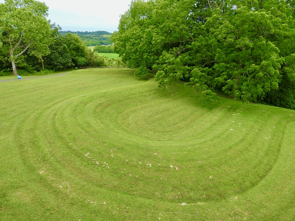
At times our route seemed almost serpentine as we clipped corners of various counties. So it seemed almost natural to stop at the Serpent Mound Historical Site when our path snaked past Peebles, Ohio (map). Scientists still debate its origin. Clearly it’s Paleo-Indian. However it might date back either to the Adena Culture (circa 320 BC) or the Fort Ancient Culture (circa 1000 AD).
Regardless, the huge effigy represents a snake and it likely served a ceremonial purpose. Measurements indicate the serpent’s head aligns with the summer solstice. The people who built it also placed it within an ancient astrobleme, the site of a small asteroid or meteor impact 250-300 million years ago.
It is a spectacular artifact in pristine condition, one of the best effigies of its kind. Thankfully early settlers of European descent preserved Serpent Mound from the start. Thus it escaped the fate of so many others that fell to plows, plunderering or settlement. It reminded me of similar structures at Effigy Mounds National Monument in Iowa.
Tiny Church
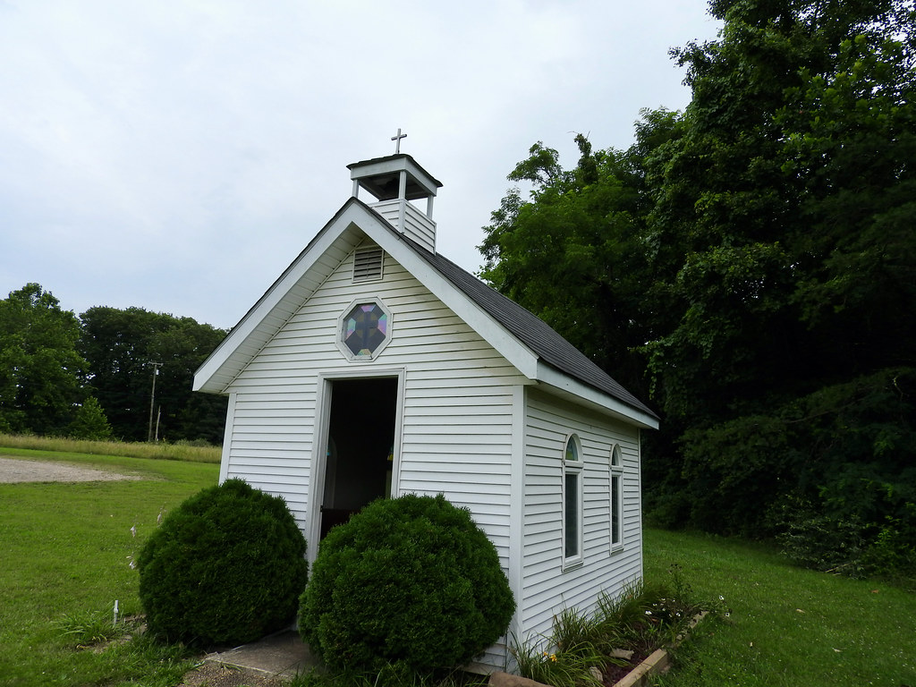
Why do I keep stopping at tiny churches? Previously I visited similarly compact chapels in Silver Lake, West Virginia and McBain, Michigan. Now I stopped at one in Coolville, Ohio. Yes, a town called Coolville (apparently named for Simeon W. Cooley in 1818).
Well, that makes three tiny churches so maybe it’s becoming a thing. Like I really need something else in my life to count. I don’t know, even so I kind of like these little structures. Maybe I’ll find out for sure when I actually go out of my way to visit one. So far they’ve always fallen directly along my travel route.
Anyway, they called this one the Healing Chapel, proclaimed to be Ohio’s Smallest Church. Smallest? Who can really tell. It’s tiny and I like it, and how much smaller than 10 X 14 feet do we want? Plus it required no effort to find it, right across the parking lot from a Rt. 50 rest stop (map).
All went well as we approached our stop for the night, in Marietta, Ohio. Then I ran into a Canada Goose that decided to waddle boldly onto a 4-line highway. I couldn’t avoid him but I think he survived. He tumbled and seemed to shake it off as I looked back at him in the rear view mirror. That was our only mishap during the entire trip.
Articles in the Ohio River Series
- Orientation
- Portsmouth
- Onward Towards Louisville
- Exploring Louisville
- Brewery Cluster
- The Big Four
- Corydon Loop
- Ark Loop
- Evansville Loop
- Heading Back Upstream
- Marietta
See Also: The Complete Photo Album on Flickr
Leave a Reply