
I created a jagged route as we passed between Portsmouth, Ohio and Lexington, Kentucky, before reaching the Interstate and continuing onward to Louisville. I needed to fill a county-counting hole in northeastern Kentucky. So I bounced between county lines for awhile and recorded seven new captures along the way. Of course I found a few interesting spots to break up the monotony too. Oddities exist everywhere. Even among rolling fields of Kentucky bluegrass.
Blue Licks
Kentucky has a wonderful system of “resort parks” as I learned a few years ago at Cumberland Falls. So I was encouraged to see Blue Licks Battlefield State Resort Park directly along our intended path (map). Additionally the main portion of the park sat on a tiny corner of Robertson County so this let me experience Kentucky’s least populous county. I call that a double-bonus.
Twelve Mile Circle previously discussed Kentucky’s “licks.” These salt deposits attracted megafauna that, well, licked the salt. Out here those included bison that still lived in the area when early settlers of European descent first arrived. I don’t know how it got the name “blue” but bison traveled through here and definitely sought them out.
Battlefield

The park actually included a battlefield, a small one commemorating a small battle. It consisted of an obelisk on a patch of grass and a tiny cemetery in the woods. Actually, I didn’t realize the American Revolution continue after the Battle of Yorktown. Yet here, nearly a year after that decisive battle, small-scale warfare continued. Loyalists to Great Britain maintained alliances with various Native American tribes and continued the fighting.
As part of that they ambushed the Kentucky Militia at Blue Licks in August 1782. Loyalists utterly routed the Militia and forced them to flee with seventy-two patriots killed. The battle may be remembered most because Daniel Boone served as part of the militia leadership and because his son Israel died from a gunshot wound.
But that’s just one tiny corner of the park, despite the name.
Trails
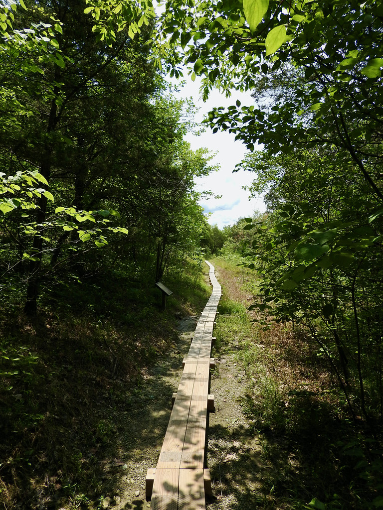
The park also included a museum, swimming pool, a campground and lodge, a restaurant and more. We checked out a couple of the trails. First we walked down the very short Buffalo Trace trail that followed the path bison once used to approach the salt springs. The surrounding plains offered habitat for many of these magnificent animals when they still lived here and they forged migratory paths throughout their range. One such trace even inspired a Bourbon Whiskey.
Then we cut over to the Heritage Trail that circled much of the park perimeter. Unfortunately we had limited time so we completed only one part of it.
Daniel Boone Cabin
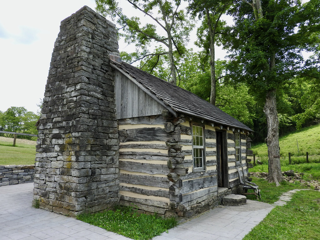
I often joke that I can’t move more than a few feet from my home without hitting something related to the Civil War. Ditto here, but replace that thought with Daniel Boone and so we ran into him again. Here in Nicholas County, Kentucky, that translated into the last place where the Boone family lived before moving to Missouri.
The household included ten children in what we’d call a Tiny House today. Yikes! They stayed there for four years, 1795-1799, which seemed like about four years too many to me (map). Then I wondered what Boone though about living only a few miles away from where his son died at Blue Licks in the prior decade. Maybe it provided comfort.
Colville Covered Bridge

Well, I have this covered bridge fixation and they had a nice one in Bourbon County. It fell pretty close to our intended path so I didn’t mind adding a couple of extra miles. This one dated to 1877 and crossed over Hinkston Creek (map). Other than that it followed the typical pattern. I drove across, took a couple of pictures and continued on my way. My family is used to this by now and nobody paid much attention. They didn’t even get out of the car. But I enjoyed it.
Woodford Reserve

Alright, I have to fudge the narrative just a little now. Our path not only brought us through Bourbon County, it brought us through the eastern side of Kentucky’s famed Bourbon Trail. Everyone traveling through this part of Kentucky has to visit a bourbon distillery. Right? I think it says so at the border.
However, we hit a serious snag. COVID created a weird double-impact on my plan. First, it seemed like everyone wanted to take a road trip this summer after being coop-ed for more than a year. Second, the distilleries still maintained a lot of their COVID precautions, offering smaller less-frequent tours, etc. This resulted in increased demand and decreased supply simultaneously.
I’ve been to distilleries in the past (e.g., Jack Daniel, Maker’s Mark) and we just showed up and took a tour. Not this summer. The distilleries time-controlled everything and required advance reservations. I started checking their websites a month in advance and couldn’t find anything that fit our schedule. We had to skip this part of the itinerary and continue onward to Louisville, our home for the week.
Obviously we made it to Woodford Reserve — you can see the evidence above — but that happened several days later. We kept checking various distillery websites throughout the week and suddenly an opening popped up for Woodford Reserve (map). I guess somebody must have canceled a reservation and we hit the website at just the right moment. I don’t know. So let’s pretend we stopped there on this particular leg of the journey because that would have been awesome. And that’s how it should unfold ordinarily.
Articles in the Ohio River Series
- Orientation
- Portsmouth
- Onward Towards Louisville
- Exploring Louisville
- Brewery Cluster
- The Big Four
- Corydon Loop
- Ark Loop
- Evansville Loop
- Heading Back Upstream
- Marietta
See Also: The Complete Photo Album on Flickr
Leave a Reply