
We spent our final overnight in Marietta, Ohio, arriving late in the afternoon after a grueling drive. So we didn’t have a ton of time to explore its historical significance. In retrospect, I might want to return someday and delve into it further.
Marietta served as the initial capital of the Northwest Territory from 1788 to 1799 as the new United States began pushing away from the eastern seaboard. This initial beachhead protected by a fort called Campus Martius opened a vast continental interior to settlement.
Mound Cemetery
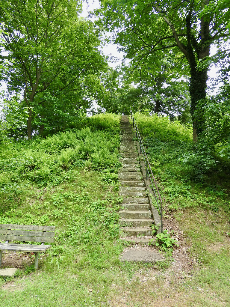
However, instead of focusing on that early U.S. history we stuck with the Paleo-Indian theme that we began earlier in the day. A mound building culture once thrived in the vicinity of Marietta. People during the Hopewell era (100 BC – 500 AD) built an entire complex at this attractive location along the Ohio River. In fact, the town founders settled amongst the remnants of that much earlier civilization by design.
Paleo-Indians constructed a large earthworks where Mound Cemetery exists today (map). Unfortunately the cemetery obscured portions of the layout although it did preserve its central feature, the Great Mound. The ancient mound served both as a namesake for the modern cemetery and its most visible marker. Great Mound rises about 30 feet above the cemetery and is in pretty good shape despite the concrete stairway to its summit.
Actually, the cemetery retained historical significance beyond the Great Mound. The United States wanted to encourage settlement but it didn’t have a lot of money. So it offered Federal land grants to Revolutionary War officers to entice them to move. They became a large part of that early Marietta population.
Later, the 1801 founding of the cemetery coincided with the golden years for many of those aging patriots. Consequently, more officers from the Revolution are buried here than at any other cemetery in the United States.
Capitolium
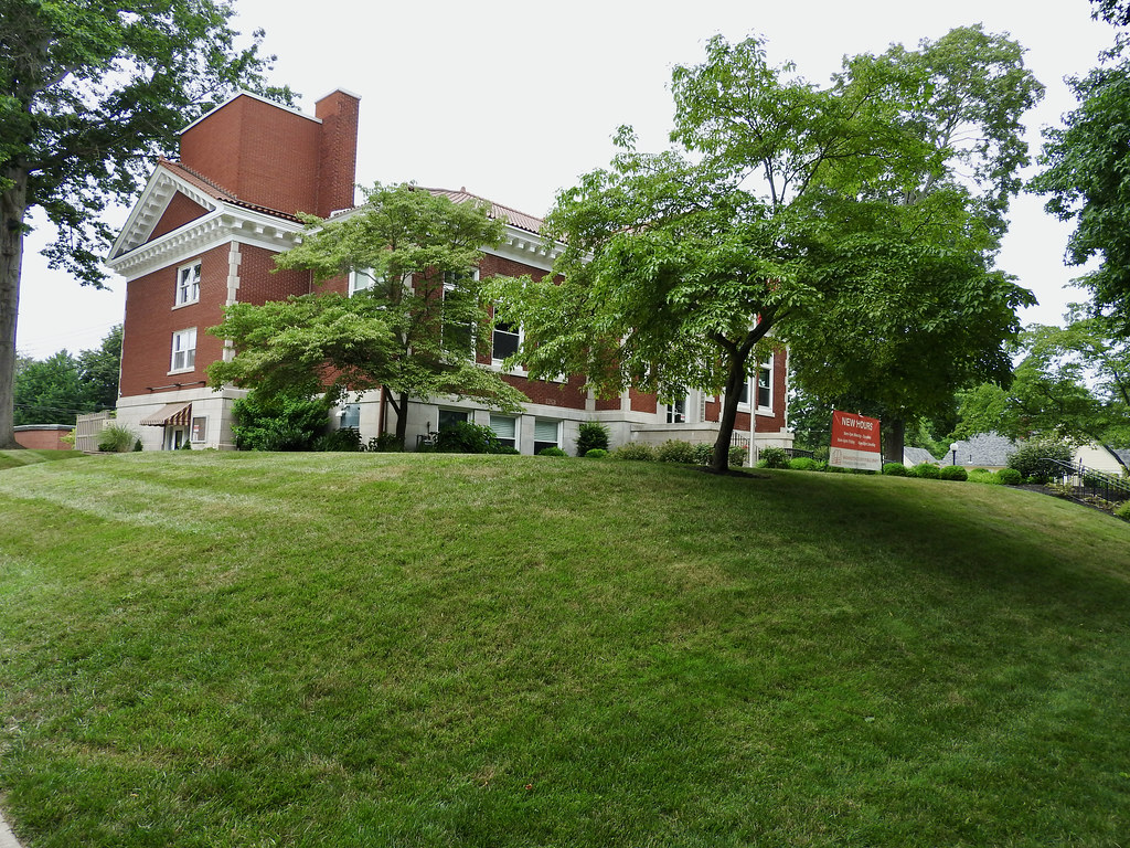
Then we visited another Hopewell site, a truncated pyramidal mound called the Capitolium (map). For some reason the early U.S. settlers liked to give them Latin-ish sounding names. So they chose Capitolium. I guess because the spot sat so close to that original capital of the Northwest Territory? Anyway, the original mound builders designed it to align fairly closely with the winter solstice so it likely served some sort of ceremonial purpose.
But then in 1918 they stuck a library on top of it. True, it was an Andrew Carnegie library so it had some intrinsic historical value. Nonetheless it still sat atop a nearly two-thousand year old archaeological and cultural artifact. Can you imagine anyone thinking that would be a good idea today? Ironically it preserved the mound in (mostly) intact condition. At least now nobody can come along and bulldoze it.
Front Street

Front Street in Marietta anchored the original, historic downtown (map). It bustled on a warm Saturday evening and thankfully we found parking without too much trouble. I couldn’t help but compare it with Portsmouth, which we visited just a week earlier. Marietta sat about 120 miles upriver from Portsmouth although it seemed to face considerably different circumstances.
Whereas Portsmouth hemorrhaged population since the 1930’s, Marietta remained fairly stable at around 14,000 residents. I couldn’t account for the reason behind the difference. Perhaps Marietta never experienced the same level of industrialization so it had fewer jobs to lose. Whatever the cause, Marietta definitely felt more prosperous.
Marietta Brewing

Like Portsmouth though, Marietta also had a long-established brewpub restaurant. Marietta Brewing opened in 1997, making it practically ancient for this type of establishment. It had a great crowd although it served only four of its own beers that day, all rather conventional. So I think it followed the same philosophy we found in Portsmouth; serve what appeals to the local populace and thrive as a restaurant. I can’t blame them one bit for that approach. Even if it means brewing styles don’t go out on that creative limb very far.
Ohio Riverfront

Those ancient Hopewell mound builders and those early U.S. pioneers chose this spot for similar reasons. Waterways were roads for them and Marietta sat at the confluence of the Ohio and Muskingum Rivers. From here, the entire Mississippi watershed unfolded, with easy access to a vast domain.
After the Native Americans came the French, and then the British, and finally the Americans who platted Marietta. The town became something of an early shipbuilding center. They actually constructed oceangoing vessels here and floated them down to New Orleans. Later they produced steamboats. So much history happened along this riverfront.
The next day we drove home and completed our trip. Nothing remarkable happened on that final day, taking the quickest route on Interstate highways. The odometer said we’d covered 2,050 miles during the week.
Articles in the Ohio River Series
- Orientation
- Portsmouth
- Onward Towards Louisville
- Exploring Louisville
- Brewery Cluster
- The Big Four
- Corydon Loop
- Ark Loop
- Evansville Loop
- Heading Back Upstream
- Marietta
See Also: The Complete Photo Album on Flickr
Leave a Reply