
Many people suggested the Big Four Bridge when I asked for Louisville suggestions. This spans a half-mile across the Ohio River, connecting the city on the Kentucky side to Jeffersonville, Indiana (map). However, there’s a catch. Only pedestrians can use it.
Has my bridge mania finally gone too far? Can I really focus an entire article on a single bridge. Yes on both counts, although in my defense, it’s quite spectacular.

Undoubtedly it resembled a standard railroad bridge. Sure enough, it went into service in 1895 for the Cleveland, Cincinnati, Chicago and St. Louis Railway. Four cities, four names, so the railway earned an appropriate nickname, the Big Four. Then they built this Ohio River span and naturally called it the Big Four Bridge. It quickly became an important crossing and it went through a refurbishment that increased its capacity in 1929. However nothing lasts forever and the last train crossed here in 1968.
Then it just sat there for nearly half a century, a hulking eyesore. Locals started calling it the “Bridge that Goes Nowhere” (12MC knows about X’s to nowhere!). It became a joke. The thing caught fire — four separate times! The President of Costa Rica even offered to buy it and move it. Still, it stood in place, just rusting across the river.
Ultimately the two states got together and decided to fix it up for pedestrian use, completing the final phase in 2014. It’s now something of a tourist attraction on both banks.
The Louisville Side
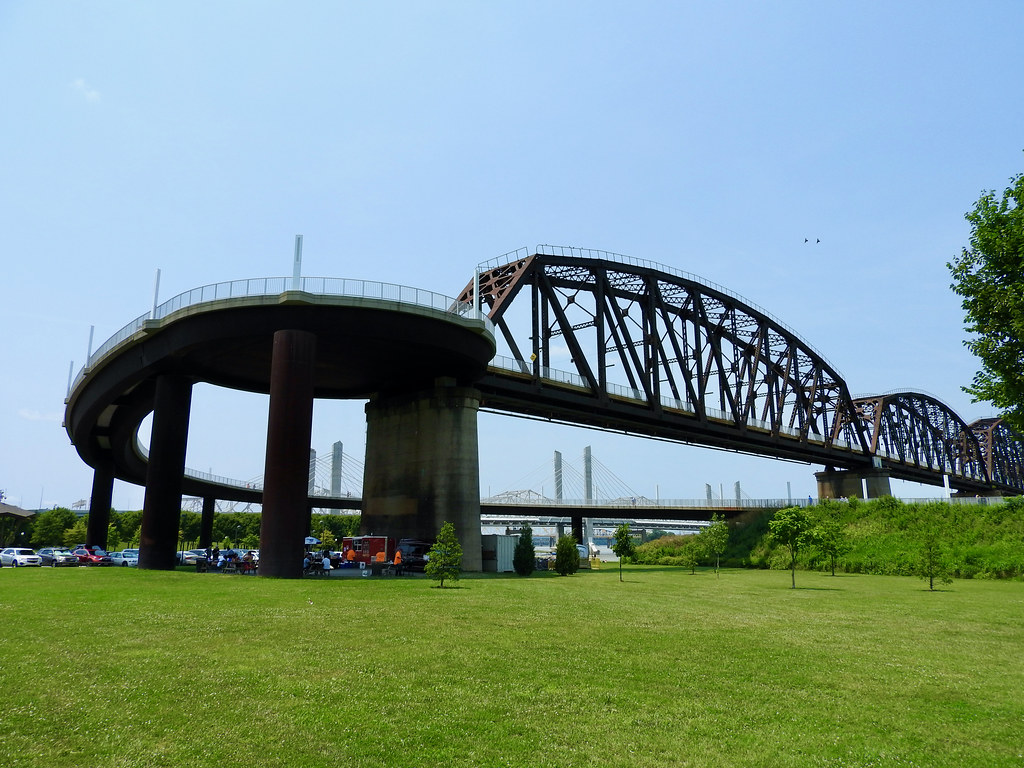
Today the Big Four Bridge crowns Louisville’s Waterfront Park, an ongoing effort to convert a former industrial area into an expansive public green space. All sorts of artistic, sporting and cultural events take place there. At the bridge, a sweeping spiral of steel and concrete guides pedestrians from ground level up to the deck. It’s a beautiful setting.
Unfortunately Louisville was one of those cities where they plowed Interstate highways through the heart of downtown. Cars were king back then and too bad for the neighborhoods they demolished along the way. Unfortunately this effectively separated much of Louisville from its waterfront. Many of the Interstates converge near the Big Four. In particular, I-64 creates the biggest barrier, running parallel to the Ohio River. So it’s inconvenient to simply walk between residential areas and the park although we did it a couple times.
The Jeffersonville Side
In stark contrast, the Indiana side of the bridge drops pedestrians directly into a vibrant area of Jeffersonville. There the city created the Big Four Station park, with plazas, a playground, fountains, a stage and an expansive lawn. It’s a centerpiece of the city and an entryway into its compact downtown. So a half-mile distance over water made an unbelievable difference.
Spanning the River
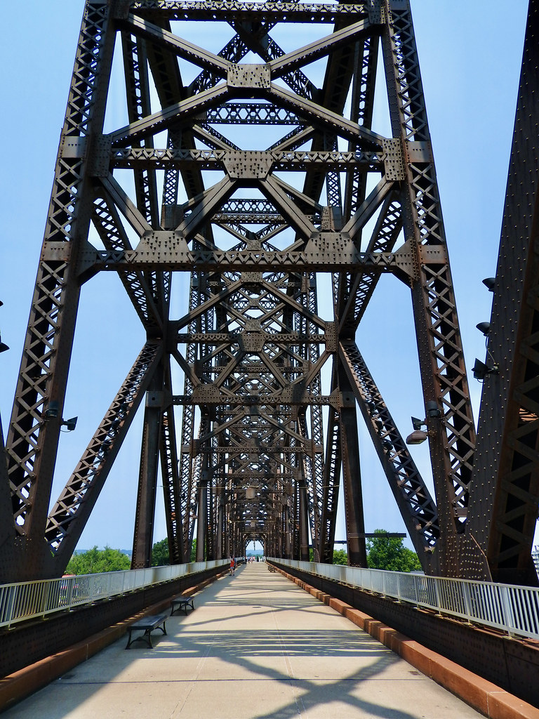
People flocked to the bridge, mostly walkers although plenty of runners and cyclists too. It seemed to be a nice mix of exercisers and amblers; both locals and tourists. The concrete deck had plenty of room for everyone. Nothing rivaled the expansive views up and down the river, with Louisville skyscrapers as a backdrop. Plus it included the bonus Kentucky-Indiana state line crossing for us geo-geeks.
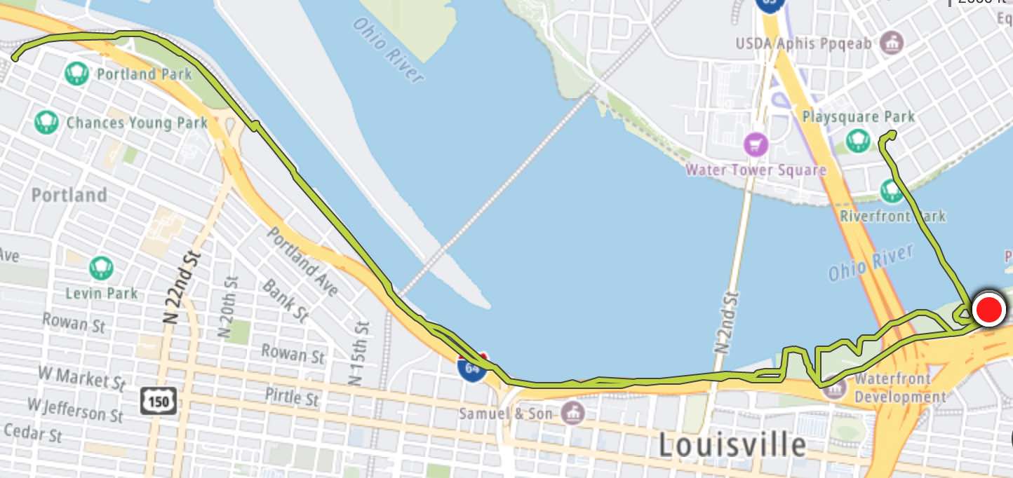
Yes, I really enjoyed the bridge. I ended-up visiting it four separate times during the week, twice as a walker and twice as a runner. The longer run, a ten-miler along the Ohio River, concluded with a crossover into Indiana and back. Certainly I felt the ramps although they rise pretty gradually. It wasn’t as bad as I expected even at the tail end of my run. I actually drove to the bridge that morning. The parking lot had plenty of spaces at dawn on a weekday.
River Traffic
Mostly though, I enjoyed the two times I walked across the bridge. Then I could stop at the top and watch the ships pass by. Wait for a little while and there’s no telling what might float along the Ohio River.
Paddlewheel
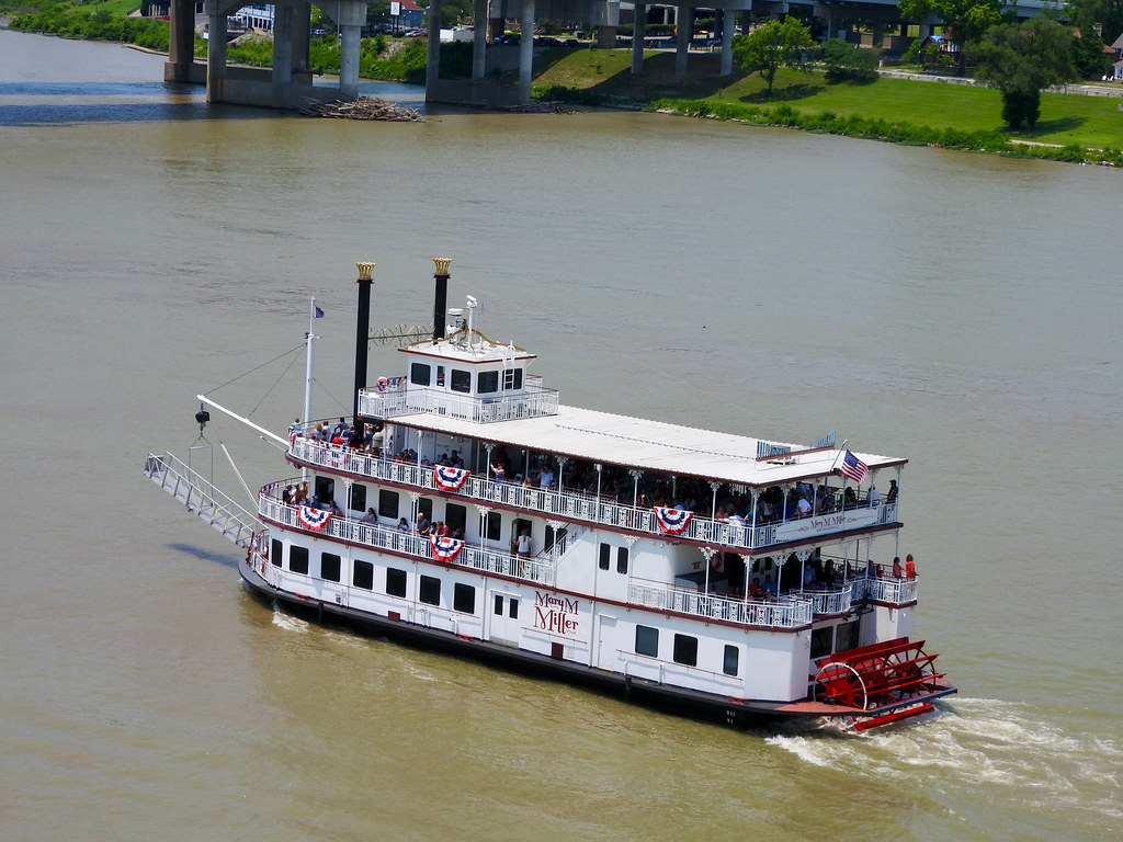
On the 4th of July, we spotted the Mary M. Miller paddle wheeler, with its patriotic flag bunting. Passengers seemed to be in a festive mood as the ship navigated its final leg before docking. It ties-up nearby at the Louisville Riverwalk, one of the Belle of Louisville Riverboats. Mary M. Miller, the person not the ship, became the first woman in the United States to earn a captain’s license for a steamboat in 1884.
Tugs & Barges

We saw tugboats and barges in abundance. A different set passed by every few minutes, or so it seemed. I particularly liked this example with downtown Louisville appearing in the background. It featured the tugboat Charles T. Jones based out of Charleston, West Virginia. So think about that. This tug will go somewhere close to 350 miles (560 km) upriver on the Ohio and Kanawha Rivers to return to its home port.
I wondered about the tugboat’s namesake. Who was Charles T. Jones? The Intertubes provided a quick answer. His 2019 obituary noting his key role in “operating and growing what has become one of the largest fleets of towboats working the nation’s inland waterways”. He worked regularly until he passed away at the age of 101! The shipping company purchased and renamed the boat for Jones in 2020 as a tribute. Then in 2021 I witnessed its passage below the span of the Big Four Bridge.
Articles in the Ohio River Series
- Orientation
- Portsmouth
- Onward Towards Louisville
- Exploring Louisville
- Brewery Cluster
- The Big Four
- Corydon Loop
- Ark Loop
- Evansville Loop
- Heading Back Upstream
- Marietta
See Also: The Complete Photo Album on Flickr
Leave a Reply