
We continued to follow the basic path of the Ohio River, this time heading west from Louisville. At the far end we hit our most westerly destination, the city of Evansville, Indiana.
Once again the day began with intentional destinations in mind. However, as once before, the second half of the journey focused on county counting. I planned a route through five new Kentucky counties somewhat tucked away from the Interstates. That afternoon I captured Breckinridge, Daviess, Hancock, Henderson and Mead.
Mesker Park Zoo

Evansville’s Mesker Park offered our second zoo visit of the trip (map). Once again, it served as something of a bribe. My older son loves zoos and I can convince him to hit the road if I can combine it with animals. It was a smaller zoo and certainly enjoyable enough. If you like zoos you’ll probably like this one too.
However getting there required some planning and logistics due to our distance. COVID restrictions remained in place and the zoo required reservations for timed admissions. We also had to factor in a time zone change. Indeed, Louisville sat on the western edge of Eastern Time and Evansville sat on the eastern edge of Central Time. Fortunately I nailed this part of the journey and got us there right at our appointed slot, 9:00 am Central Time when the doors opened.
I got to use my Interstate Highway Time Zone map again, which I designed for my personal travels several years ago. That map now has more than ten million views! Crazy! Now if I could only figure out how to get all that traffic to Twelve Mile Circle.
LST-325
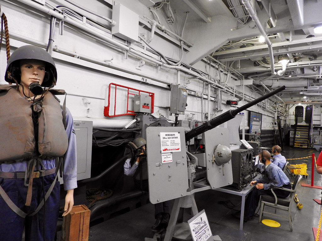
Our younger son loves World War II history so we had a stop designed for him too (map). We headed over to Evansville’s Ohio River waterfront to visit the LST Ship Memorial. What is an LST? It stands for “Landing Ship Tank.” So it means it delivered tanks to battlefield beachheads.
Very few of these old ships remain. The Memorial lists LST-325 as the “only operational LST in WWII configuration afloat in US waters”. This one supported the invasions of Sicily, Salerno and Normandy, carrying numerous payloads of tanks, troops and ammunition. Later it served a second life the Greek navy from 1964 to 1999. Finally the memorial foundation acquired it and returned it to the United States. And it’s still operational! They send it out to different ports within Mississippi watershed during the summer.
Damsel Brew Pub
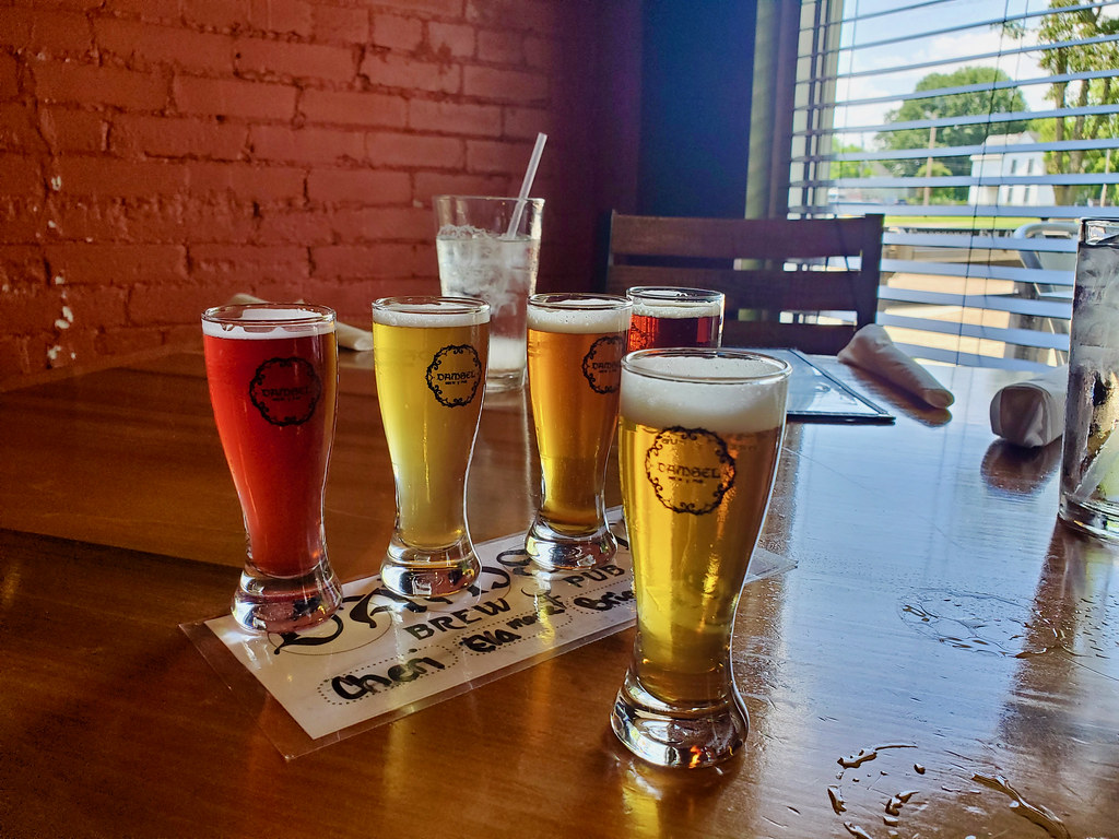
By then lunchtime approached. So of course we found another brewery, Evansville’s Damsel Brew Pub.
Interesting name. They also named all of their beers for women, the “damsels” I supposed. Then I considered that damsel doesn’t appear very often as an English word anymore except as a part of a Damsel in Distress trope. It’s a somewhat archaic term for a young, unmarried woman. My mind went on another tangent as I wondered about the male equivalent. Apparently other people already wondered the same thing. No consensus existed although I personally liked damoiseau.
Anyway, the brew pub featured diminutive taster glasses purchased individually rather than as part of a flight. I’m not sure I’ve seen smaller tasters before; maybe they were 3 ounces. Even so I rather liked that. It meant we could try more varieties, and practically their entire range.
Green River Island
I love when old Twelve Mile Circle articles collide with my on-the-ground reports. Long ago I wrote about the significance of Green River Island. I’ll provide a summary here but feel free to read the earlier article for the complete story.
A U.S. Supreme Court case (Indiana v. Kentucky) focused on Green Island back in 1890. Green Island belonged to Kentucky from its very earliest days. Much later the Ohio River shifted, connecting Green Island to the Indiana shoreline. So then Indiana tried to claim title to the land but the Supreme Court disagreed. Just because the river shifted, they said, it didn’t mean the border shifted. This set an important precedence for land disputes between the states that still stands.
But wait! This left a tiny tip of Indiana disconnected from the rest of the state (map). That’s where LST-325 used to dock back in 2012 when I wrote the original article. It would have been really cool to visit the exclave if that were still the case. But it was a long day and I didn’t want to drag the family to an empty parking lot so the Street View image above will have to do. Everyone will surely be relieved to know that I told them all about Green River Island as we drove across it.
U.S. Route 60
Getting back to Louisville didn’t require a lot of technical driving. I simply followed a portion of U.S. Route 60 through pleasant Kentucky countryside. Thus we took a contiguous length of Interstate highway to Evansville, and a contiguous length of U.S. highway from Evansville. That’s the path I needed to follow to meet our objectives.
I often meander through the backwoods to access out-of-the-way locations. Rarely though do I journey down such a long stretch of contiguous U.S. highway. It reminded me of what it must have been like to take a road trip ninety or a hundred years ago. No comment other than that; just oddly nostalgic for an era happening decades before I learned to drive. Someday I do want to experience the entire length of a U.S. Highway but it would probably be U.S. Route 50 or the iconic Route 66. Now that would be an adventure!
Articles in the Ohio River Series
- Orientation
- Portsmouth
- Onward Towards Louisville
- Exploring Louisville
- Brewery Cluster
- The Big Four
- Corydon Loop
- Ark Loop
- Evansville Loop
- Heading Back Upstream
- Marietta
See Also: The Complete Photo Album on Flickr
Leave a Reply