
Bicycles are the most popular form of transportation on Michigan’s Mackinac Island, other than foot. They’re perfect for an area of less than four square miles where motorized vehicles are essentially prohibited.
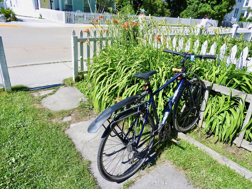
There are plenty of places to rent bicycles within an easy walk of the ferry docks. However, I had an inside track. My old Trek hybrid, the bike I rode 150 miles on the Great Allegheny Passage a few years ago, was already on the island. My kid took it to college and then to Mackinac for the summer, and I got a new hybrid to add to my collection. So this was a little bit of a reunion for me during the week when I got to borrow it.
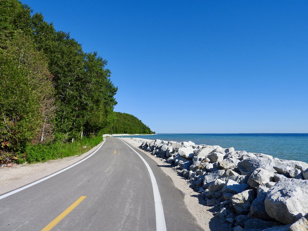
There’s a perfect road for them too, a circuit extending entirely around the island on Michigan Route M-185. It’s paved and nicely maintained, and totally free of cars or trucks. Supposedly this is the only state highway in the nation with such a restriction. Naturally I wanted to complete the 8-mile loop, and I did it multiple times.
It’s a super-easy ride with amazing scenery. The island interior is considerably hilly but not along the coast. M-185 includes only one “hill” and I put that in quotes because it barely registered. Otherwise it’s nearly flat.
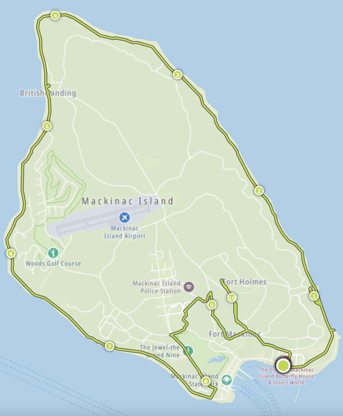
The first time I rode around I wore a GPS watch, the same one I use when running. Then I downloaded the coordinates to create the map, above. It follows most of M-185, the Lake Shore Road portion, but towards the end I veered inland to avoid the crowds on Main Street and explore a little bit. The mileage recorded by my GPS correspond pretty closely with the actual mile markers along the highway.
So let’s start the ride!
Mile 0
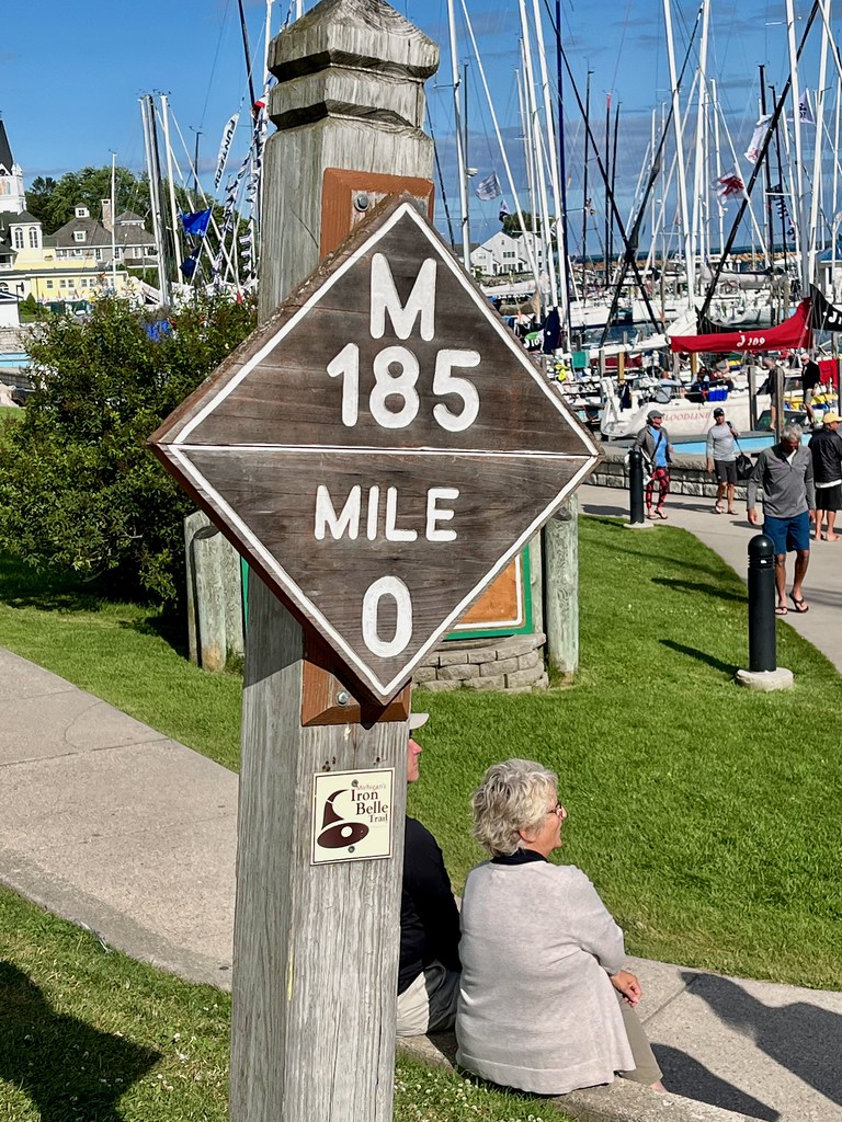
Technically it begins at the harbor, at the Mile 0 marker. But it’s a circuit so it doesn’t really matter. Riders will return to the same place eight miles later no matter where they start and it’s impossible to get lost.
But for the sake of argument let’s say we start here at Mile 0. I was told the best direction is counter-clockwise. That’s for a couple of reasons. First that’s how the highway mileage markers go. Second, and probably more important, prevailing winds most often blow from the west. So the island itself blocks most of the headwinds on a counter-clockwise loop. It didn’t make much difference on the days I rode but it certainly could on a windy day.
Dwightwood Spring
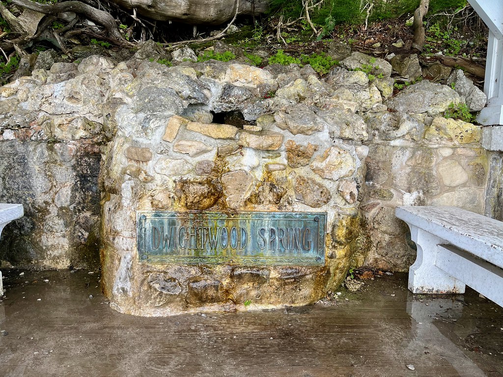
The first place I stopped, probably not even a mile in, was Dwightwood Spring (map). It offered a nice little respite with beautiful lakeside scenery. The first time I looped around I didn’t even stop for it. I was heading towards one of the main attractions just up the road. However, I decided to check it out on a later circuit because it looked like an interesting setting.
Well, it’s a spring as the name implies. Water gurgles from the hillside into a stone basin. I can’t imagine many people drinking from a mysterious source like this today when they’re probably carrying a plastic bottle of sanitized water with them already. Even so, I’m sure our forebears a century ago appreciated this kind gesture.
There’s a sad underlying story. The spring got its name from a child, Dwight Wood, “who perished after his bicycle was struck by a horse-drawn fire engine in Flint, Michigan.” His father donated funding for the site in 1909 so it’s a memorial to a child as much as it’s a break for weary walkers and cyclists.
Sannillac Arch
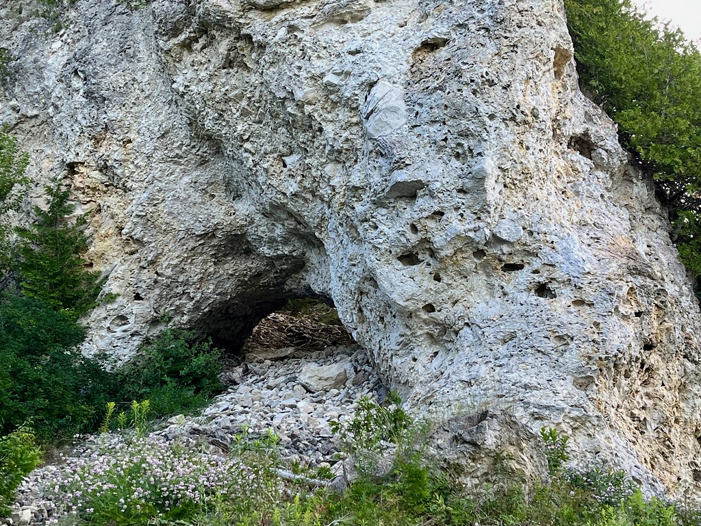
Sannillac/Sanilac Arch goes by a variety of different names including Maiden Arch, Lower Arch and Little Arch. Regardless, it’s all one and the same, and it appears about a mile into the ride.
It doesn’t look all that impressive, does it? Well there’s a reason. Often today whenever anyone goes to a park there are signs that tell people to stick to the trails. Lots of people think, oh, one little footstep won’t make a difference. So in generations past, people had the same attitude and they walked all around and through Sannillac Arch. Now it’s a debris-strewn shell of its former self. Thanks early 20th Century tourists!
Arch Rock
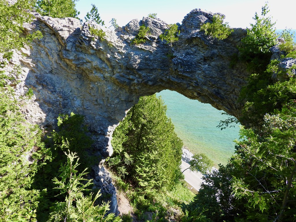
The reason Sannillac Arch is sometimes called Lower Arch is because it sits below — and belongs to the same formation — as the famous Arch Rock. This is another sea stack, like several others I encountered on the mainland earlier in the week. Erosion created the arch and it’s become one of the most iconic features of Mackinac Island. In fact, I think this is one of the reasons why people rent bicycles here. It’s just a little too far for most people to walk. Tons of visitors stopped at this point on the highway and traffic started thinning out just beyond it.
A long wooden stairway leads up from M-185 to the arch itself (map). Once atop, a view through the arch shows Lake Huron and the highway far below.
Northeast Shoreline
There aren’t many places to stop for the next three miles. There are a few benches, a nature trail and occasional interpretive signs that note the former Native American presence on Mackinac Island. Somewhere along this stretch might be an ideal place for a picnic or something like but I kept going. I liked the simple fact that I had the highway nearly to myself. And of course, the backdrop was simply stunning.
Point aux Pins
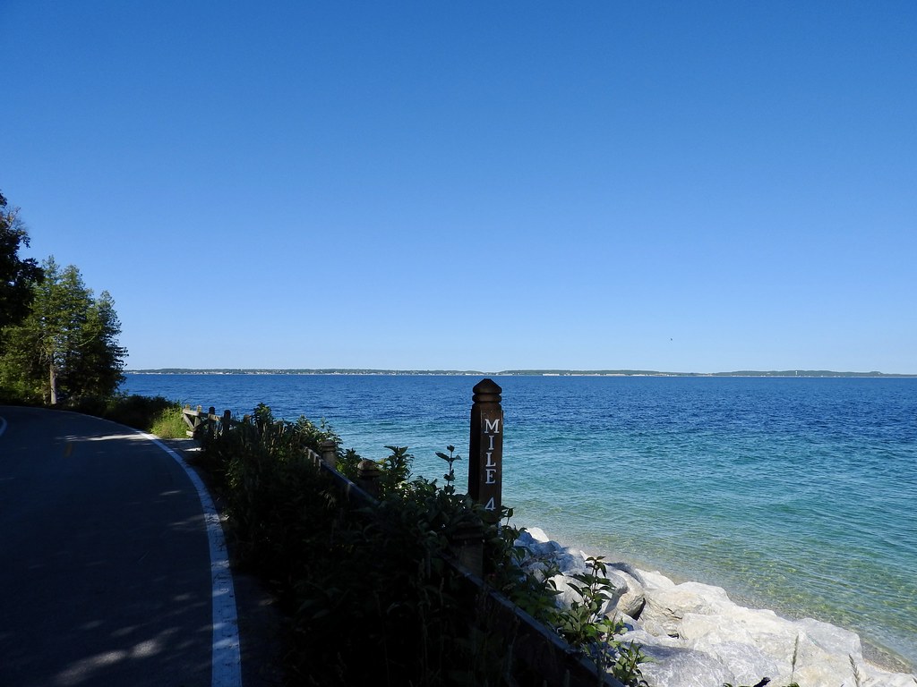
Mile Marker 4 signaled the halfway point, just past the northern tip of the island and turning back towards the south. The “hill” appeared just before this. I briefly switched to a lower gear although honestly I probably didn’t even need to do that. A one-speed cruiser bike could handle M-185 without any trouble. I could feel the wind as I came around the tip although it was only a light breeze. It made me appreciate why people take a counter-clockwise circuit on windier days though.
Commercial Dock
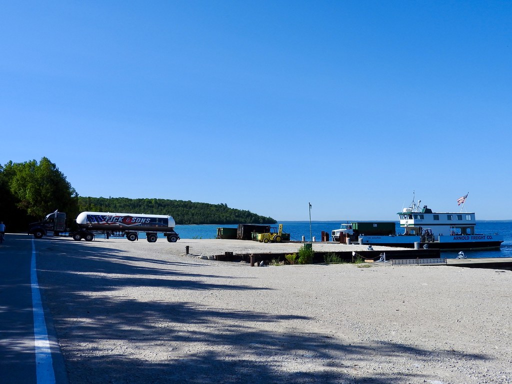
Then I saw a curious site around Mile 4.5. It was a freighter ferry unloading trucks on the shoreline! One appeared to be a garbage hauler of some sort and the other was a full-blown tractor trailer fuel truck. I actually saw the fuel truck cross M-185 and disappear down a gravel road. Looking online (map), I noticed it led into an obscure part of the island on the backside of the airport.
So Twelve Mile Circle does what it does best, and I dug deeper into the story. I thought it might be jet fuel, however the airport insists that no fuel is available for anyone who lands there. Then I searched the name displayed on the tank, Fick & Sons. They specialize in residential and commercial propane so the delivery is likely intended for heating and cooking throughout the island.
Mackinac Island famously bans motorized vehicles. Obviously that’s baloney based on what appeared right in front of me. Instead what they do, I think, is hide certain necessary vehicles from tourists (another example — they allow snowmobiles during winter months when tourists are scarce). A huge tank of propane can’t be loaded onto a horse-drawn cart.
This reminded me of the time I went backstage at Disney World. There’s a fantasy view presented to tourists and then there’s an elaborate infrastructure hidden from sight making it happen.
But I caught ’em red-handed!
British Landing

Crowds started picking up again once I got to British Landing, closer to Mile 5. I think most of the rental bicycle crowd hits the highlights either on the east or the west side of town rather than taking the entire loop. In that case, British Landing would be the farthest point that would interest them on the western side (map). It came by the name honestly. This is where the British landed during the War of 1812 when they snuck up behind Fort Mackinac and captured it.
There’s a bunch of reasons why it’s a popular stop. Most importantly, after leaving town, these are the only restrooms at any point along M-185. There’s also a nature center that seemed to be perpetually closed whenever I rode past. I’m sure it’s nice if it’s ever open. Finally, and somewhat inexplicably, there’s a casual take-out restaurant called Cannonball Oasis located here. It’s the only business anywhere on this half of the island and everything has to be hauled four miles from town, including the people who work there.
Devil’s Kitchen
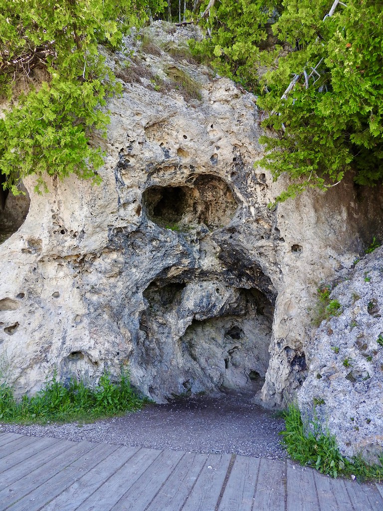
There’s more pretty scenery for the next three or so miles, with views of St. Ignace and the Mackinac Bridge, and an occasional Great Lakes freighter passing by. Then Devil’s Kitchen appears somewhere around Mile 7 (map). It’s full-on tourist central by this point with loads of bicycles because it’s getting pretty close to town.
I found the frighteningly named Devil’s Kitchen a bit underwhelming given the billing. It comes complete with its own Native American “legend” about evil spirits cooking victims, with black soot from the fire discoloring the formation. In reality, wave action from a period when the lake was higher eroded the base of the cliff and formed a small indentation.
Somewhere in Time Tree

I’m not much of a movie fan and I’m even less of a romantic drama fan. Nonetheless, a 1980 movie called Somewhere in Time, starring Christopher Reeve and Jane Seymour used Mackinac Island for several key filming locations. One of them happened to be this tree near the final segment M-185, nearly into town (map). Supposedly it had a pretty significant role in the film at a pivotal point, but I won’t knock it because fans of the movie are pretty intense. Nonetheless, it didn’t interest me much so I took the photo, moved on and completed the circuit.
Articles in the Mackinac’s Orbit Series
- Up North
- Counting Fingers
- Sault Ste. Marie
- Petoskey
- Eastern U.P.
- Mackinaw City
- St. Ignace
- Town of Mackinac Island
- Lake Shore Road
- Into the Highlands
- What’s Brewing?
See Also: The Complete Photo Album on Flickr.
Leave a Reply