
I had good reason to travel up to Mackinac Island in Michigan, a place sandwiched between its Upper and Lower Peninsulas. My older child worked at an internship there this summer, a requirement for a University degree. You know, the kid who loves zoos, designed a town, and noticed all those modes of transportation? Yes, that one. Halfway done with college now. And suddenly I feel old.
However I never spent a single night on Mackinac Island during the journey. We checked. By the time we got our act together, the few rooms available cost $1,400 a night. Instead we circled all around Mackinac’s orbit, in every possible direction except due-east into Lake Huron. And some people did that by the way. At least two Great Lakes cruise ships sailed into port during our stay, and numerous freighters passed by.
So I think I’ll (over)use this “orbit” analogy to organize this latest series on Twelve Mile Circle. I’ll start with the most distant planets of our virtual solar system and work my way towards the center of the sun on Mackinac Island itself.
Target Area
The name Mackinac appeared in a variety of geographically-clustered and sometimes overlapping places:
- The well-known island situated between Michigan’s Upper and Lower Peninsulas (map)
- An adjacent county on the Lower Peninsula (map)
- The straits connecting Lake Michigan to Lake Huron (map)
- A mighty bridge spanning the straits (map)
- Plus a bonus location spelled slightly differently — Mackinaw City — on the nearby Lower Peninsula (map)
Regardless, they were all pronounced Mackinaw (with a “W” sound). It all tied back to local Native inhabitants and the term Michilimackinac, meaning “place of the great turtle.” Early French traders adopted the name for their fort on the mainland, a settlement that later passed to British control.
By a convoluted process filtering through three distinct languages it became Mackinac pronounced with a W as the final consonant. Mackinaw City decided to spell it phonetically, possibly because the postal service kept confusing it with its nearby island cousin, and possibly because they wanted people to actually pronounce it correctly.
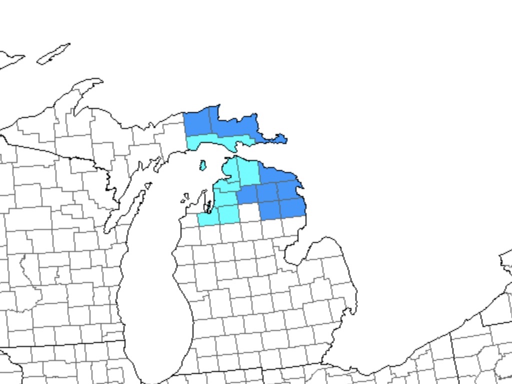
Anyway, we focused on the counties marked on the map. Light blue represented counties I visited previously while dark blue represented new counties. Thus, as the map clearly shows, I captured eight new counties during this trip. I’m now approaching completion of the Lower Peninsula on my County Counting map.
Cherry Capital
So let’s start this thing already. We landed at Cherry Capital airport in Traverse City, a gateway to Northern Michigan.
That geographic designation is a bit of a misnomer. It actually refers to the northern end of Michigan’s Lower Peninsula. To some, it’s simply Up North. Funny thing though, a whole different section of Michigan sits even further north, namely the entire Upper Peninsula. Nonetheless, colloquially, it’s still Northern Michigan. It didn’t make sense to me either but I don’t write the rules.
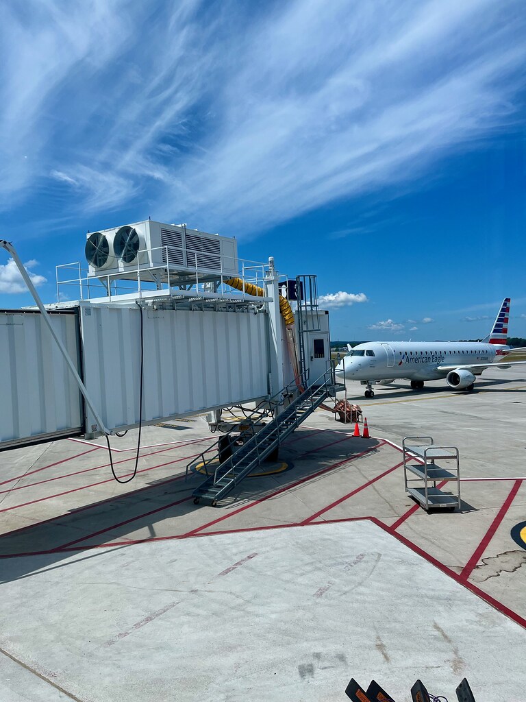
Anyway, it’s the cutest little airport and I just wanted to pinch its cherry cheek. We could catch a direct non-stop flight twice a week from my home airport during the summer and that’s exactly what we did. It’s so much easier dealing with a tiny airport even during peak tourist season. Flights arrived regularly at this popular summer destination, but still it was only six gates so how “busy” could it get?
I also loved the address: “727 Fly Don’t Dr.“. Yes, the street (drive) was called Fly Don’t. Even so, I’m not sure the airport actually handled a lot of Boeing 727’s. Maybe that part was aspirational. We arrived on an Embraer, a much smaller regional jet. Also this counted as a new airport visit for me so that was an added bonus. Plus it landed us only two hours away from Mackinac by car. It’s not an easy to reach Mackinac from anywhere beyond Michigan so I considered that a great success.
45th Parallel

We didn’t do much driving the first day, in fact we didn’t even make it to Mackinac. And we weren’t going to take the most direct route anyway. Our rental home for the week wasn’t available until Sunday and we landed on Saturday afternoon. So I used this as an opportunity to position ourselves for a day of county-counting exploration to begin on Sunday morning.
That brought us over to Interstate 75, with its matching 75 mile per hour speed limit running straight through the middle of Northern Michigan. I love symmetry. Anyway, I figured we could find a generic name-brand hotel next to an Interstate exit and settle-in for the night.
An interesting line of latitude crossed directly through the Lower Peninsula, the 45th. That’s halfway between the equator and the north pole. I stopped at the renowned 45X90 spot in Wisconsin a number of years ago so I figured I should replicate my crossing in Michigan. So I found a nice sign outside of Gaylord (map) and stopped for the obligatory photo. Nobody else even bothered to get out of the car.
Gaylord
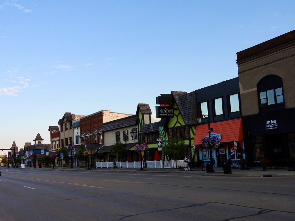
Then we checked into our hotel in Gaylord. It was a small Midwestern town like many other small Midwestern towns, but with a twist. Many of the buildings downtown featured a Tyrolean architecture and they called themselves the “Alpine” city. I have no idea why. Maybe it’s a marketing thing. But I enjoyed walking around its nearly deserted streets early the next morning before most of its residents even got out of bed.
Elk Capital

They sure love their “Capitals” in Northern Michigan. Not only was it the Cherry Capital, it was also the Elk Capital. Elk in Michigan. I had no idea. Even so, there are supposed to be wild herds somewhere near Gaylord although I never spotted any. I did see elk at a dedicated park in town though. That felt more like a zoo enclosure than a free range so maybe it didn’t count. Oh, and I guess I saw a taxidermy elk in a glass box at the town limits sign outside of tiny Atlanta, Michigan too (photo). So much for my elk adventures.
We barely scratched the surface at the outer limits of our solar system that first day as we prepared for greater adventures to come.
Articles in the Mackinac’s Orbit Series
- Up North
- Counting Fingers
- Sault Ste. Marie
- Petoskey
- Eastern U.P.
- Mackinaw City
- St. Ignace
- Town of Mackinac Island
- Lake Shore Road
- Into the Highlands
- What’s Brewing?
See Also: The Complete Photo Album on Flickr.
Leave a Reply