
One day we decided to explore Emmet County, at the northwestern tip of Michigan’s lower peninsula. Prior to that, my only exposure to this place happened along a brief segment of I-75 barely clipping the county line before crossing the Straights of Mackinac. My entire elapsed time in Emmet lasted mere seconds. However I’d completely vindicate that by the end of the day in a lazy loop through nearly every corner of the county.
The main town and county seat is Petoskey. It sounded vaguely Eastern European although it hardly seemed likely. Indeed, the etymology traced to an Anglicized version of a Native American name. It descended from Odawa (Ottawa) of the larger Algonquian language family, and that made much more sense.
The Odawa lived here when French and English settlers arrived. The underlying phrase meant something like “where the light shines” or “light that is coming”, a name bestowed upon Chief Ignatius Petoskey (Petosegay, Biidassige) (~1787-1885), the son of a French fur trader and an Odawa woman.
Construction Season

Summer is brief this far north and pleasantly cool. That’s great for summertime visitors such as myself although it does present some issues. For instance, it compressed the time available for road repairs. State and local highway departments have to fix those winter-ravaged roads as quickly as possible before the window closes. And that means drivers encounter active construction sites all over the place.
Our experience was no exception. Even out here in the middle of nowhere west of Levering, Michigan (map). Stop, wait, move, repeat. That wasn’t the way I wanted to start our little adventure for the day but that’s how it goes and that’s to be expected. I could have taken a similar photo at numerous places during our week of wandering the highways and backroads.
Tunnel of Trees
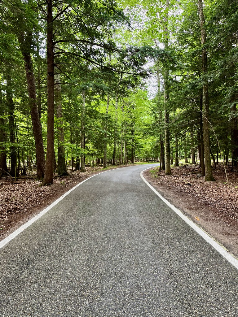
Despite that, we finally made it to shores of Lake Michigan. There we intersected with Michigan Route M-119, the “Tunnel of Trees Scenic Byway” (map). This narrow, winding road hugged the lake and its Little Traverse Bay for nearly thirty miles, to the outskirts of Petoskey.
I think my photo captures the spirit of the trail as much as the actual name does. Literally, we drilled our way through a tunnel of trees. The road wasn’t designed for speed, and in fact it barely accommodated two cars passing in opposite directions on its abundant curves. It didn’t even have a center line. Drivers meandered down the path and shared the asphalt when they encountered each other.
Sometimes I caught-up to cars moving even slower than my casual, leisurely pace. So I would simply pull over, take a couple of photos and let the other driver move out of range. I’d stand right in the middle of the road with my camera. Didn’t matter. There wasn’t much traffic. Then I’d start up again, enjoy the scenery as it unfolded and realize I’d get there eventually.
Petoskey Pierhead Lighthouse
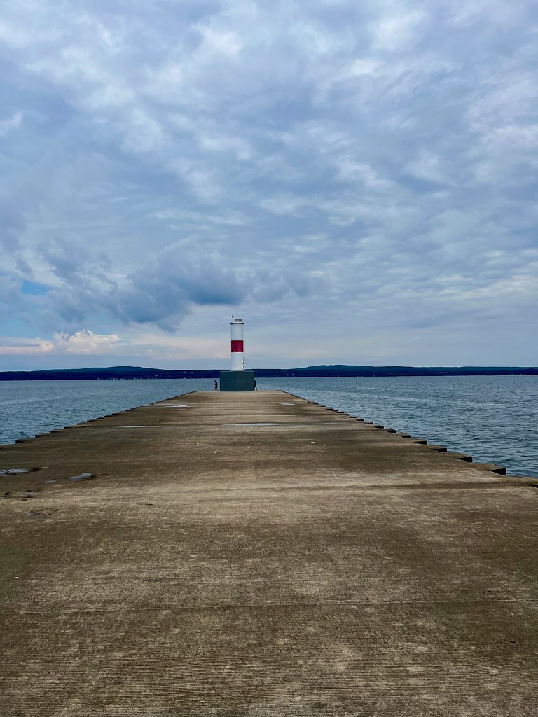
And “there” was the Petoskey Pierhead Lighthouse (a.k.a. Bayside Light). Well, that’s not completely true. First I tried to stop at the Little Traverse Lighthouse in Harbor Point (map) but that one stood behind the guarded walls of a gated community. So we rolled onward to the other lighthouse, the one in Petoskey (map).
I couldn’t imagine a town of 6,000 residents with a traffic problem. Even so, Petoskey somehow managed to defy the odds. Traffic was terrible, at from the east on its primary road, U.S. Route 31. They really need to widen it to four lanes.
Anyway, we pulled into Bayfront Park eventually and found plenty of parking at the base of the breakwater. From there we walked the breakwater for about a quarter-mile onto the lake where it terminated at a 1930 lighthouse. It’s, um, not particularly exciting as far as lighthouses go. Even so, the breakwater stroll was worth it and I enjoyed views of the harbor.
Petoskey State Park
We’d reached the southern terminus of our loop and we started our way back, arriving at Petoskey State Park. It hugged Little Traverse Bay, at a scenic spot studded with an expansive beachfront, sand dunes, walking paths and a campground (map).
Intermittent Rain

Pop-up showers nipped at our heels all day but finally caught us at the beach. Fortunately the park included a large covered shelter so we watched the storm roll through for a few minutes and then it cleared out. It was actually quite scenic at our comfortable protected spot so I didn’t mind.
The Great Lakes shoreline always impresses me, particularly on the western side of Michigan where it’s surprisingly sandy. This isn’t some trucked-in artificial beach either, it’s completely natural. I hate lakes with mucky, muddy bottoms but that’s not a concern here. It’s rather more reminiscent of the ocean except with smaller waves and fresh water.
Petoskey Stones
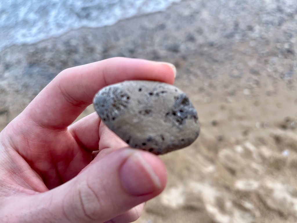
I’m not much of a beach person. So why was I even here? To hunt for Petoskey Stones, the official state stone of Michigan of course. A coral reef thrived in a warm, shallow sea 350 million years ago, and parts of it fossilized. Much of it was an extinct coral species with a characteristic hexagonal shape called Rugosa. Recent Ice Ages scraped the bedrock, smoothed debris into small pebbles, and spread the fossil layer across a swath of Michigan.
New specimens continuously wash up onto local beaches near Petoskey, especially in the spring when the ice breaks up. Then the state allows park visitors to collect up to 25 pounds per person per year. Some people polish their stones and make attractive jewelry or paperweights from them.
However, it was mid-summer and I was at a popular public beach that I’m sure was already thoroughly picked. In fact several people at the beach had the same exact plan as us that day. But it was a cloudy and just after a rainstorm so that worked to our advantage (some specimens only show their pattern when wet or polished). We walked from the public beach about a mile down towards the campground, glancing at the closest stones along our path.
I figured nothing would be left for us but actually they appeared everywhere. None were particularly remarkable although that was hardly the point. We weren’t expecting jewelry quality specimens, in fact we weren’t expecting much of anything. So finding even these inferior samples thrilled us.
Woodland Trails
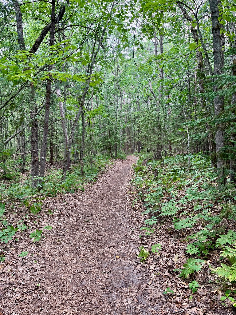
Eventually we found ourselves a mile from our car with a pocketful of stones. It didn’t make sense cover the same ground because we already found what we wanted. So we crossed the dunes and arrived at a completely different environment. The sandy shoreline berm deflected westerly winds and we entered a quiet woodland on the backside. Gentle walking trails brought us back to the parking lot where our adventure ended for the day.
Articles in the Mackinac’s Orbit Series
- Up North
- Counting Fingers
- Sault Ste. Marie
- Petoskey
- Eastern U.P.
- Mackinaw City
- St. Ignace
- Town of Mackinac Island
- Lake Shore Road
- Into the Highlands
- What’s Brewing?
See Also: The Complete Photo Album on Flickr.
Leave a Reply