
The final race in the series ended but the vacation kept going strong. We still had a couple of days reserved for some special places and additional exploration within the Appalachians. Much of this concentrated on an area I hadn’t explored before, a rugged place where three states joined.
Day 5 focused on one portion of that larger pursuit, heading North-Northeast from Seneca, South Carolina to Asheville, North Carolina. It was a rather straightforward route although roads through there twisted over and between the mountains.
I even created one of my somewhat rare videos to mark the occasion. It includes a couple of sites described in more detail below, plus a site from Day 6. Think of that as a piece of foreshadowing.
Isn’t this a pretty image? Yes I think it’s rather pleasant, so click on it and see some waterfalls and a mountain. Most of my YouTube videos get like a dozen views so make an old geo-geek feel better and watch it. It’s short! I promise you’ll be done in less than two minutes.
Twin Falls
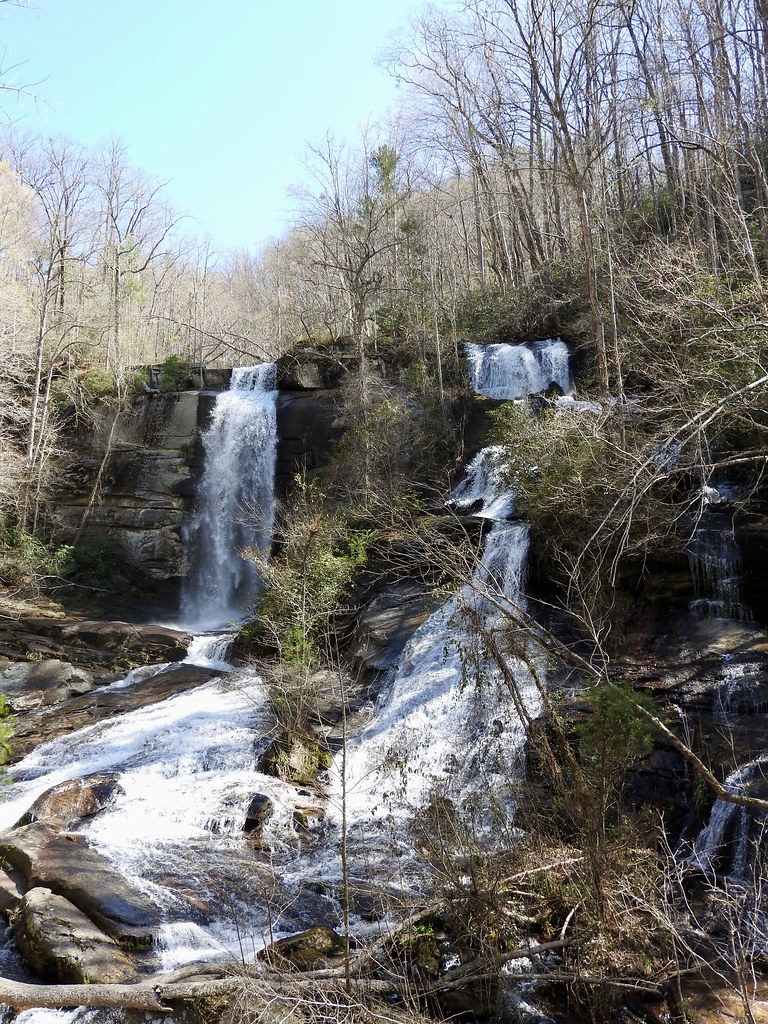
I wonder why they call it Twin Falls? I’m kidding of course. There were, in fact, two falls found at this spot in the forest near Sunset, South Carolina (map). It was a beautiful spring Sunday morning. We pulled up to the trailhead parking lot and followed an easy path through the woods for maybe a half-mile. We heard the falls first and then reached a viewing platform at the base. Eventually we got our fill so we walked back to our car.
By then, activity was beginning to pick up with considerably more people trudging up the trail. This is an easy day drive from Greenville, Spartanburg, Clemson and various other South Carolina places so I guess a lot of people wanted to come out and enjoy the outdoors on a weekend.
Sassafras Mountain
Sassafras Mountain was the most important waypoint of the day and we wanted to get there ahead of the crowds. So we skipped a hike to another nearby waterfall we’d previously planned.
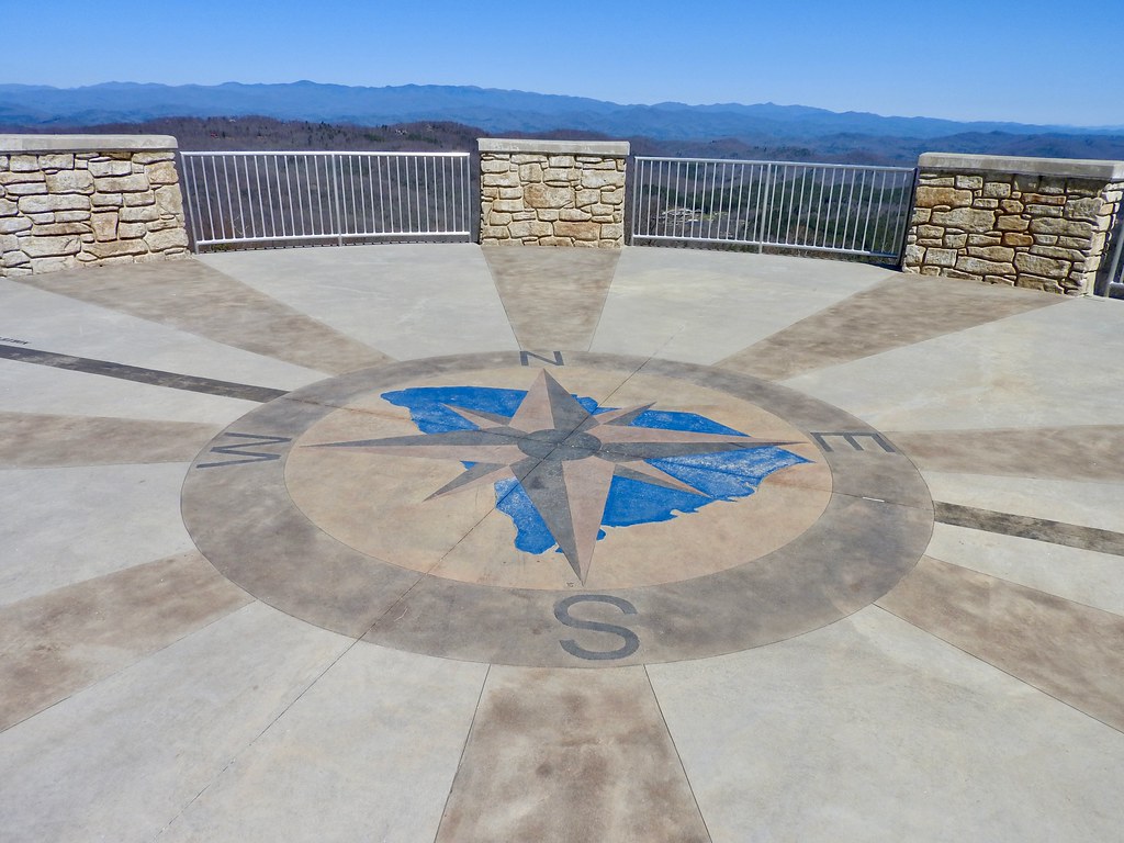
From a geographic perspective, Sassafras Mountain is both a state border and a state elevation highpoint (map). This is South Carolina’s roof at 3,553 feet (1,083 metres) above sea level. For one brief shining moment, nobody in South Carolina stood higher than I did.
Better yet, it required minimal effort. A road goes straight to the summit, topped by an observation tower opened in 2019. We viewed a wide arc of the Blue Ridge on this clear, cloudless day.
I’m not a highpointer specifically but I’ve been to the maximum elevations of eleven states plus the District of Columbia now.[1] Most of them — like this one — were easy catches requiring little more than a car ride and a short hike.
As I mentioned, the border between the Carolinas ran through here too. It appears as the darker, thinner line outside of the compass rose on the photo. From this position I’m standing in South Carolina and peering into North Carolina.
However, this is not the North Carolina highpoint which is at Mount Mitchell. A similar situation exists along the Tennessee – North Carolina border where Clingmans Dome is the highpoint for Tennessee but not for North Carolina. I’m not sure if that’s unique for a state but I’m too lazy to look it up.
Sierra Nevada
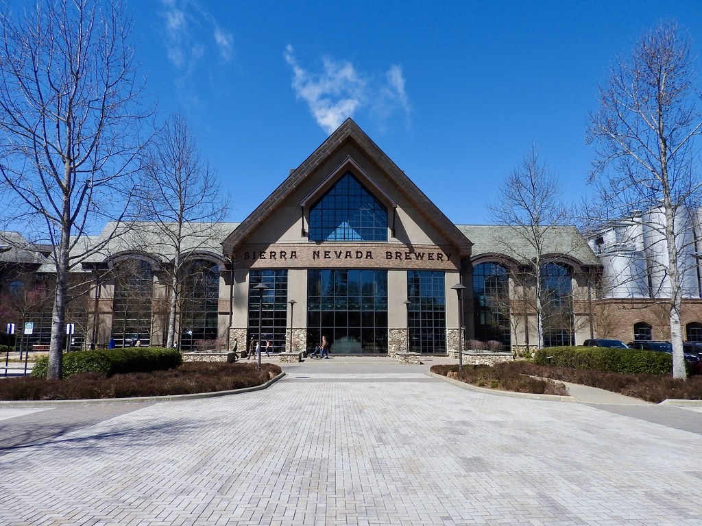
Now we faced a dilemma because we skipped the second waterfall hike. Our spontaneity blew a big hole in our itinerary. What could we possibly uncover during a drive between Sassafras Mountain and Asheville to fill the gap? More mountains, obviously. However rather than Blue Ridge we headed towards the Sierra Nevada range, at least figuratively (map). The last time we came to Asheville in 2015 we arrived from the north and we didn’t explore much to the south. Consequently, even though we hit a lot of breweries on that trip we never made it to Sierra Nevada Brewing‘s North Carolina facility.
Problem solved. We found a way to kill a couple of hours before we could check into our hotel, and we got to experience a new brewery visit. The place was massive; so much different from most of our brewery adventures. I’m glad we did it and I certainly enjoyed it, but I kind-of like the intimacy of smaller places.
Asheville Evening
Fortunately we hit plenty of those smaller places once we arrived in Asheville, proper (map). On the previous trip in 2015 we had a clear favorite, Wicked Weed’s Funkatorium on Asheville’s brewery-laden South Slope. That’s where they produced their funky, sour and barrel-aged beers. Allow me to quote myself from that earlier article: “If I return again it will be to visit the Funkatorium“. Well, I wasn’t lying. That was an early stop while our palates were still fresh.
A lot has changed in the brewing world since then, principally a huge explosion in the overall number of breweries. Asheville also added some more, and lost a couple too in the meantime. So we focused some attention on two places that didn’t exist during our last visit.
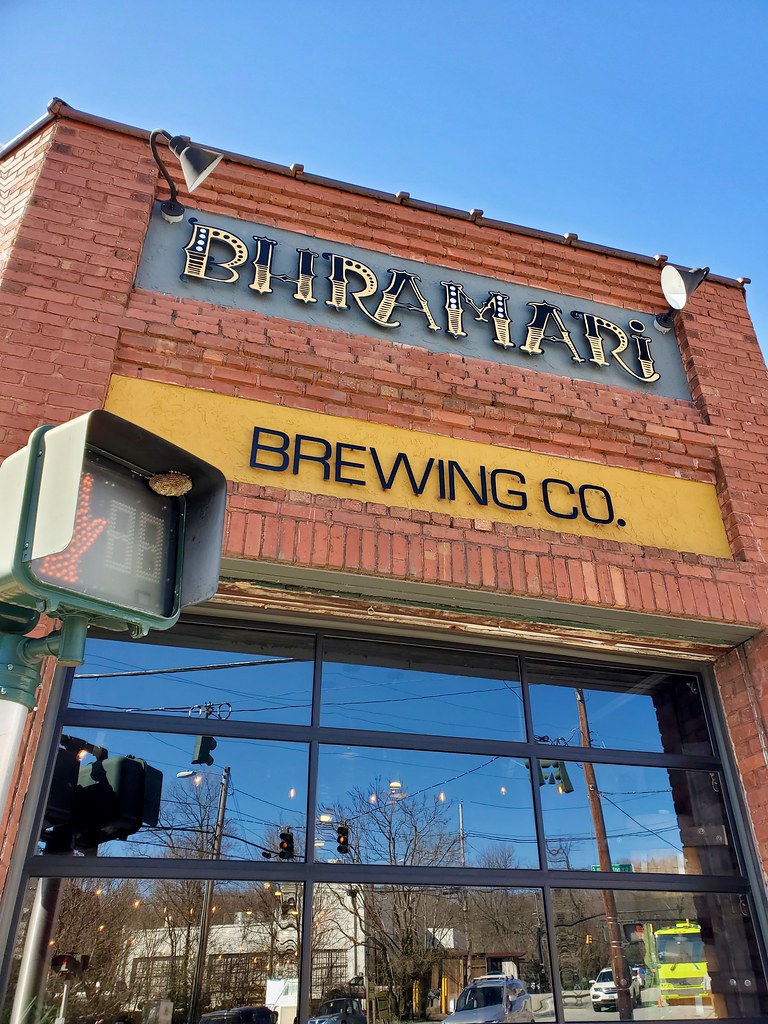
Bhramari Brewing sat within the South Slope. Bhramari is a Hindu goddess of bees and the theme carried forward into some of the eclectic artwork and exotic feel of the place. How did they get wasps to build a nest in the corner of the walk sign (in the photo) though? Pretty clever.
Then we visited White Labs Brewing just outside of the South Slope core. This Asheville outpost of a San Diego operation had an interesting premise. They focused on yeast research, and in fact yeast was their primary commercial product that they sold throughout the brewing industry. However, in Asheville they ran a restaurant brewpub too. People can order the same base beer fermented with different strains of yeast and compare the differences. Sometimes those difference were profound!
Seneca Race Recap
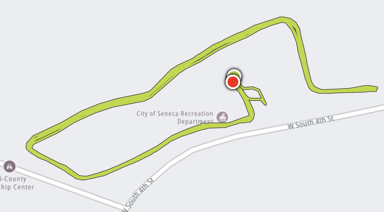
Alright, let’s talk about the race we ran first thing that morning in Seneca, South Carolina.
Mainly Marathon races involve a series of out-and-backs and this one looped around the Shaver Recreation Complex (map). Ordinarily that wouldn’t work well for a long distance race but somehow it clicks when the same basic group of people follow a series from state to state on successive days. Everyone gets to know everyone else so it’s nice to be able to offer encouraging words or simply chat as people pass back and forth along the course. Plus, it guarantees a water stop and snacks every 3-ish miles or so.
Unfortunately they had to shorten the Seneca course this year because of construction. This eliminated some of the flat terrain while retaining a vicious hill with a sharp grade. It wasn’t a particularly long section, but runners hit it on the way out and then on the way back, over and over. My wife opted for the early start so she began her run an hour before me. I arrived just as she completed a lap and all she could say was, “this course sucks” as she was trying to catch her breath.
Yup, she was right as I discovered soon enough. I did manage to preserve my goal by finishing the 10K in less than fifty minutes and at a better than 8 minute pace. But not by much. I finished at 49:22 with a 7:58 pace. I also pretty much trashed my legs going up and down that beastly hill. So that’s the real reason we didn’t go on that second waterfall hike later in the day.
I felt sorry for the kid who was doing his first marathon on that course.
Articles in the Southern Hills Series
See Also: The Complete Photo Album on Flickr.
12MC Loves Footnotes!
[1] State highpoints I’ve visited so far include Connecticut (Mount Frissell); Delaware (Ebright Azimuth); Maryland (Hoye-Crest); New Hampshire (Mount Washington); New Jersey (High Point); North Carolina (Mount Mitchell); Rhode Island (Jerimoth Hill); Tennessee (Clingmans Dome); West Virginia (Spruce Knob); Wisconsin (Timms Hill), plus the District of Columbia (Fort Reno)… and now South Carolina.
Leave a Reply