
I returned to more familiar travel patterns during the current and hopefully permanent lull in the COVID-19 pandemic. This included my first airline flight since February 2020 when I returned from Bermuda. Then the world shut down and I endured the longest period of my life without an airline flight since I was fourteen years old. We decided to land at Atlanta, Georgia as we reemerged from our protective shell.
We wanted to reconnect with one of our favorite activities, the running races sponsored by Mainly Marathons. This time we focused on three states in their Appalachian Series of races. My wife added to her collection of states where she’s completed a race and I added to my county-counting list. Everyone wins!
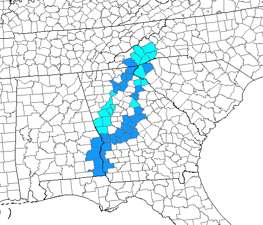
I traveled into a target-rich area where I hadn’t captured a lot of counties before. This map shows our route. Previously-visited counties appear in light blue and new counties appear in dark blue. During the week I added 33 new counties; 27 in Georgia, 4 in Alabama, and 1 each in North and South Carolina.
Georgia is an interesting case. The counties are small so it’s easy to collect a lot of them in a short time. Nonetheless, it’s hard to color-in much territory because they’re all so tiny.
We focused on positioning that initial day, simply flying to Atlanta and driving down to Columbus, Georgia and getting ready for the heart of the trip. It was nothing but Interstate Highway, a straight shot between the two.
Kadie the Cow
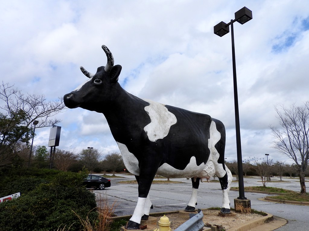
Soon we arrived on the outskirts of Columbus and of course we had to greet Kadie the Cow. Here the Kinnett Diaries once occupied a property overlooking Manchester Expressway (map). They added Kadie in 1967 and she still stands sentinel even though the dairy departed long ago.
It’s a pretty forlorn setting, actually. We found her on the edge of a vast empty parking lot in front of an abandoned Best Buy. Nonetheless, it’s still a local landmark and it deserved appropriate homage.
I would see a very similar cow in a different setting days later!
National Civil War Naval Museum
Then we stopped at the National Civil War Naval Museum just south of Uptown Columbus (map). I’ve been to more Civil War battlefields than I can count but I didn’t know much about the naval history. Well, I knew the basics of the Anaconda Plan and about the ironclad clash between the Monitor and the Virginia (Merrimack). But that was about it. Surprisingly, or maybe not so surprisingly, there was so much more to learn.
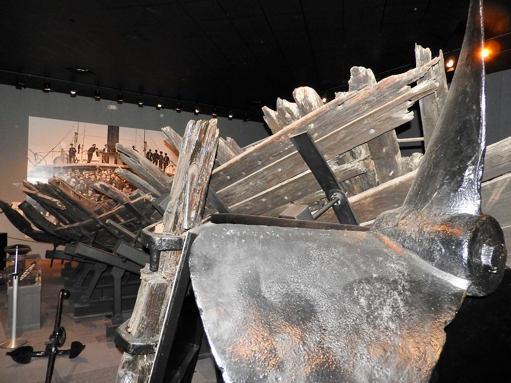
The museum told that story, of course. Even more so it included the remains of several actual vessels. Naval archaeologists dug one of them, the oversized ironclad CSS Jackson, out of the muck of the Chattahoochee River in the 1960’s. The Confederate navy scuttled the ship near the end of the war to prevent its capture.
The ship in the image above, the much smaller CSS Chattahoochee, suffered a similar fate. She was undergoing repairs at the Columbus shipyard when Confederates intentionally sank her as the Union army advanced.
Along the River
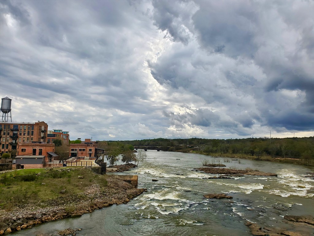
Columbus had miles and miles of walking a biking trails. Much of it fell within the boundaries of the Chattahoochee RiverWalk, which lined both sides of the river. This offered plenty of opportunities to walk between two states because the Chattahoochee defined the border here.
More accurately, it seemed the river actually fell within Georgia’s territory. So Alabama began on the opposing bank. Technically I guess I was standing in Georgia when I took this photo. The red brick buildings are part of Uptown Columbus and the tree-line park on the other side belonged within Phenix City, Alabama.
Phenix City appeared in 12MC all the way back in April 2009, and not because they spelled Phoenix weird. No, it’s one of those unusual areas that follows a time zone unofficially. Legally, all of Alabama recognizes Central Time. Yet, this little corner of the state uses Eastern Time. Naturally that’s because of Columbus. It’s so much larger geographically, economically and demographically that it makes no sense for Phenix City to observe a different time. So they ignore the rest of Alabama and hitch their wagon onto Georgia, at least chronologically.
I really did enjoy that RiverWalk. We spent a good hour one morning exploring its banks. Columbus even converted one of its bridges, formerly carrying automobiles across the Chattahoochee River on 14th Street, into a pedestrian-only crossing (map).
Let the Brewing Begin!
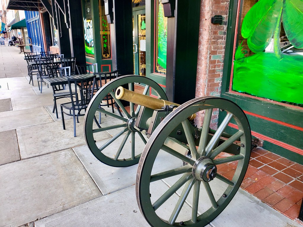
Alright, now I get to provide the standard disclaimer. We visited a bunch of breweries on this trip, something like 16 I think. However we consumed minimal quantities, generally splitting a flight of 4 or 5 taster-sized glasses between the two of us. That worked out to less than a single beer each in many cases. Truly, this was about appreciation of the craft, not about volume. So let’s bear that in mind as we proceed with the rest of the articles in this series, ok?
We visited two breweries in Columbus: Chattabrewchee Southern Brewhouse and The Cannon Brewpub. Both were fine. Chattabrewchee sat in what was formerly a light industrial area just outside of the Uptown core, a common layout for many modern breweries. Cannon was a true brewpub with a restaurant and sat directly within Uptown Columbus. The weather cooperated and we enjoyed our flights outdoors in the cool breeze. This set a nice tone for the remainder of the journey.
Articles in the Southern Hills Series
See Also: The Complete Photo Album on Flickr.
Leave a Reply