
Bayfield, Wisconsin, USA (August 2007)
Bayfield (map), the Apostle Islands gateway, owes its identity to Admiral Henry Wolsey Bayfield. He charted much of the western Great Lakes in the 1820’s as a Royal Navy Surveyor. That included Chequamegon Bay and areas surrounding present-day Bayfield and Madeline Island. When the Bayfield Land Company platted their town in 1856, they chose this explorer as their worthy namesake.
The Bayfield settlement came late to the peninsula. Native American Ojibwa lived here long before the first person of European ancestry arrived. Then a trading post and later a town across the bay arose in La Pointe. French, British, and finally American pioneers lived there more than 150 years before Bayfield existed. However, Bayfield soon took off as a center of fishing, shipping, ship building, forestry, and tourism.
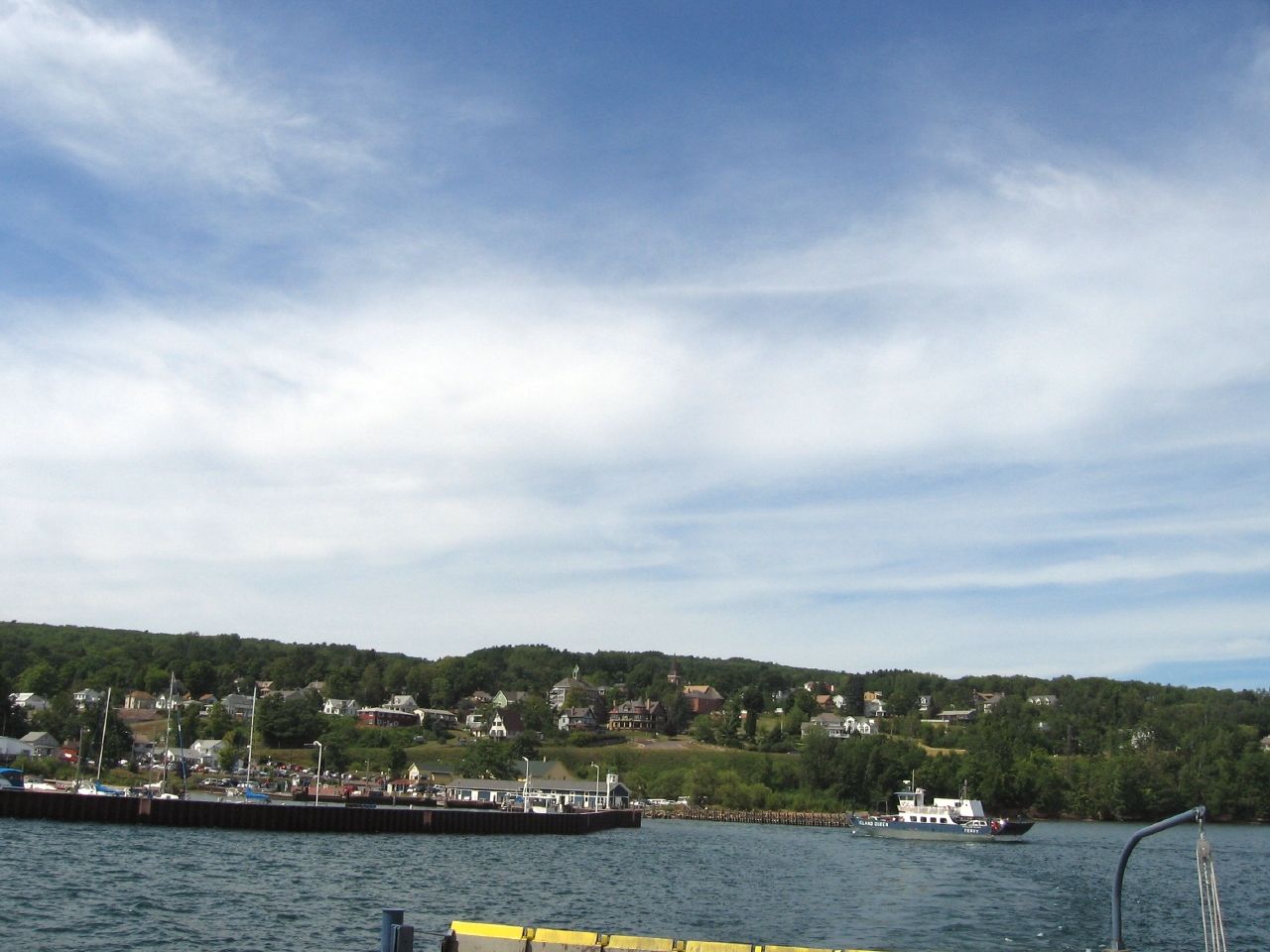
We discovered a quiet little town of perhaps 600 people centered along Rittenhouse Avenue (map). It sloped downhill towards Lake Superior and the forested knobs of the Apostle Islands. A commercial district stretched about four blocks. Shops seemed to cater primarily to a seasonal tourist trade of bed and breakfast inns, restaurants, curio shops, artisans, and all types of waterborne activities. It did not feel overcrowded even in the middle of summer.
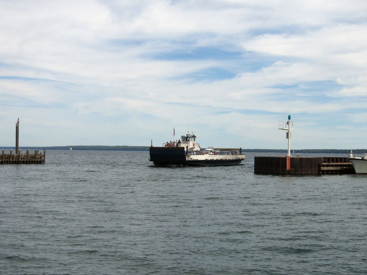
Walkable streets existed throughout Bayfield. That allowed us to amble through much of the town, and down to the shore and along the marinas. At one point we entered the Apostle Islands National Lakeshore Headquarters on Washington Avenue (map) . That helped us orient for our upcoming journey among the isles. Then we sat within a gazebo at the town park for awhile. From there we watched ferry boats travel back and forth to Madeline Island on a lazy afternoon (map).
City Marina
We walked down south 1st Street by the waterfront to its intersection with Wilson Avenue and the city marina. We targeted the large town park playground as it came into view. The kids got an opportunity to burn off some excess energy. We, on the other hand, relaxed under a shade tree with no particular plan.
The marina sat right across the street, a convenient backdrop for the moment on an idyllic day. Sailboats filled many of the slips, stored here for the season or more transiently. From there they got easy access to the nearby Apostle Islands across the bay. Sailors could cruise among the islands in daylight, return to Bayfield in the afternoon, and rest in one of the luxurious inns overnight.
Maritime Museum
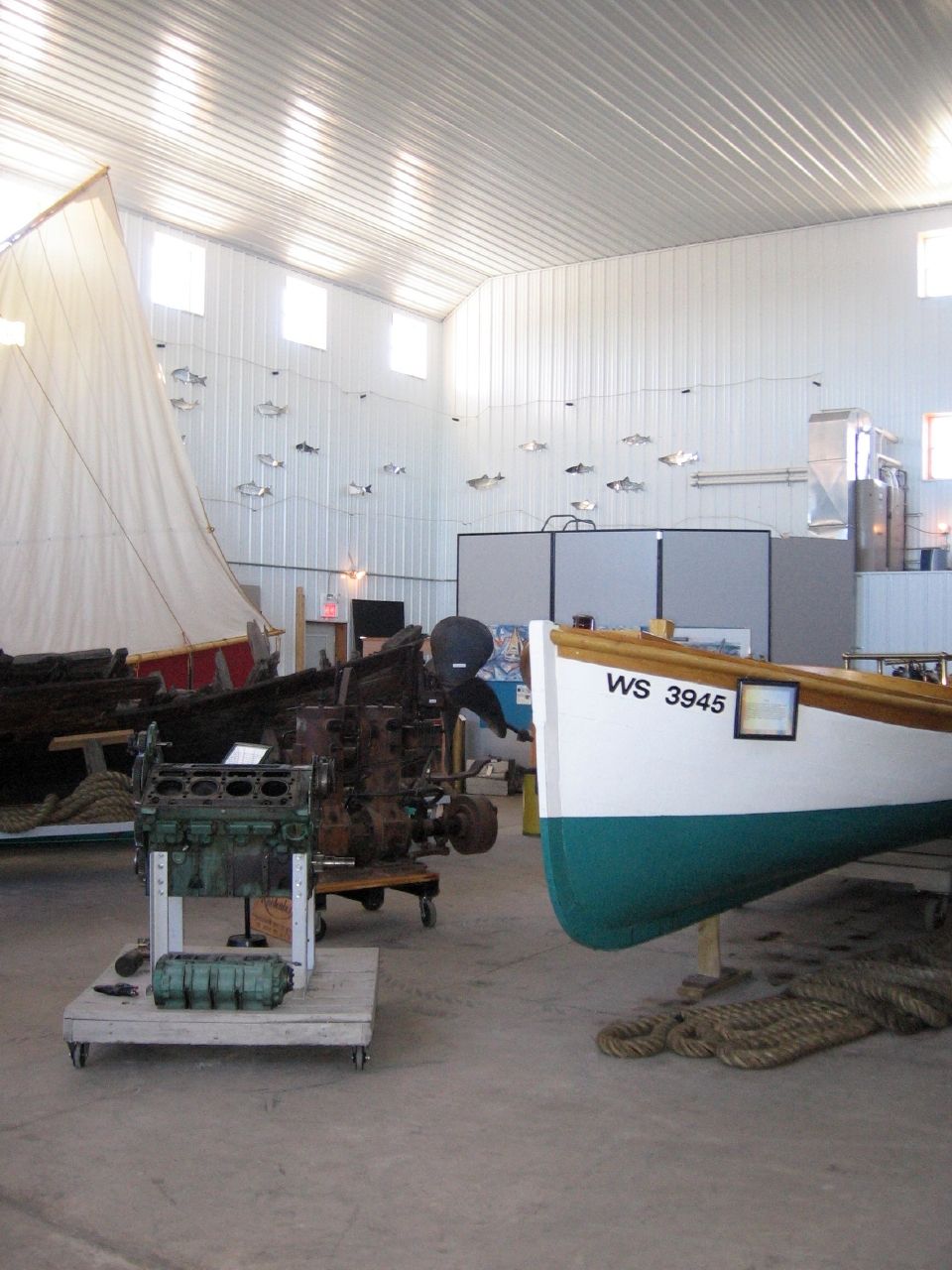
Local residents must have emptied every attic and vacant lot in town to fill the spacious Bayfield Maritime Museum. It held more than a century worth of nautical artifacts and exhibits (map). We explored the museum in its modern clapboard-faced boat shed. It portrayed the rich waterborne legacy of Lake Superior’s Bayfield Peninsula and Apostle Islands.
Exhibits focused on a multiple disciplines and perspectives that contributed to the lifeblood of the people who settled along the lake. Commercial fishing occupied one corner, including boats and gear used by fishermen as well as equipment for processing and packaging seafood for market.
Other exhibits focused on the large freighters that transported ore, coal and grain through the Great Lakes shipping channels and waterways just offshore. Pleasure craft that formed the backbone of a local tourism industry occupied other displays. Finally the museum focused attention on the lighthouses and keepers that worked tirelessly and without recognition to preserve the safety of all mariners, whether fishermen, freighter crews or weekend sailors.
Outdoor Exhibits
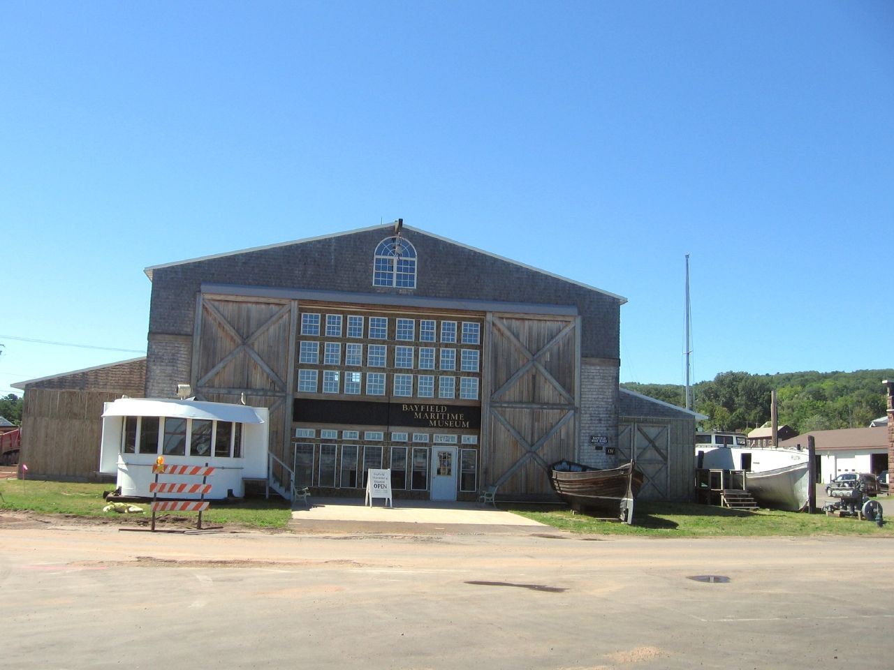
More exhibits could be found on the outdoor grounds of the Bayfield Maritime Museum. Our little guy enjoyed pretending to be the captain of a Lake Superior freighter in an authentic recreation of an actual pilothouse (the white structure to the left of the entrance). It had been cut from a real Great Lakes freighter and dropped outside the front entrance to the museum. The curators outfitted it with period equipment that gave an illusion of what it must have been like to steer several hundred feet of iron and cargo across Lake Superior. Wheels turned, handles pointed full speed ahead, and the kids prepared to get underway.
The Iron Bridge and the Flood
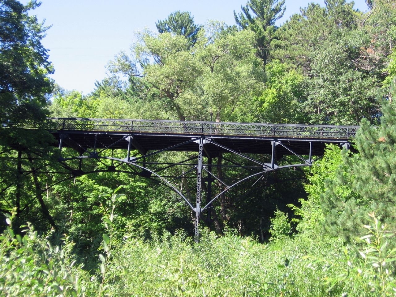
We found Bayfield to be a highly walkable community, complete with bluffs, nooks and lakefront vistas that satisfied our wanderings without being overwhelming. We discovered an amazing iron bridge built in 1912 and restored in the 1980’s, just a couple of blocks north of Rittenhouse Avenue (map).
A hill rose behind Bayfield Harbor, with each successive avenue terraced on a higher level, providing nearly every spot with an expansive view of Lake Superior and the inner Apostle Islands. We wandered across the iron bridge on Rice Avenue, between North 2nd and 3rd Streets. While its supports may have been solid metal, we were surprised to find that the roadbed itself consisted of wooden beams laid side-by-side against themselves. Pylons blocked automobile access at either end, making the crossing ideal for bicycles and pedestrians, but in decades past, motorists would have driven over this steep gully along a narrow timbered track.
A large catch basin formed a semicircle beneath the downstream slope below the iron bridge. A creek flowed gently, harmlessly through a weedy glen, and down through town to Lake Superior. The trailhead for a half-mile nature trail began here too. It followed the creek uphill through the gully a world away from civilization.
That same little creek turned into roaring whitewater when Bayfield flooded in 1942. It cascaded down streets, through buildings, and over embankments, pulling stones, mud and homes along with it towards the lake. The Army Corps of Engineers built the basin to prevent future flooding. During normal times the creek flows as it always has, but during severe storms tumbling waters will collect in the basin rather than careening through town.
Leave a Reply