
Apostle Islands National Lakeshore; Bayfield County, Wisconsin (August 2007)
Mariners navigated through the Apostle Islands with the Raspberry Island Light as their companion since its 1863 activation. This “Showplace of the Apostles” took its present form in 1906 when the U.S. Lighthouse Service expanded the keeper’s quarters to accommodate additional workers to operate a new fog signal station (map).
Keepers tended this facility by hand until they became obsolete in the 1940’s when automation took over. Structures slowly deteriorated in the harsh Lake Superior winters and fell into disrepair. The U.S. National Park Service restored and stabilized the shoreline in 2002 to keep the installation from eroding into lake. It then spent more than a million dollars between 2005 and 2007 to restore the lightkeeper’s house back to its original showplace condition.
We were lucky enough to visit the lighthouse in absolutely pristine condition soon after its public reopening in the summer of 2007. Historians decided to remodel the interior on a 1920’s appearance down to every detail, including antique furniture, a cast iron stove and period kitchen, a battered manual typewriter with half-typed correspondence on the dining room table, a wax cylinder phonograph in a living room corner, and even vintage copies of National Geographic spread atop a small parlor table. Park Rangers lived on-site during the summer in the northern half of the duplex to keep an eye on things and give tours to any visitors that happened to stop by the island.
Getting to the Island
A single small boatload arrived each day via Apostle Islands Cruises. They provided drop-offs for overnight camping, but otherwise visitors had to be ready for the return trip unless they really wanted to stay an extra day. Others came by personal sailboat or sea kayak, stopping at Raspberry Island while exploring various other points along the archipelago. The ranger on-duty told us that a steady stream of people visited in the summer, especially on the weekends. About 5,000 – 10,000 people tour the lighthouse each year. That was pretty remarkable considering that nobody gets here without a boat.
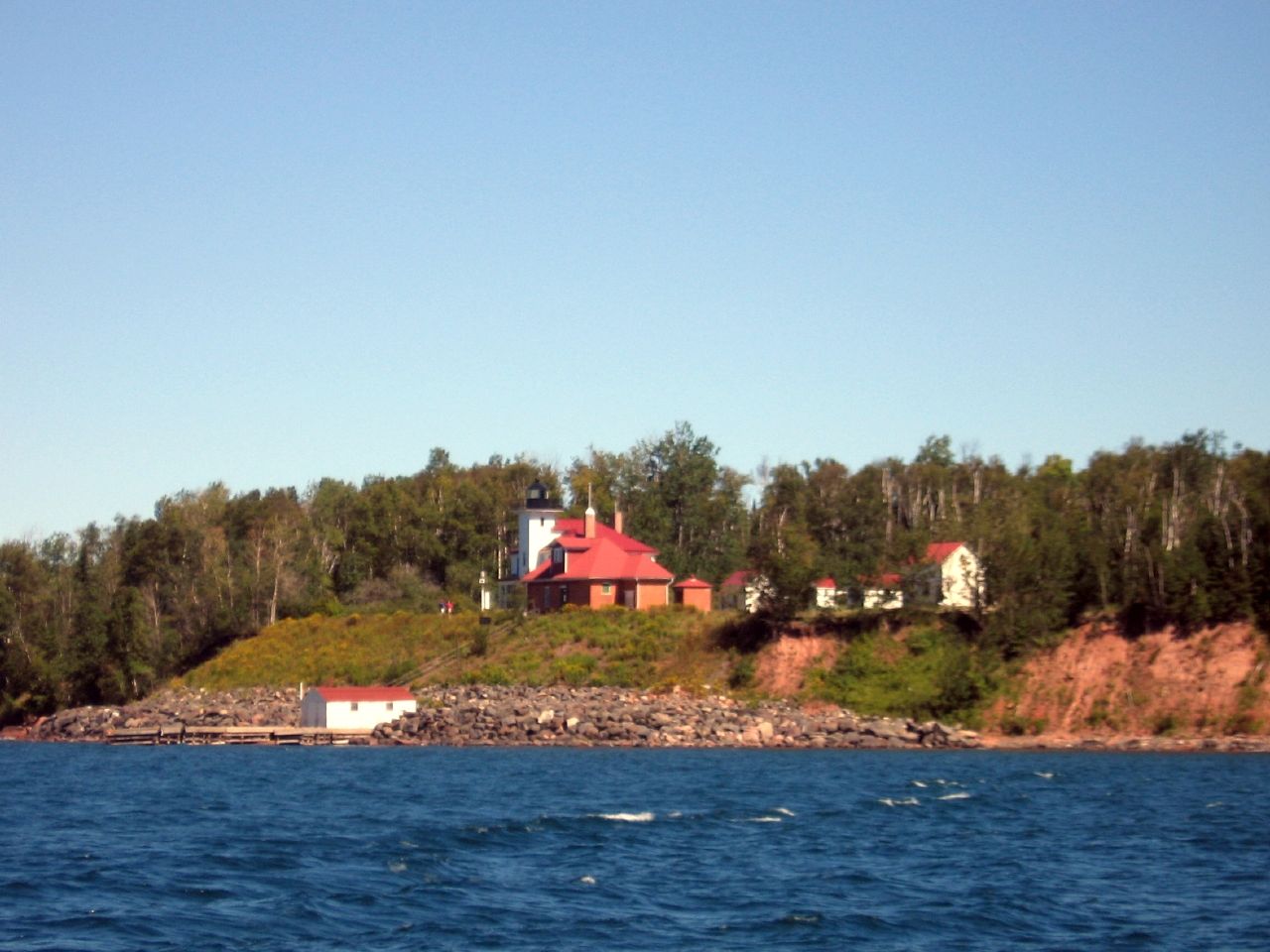
I took the photograph above as we prepared to disembark. The dock and boathouse can be seen at the bottom of the bluff. The fog signal station sits at the foreground, with the lightkeeper’s home and tower immediately behind it, partially obscured. Outbuildings continue towards the right: the oil house; a woodshed; the head keeper’s privy, a cabin and a barn. The workers had to be somewhat self-reliant so they kept animals and farmed small plots to provide themselves with a little variety.
From the Tower
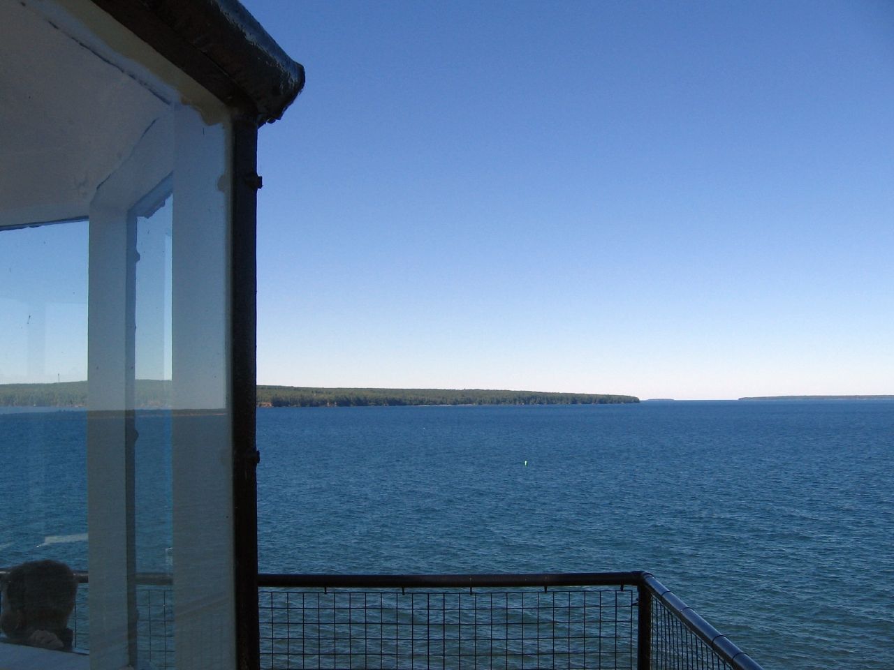
We climbed vertically through a narrow passageway up to the lighthouse tower, 40 feet higher than the ground and 80 feet above Lake Superior. Only a few people could stand around the small tower deck. Upon reaching the perch, I understood exactly why the government placed a lighthouse on this remote spot. From our vantage point about half of the Apostle Islands and twenty miles of mainland could be identified on this crystal-clear morning.
Oak Island can be seen most clearly in this photograph, but others appear further in the distance on the right side of the image. The Raspberry Island lighthouse along with another one on Sand Island guided ships between Duluth and Ashland, as they traveled past between the inner set of islands and the mainland through the West Channel.
The Light
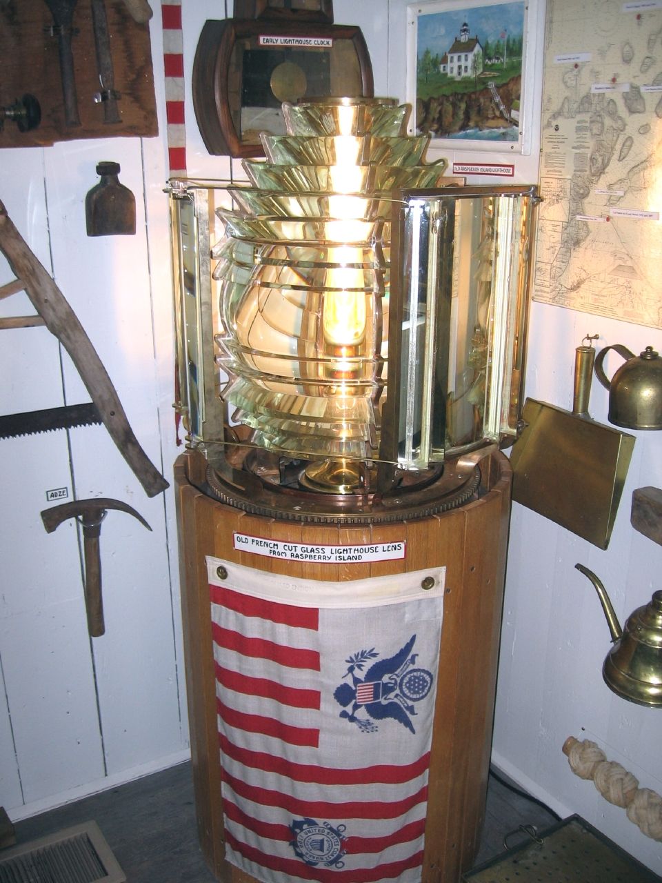
A light continues to pulse on Raspberry Island once every few seconds, but it’s a modern strobe light on a nondescript bare pole. It’s more efficient but considerably less romantic. The 5th Order Fresnel lens that formerly graced Raspberry Light now resides in the Madeline Island Historical Museum in La Pointe. A 5th Order lens is designed for harbor navigation so it’s relatively small. It fits easily within a rustic museum corner. A switch allows visitors to activate the light and that is why it’s shining in the photograph.
Notice the other artifacts in this exhibit: a map of the Apostle Islands; an antique print of the Raspberry Island lighthouse, an original lighthouse clock; and various tools and implements that would have been used at that time. The plaque on the base reads “Old French cut glass lighthouse lens from Raspberry Island.“
Sandspit Trail
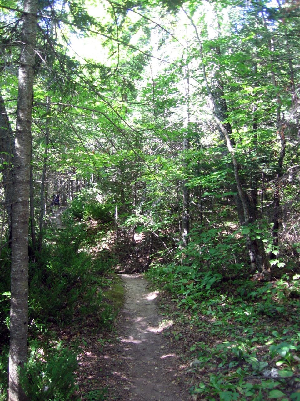
A path known as the Sandspit Trail cuts from the lighthouse through dense forest, to a cove three quarters of a mile away on the southeastern side of the island. In the old days, ships docked in the sheltered cove and unload their supplies along the shallow sandy beach. Workers then hauled cargo up from the beach along the trail to the lighthouse. Eventually they installed a pulley and tram system in front of the lighthouse so they could wheel supplies up from a dock they constructed at the base of the bluff. This would have been much easier than dragging supplies uphill through the forest.
Unlike many of the islands in the Apostle archipelago, Raspberry never experienced commercial logging because it was protected land, part of a U.S. Lighthouse Service reservation. Much of the original old growth forest still remained intact. We caught only brief glimpses of Lake Superior during our Sandspit Trail hike. It was hard to tell we were on an island.
Cuspage Foreland
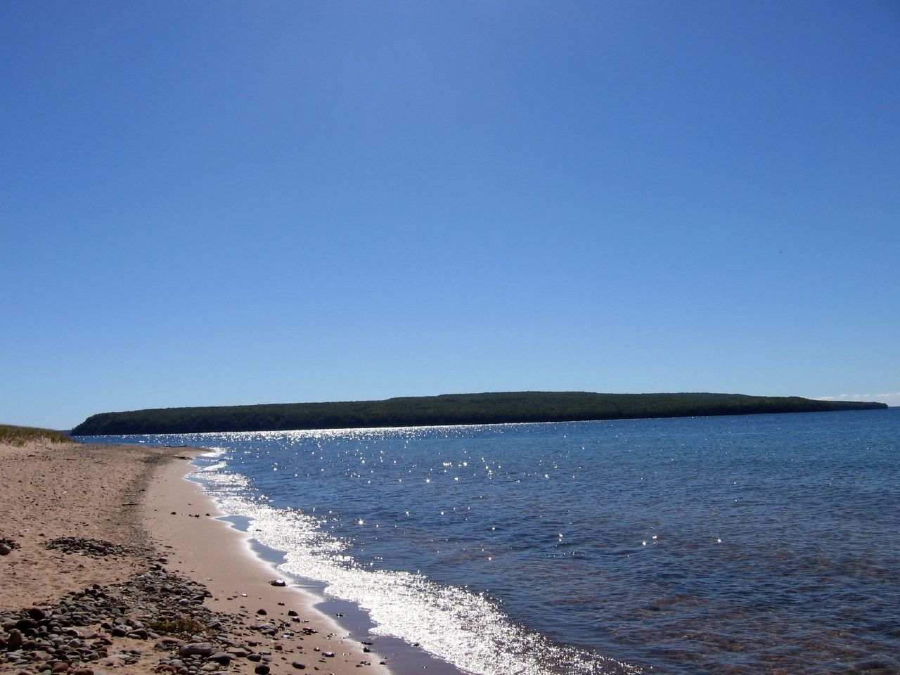
The trail led to an isolated sandy beach on the southeastern end of Raspberry Island (map). Despite the trail’s name, the endpoint is more properly a “cuspage foreland” rather than a sand spit. It formed as bluffs eroded along Lake Superior and sediment traveled down two sides of the island in a process known as long shore drift, combining into a triangular point where the dueling streams of sand collided. Long crescent beaches lined both side leading to the tip. Grasses and scrub held the entire assemblage together.
We had this whole side of the island and the entire beach to ourselves. Other visitors remained at the lighthouse. I guess they didn’t want to risk missing the only boat back to the mainland. Even so there was plenty of time to hike the entire trail, relax and beachcomb for a while, and then return to the dock.
Two sailboats rested in the protected cove, having dropped anchor overnight while cruising through the Apostle Islands. We could catch snippets of conversation across the water as these weekend mariners awoke and prepared their breakfast. Neighboring islands dotted the horizon, green bumps rising above an azure surface, so clear they seemed a quick swim away. Oak Island jutted from the surface across the channel in the photograph above.
Readers who have an interest in lighthouses might also want to check my Lighthouse Index page.
Leave a Reply