
I started Twelve Mile Circle back in 2007. Sometimes I wish I could return to those earliest pages and rewrite them though. They didn’t have nearly the thoughtfulness that I applied to later efforts. Even before that though I posted a number of travel topics including a visit to Niagara Falls in 2003. Eventually I transferred those ancient pages onto the 12MC platform but that didn’t mean they didn’t suck. So I feel completely justified talking about my recent visit to the falls as if that earlier event never happened.
Most everyone probably knows about Niagara Falls (map). I suppose we may have some in the international audience with less familiarity so I’ll explain it briefly. The Niagara River is an outflow of Lake Erie into Lake Ontario, part of the Great Lakes system situated between Canada and the United States. A huge volume of water pushes through that narrow slot. There it hits a ledge on the Niagara gorge and drops vertically about 50 metres (160 feet). River islands split the flow at a critical point so there are in fact multiple falls: Horseshoe; American; and the much smaller Bridal Veil (kind of an extension of American Falls, but whatever).
Crossing the Border

We spent very little time on the U.S. side of the falls. I’ve always liked the Canadian side better and that’s where we headed, COVID be darned.
The Canadians re-opened their side of the border just a few weeks earlier. However, they included an extra hoop this time. U.S. visitors had to present written evidence of a negative polymerase chain reaction (PCR) test or something similar. Plus, the results needed to be less than 72 hours old. So we took care of that before we left home because we knew we could fit it within the window.
Getting across the border was a breeze. We filled out the online ArriveCAN health forms in advance, we had negative test results in hand, and we carried our passports at the ready. Nobody else, and I mean nobody, walked across the Rainbow Bridge (map) at the same time we did. We strolled right up to the sole Canadian border official with zero wait and then processed through in about a minute.
Few Americans, I guess, wanted to bother with the extra paperwork. Plus, as of the time I write this, Canadians still can’t cross into the United States for tourism purposes. So we experienced the sensation of mingling amongst an almost exclusively Canadian crowd once we passed into Ontario.
Along the Promenade
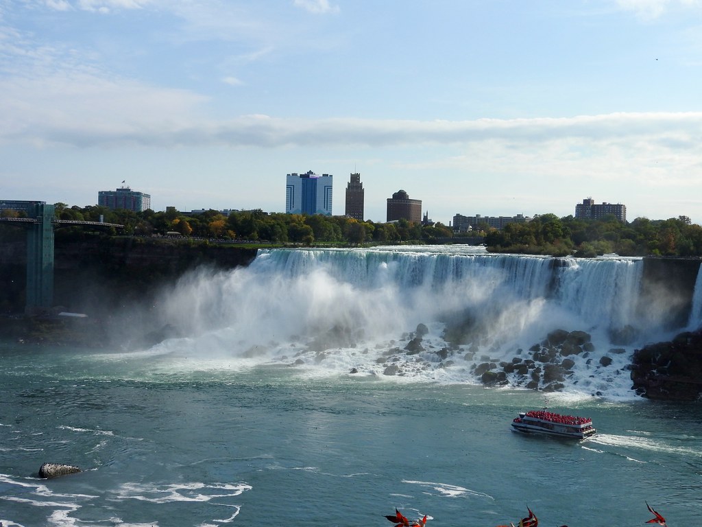
Logically, the place to start is a walk along the riverside promenade atop the Canadian bluff. This let us views the falls and orient ourselves to various attractions nearby. It was lovely weather, surprisingly mild for October, and of course everyone wanted to take advantage of it. I’m sure it helped that Canadians were there on the Sunday of a 3-day holiday weekend. While we “celebrated” Columbus Day (and increasingly Indigenous Peoples’ Day), we encountered Canadian Thanksgiving weekend on the other side. Or as they call it in Canada, just Thanksgiving, without the qualifier.
People wished us a happy Thanksgiving, maybe because there were so few Americans around that they assumed we were all Canadian. At first I thought it was a little prank, you know, a lighthearted way to mess with American tourists. But no, we looked it up on our phone after the second occurrence and indeed it was a thing, with a statutory holiday and all.
Skylon Tower
It’s hard to miss Skylon Tower (map). It literally rises above everything else on either side of the border (image). So nobody can say they didn’t see it, and it’s really more a matter of whether someone wants to be all touristy or not. And we were going full-on tourist, y’all. Well, maybe not quite that far. We didn’t eat at the revolving restaurant or any of that. Tickets to the observation deck seemed fine for our purposes. The scenery certainly impressed us though, standing there at 143 m (469 ft) above street level on such a clear day.
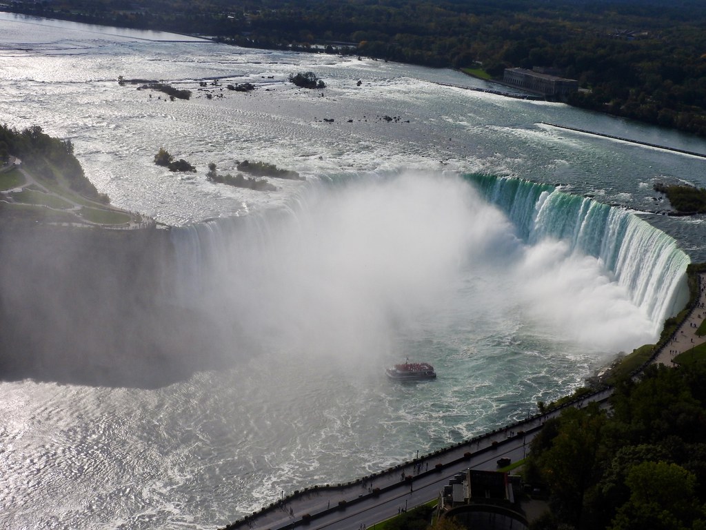
Falls Cruise
Boats from the Canadian and American sides of the river continuously buzzed the base of the falls. I wanted to get in on the action. Somehow we skipped this in 2003 (probably because our older son was a toddler). But it looked like a lot of fun. This also let me add another video to my very lame YouTube channel. I post there only about once a year anymore so here you go. Actually I’m pretty amazed at the quality of phone video nowadays. Maybe I’ll start doing this more often again.
The video gets right into each of the falls. Incidentally, some people call Horseshoe Falls the Canadian Falls. This is a misnomer. A small corner of it crosses onto the U.S. side (map) so it can’t truly be “Canadian” can it? I can split a hair with the best of them.
Anyway, each passenger got a plastic poncho prior to boarding. Sure, I thought, it could get a little misty so it might be useful. Well, the boats get really close to the base of the falls, particularly at Horseshoe. It’s like a full-on thunderstorm with wind and waves and spray, and of course gave quite a soaking. I’m glad we did this.
Niagara Brewing
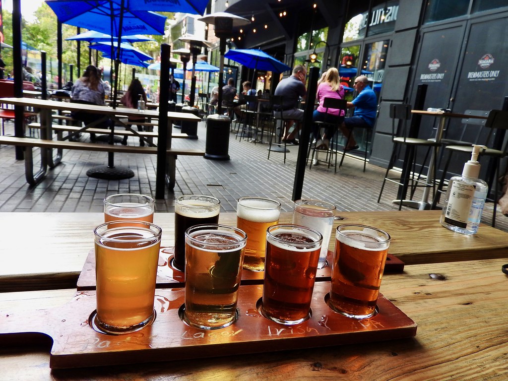
Lunchtime arrived soon enough. Of course I was going to find a brewpub within walking distance if one existed, and there we found Niagara Brewing Company (map). Once again we dined al fresco. That seemed like the responsible thing to do during what I hope are the waning days of the COVID pandemic. Split a nice little flight of beverages with my wife to accompany the meal? Why yes, that sounded downright pleasant. Then I notched another international destination on my brewery visit map.
Incidentally, the Canadians seemed to take precautions a lot more seriously than people just across the bridge in New York. Masks appeared everywhere, with mandatory usage indoors and an impressive voluntarily presence outdoors. Some of the crowds in New York actually scared me, like COVID wasn’t even a thing anymore. Ironically, it’s the Canadians who can’t get into the U.S. instead of the other way around.
Clifton Hill
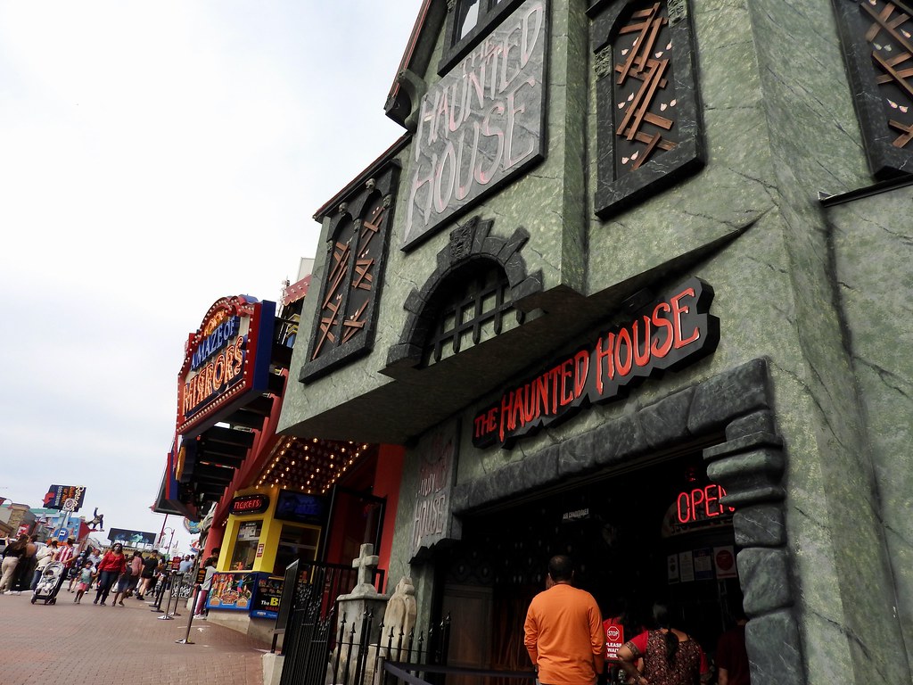
Yikes! Walk up from the falls onto Clifton Hill (map) and all of the natural beauty switches to, well, this. Imagine the complete lowbrow tackiness of a Jersey Shore boardwalk dropped onto Canadian soil and that’s what we got here. A single photograph simply can’t do it justice. Just multiply this by several blocks of increasingly cheezy attractions and gain a better appreciation. Yes, unquestionably, I loved it.
That didn’t mean I could figure in my mind how it ever came to pass. Large crowds gawking at the falls meant large crowds available to gawk at other things I supposed, but the dichotomy seemed unfathomable. Well, it’s best to avoid overthinking such things. So I suspended my disbelief and immersed myself within the experience.
Articles in the Niagara Weekend Series
See Also: The Complete Photo Album on Flickr.
Leave a Reply