
Ashland County, Wisconsin, USA (August 2007)
With the exception of the immediate boundaries of La Pointe, the most popular spots on Madeline Island were the adjacent state and town park along Big Bay’s sandy hook. “Popular” was a relative term however. We never felt crowded anywhere on the island. We found Big Bay State Park easily, rolling out of La Pointe on Highway H – Middle Road, onto Hagen Road to the park entrance (map).
This cut straight across Madeline Island from west to east, a distance of about seven miles. We drove along slowly as we shared the road with two-wheelers. The flat terrain and low traffic attracted lots of bicyclists who either brought their gear on the ferry or rented something suitable in La Pointe. We passed by with a waive as we continued towards the beach.
Barrier Beach
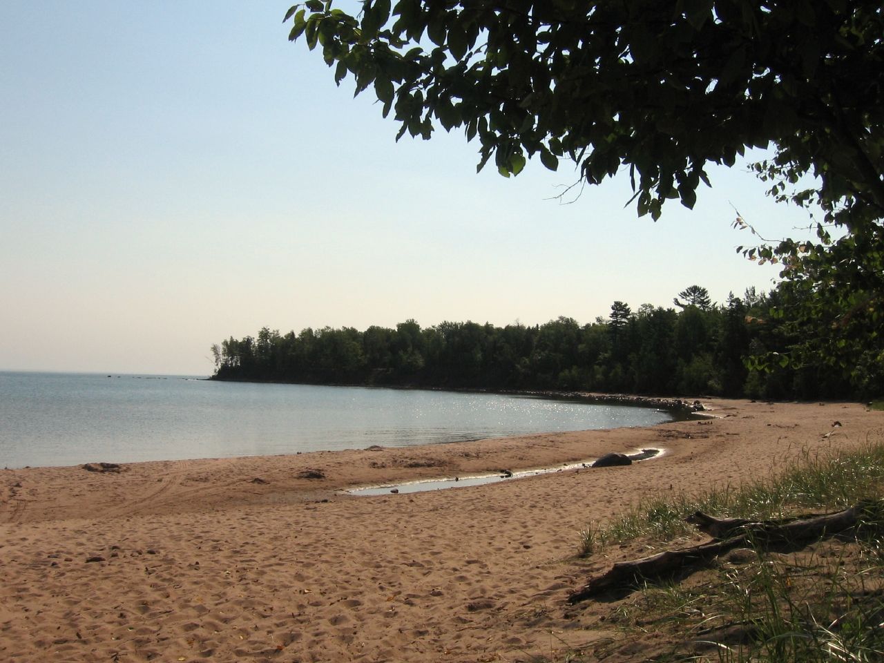
We arrived at the Barrier Beach after a short hike through a forested trail. Then we reached a one and a half mile crescent of magnificent, unspoiled Lake Superior waterfront. A handful of other people shared the strand but that wasn’t an issue. A short walk provided plenty of seclusion. The sun shone brightly through a deep blue sky on this summer afternoon.
It was hard to imagine that such an amazing beach in pristine condition and total isolation could still exists in the United States. No doubt the location mattered. It’s quite a bit off the beaten path. People really have to want to get here. First, Visitors need to travel all the way to the northern extremity of Wisconsin. Then they have to take a ferry across to Madeline Island. Finally they have to drive to the other side of the island. Not everyone wants to make the effort. That’s just fine with the rest of us.
Something about the sand, something about the way it scraped from sedimentary rock in the basin that formed the Apostle Islands and rode Lake Superior currents only to snag on this gentle crescent, something about that process formed the absolute best sandcastle sand I’ve ever known.
The Boardwalk
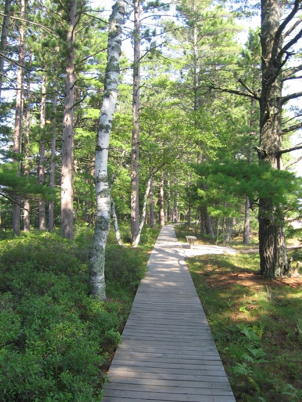
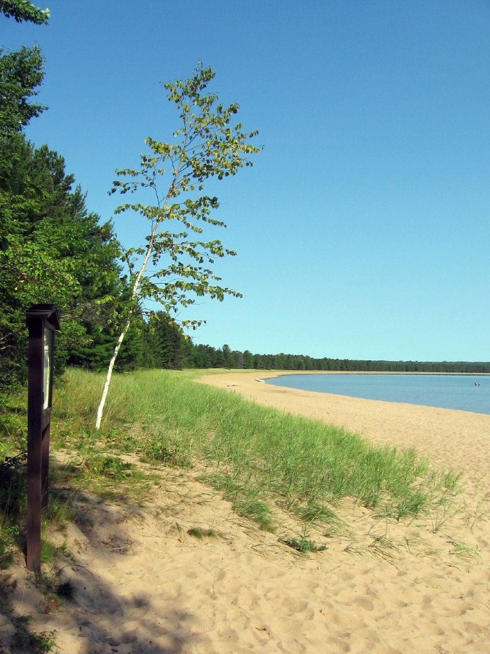
Much of the Barrier Beach formed a ridge between the lake and an inland lagoon. The Wisconsin Department of Natural Resources built a narrow wooden boardwalk along much of the ridge up to the border with the Town Park. This allowed a pleasant stroll through the woods atop the plank road that protected ancient dunes and native plants from trampling feet.
Every once in awhile we arrived at a wide point with a bench, providing an alcove for quiet contemplation or simply a brief rest. Small signs atop posts explained the geography, animals, plants and ecology of the lake, sand and lagoon on this self guided nature trail. A loop near trail’s end housed a wildlife observation deck overlooking the lagoon and its surrounding marshland.
At the Town Park
The much smaller Big Bay Town Park perched atop the northern end of the sandy crescent where the lagoon joined Lake Superior (map). It was an easy swing up from the State Park. More people congregated here, although like it’s nearby cousin, it never felt truly crowded.
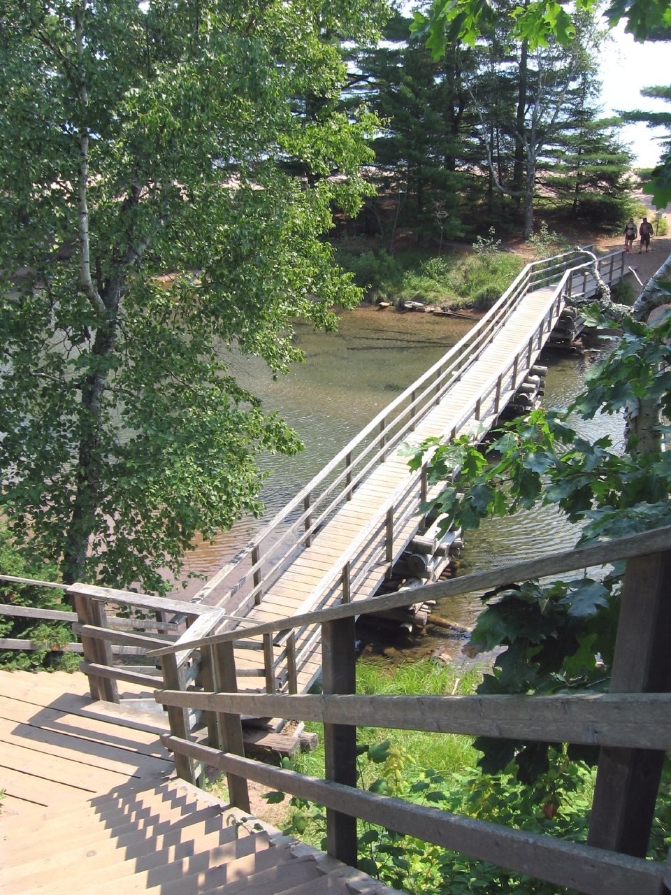
One reason for its greater popularity may have been it’s lack of an admission fee unlike the State Park. No doubt most of the visitors came straight from La Point on Big Bay Road, having bypassed the other park entirely. From the parking lot we descended a steep stairway to a wooden footbridge across the mouth of the shallow estuary. On the far side stood racks of canoes and kayaks, each marked by the names of individuals, hotels, rental companies and fishing clubs.
Most of the crowd seemed to congregate on the sandy shelf just past the footbridge, right next to where a great lake cut through a narrow channel to penetrate the island interior.
Madeline Island didn’t have a public swimming pool but this park served a similar purpose. Little kids splashed around the shallow estuary without fear or danger. Bigger kids and adult waded into Lake Superior itself, assuming they could acclimate to chilly water.
Big Bay Lagoon
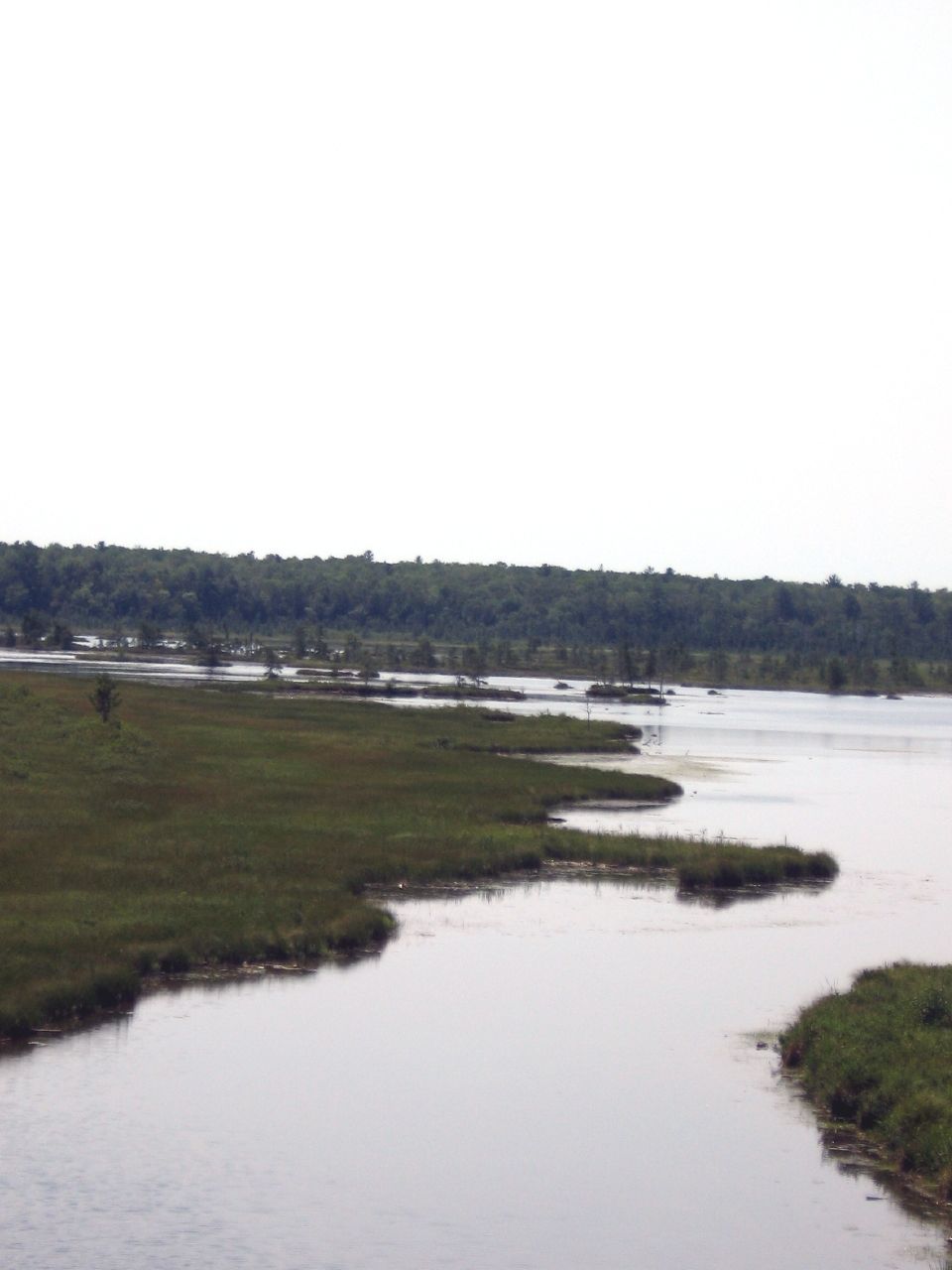
From the town park beach they could slip into the lagoon a few feet away. The lagoon was once part of Big Bay when the Apostle Islands first appeared after the glaciers receded at the end of the last ice age. Currents, sediment and shoreline waves built a Barrier Beach but by fate missed a narrow inlet to the north. Otherwise we’d have some great examples of the island-on-an-island phenomenon.
Anglers rowed or paddled about the lagoon, catching Northern Pike and trout. Kayakers glide serenely among the little coves and island dots before venturing out along more challenging Lake Superior coastline.
Varied Terrain
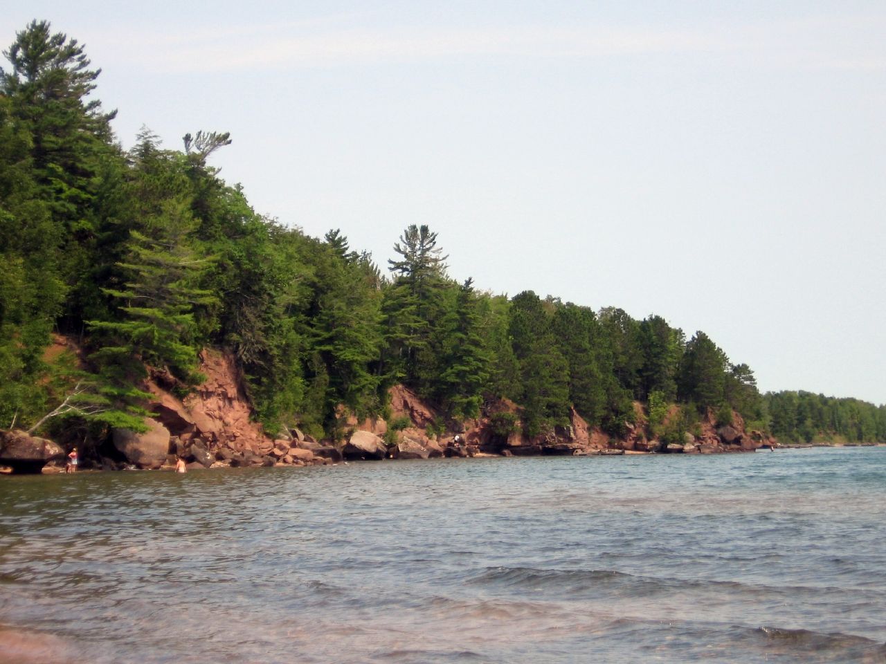
Madeline Island wasn’t perfectly sandy beaches forever. That made it all the more interesting. Terrain depended on weather patterns, water currents and the cycle of erosion that deposited sand in some spots and chewed away at shoreline in others. The terrain changed quickly just north of the Big Bay Town Park. Evergreen plateaus rose above the lake on the back of sedimentary brownstone. This was typical of the Apostle Islands. Beaches made way for cliffs in an ever changing panorama as we rounded each bend on our expedition around Madeline Island.
Leave a Reply