
São Miguel, The Azores (Açores), Portugal (March 2001)
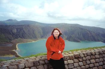
Lagoa do Fogo, or “Lake of Fire” floods the bottom of a caldera in São Miguel’s middle interior (map). However, this isn’t some ancient formation. A volcano created this caldera within the period of human habitation. It happened in 1563 and it could happen again.
A well maintained road cut across the island between the towns of Ribeira Grande on the northern shore and Lagoa on the southern shore. Then it quickly gained altitude as it climbed the central spine. This allowed excellent opportunities to appreciate scenic views from high above. The steepness of the caldera walls became apparent in the photograph above. Also notice the sandy beaches along the left edge of the lake.
Then the Weather Turned
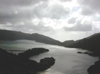
The weather changed quickly as clouds rolled in. Lagoa do Fogo looked considerably different when the sky and the water changed from blue to gray. I took the two photos on this page only minutes apart. We experienced these types of weather changes frequently throughout the day.
Leave a Reply