
São Miguel, The Azores (Açores), Portugal (March 2001)
Most of the Azores seemed rather quiet and sparsely populated. Typically we encountered villages set amongst rolling farmland. However, Ponta Delgada on São Miguel’s southwestern coast, came closest to be being a city (map). Its population approached nearly seventy thousand people. So it served as both the capital of the Azores and its largest settlement.
We loved the geometric tile designs built into sidewalks and crosswalks in towns throughout the Azores. Some of the most creative and complex examples existed in Ponta Delgada.
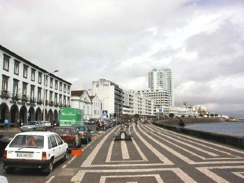
Avenida Infante Dom Henrique hugged the coastline (map). It began at the Forte de São Brás. Then it stretched past the protected harbor and marina, and led out of town. This is one of the main city streets, and certainly one of the more scenic. One side featured a bustling streetscape of inviting shops and restaurants. The tall building in the distance is probably the highest in the Azores.
Likewise, the other side faced the sea. It featured a wide promenade that allowed for long leisurely strolls along the waterfront. The tile pattern and the length of the boardwalk reminded me of a running track as it followed the gently curving contours of the harbor.
A Shopping Street
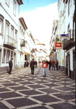
There are many shopping streets in Ponta Delgada. The one pictured above was typical. Everything appeared tidy, orderly and well-maintained. Here the tiles formed a diagonal checkerboard pattern. Shops lined both sides of this wide pedestrian walkway.
A Public Square
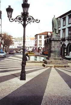
Pictured above is a public square in the interior of Ponta Delgada. This area of the city focused away from the waterfront. Instead it pointed towards the town’s civic life. Here the tile pattern seemed to radiate from the base of a statue. It reminded me of the sun’s rays as it followed the curvature of nearby roads.
Leave a Reply