
We stayed put more than usual during this adventure. Nonetheless, I managed grow my various lists in modest ways. The Twelve Mile Circle audience knows what I like so none of this will be a surprise. I thought it might be a nice way to wrap-up the series.
Lighthouses
I’ve been captivated by lighthouses for the longest time and I’ve seen a bunch of them. By definition, some trips do better with this feature than others. Obviously there needs to be an actual coastline for a lighthouse to exist. However, most of the time I’m nowhere near a navigable body of water. For instance, they would never occur in the mountains of central Pennsylvania where I visited earlier this summer.
Good news, though! The Great Lakes surrounded Michigan on multiple sides. A ton of lighthouses ring the state wherever the lakes touch it. We went to Lake Huron and Lake Michigan, so naturally we found lighthouses.
Tawas Point Light Station
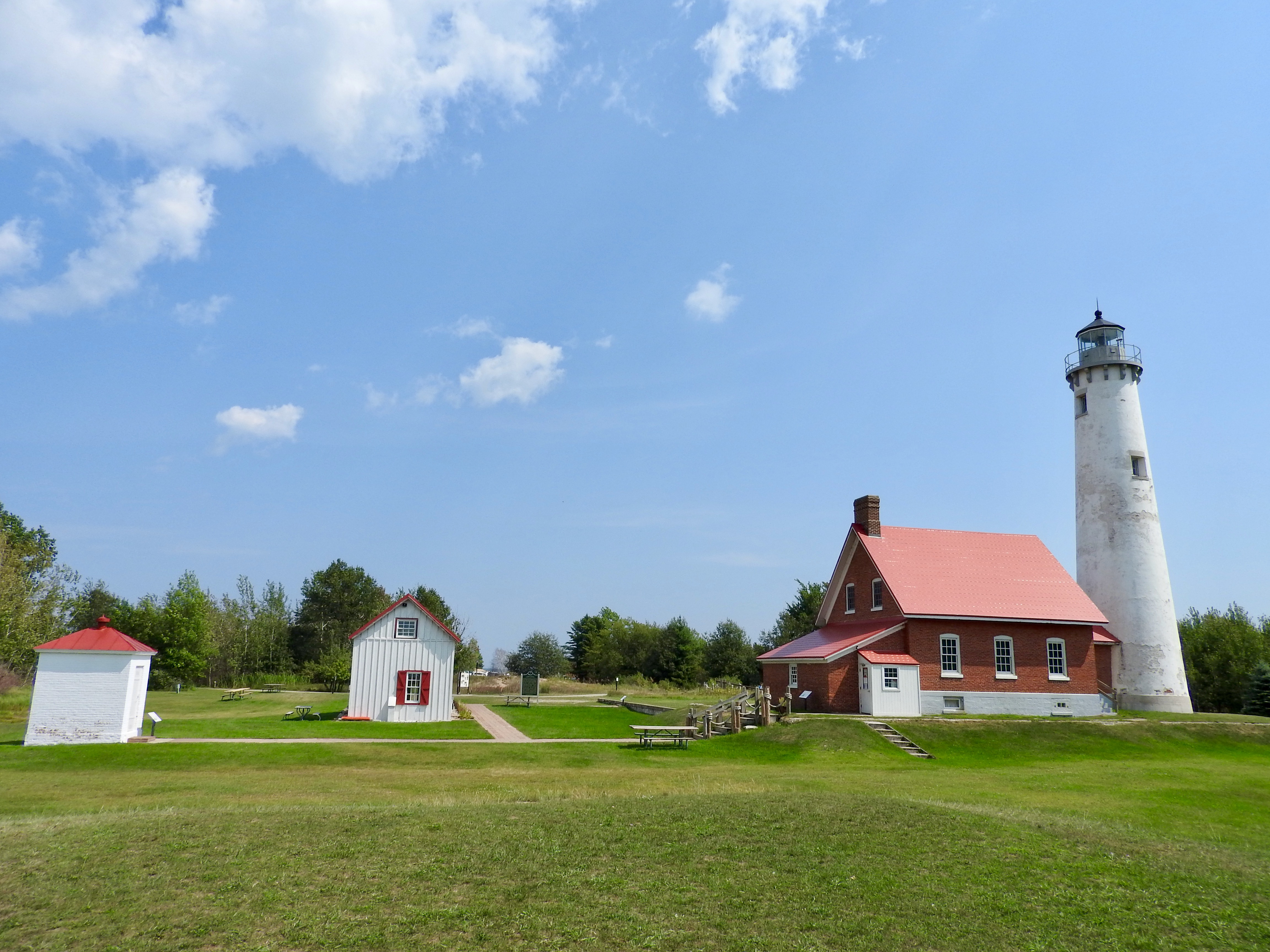
Our initial day trip brought us to a sandy hook on Lake Huron adjacent to Tawas City. Here we visited the Tawas Point Light Station (map). More accurately, I guess, I should say that I — not we — visited. The rest of the family hung out at the nearby beach. Even though they could see the tower from the beach, they wouldn’t budge. I couldn’t resist the temptation, and in fact the lighthouse figured prominently when we considered this park in the first place.
Normally visitors could enter the lighthouse and climb the tower. However, the “year of pandemic” forced it to close for the season. I could walk all over the grounds, though. So I did.
Point Betsie Lighthouse
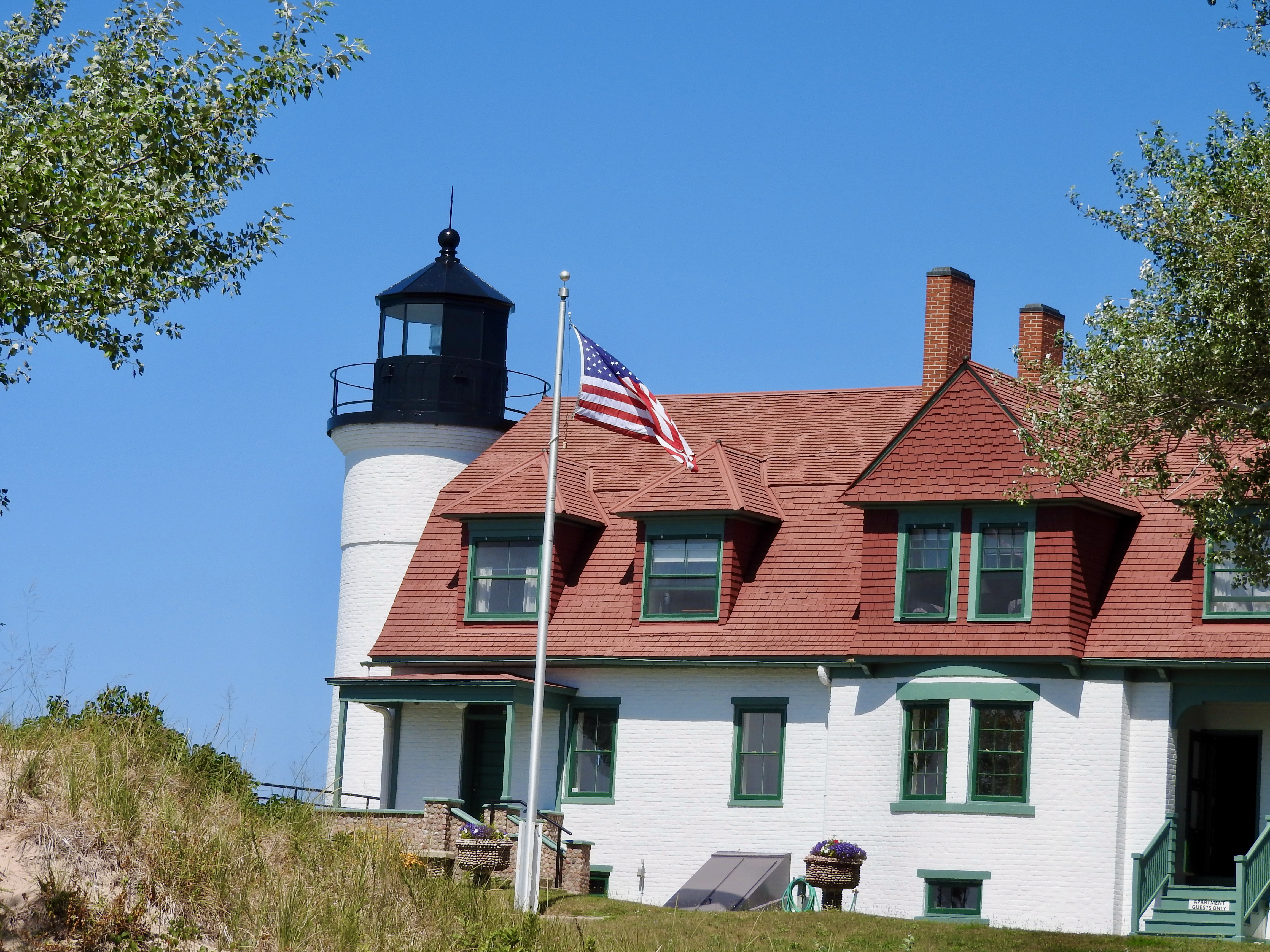
Then we headed over to the western side of the peninsula to Lake Michigan. There we stopped at Point Betsie as one of several destinations. The same pattern repeated itself. I took a look at Point Betsie Lighthouse (map) while the family checked out the beach. There was one notable difference, though. Here, even the grounds remained closed. I took photos from the access road and beachfront along the perimeter.
Another Covered Bridge
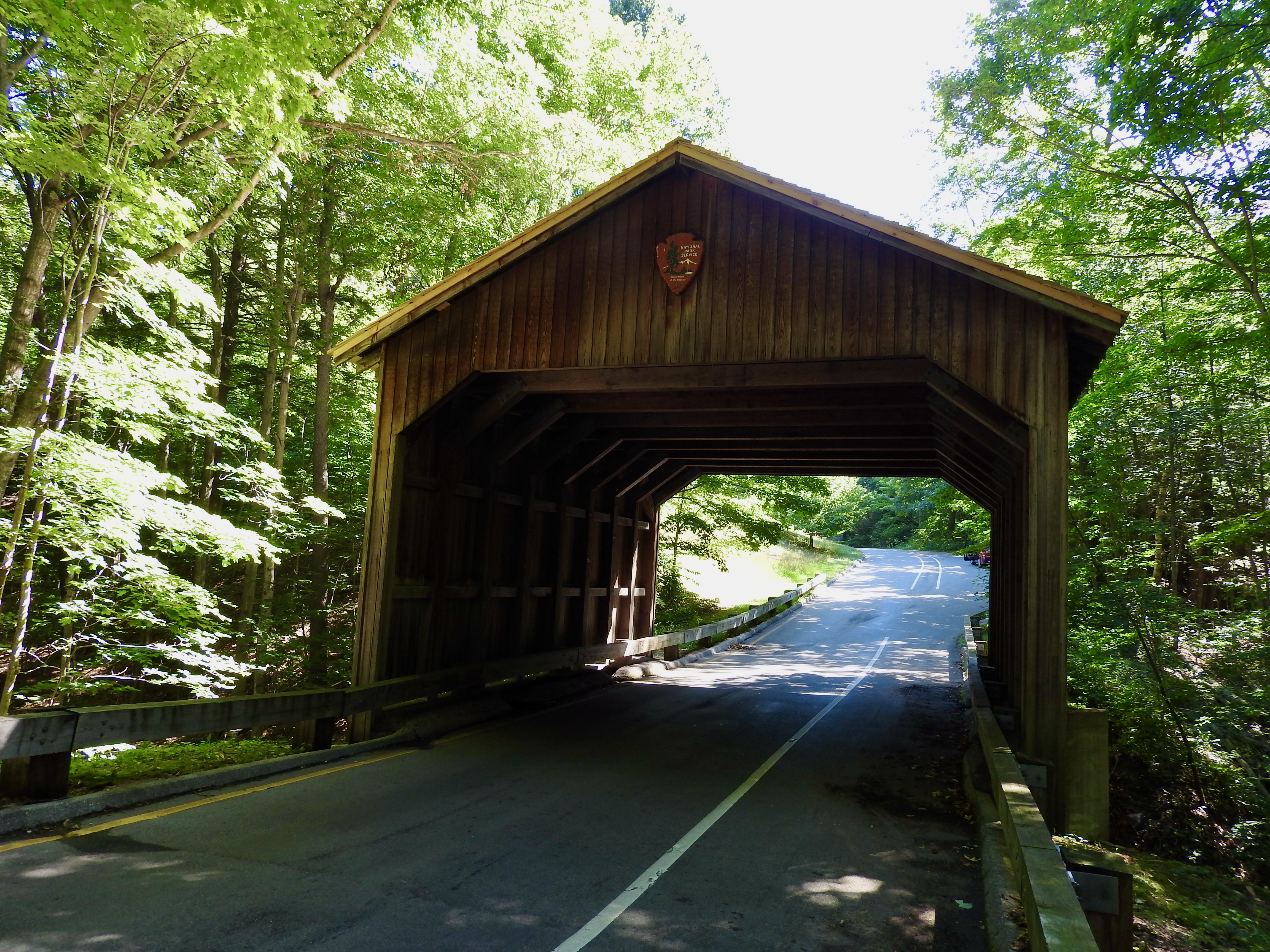
I still wonder if the covered bridge on the Pierce Stocking Scenic Drive should count. The 7.5 mile (12km) loop through Sleeping Bear Dunes National Lakeshore offered exactly what it implied. We drove and scenic things appeared. This included a simple, rustic covered bridge (map).
It just felt a little off. Really, it looked more like a shed bolted onto the roadway where it happened to cross a creek. Nothing about it looked functional or historic. Indeed, the National Park Service admitted that Pierce Stocking himself added the bridge as a purely ornamental element when he built the loop in the 1960’s. Nonetheless, I did enjoy learning that “the sides of the original bridge were largely consumed by porcupines, which seem to relish man-made structures more than the native wood of the forest.” I’m strange like that.
I didn’t feel cheated or anything. Maybe a little underwhelmed.
Breweries
My brewery visit count really took a beating this year. COVID-world made it difficult. Last year, as an example, we stopped at seventeen establishments during our excursion along the Jersey Shore. This time we visited only two brewpubs, and that doubled our total for 2020. I still feel there’s an elevated risk at breweries in general. We take plenty of precautions though. For instance, we enter a brewery on the condition that we will walk right back out if we feel even a little bit uncomfortable.
Both breweries seemed to be taking the situation seriously, with plenty of distancing and other safety measures. Consequently I’ve now had my only two indoor restaurant meals since March. I’m well past the potential incubation period at this point so everything that everyone did worked.
The Highway Brewing Company
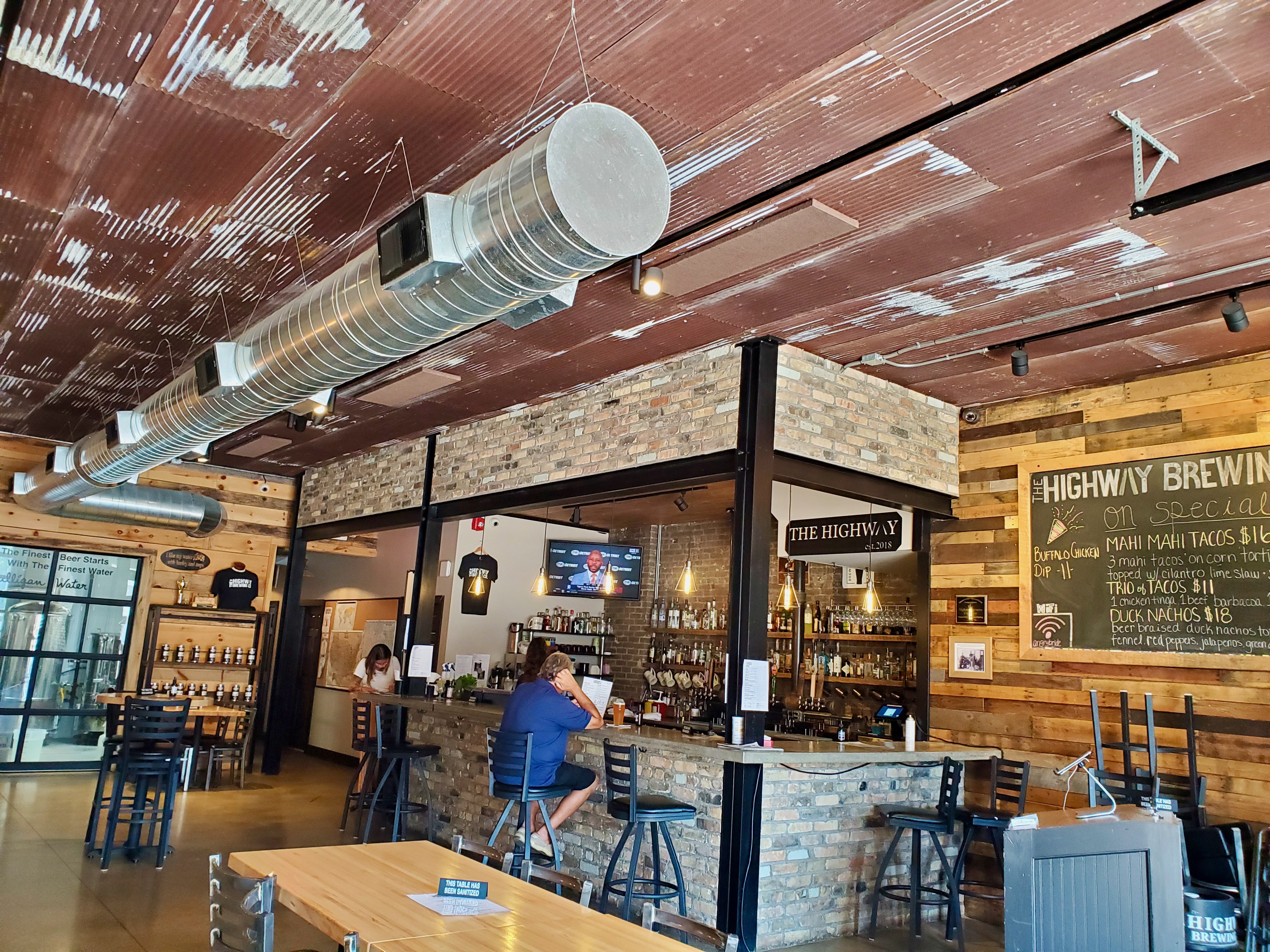
Of course, arriving on a Monday for an early lunch in a small town certainly decreased the odds of a large crowd. That’s exactly how we planned it. The photo shows that we distanced quite effectively at the The Highway Brewing Company in West Branch, Michigan (map). They even posted the beer menu at the entrance so we could take a picture. That reduced touching and saved paper at the same time.
Dented Keg Brewing
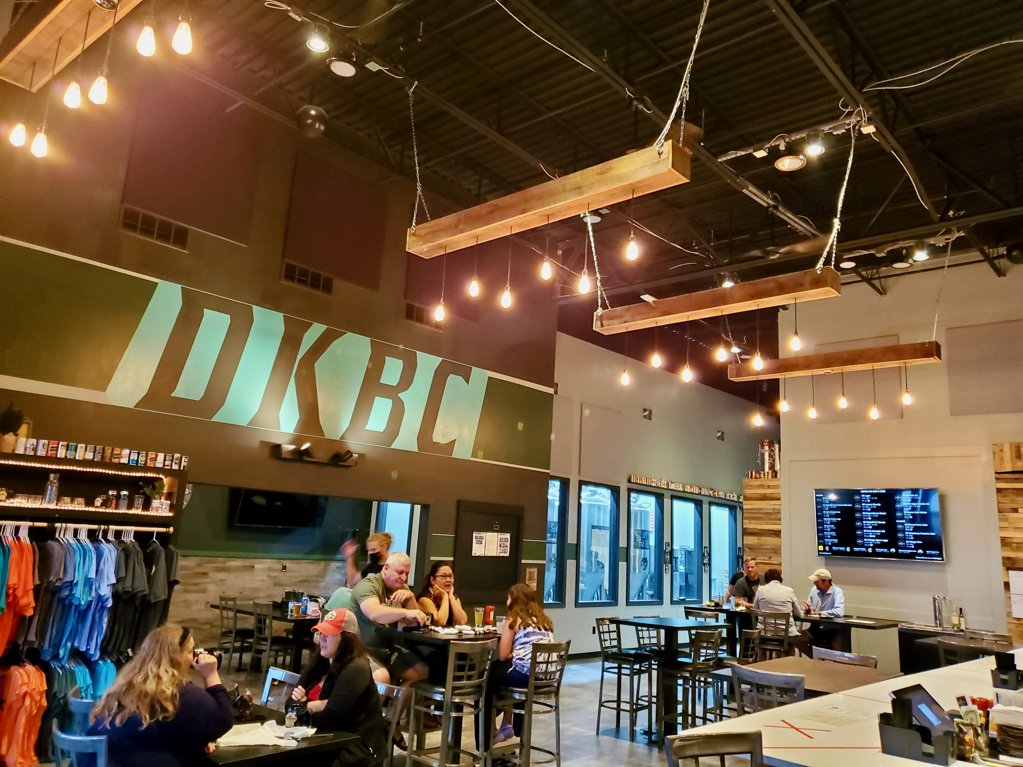
On the way back we stopped at Dented Keg Brewing Company in Mars, Pennsylvania (map). They placed a tent out front with tables set beneath it. Then a thunderstorm hit just as we arrived so the tent wouldn’t be an option for that evening. We considered the walk away rule. Fortunately, tables indoors seemed to be spaced pretty nicely and we could actually feel the ventilation. They also had a nook in the corner that gave us plenty of distance.
Articles in the Exploring the Mitten Series
See Also: The Complete Photo Album on Flickr
Leave a Reply