
The upper tier of the mitten sits between two of the Great Lakes: Huron and Michigan. That means the farthest someone needs to travel to hit an immense body of water is maybe 75 miles (120 kilometres). Generally, unless situated directly atop the midpoint, a given location will sit even closer than that to at least one of the lakes. Oftentimes considerably so.
We based ourselves in Gladwin County (map), somewhat east of the peninsular midpoint, although clearly within striking distance of both Great Lakes. I’ve been to the Great Lakes region many times. These bodies of water truly deserve their name. They seem more like oceans from the shorelines, albeit with fresh water and smaller waves.
Lake Huron
So, let me clarify the last paragraph. I’d been to beaches at four of the five Great Lakes before this trip. However, I’d never been to Lake Huron! Within the United States, only northeastern Michigan touched Lake Huron. I’d never been to that corner of the state before so I’d never seen the lake. Thus, I needed to make it a priority this time.
The best, closest place to our home base for the week seemed to be Tawas Point State Park. They called it the “Cape Cod of Lake Michigan.” Um, no. Sorry. I’ve been to Cape Cod. The mile-long sand spit of Tawas Point (map) simply couldn’t compare. Nonetheless, I quickly set that aside and enjoyed it on its own merits.
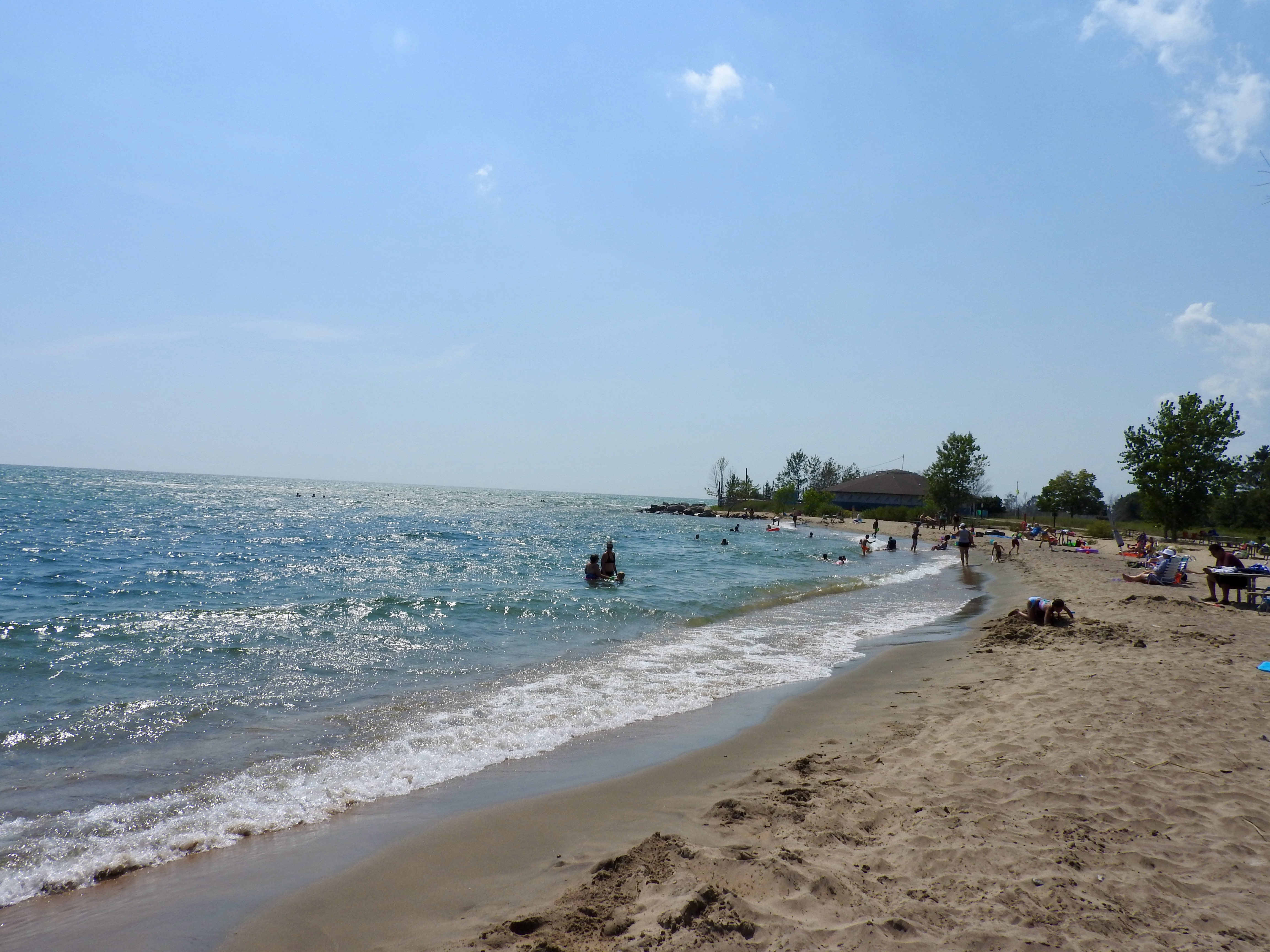
Severe flooding inundated the Great Lakes watershed about a year ago. Apparently it takes a long time to drain away so much water. Now, all these many months later, the water level of Lake Huron remained about three feet higher than usual. See that nice crescent beach in the photo above? Usually that would be the back side of the lagoon in the Google satellite image. The GPS chip in my camera recorded that exact spot when I took the photo. The normal beach, now underwater, transformed into a sandbar just beneath the waves.
Lake Michigan
We actually saw much more of Lake Michigan than Lake Huron, even if farther away. It had better beaches, generally speaking. I’ve mentioned the geology of the southern and eastern sides of Lake Michigan a couple of times. Extensive dunes covered the Indiana and Michigan shorelines. Briefly recapping — an Ice Age, grinding glaciers, sand, wind, currents, dunes. Got it?
Sleeping Bear Dunes
Nowhere along that coastline did the dunes rise more spectacular than at Sleeping Bear Dunes National Lakeshore. Usually I don’t like going to the same place twice. I rarely make exceptions. There needs to be something spectacular, like last summer when I returned to the Finger Lakes in New York. Sleeping Bear Dunes fell into that category. My wife and I went there in September 2000 and I’d wanted to return for the longest time. Here, I finally got my chance nearly two decades later.
The park covers several distinct areas including a couple of islands. The Pierce Stocking Scenic Drive probably attracts the most attention though (map). We had limited time available so we focused our visit there. This one-way winding circuit featured a few overlooks facing inward towards the dunes and a few facing outwards towards the lake and islands along its twisting route.
Dunes Overlook
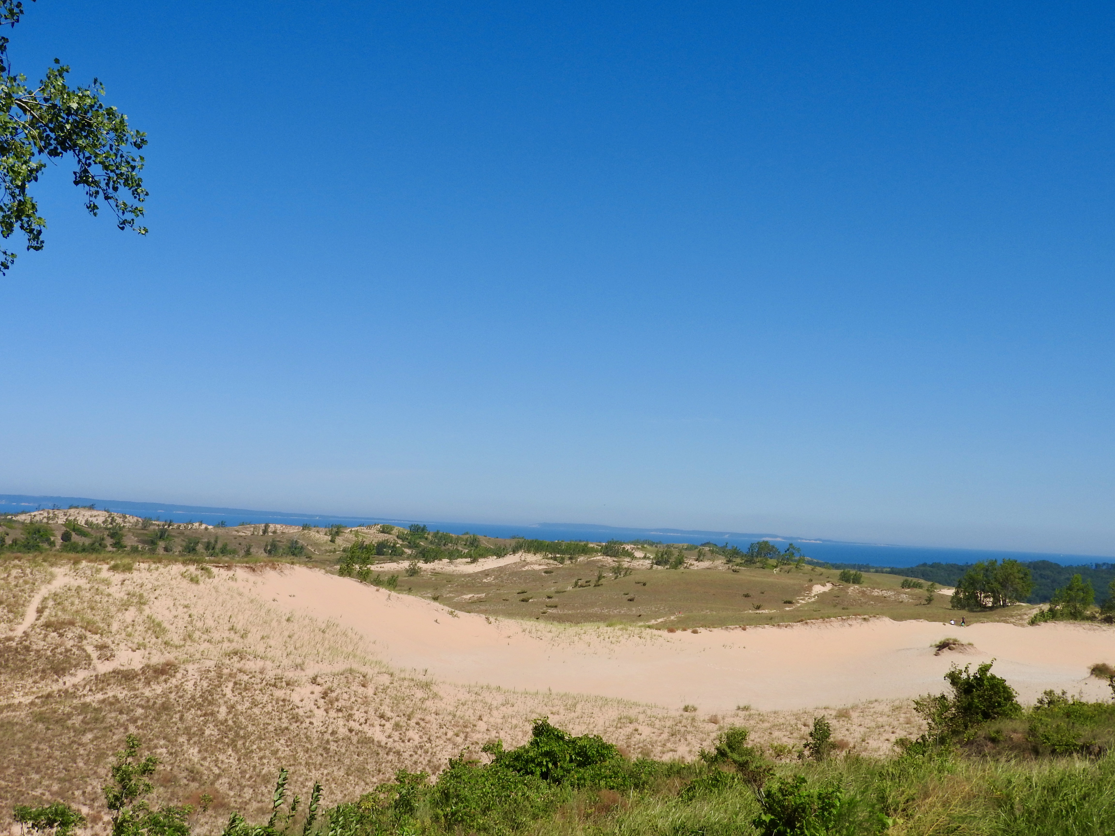
The inland portion came first. Attractions included a covered bridge, a scenic spot above a mainland lake (Glen Lake), and finally a long stretch atop the dunes themselves. People could enjoy the view or put on their hiking boots and wander across miles of sandy trails. I did some of that on my earlier visit. Unfortunately, we didn’t have time today.
Lake Michigan Overlook
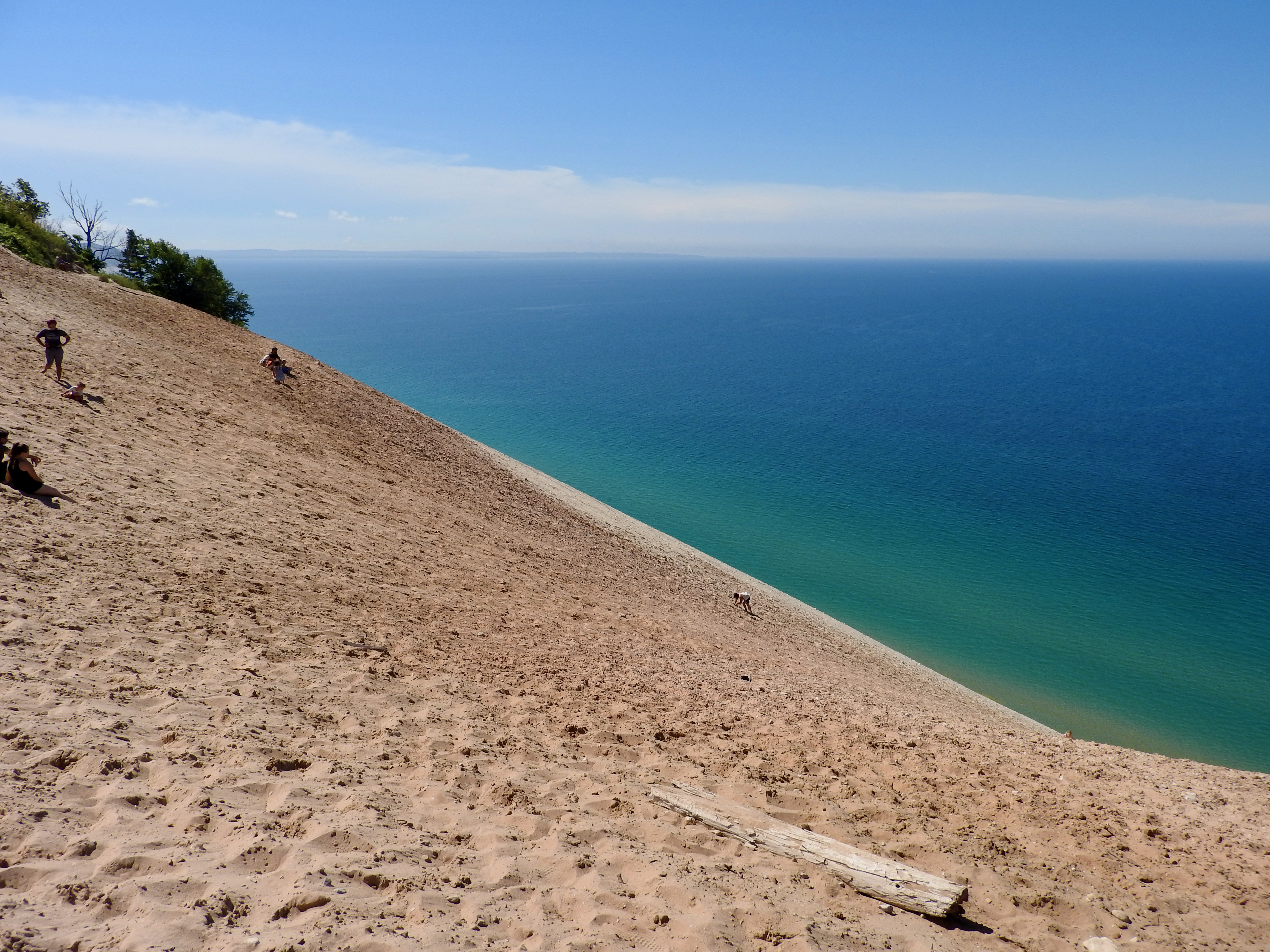
However, we certainly had time for the massive dunes overlooking Lake Michigan. They really cannot be completely appreciated except in person. My photo doesn’t do them justice. For scale, notice the person climbing up the dune on all-fours. Sand, yes nothing but sand, juts at an amazingly steep angle to about 450 feet (140 metres) directly from the lake below.
Obviously people can and do hike down to the lake and then back up. The Park Service doesn’t prohibit this pursuit although it discourages attempting it. For instance, a sign warns of a $3,000 rescue charge for those who cannot make it back up on their own. It takes only a few minutes to get down. On the other hand, it can take an hour or more to return to the top after a strenuous uphill slog with little traction.
Point Betsie
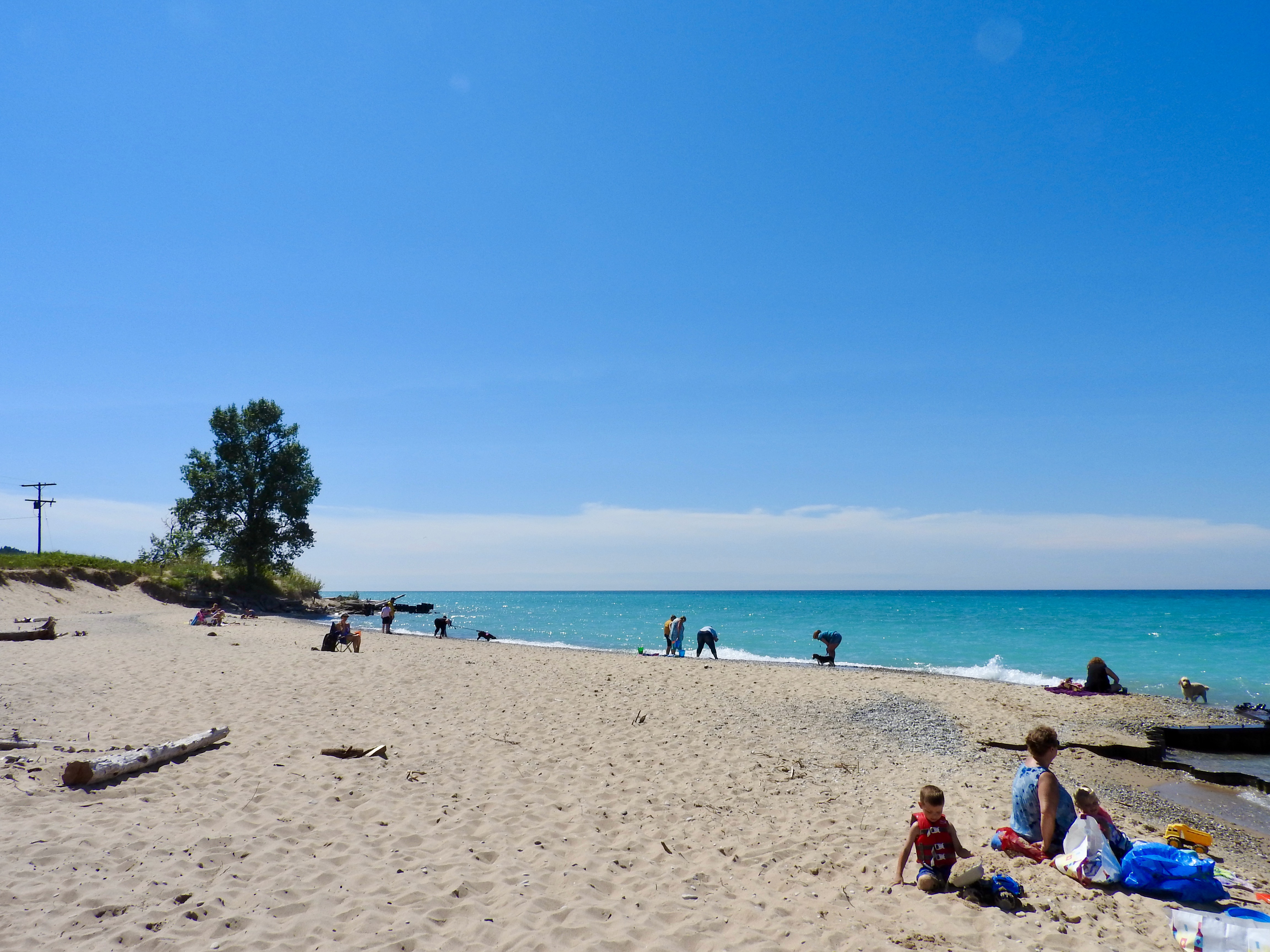
I preferred the beach at nearby Point Betsie. It required minimal walking and none of it uphill. I stumbled upon the location — a little south of Sleeping Bear Dunes — when visiting its nearby lighthouse (map). This beach seemed to be more for local residents. Tourist hordes tended to gather a few miles away at the Park Service property.
It did lack a parking lot, for those concerned with such things. However, people simply pulled over on either side of the access road and it worked out fine. Then a short stroll led to a nice, sandy beach along the iridescent shores of Lake Michigan. Hopefully I didn’t just give away a great local secret.
Frankfort Town Limits
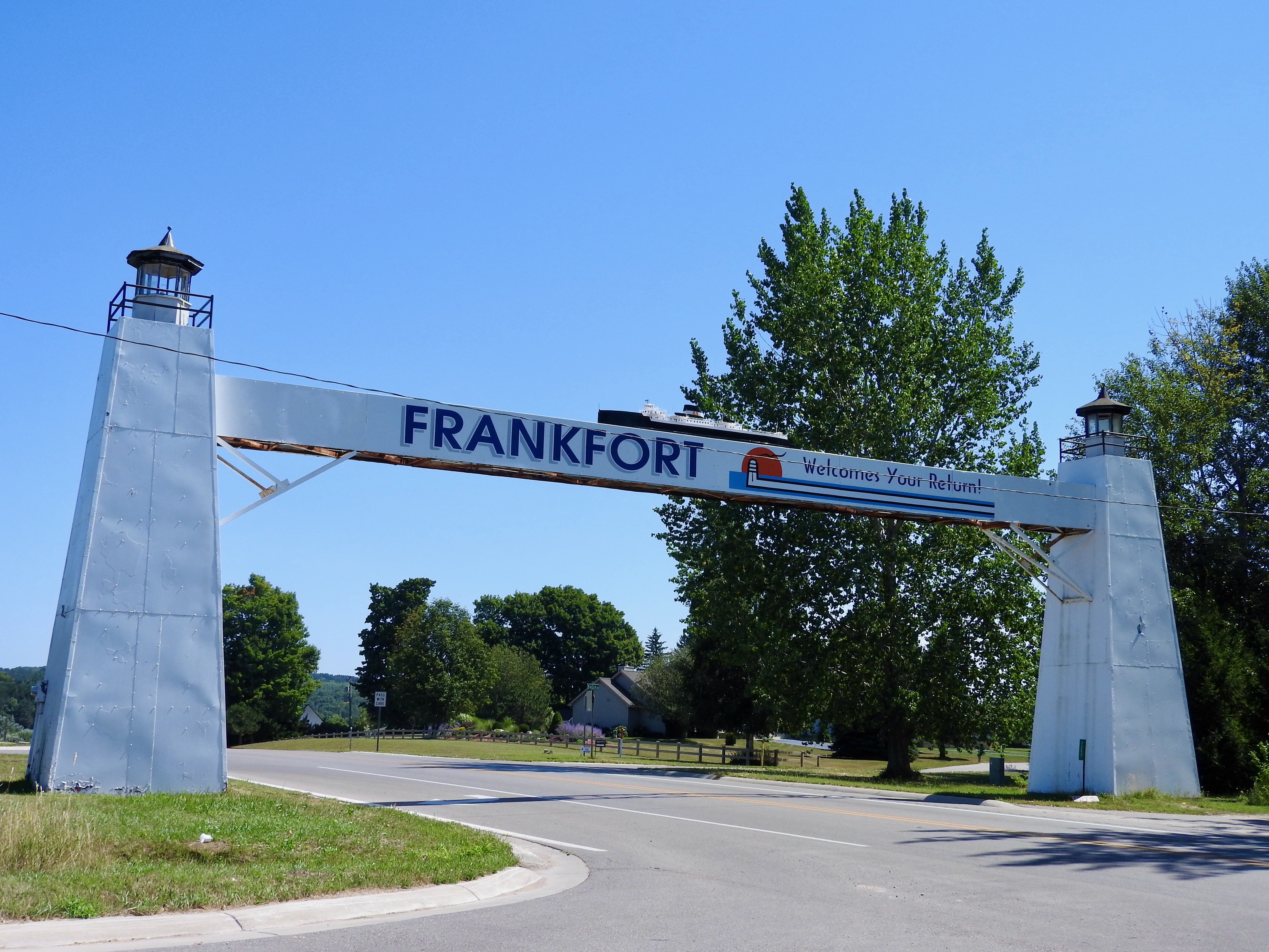
I wish I could have spent more time in Frankfort, Michigan (map). It served as the southern gateway to Sleeping Bear Dunes. It also offered this great welcoming sign at the town’s eastern border on Rt. 115. Actually, I was leaving town which is why it read “Frankfort Welcomes Your Return!” Whatever. The sign incorporated two lighthouses and a ferryboat within its design. Did this count as sightings for my lighthouse and ferry lists? Sadly no, although I applauded the theme.
Articles in the Exploring the Mitten Series
See Also: The Complete Photo Album on Flickr
Leave a Reply