
I bypassed all sorts of interesting and historical places because I wanted to avoid indoor spaces during the pandemic. So I searched for outdoor attractions to keep us busy. Typically we do a lot of this on our trips anyway, but we really took it over the top this time. A whole lot of walking, running and hiking happened during the week.
Givhans Ferry
While in South Carolina, we stayed at a house near Givhans Ferry State Park (map). That made it easy to cover the trail network there. Actually, that didn’t take much. The park only had two trails. Well, maybe one.
River Bluff Trail
The easier more scenic trail ran along the Edisto River before turning into the woods and terminating at a meadow. A bluff offered scenic views of the river along an initial stretch, giving this trail its name: the River Bluff Trail. The entire path stretched only 1.5 miles although hikers could double the distance as an out-and-back. Unfortunately, the meadow appeared right next to the parking lot and our son considered our journey complete.
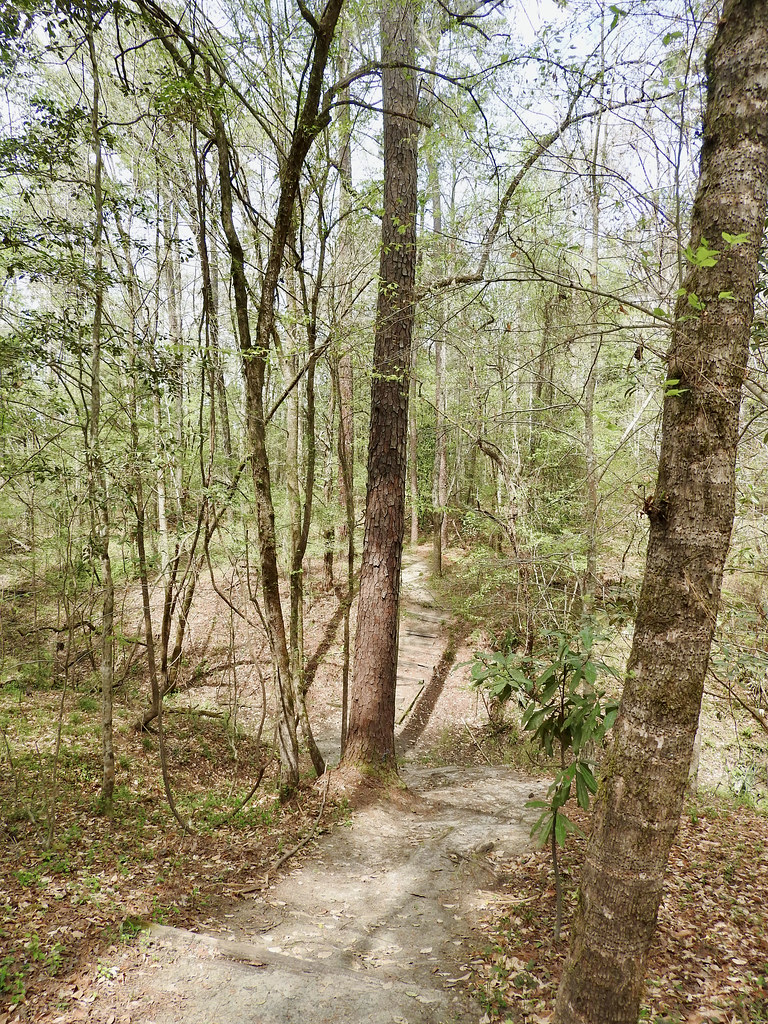
Old Loop Trail
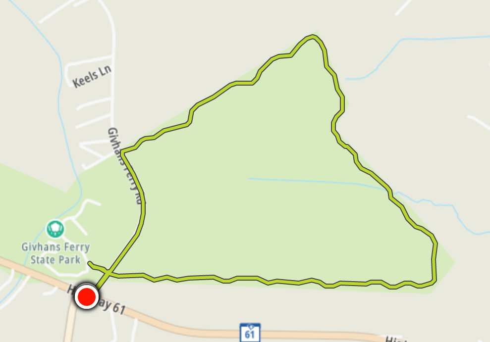
Later I ran the Old Loop Trail that followed the perimeter of the non-river side of the park. That morning I awoke to a hot, sticky scene unusual for late March, even for South Carolina. I didn’t really feel like going out in that mess and romping through the woods, although I did it anyway for five miles.
I can’t say I enjoyed the trail particularly but I prefer to run on asphalt so that explained a lot of it. Also the trail didn’t seem all that well maintained, with bogs, mud, logs to jump, knee-high grass in places, and various other obstacles. It was a flat with unchanging scenery and not all that memorable either. I’ll bet people who enjoy trail runs would like it, though.
Some Internet sources implied the trail might be closed. However, I checked the park website before I ran it and I saw a complete listing and description. So I ran it. Now, just a couple of weeks later, it’s been deleted! The page still says Trails (plural!) but it only lists the River Bluff Trail. Who knows, I might have been the last person to finish the Old Loop Trail legally.
Sawmill Branch
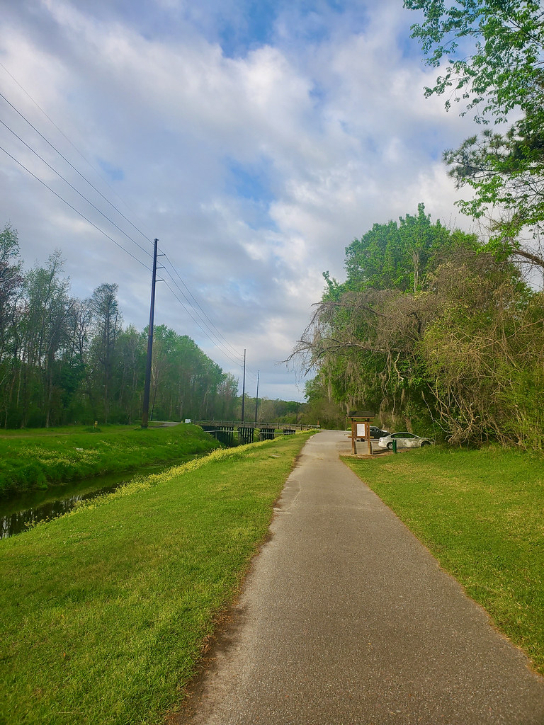
The Sawmill Branch Walk/Bike Trail cut deep into the southern tier of Summerville, South Carolina (map). A Historical marker near the northern terminus provided context for the name and the route. Sometime around 1700 a colonial settler built a sawmill and a dam on a creek the Native inhabitants called Boshoe. Eventually the waterway became Sawmill Branch, and of course neither the mill nor the dam continue to exist. So there you go.
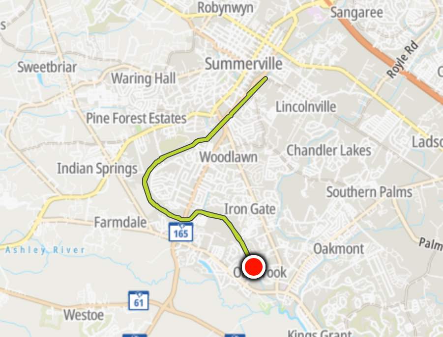
It’s mainly a drainage ditch for adjacent suburban neighborhoods now, or so it appeared. Along that ran an asphalt track that switched occasionally from one side of the canal to the other to keep things interesting. The only hills — and I use that term loosely — appeared where the trail crossed roads, via underpasses or at street level. Thus it was a very fast course.
So it wasn’t exactly what I’d call a “scenic” route although it served its basic purpose. I started at the southern trailhead at the YMCA Oakbrook Facility and did a complete out-and-back to make it a half-marathon distance. It was a beautiful chilly mid-week morning and practically deserted. I rather enjoyed it.
Old Santee
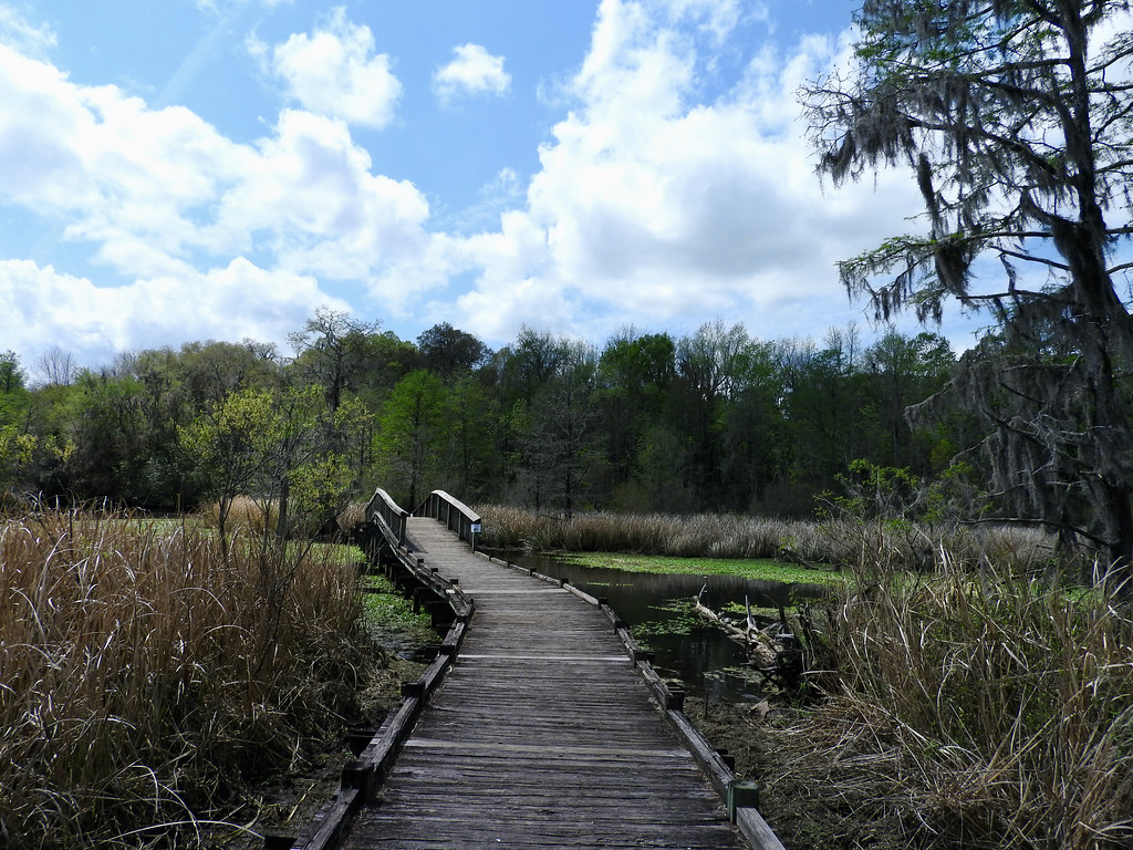
A lot of tantalizing possibilities filled a compact area at Old Santee Canal Park in Moncks Corner, South Carolina (map). This included several miles of loop trails and wildlife overlooks through blackwater swamp forest. Unfortunately I didn’t have a lot of time at the end of a long day of county counting. So I concentrated on the two shortest trails closest to the Interpretive Center; the Alligator Loop and the Osprey Loop.
I particularly enjoyed the Alligator Loop. It featured a bunch of observation platforms and a long boardwalk over Biggin Creek. No, I never saw an alligator. However, I did hear at least one gator grunting for sure. They’re in there hiding, I know they’re in there! If only I’d had a little more time to stand motionless for awhile and watch for subtle movements.
I wouldn’t mind coming back to Old Santee. There’s still a lot more there I want to see.
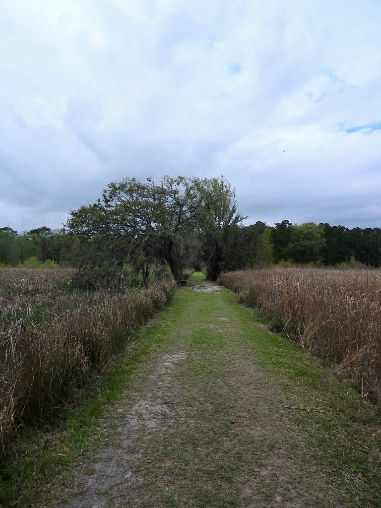
Caw Caw
How did they come up with the name for Caw Caw Interpretive Center in Charleston County, South Carolina? Maybe it signaled onomatopoeia, like the sound of a crow? Maybe it was some ancient pre-Columbian term? I don’t know. I’m not even sure why I mentioned it. Sometimes I find the weirdest things funny.
Anyway, and to the point here, the park included several miles of trails. What made this one different was the number of different habitats they crossed. Landscape architects created distinct sections including swamp, forest and tidal marsh. Most poignantly, one area traversed former rice fields cultivated by slaves during the Antebellum period. Each section felt completely different even though they abutted each another, with their own characteristic attributes, from dense forest to open field, from solid ground to soupy swamp.
Fort Fisher
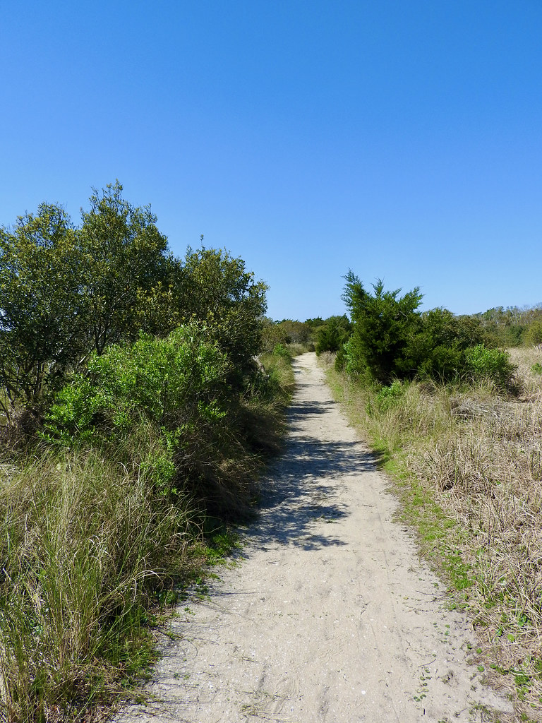
I did some walking in the sand, too. More specifically I followed the shoreline for quite awhile at Hunting Island State Park in South Carolina and the Fort Fisher State Recreation Area in North Carolina.
We also took a formally blazed trail at Fort Fisher. Here, the Basin Trail led about 1.1 miles through the scrub, across open sand, past a World War II bunker, and over a tidal marsh on a boardwalk. It terminated at an observation deck on the Cape Fear River, close to where it met the Atlantic Ocean (map). Then, of course, we took the same path back to the trailhead. All things seemed quiet here, far away from the crowds at the public beach parking lot.
Articles in the Carolina Wetlands Series
- Padding the Count
- All About the Water
- The Great Outdoors
- This Means War
- The Swamp Fox
- Ruins and Tombs
- Breweries During COVID
- Rounding it Out
See Also: The Complete Photo Album on Flickr
Leave a Reply