
Hopefully this will be the last set of articles where I ever have to mention the COVID-19 pandemic. Maybe this will all seem quaint five or ten years from now when someone stumbles across this page. For now though it continues to shape how I travel and where I go. Even so, life goes on and we had to get out of the house for spring break, if only to preserve our sanity.
My wife and I already received our vaccines. Unfortunately, our younger son did not so we continue to move with caution. Our older son is away at college and he didn’t figure into the equation for this adventure.
We set off on something of a spontaneous road trip. Well, spontaneous for me. We decided to go only two weeks before our departure, and as longtime readers know, I like to plan these things out in excruciating detail months in advance. So that’s about as spontaneous as I get.
I still don’t feel comfortable flying. In fact, I haven’t been inside of an airplane since February 2020, the longest period of my adult life. So that continues to limit us to “reasonable” driving distances for now. Naturally I wanted to add to my county counting list and every time I venture out farther it makes the task more difficult. Now I need to drive more than five hours to hit the nearest untapped seam.
That’s not a problem for a week-long trip. I can go out several hundred miles, easy. And I spotted a nice cluster along a coastal area shared between the Carolinas. Also I have family near Charleston (remember the eclipse?). Even the traffic hell of Interstate 95 couldn’t dissuade us.
Home Base
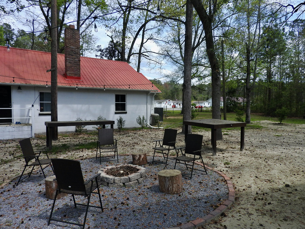
During the majority of our trip — the South Carolina portion — we stayed outside of Ridgeville (map). This was a nice Airbnb property, a small but lovingly restored farmhouse on a big chunk of land. It was quite rural. This remote locale served us just fine. It gave us plenty of space so we could visit with family outdoors. Plus it served as a convenient gateway to the South Carolina counties I needed to grab.
Wouldn’t we rather stay right on the beach like we did over the Christmas holiday? Well, sure. Don’t be silly. But nobody’s getting a beachfront rental during spring break with two weeks notice. Our middle-of-nowhere option worked out great and, I think, ultimately kept us away from any possibility of super-spreading events.
So let’s grab some new counties!
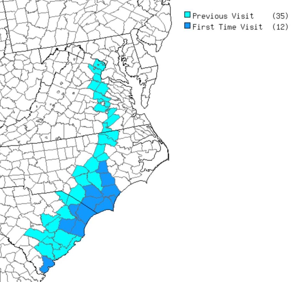
Low Country Out-and-Back
Take a look at the route map again. Notice that dark blue splotch at the southern tip. That’s Beaufort County, South Carolina. Unfortunately it was also a doughnut county, stranded all by itself amid a sea of previously-visited counties. So I had no choice but to go down there and capture that single county (route). Which I did.
Originally I wanted to go to Beaufort’s most famous locale, Hilton Head. Then I considered the pandemic, spring break, all the vacationers, crowded streets, and I decided to skip it. Instead I selected a route through the town of Beaufort, also within that county of the same name.
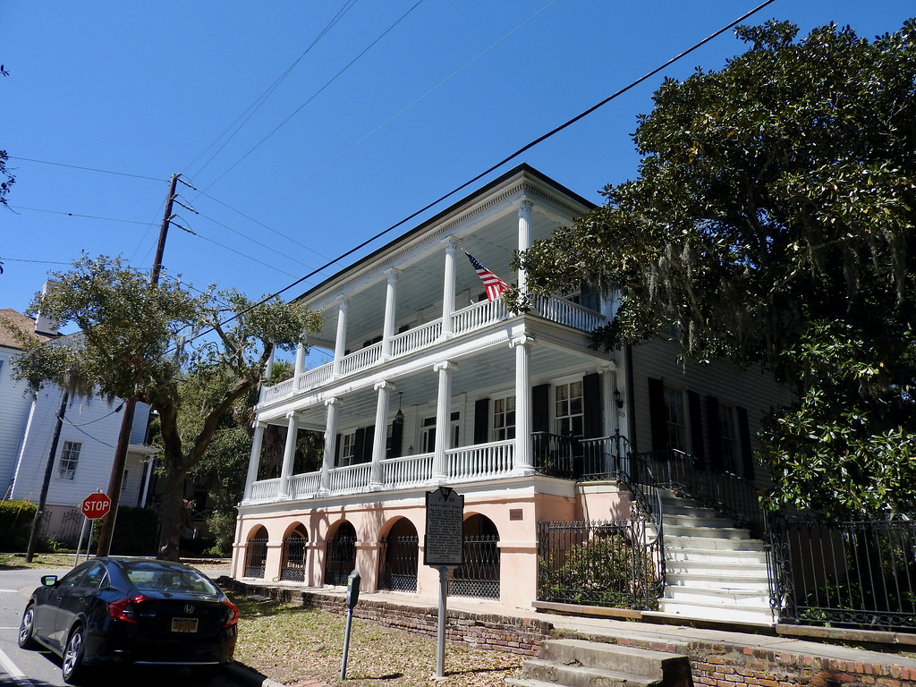
Architectural gems from the first half of the Nineteenth Century lined the streets of Beaufort’s historic district. Spanish moss draped from limbs of gnarled trees. A lovely waterfront park hugged the shore. We walked all through town and it never felt uncomfortably crowded. I think we chose wisely.
Pee Dee Cluster

Still, a larger South Carolina cluster awaited and I couldn’t make it sound exciting like Beaufort. I simply had to power through an all-day drive into Williamsburg, Georgetown, Marion, and Horry in the Pee Dee River basin (route). Naturally nobody wanted to join me. At that point I certainly missed my reliable county-county buddy, now away at college. So I had to head out on my own.
Well I certainly found a lot of interesting spots, or at least interesting to me. Historical events unfolded within an amazing concentration and my path plowed directly through them. The whole expanse echoed of skirmishes, battles and warfare from a bygone era. Not from the Civil War as one might expect, but from something earlier: the Revolutionary War. Brigadier General Francis Marion, the famous Swamp Fox, used this area as his base. I’ll talk some more about that in a future article.
I grew tired after several hours of hard driving below the speed limit, consistently stuck behind trucks. So I nearly skipped the final destination; Old Santee Canal Park on the Cooper River (map). Fortunately I didn’t because it turned out to be the highlight of the drive. I even got in for free. The park waived all admission fees because the indoor facilities were closed due to COVID. I could only walk outdoors there, but I only wanted to walk outdoors!
Cape Fear Watershed
In North Carolina, the state where we spent the final two nights of our week, we dug deep into the larger empty cluster. Actually, I didn’t have to do anything remarkable to capture them. We drove from South Carolina to Wilmington on Thursday. Then we drove from Wilmington north towards our home on Saturday. Just like that, seven new counties added to the map (route).
I took one small jog from the default route on the first leg. Going from Interstate 95, I swung up to Elizabethtown so I could prevent a Bladen County doughnut hole, which added less than five miles to the trip. Then I quickly added Columbus, Brunswick and New Hanover.
The second leg took nothing special at all. I simply drove straight up from Wilmington until I hit I-95 at Wilson. That netted Pender, Duplin and Wayne. Oh, and I also clipped the border of Sampson. Long ago I marked Sampson as a “visited” county. However, as I thought about it, I couldn’t actually remember crossing into Sampson earlier. It used to be much harder to map county lines back then and I might have made an error decades ago. So like Los Alamos and Poquoson, I reconfirmed Sampson just to make sure.
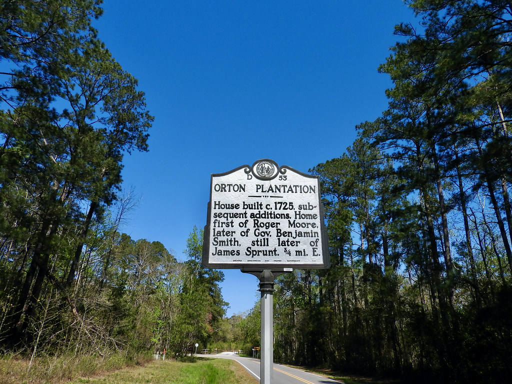
I featured my one and only photo from Brunswick County, above. We drove an hour out of the way to see Orton Plantation and the Brunswick Town/Fort Anderson State Historic Site (map). I liked the name because it reminded me of the fictional town my older son invented years ago.
Well, apparently the state closes its parks on Good Friday. That left us with no choice but to visit a bunch of breweries instead. Hey, I don’t make the rules.
Articles in the Carolina Wetlands Series
- Padding the Count
- All About the Water
- The Great Outdoors
- This Means War
- The Swamp Fox
- Ruins and Tombs
- Breweries During COVID
- Rounding it Out
See Also: The Complete Photo Album on Flickr
Leave a Reply