
Water, water everywhere! Well what else would anyone expect? After all, the whole area was basically a swamp. They even called one big chunk of South Carolina the Lowcountry for its very specific lack of elevation and percolating water table. Liquid gurgled, flowed, pooled or crashed just about everywhere I stepped during the week. So I thought I’d offer a few examples in approximate chronological order.
Givhans Ferry State Park

Obviously, if a ferry once existed then a body of water accompanied it. Long ago, way back at the tail-end of the 1700’s, people needed to cross the Edisto River at a specific spot. So a ferry served an essential function on the primary road connecting Charleston, South Carolina to Augusta, Georgia (route). Phillip Givhan made his living there and the ferry took his name. Much later the state of South Carolina got the land and created Givhans Ferry State Park as part of a Civilian Conservation Corps project during the Great Depression (map).
The Edisto River is either the longest or one of the longest blackwater rivers in the United States. The river flows slowly through woodlands and falling leaves drop into the water. As vegetation decays it releases tannins, making the water look more like tea. It’s not dirty, it’s stained. Supposedly this phenomenon is rather unusual in most places although the southeastern United States seems to create particularly favorable conditions.
Beaufort Waterfront
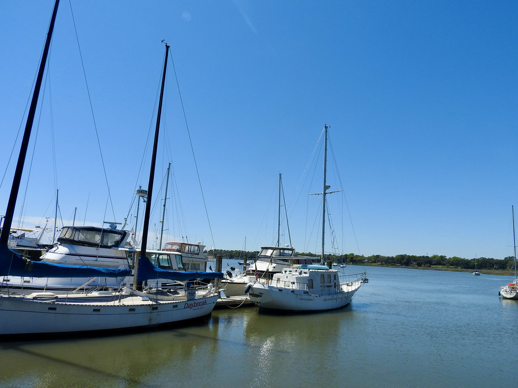
Beaufort owed its existence to water (map). Here, ships entering from the Atlantic Ocean could slip behind the Sea Islands into a protected harbor. Spanish explorers came through the area as early as 1514 but never settled permanently. Finally in 1711 the British put down roots there and formed a town.
Later, the U.S. Civil War left the town mostly untouched because the Union army captured Beaufort very early in the conflict. Even so, the inevitable destruction of the Plantation economy caused Beaufort to decline considerably in the aftermath.
Modern Beaufort seemed to be doing quite well. A combination of romantic tourism, retirees fleeing cold weather, and the Marine Corps base at nearby Parris Island pumped a ton of cash into the area.
Hunting Island Beach
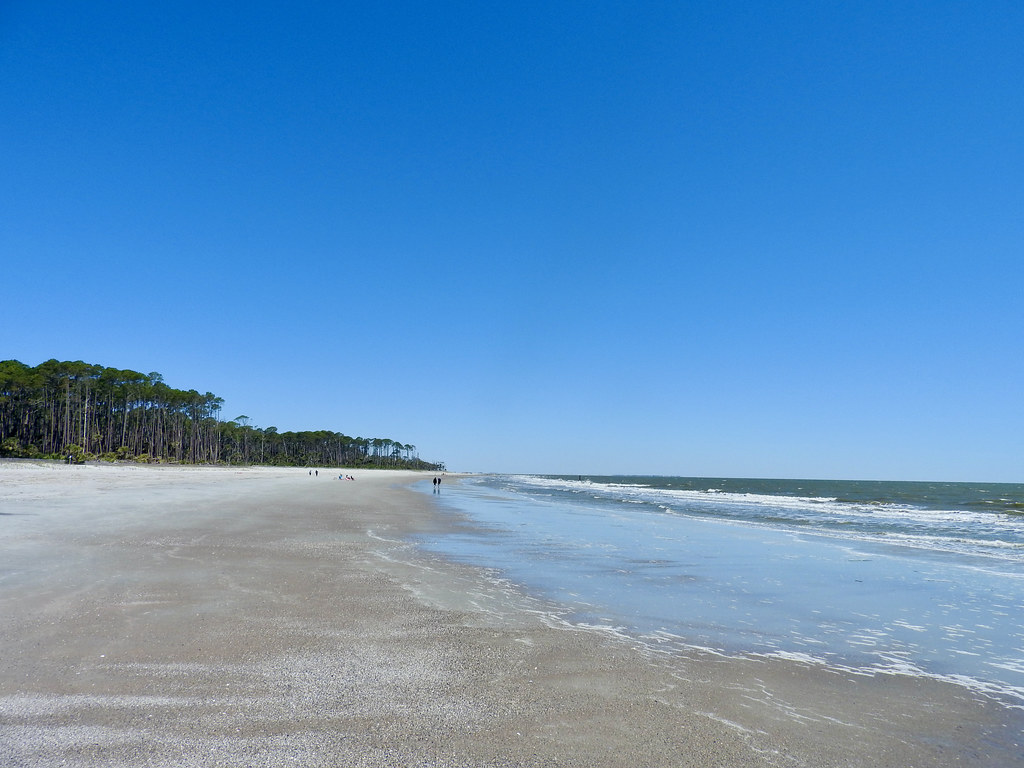
Speaking of those Sea Islands, one of those near Beaufort became a state park. Check out this beautiful beach on the Atlantic side at Hunting Island State Park (map). I mentioned in the previous article that we sidestepped Hilton Head because we didn’t want to deal with spring break crowds. Well, the beach at Hunting Island, only another twenty or thirty miles further up the coast, barely registered any visitors at all.
To be honest, we came during the middle of the week on a relatively windy, chilly day. An old saying came to mind, “a bad day at the beach is better than a good day at the office.” And it was considerably better than bad.
Hunting Island Marsh
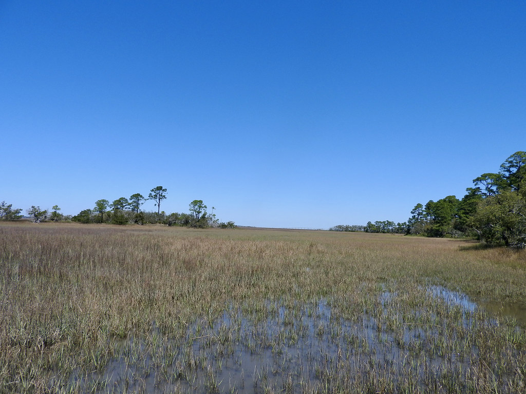
The backside of Hunting Island looked completely different. There a boardwalk trail led deep into a tidal marsh (map). Much of the Sea Islands topography looked just like this. An island might contain a dry, solid spine. However, much of what appeared as “island” on a map might actually be rather ephemeral in person. Was it land or was it sea? It might even be both because it changed with the tides. Don’t be fooled by the reeds growing there either. The footing beyond the boardwalk was anything other than solid.
Fort Fisher Beach
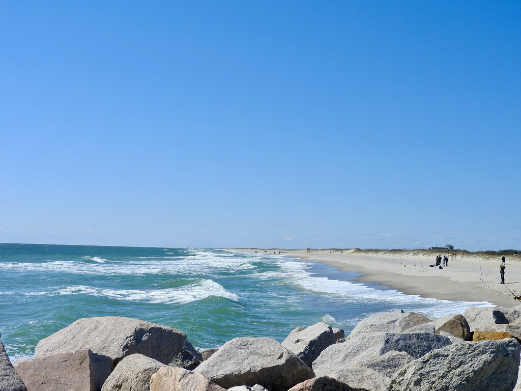
Then we traveled up the coast a couple hundred miles. We hit the Atlantic Ocean again in a different state and a different park, the Fort Fisher State Recreation Area. It filled a narrow peninsula just south Kure Beach, North Carolina (map).
Once again we had the beach nearly to ourselves. The predominant activity seemed to be surf fishing rather than swimming or sunbathing. But springtime was just getting started in early April this far north and we arrived during a cold snap. Even so the beach looked quite inviting and we certainly enjoyed beachcombing. Too bad we didn’t bring a kite!
Wilmington Riverwalk
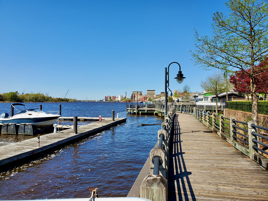
Honestly we only went to Wilmington for the county counting. I’d never been to New Hanover County and Wilmington had the best hotel selections. What can I say? Even so it came as quite a pleasant surprise. I genuinely liked Wilmington and our accommodations directly along the Cape Fear River. If I ever happen to be in the area again I’ll definitely stay in Wilmington a bit longer and explore some more.
The downtown core seemed to be in the midst of a revival of sorts. Part of that involved construction of the Wilmington Riverwalk (map). The Cape Fear River here was another example of a blackwater river although pretty wide so close to its Atlantic Ocean terminus.
Articles in the Carolina Wetlands Series
- Padding the Count
- All About the Water
- The Great Outdoors
- This Means War
- The Swamp Fox
- Ruins and Tombs
- Breweries During COVID
- Rounding it Out
See Also: The Complete Photo Album on Flickr
Leave a Reply