
Longtime readers of Twelve Mile Circle know that I love my forts, fortresses and fortifications. So I really loved Bermuda, a place practically custom-designed by Great Britain to be one giant fort. Its strategic placement and and heavy militarization led to its nickname the “Gibraltar of the West.” Maybe I should have included it in my Gibraltaresque article?
For centuries Bermuda occupied a strategic point within the British Empire although one would hardly know it now. It protected British interests across the entirety of the North Atlantic region for nearly two hundred years. This extended all the way through the Second World War when it became a naval air station and a gathering point for convoys sailing between the the Americas and Europe.
Fort St. Catherine (St. George’s Parish)
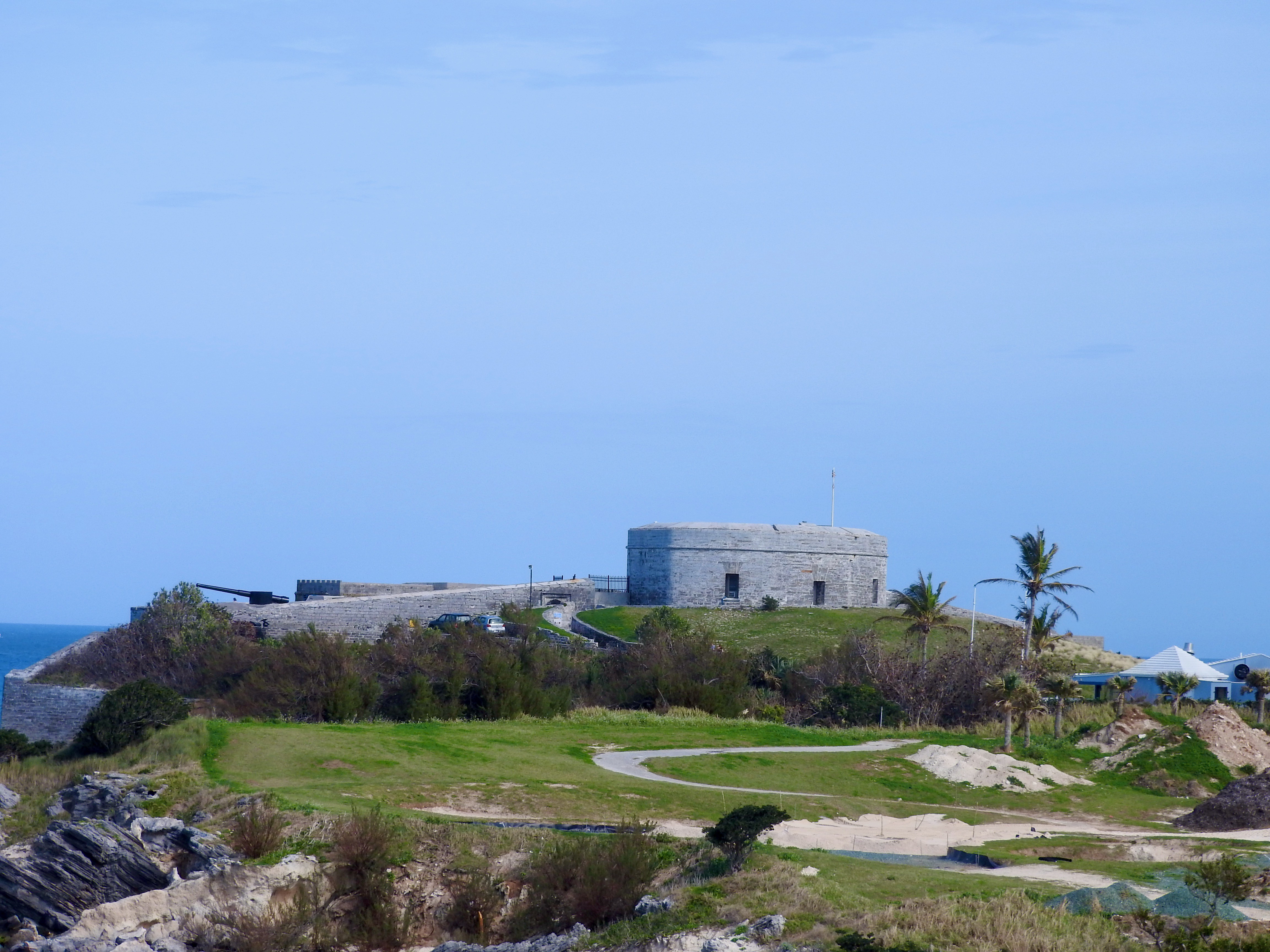
Protection of Bermuda began almost immediately after English colonists arrived. They settled on St. George’s Island at the far eastern tip of the archipelago. There they discovered a natural harbour well-suited for the elements although vulnerable to rival powers.
A hill outside of town overlooked seagoing traffic as it approached St. George’s. This became an ideal spot for Fort St. Catherine to be constructed in 1614 (map). The current fort — now a museum — looks considerably different than the original. Significant retrofitting and expansion took place over centuries of occupation.
One major redesign took place right after the end of the War of 1812 with the United States. Britain viewed the US as a potential naval threat at the time. More improvements happened after the US Civil War demonstrated the vulnerability of masonry forts to newly-invented rifled cannons (e.g., the destruction of Ft. Pulaski in Georgia). Fort St. Catherine, the “Jewel of the East,” served through World War II and became a museum in the 1960’s.
Fort George (St. George’s Parish)

The military simply abandoned most of the old forts in Bermuda. A couple of them became museums. Only one continued to serve in a more traditional government role, Fort George (map). Like Fort St. Catherine, this one dated to the earliest days of colonial settlement. It sat on the tallest hill in St. George with amazing lines of sight in all directions.
This commanding position made it an attractive location for Bermuda’s current Maritime Operations Center. The promontory worked well for ship surveillance, rescue operations and marine radio. It felt a little strange walking around an active worksite although interpretive signs around the perimeter certainly implied we could.
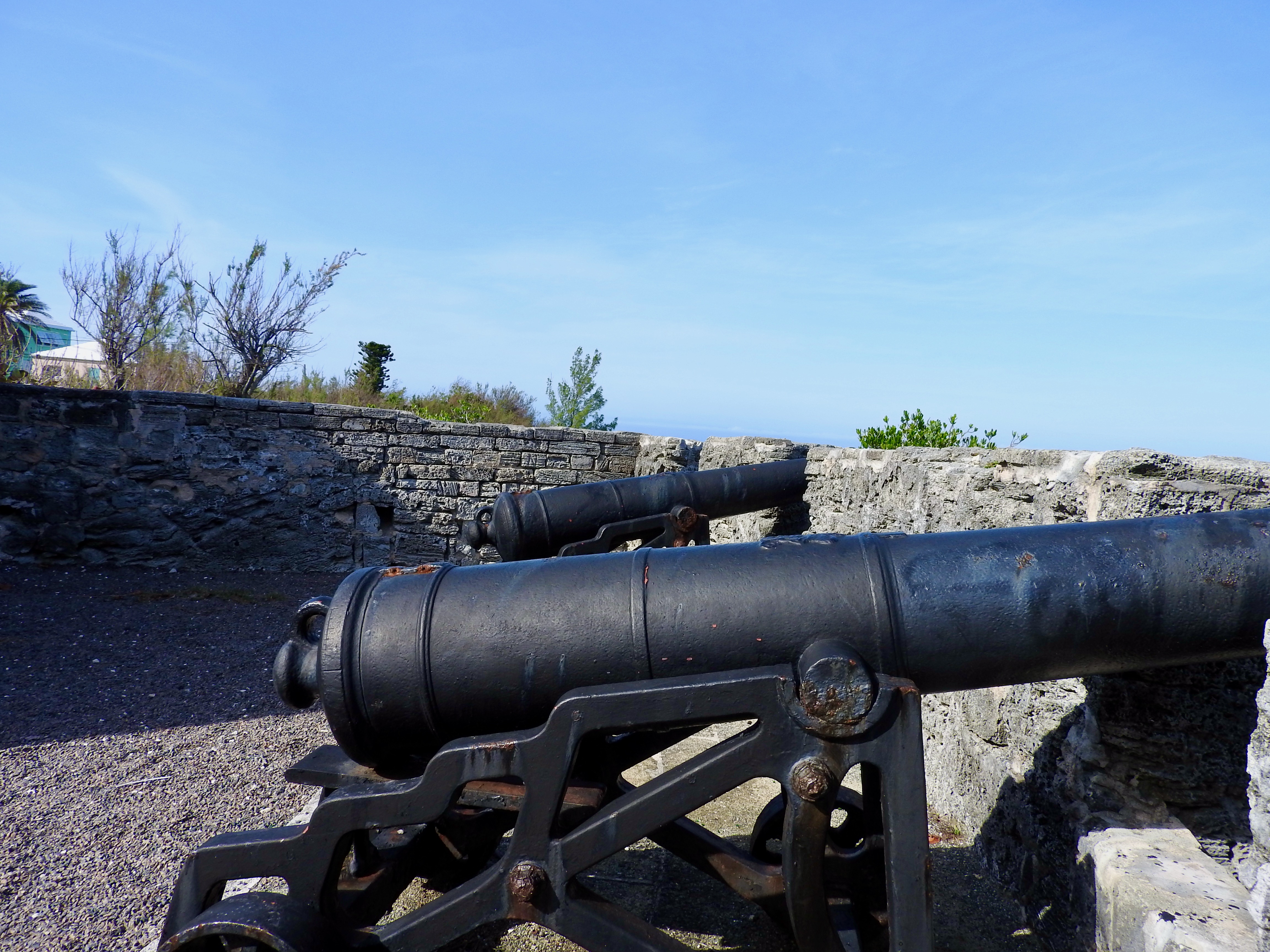
Alexandra Battery (St. George’s Parish)

Albert Edward, Prince of Wales (later king Edward VII of Great Britain), married the Danish princess Alexandra in 1863. That seemed like a fine reason to name an obscure far-flung fortification after her, I suppose (map). This one remained operational through the Second World War.
Liability laws in Bermuda must be a lot different than those in the United States because people can climb all over this thing. So I did, scaling to an elevated perch atop its most precarious point.
Then I noticed some guy walking by the side of the road. He must have lost his footing because he rolled down an embankment into some bushes. Of course I couldn’t help him because I was all the way up on the most isolated part of the battery. Fortunately a taxi driver coming down the road spotted him and helped him up. He seemed okay and walked away like nothing happened.
Gates Fort (St. George’s Parish)
Gates Fort (map) didn’t cover much space. However it was a hidden gem of a park overlooking Town Cut, a channel leading into St. George’s harbour. The fort had obvious strategic importance to colonial settlers who build the original outpost in the 1600’s. It didn’t amount to much more than a small tower and a couple of canons. Even so, I deemed it worthy for its spectacular waterfront scenery.
Martello Tower (St. George’s Parish)

We took a long walk on the Bermuda Railway Trail from the Town of St. George to the far southwestern tip of St. George’s Island. We found two fortifications there. The first one was Martello Tower (map), built in 1828 to protect a channel known as Ferry Reach.
Literally, it consisted of a lone stubby tower with room atop it for a single cannon, long since removed. Such a structure with one narrow entrance within a protective moat would be difficult to seize. It served as a rather effective deterrent although it never needed to prove the point.
Ferry Island Fort (St. George’s Parish)

Another fortification rose nearby, a more impressive structure during its heyday although standing in ruins today. The Ferry Island Fort (map) overlooked a ferry line that tied St. George’s Island to the rest of Bermuda beginning in the 1790’s. Back then, no bridge or causeway spanned the straight so a ferry served as the sole connection. It needed protection.
Not much remained of Ferry Island Fort although the scenery more than compensated for it. That became a familiar theme.
Fort Hamilton (Pembroke Parish)

Just outside the City of Hamilton, in Pembroke Parish, stood Fort Hamilton (map). This major fortification included extensive ramparts, tunnels, artillery and a moat. It protected Hamilton Harbour and the city itself from the 1870’s.
After decommissioning, Bermuda converted the fort into a lushly landscaped park. I particularly enjoyed the moat, now an enchanting tropical garden. However, we arrived late in the day and we pushed up against closing time. I had visions of getting locked into the moat overnight so we rushed along quicker than I would have liked.
Whale Bay Battery (Southampton Parish)
The Bermuda Railway Trail also served as a gateway to Whale Bay Battery in Southampton Parish (map). I had to take a short detour to get there although I found it worth the effort.
It seemed about middle of the pack in terms of size and scale for Bermudian fortifications. It protected Hogfish Cut, a channel leading up to the Royal Naval Dockyard, from the 1700’s to the 1870’s. Now it overlooked beautiful Whale Bay Beach and the Port Royal Golf Course.
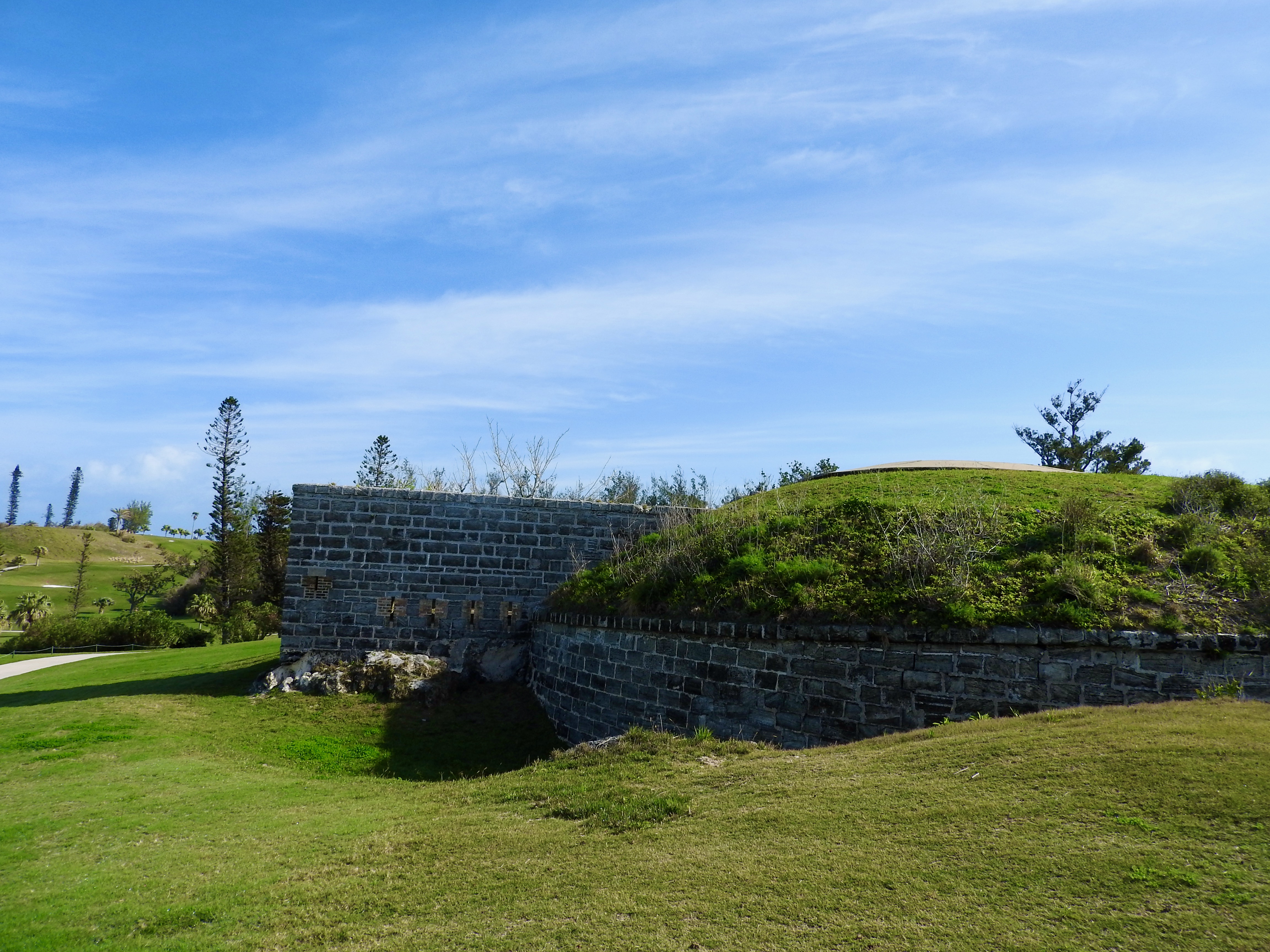
Fort Scaur (Sandys Parish)

Next I rolled up to a walkway connecting the Railway Trail to Fort Scaur (map). I climbed the steep path, pushing my bike, then exited from thick forest to a clearing atop a prominence.
Great Britain constructed Fort Scaur in the 1860’s after the U.S. Civil War. While Britain steered clear of the war, it tacitly sided with the Confederacy because of trading relationships. Blockade running even became a lucrative pursuit for many Bermudians. The U.S. government bristled at this even after the war.
Fort Scaur existed solely because Britain thought the United States might actually try to invade Bermuda. Ironically, U.S. troops were among the last occupiers of Ft. Scaur decades later, manning a joint outpost during the Second World War.
Now it’s a wonderful park perched high upon an embankment with spectacular views of the Great Sound.
Royal Naval Dockyard

If Fort St. Catherine anchored the east end of Bermuda, then the Royal Naval Dockyard anchored the west. The Dockyard was by far the largest fortification complex anywhere along the archipelago (map).
Great Britain lost most of its North American military bases in the late Eighteenth Century after thirteen colonies declared independence and formed the United States. It still had a presence in Canada although Britain needed something better positioned to protect vital shipping channels. Bermuda would do.
By 1818, the Royal Naval Dockyard became Britain’s headquarters for its North American and West Indies operations. It served that role for the next 150 years, extending well into the Cold War.
Now the massive complex serves the tourist market. This is where the large cruise ships unload their passengers. Here they find museums, shops, restaurants, entertainment, and transportation to other parts of Bermuda.
Articles in the Bermuda Shorts Series:
- Follow the Leader
- Shoreline Scenery
- The Outsider
- Bermuda Railway Trail
- St. George
- Forts
- Architectural Details
- Museums & More
- Lists
See Also: The Complete Photo Album on Flickr
Leave a Reply