
County counting scratched an important itch along my preferred route and it also offered an attractive side benefit; being able to stay in a lot of different Colorado towns. Each one displayed its own distinct personality. Admittedly I gained a skewed perspective at ski resorts without the snow or crowds although I didn’t have any control over the timing either. Several of the towns made it into earlier Twelve Mile Circle articles and my adventures overlapped with some of those topics. Now I finally got to see these Rocky Mountain places in person.
Steamboat Springs

Steamboat Springs (map) appeared in a 12MC article called Where in the World?. There used to be a game — since discontinued — on one of the Internet photo sites where people could guess locations based on geo-located images from its vast collection. I liked to play the game at the time and I described a means to try to identify one of the places that turned out to be Steamboat Springs:
“Things to consider: snow-covered mountains; a broad, flat valley; width of the road; the type of cars; the man’s style of clothing; his stance and physique; buildings in the background and their awnings; stoplights and street light.”
Now I got to see that exact scene in person. Steamboat Springs didn’t have much beyond that single main road, really. We enjoyed the one day we spent there. I imagined it had a lot more to offer during skiing season.
Aspen
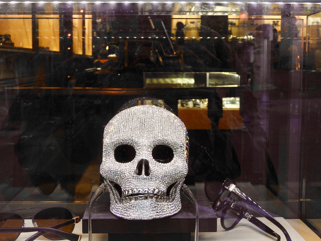
Aspen (map) graced the pages of 12MC in Wandering Through Real Estate. Google Maps once included a real estate feature. First I examined housing prices in certain areas of Detroit, Michigan where a protracted downturn made it possible to purchase homes for a few hundred dollars. I also wanted to examine the opposite end of the spectrum and selected Aspen where better homes topped $10 million.
We stayed overnight in Aspen and I took a stroll through empty streets early the next morning, long before most rational people would even consider getting out of bed. I had Aspen pretty much to myself. It dripped in luxury and wealth on every path. I’m not sure who would want a diamond encrusted skull but it could be had at the right price for the right buyer. Gucci, Prada, Louis Vuitton, you name it, they all had boutiques waiting for those of sufficient privilege. I didn’t bother. I’m pretty sure I didn’t match their target demographic unless they preferred cynical and cheap.
Much of the old downtown featured rows of beautiful historic structures dating from the silver mining boom of the late Nineteenth Century. Contemporary condominiums and houses lined streets closer to the slopes. I walked by some of those palatial modern homes near the base of the mountain. I had a hard time telling whether they were hotels or individual houses because of their immense size. I’m pretty sure they were houses though, the weekend retreats of people with more dollars than sense.
Leadville

Then we moved onward to Leadville (map), a place that professed to be the Highest Elevation Town in the United States. Many sites there noted their status as the highest [name a type of business] in the country. The local weed dispensary probably made the most legitimate claim. It didn’t seem far-fetched. After all, Leadville stood at an elevation of 10,578 feet (3,224 metres).
I’m not sure what I expected as we rolled into Leadville, although a flat, broad valley certainly didn’t match my mental image. I expected mountains. They could be seen on the horizon although Leadaville itself stood remarkably horizontal, just at a very high altitude. Without mountains at its immediate doorstep, the town didn’t have ski resorts or the resulting tourist dollars like other places nearby. It remained a working class town of miners and ranchers, and the mines fell onto hard times many years ago as did Leadville did too by all appearances.
I found the best view of Leadville from the upper balcony of its Mining Museum. Evidence of this once mighty industry still marked the landscape, from abandoned buildings and equipment to huge piles of tailings left behind. We did not stay overnight in Leadville. Besides, another town called Alma (map) claimed a higher altitude, even if it was a much smaller place than Leadville. We drove through Alma the following day in about thirty seconds.
Breckenridge
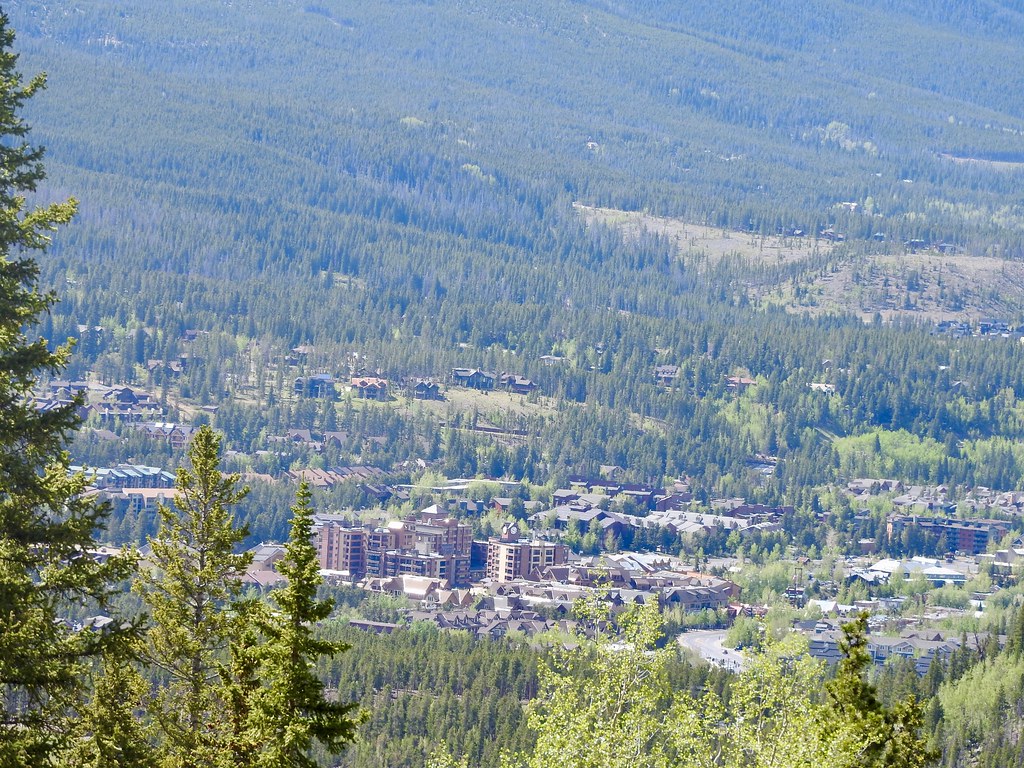
I’ve never featured Breckenridge (map) on 12MC before although I decided to talk about it anyway because we did stop there overnight. I’m sure Breckenridge existed before the advent of ski resorts even if little of its historical past seemed to remain. It felt more contrived than the other towns, almost like a movie set version of how a ski town should appear. It felt a little too perfect, a little too neat.
Still, we found a great hike and the mountain views impressed us. I left with a neutral opinion of Breckenridge, neither thrilled nor disappointed, and with no real burning desire to return either. I’m still glad we added it to our county counting list.
Articles in the Rockies Loop Series:
See Also: The Complete Photo Album on Flickr
Leave a Reply