Interstate Highway Time Zone Crossings

I’ve noticed a lot of search engine queries lately seeking additional information about points along US Interstate Highways where travelers cross from one time zone into another. I’m going to do that myself soon on my upcoming trip and I couldn’t find a comprehensive resource either. Maybe there’s one out there hidden away in a lonely corner of the Intertubes. Maybe not. I didn’t see it so I decided to create my own. Hopefully others will find this compact reference useful too.

Entering MOUNTAIN time zone. Photo by daveynin; (CC BY 2.0)
Crossing a time zone on Interstate 90

Yes, I understand that mobile phones and other networked devices grab time changes automatically without human intervention from nearby cell towers as someone drives merrily down the highway. However some of us like to be hyper-prepared before embarking on a journey. I even collected the lat/long coordinates so travelers (OK, maybe just me…) could drop the waypoints into their GPS receivers and know exactly where time changes happen well in advance.

Readers will want to open this map in another tab or window. It’s not very useful in its present scaled down version that is included for illustrative purposes. Others may prefer the even more detailed Google spreadsheet with links that I prepared. The spreadsheet layout mimics the geographic footprint of the United States in rough terms, for example I positioned Idaho at the top-left (northwest) and Florida at the bottom-right (southeast).

That was also the reason why Interstate numbers on the spreadsheet and the lists below were ordered from large to small (I-94 to I-8). I didn’t reverse the order just to be obstinate. Even-numbered Interstates run roughly west to east across the nation with the 2-digit numbering increasing from south to north. There were also a handful of odd-numbered highways that crossed time zone boundaries too and muddied the construct a bit. Again, the rules applied in general terms only.

This exercise was a lot more tedious than I imagined. Believe me, I’d use much more colorful language if this wasn’t a family-friendly website. I assumed quite foolishly that the preponderance of time changes would happen at state borders and simplify my task. Some do, although many more switch at random county borders which were much more difficult to pinpoint on a map. That’s why I think people have trouble tracking time zones as they drive. Now they have a tool to do that — this page.

Here’s what I found. I’m sure errors or omissions crept into this because it was such a pain to compile. Please let me know and I’ll make corrections.


Change Between Pacific Time and Mountain Time

  • Interstate 90: Idaho <–> Montana
  • Interstate 84: Baker Co., OR <–> Malheur Co., OR
  • Interstate 80: Unincorporated Elko Co., NV <–> West Wendover, Elko Co., NV(1)
  • Interstate 40: California <–> Arizona (Standard Time); Eastern Arizona <–> SE corner of Navajo Reservation in AZ (Daylight Saving Time)(2)(3)
  • Interstate 15: Nevada <–> Arizona (Standard Time); Arizona <–> Utah (Daylight Saving Time)(2)
  • Interstate 10: California <–> Arizona (Standard Time); Arizona <–> New Mexico (Daylight Saving Time)(2)
  • Interstate 08: California <–> Arizona (Standard Time); no change during DST(2)(4)

Change Between Mountain Time and Central Time

  • Interstate 94: Stark Co., ND <–> Morton Co., ND
  • Interstate 90: Jackson Co., SD <–> Jones Co., SD
  • Interstate 80: Keith Co., NE <–> Lincoln Co., NE
  • Interstate 70: Sherman Co., KS <–> Thomas Co., KS(5)
  • Interstate 40: New Mexico <–> Texas
  • Interstate 10: Hudspeth Co., TX <–> Culberson Co., TX

Change Between Central Time and Eastern Time

  • Interstate 94: Indiana <–> Michigan
  • Interstate 90: LaPorte Co., IN <–> St. Joseph Co., IN(6)
  • Interstate 85: Alabama <–> Georgia(7)
  • Interstate 80: LaPorte Co., IN <–> St. Joseph Co., IN(6)
  • Interstate 74: Illinois <–> Indiana
  • Interstate 70: Illinois <–> Indiana
  • Interstate 65: Jasper Co., IN <–> White Co., IN /AND/ Hart Co., KY <–> Larue Co., KY(8)
  • Interstate 64: Perry Co., IN <–> Crawford Co., IN
  • Interstate 59: Alabama <–> Georgia
  • Interstate 40: Cumberland Co., TN <–> Roane Co., TN
  • Interstate 24: Marion Co., TN <–> Hamilton Co., TN
  • Interstate 20: Alabama <–> Georgia
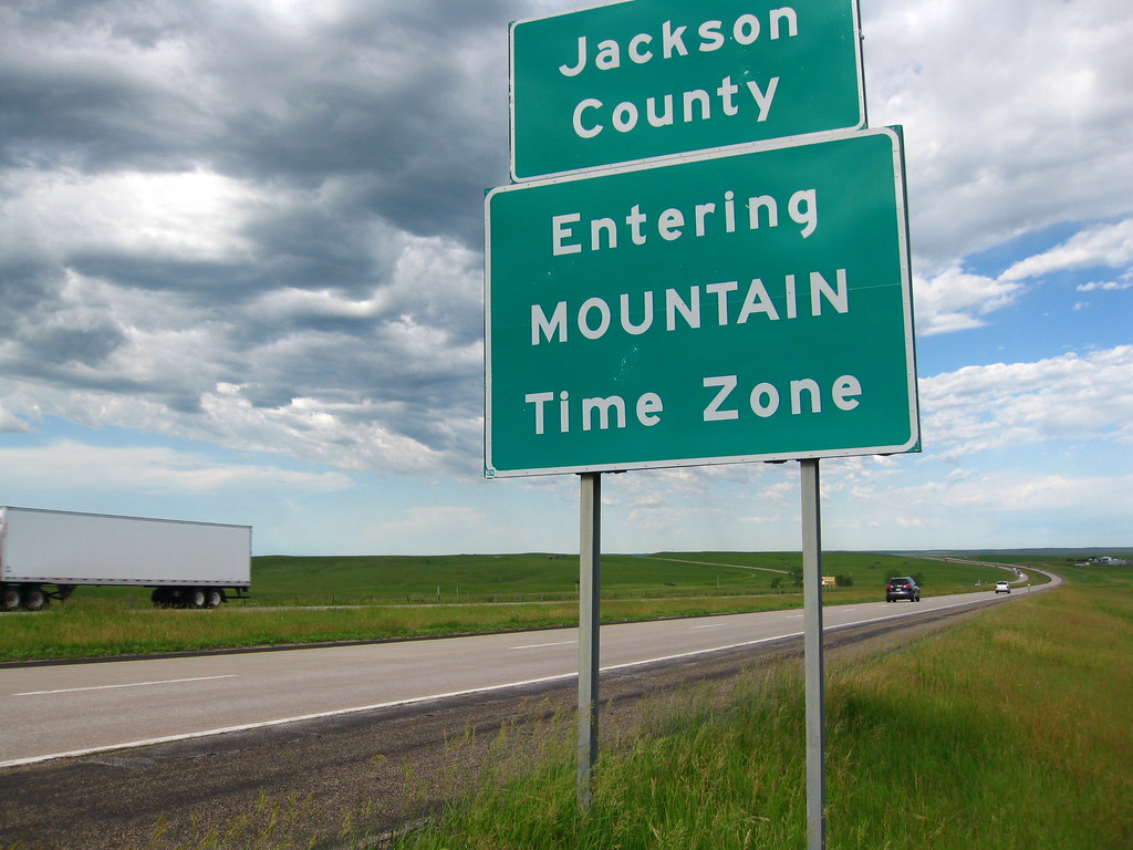
  • Interstate 10: Jackson Co., FL <–> Gadsden Co., FL

Bonus Roads(9)

  • Western Kentucky Parkway: Grayson Co., KY <–> Hardin Co., KY(10)
  • Cumberland Parkway: Russel Co., KY <–> Pulaski Co., KY(11)

Footnotes

(1) West Wendover is the only part of Nevada that officially observes Mountain Time, primarily so gamblers from Salt Lake City — the nearest large town — won’t have to deal with a time change and can focus on losing their money without distraction. This was described in (West) Wendover: What Time? What State?
(2) Arizona does not recognize Daylight Saving Time, meaning that for practical purposes the spot where the time zone change takes place shifts in the Spring and the Fall. This can sometimes lead to embarrassing situations.
(3) The exception to the “Arizona doesn’t recognize DST rule” is the portion of the sprawling Navajo Nation that crosses into Arizona. The Navajo did this to assert their sovereignty as well as to keep their tri-state Nation on the same time all year.
(4) Interstate 8 extends from San Diego, California to south-central Arizona; fairly short by interstate standards. Therefore it does not experience a time change when the two states observe the same time (i.e, when the Pacific Time Zone switches to DST and Arizona remains on Mountain Standard Time)
(5) I crossed this one during my Dust Bowl trip. See Kansas Mountain Time.
(6) You’re not seeing things. Interstates 80 and 90 are repeated with the same information here. That’s because they’re co-signed at this spot.
(7) Interstate 85 is the best example of an odd-numbered Interstate messing up my chart. The time change happens at a very southern segment of this very eastern highway.
(8) Interstate 65 starts in Central Time in an Indiana suburb of Chicago, switches to Eastern Time as it heads south, then switches back into Central Time in Kentucky
(9) I included Kentucky parkways because they’re significant roads albeit they’re not Interstate highways (not even Secret Interstates). I probably could have added other roads too.
(10) I will be crossing here on an upcoming trip. This was the spot that inspired me to go ahead and compile the list.
(11) I crossed here in the summer of 2013 during my Kentucky Adventures.

Comments

25 responses to “Interstate Highway Time Zone Crossings”

  1. Mark Sundstrom Avatar

    That’s a nicely done chart! I’ve done all of those crossings except for a few of the more southerly CentralEastern ones.
    –Mark

    1. Eric Avatar
      Eric

      This is awesome! Thank you.

  2. David Burrow Avatar
    David Burrow

    This is very well researched. I just noticed a couple of typos you may want to correct. I’m sure you mean that on I-10 the change during Daylight time is between ARIZONA (not California) and New Mexico. Also I’m pretty sure you mean that West Wendover is the only part of Nevada in MOUNTAIN (not Central) time.

    Thanks again for all the work you do on this blog. It covers a lot of fascinating topics.

    1. Twelve Mile Circle Avatar

      You’re absolutely right — thank you for the corrections. I was so cross-eyed by the end of this exercise that I had trouble focusing anymore.

  3. Ross Finlayson Avatar
    Ross Finlayson

    A small nit (typo): “West Wendover is the only part of Nevada that officially observes Central Time”. You meant to say *Mountain Time*, of course.

  4. TB Avatar

    The sign at the I-80/I-90 crossing is unusual because it’s blue, it’s in the median and – here’s my question coming up – it says either NOW ENTERING E.S.T. ZONE or NOW ENTERING C.S.T. ZONE.

    Is this sign incorrect during summer months since there is no EST/CST, only EDT/CDT, even in Indiana now?

    1. Twelve Mile Circle Avatar

      I noticed that sign when I was researching this article and pondered that same logical disconnect. In my opinion, yes, the sign is wrong during DST. It should say “now entering Eastern Time” or “now entering Central Time” (depending on which direction one is traveling of course) unless they plan to switch the message twice a year.

  5. Fritz Keppler Avatar
    Fritz Keppler

    Although it’s not traversed by an Interstate highway, the Hopi Nation asserts its independence from the Navajo Nation by NOT observing Daylight Saving Time. The time situation in Arizona during DST lends itself to confusion.

  6. Kc Matheny Avatar
    Kc Matheny

    Thank you for doing this. I plan cross-country trips for people & love to give them detailed info such as this.

  7. Jennifer Avatar
    Jennifer

    We are currently on I-64 heading east through Indiana and my husband wants to change the clock in the car, I suggested we wait until we cross into the eastern time zone. I then wondered why there weren’t signs on the highway to let drivers know when they cross into a different time zone. Now I know, thanks to you, that we are exactly 26 minutes from the line! Ha.

    1. Twelve Mile Circle Avatar

      Awesome! I’m glad you found it useful.

  8. Blake Walter Avatar
    Blake Walter

    This is a great map — I haven’t found anything that duplicates this information within Google Maps. Evidently there is some kind of a timezone overlay within the full desktop version of Google Earth, but I haven’t experimented with it. I’ve always wondered if there are places where your next door neighbors are in a different time zone from you; it seems like it would have to happen. Thanks for your work to make this available.

  9. LeslieAnne Seifert Avatar
    LeslieAnne Seifert

    This is amazing! Thank you for all the work that went into this from all of us travelers using your good work!

  10. RT Casalenda Avatar
    RT Casalenda

    Thank you, thank you, thank you. I was feverishly looking for time zone change and came across your site. Loved the intro…

  11. Chris Kingsley Avatar
    Chris Kingsley

    I just crossed from central time to mountain on I-80. The crossing is between mile 149 and 150. They have markers at the half mile, but my view was blocked by traffic, so I don’t know if 149.5 is in central or mountain

  12. Sue Avatar
    Sue

    Thanks for doing all this work and sharing it for anyone to use. Much obliged! You rock!

  13. Liz Salter Avatar
    Liz Salter

    exactly what i was looking for. thank you so much for putting this together!

  14. Maria Avatar
    Maria

    Thank You! Great resource

  15. Laurie Fox Avatar
    Laurie Fox

    THANK YOU SOOOO MUCH for this wonderful and much-needed resource! I provide “ground support” for my son & his family as they travel cross country. An hour one way or the other makes a big difference when you’re planning how far you can travel in one day!! IDK *why* the people who make time zone maps don’t put interstates on them and the people who make “street” maps don’t put time zones on them. But today I finally put the right question into the search and it sent me to your WONDERFUL map! You will save me SOO much trouble and frustration as I try to compare separate maps to discover this information each time and for that I am VERY grateful!!

  16. MDV Avatar
    MDV

    Nicely done! Thank you for your hard work – will definately be using this site again.

  17. Lesley Lint Avatar
    Lesley Lint

    THANK YOU SO MUCH for posting this content! We struggled for a long time to find an exact answer to the time zone change question. We also searched a long time on Google before your site came up. I realize this took so much time for you but we are thrilled that you did. Thank you, thank you, thank you!

  18. KERRY LARSON Avatar
    KERRY LARSON

    Thank you!!!

  19. Naomi Avatar
    Naomi

    Traveling from MN to MT and back via two different routes through SD and ND, so this was very helpful. I also like to know ahead when exactly the time change will occur.

  20. Gary Avatar

    My wife’s aunt recently got back from a trip to Chattanooga. It is right on the border between Eastern Time and Central Time. She said that TV stations there had when shows were in both Eastern and Central time. The city and county itself is in Eastern Time. The county (Hamilton County) borders 10 different counties (six in Tennessee, and four in Georgia). Three of the six Tennessee counties bordered are in Central Time.

  21. Mark Evans Avatar

    Thanks buddy! I’m glad i found this page and your map! Btw… Phones don’t change time zones when they’re supposed to.
    I drive a truck and when i pass a timezone sign going from Texas to Colorado phone don’t catch up until 30-60 minutes after. Lol

    Thanks a lot my friend!

Leave a Reply

Your email address will not be published. Required fields are marked *

Latest Comments

  1. Many of these comments are very interesting, have enjoyed reading. We cross several times a year as well going from…