
Matthew of the prullmw blog[1] is a regular reader and commentator on the Twelve Mile Circle. Recently he wondered whether I might have an interest in time zone boundaries. Indeed I do!
Hopi and Navajo Anomalies
I mentioned the whole Arizona, Navajo, Hopi complexity in my response, but I’d been unable to find a decent map to get the point across. Mapquest provides time zone boundaries at its higher-level views but those disappear just as I click-down to the proper level of detail. The other online mapping sites provide no help either, and the static maps are entirely hit-or-miss. It shouldn’t be this difficult to find a good time zone map but apparently that’s the case unless one wants coverage of the entire United States.
Mapping It
Finally I found a map that demonstrates my point. Actually, more specifically, I made a map. I went to the National Atlas of the United States, applied a time zone layer and dropped the resulting image into graphics software to affix the proper labels. Thanks goodness for taxpayer supported public-domain images [EDITOR’S NOTE: unfortunately the program ended in 2014 and is no longer available].
Here’s the result, as edited:
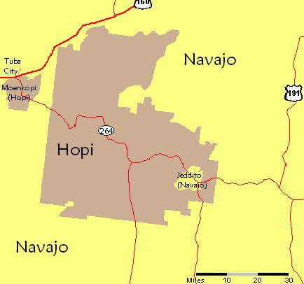
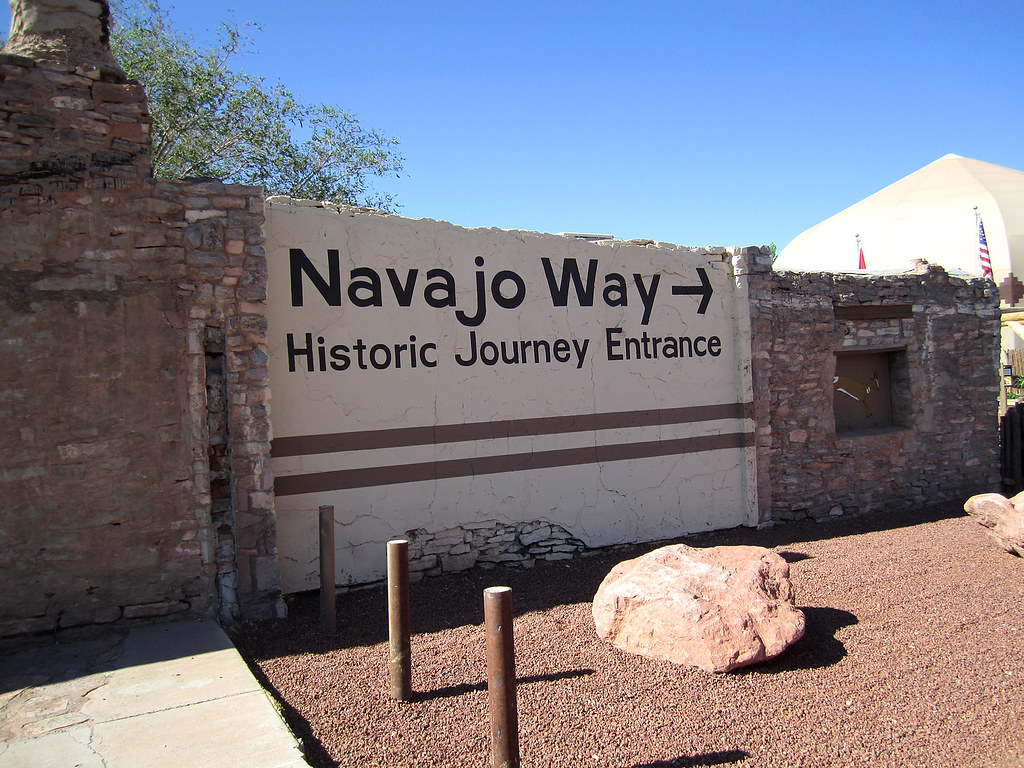
The boundaries of the Hopi Nation are enclosed entirely within the boundaries of the Navajo Nation. The Navajo Nation has an exclave, Jeddito, within the primary Hopi territory. Likewise the Hopi Nation also has an exclave, Moenkopi, within the Navajo Nation. A major Navajo town with more than 8,000 inhabitants, Tuba City, sits just above Moenkopi north of the intersection of Routes 160 and 264.
Time Zone Complexity
The Navajo Nation recognizes daylight saving time (DST). Arizona and the Hopi Nation do not. All is fine during the winter months when everyone observes Mountain Standard Time but it spirals into confusion when DST kicks-in.
Imagine someone traveling from Jeddito on Route 264 to Tuba City during the summer. This is not far-fetched. Undoubtedly this happens all the time. Our fictional traveler would start in DST (Jeddito, Navajo exclave), switch to standard time (Hopi), switch to DST (Navajo), switch to standard time (Moenkopi, Hopi exclave) and switch to DST (Navajo) at Tuba City.
In reality our traveler wouldn’t actually change his watch four times along this 90 mile route. However it’s still a fun set of circumstances to ponder. Plus the lines aren’t even as clean as suggested. For instance, many businesses in Tuba City observe standard time just like the rest of Arizona for commercial reasons and to avoid confusing tourists.
You can find more information about Arizona time zones elsewhere on the blog at “Arizona Does Not Recognize Daylight Saving Time.”
Idaho Anomaly
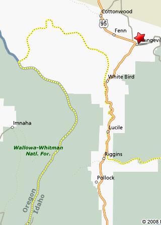
Matthew brought another fun time zone anomaly to my attention and it’s definitely worth discussing. He suggested I check out the land just south of Grangeville, Idaho. This one is awesome!
Much of northern Idaho follows Pacific Time which makes sense from an affinity perspective. Residents of Coeur d’Alene are located over four hundred miles away from Boise, the state capital. However they’re only thirty miles away from Spokane, Washington. It’s natural that they would want to align with Pacific Time like their nearby neighbors and cohorts in Washington rather than the Mountain Time observed downstate. Indeed, that’s the case.
So, the time zone boundary crossing Idaho doesn’t follow a straight path. Exact lines don’t make much sense in a rugged, wilderness area. Rather, the boundary snakes along natural features, primarily the Salmon River, as it courses between Oregon and Montana. Either you’re standing on one side of the river or the other. You know what time to expect. Easy.
Rivers, being what they are, follow underlying terrain in search of an outlet. This creates a little hernia of Mountain Time protruding into Pacific Time along the western edge of Idaho. Right there it’s possible to travel due east and move into a later time zone. Generally one has to turn the clock forward when crossing a time zone boundary heading east, but not here. For within this anomaly, this little knob created by the Salmon River, the exact opposite holds true. One turns the clock back.
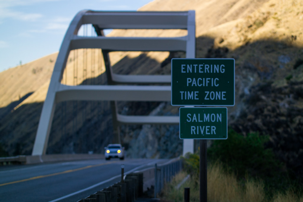
The Time Zone Bridge (map) sits a couple of miles outside of Riggins, Idaho, a town situated within the anomaly. Cross the little bridge heading northeast, and pay attention to the sign. You’ve transitioned into Pacific Time!
Thanks, Matthew, for that amazing fact. Also check out Part II for even more time zone anomalies in the United States.
12MC Loves Footnotes!
[1]Currently in hibernation but I look forward to when he starts reporting on his Goals for 2009, some of which involve geography quests!
Leave a Reply