
It seemed like a good idea last January when a friend mentioned Le Tour De Shore to me. He wanted to try a long distance bicycle ride and what better place to try that a place almost completely devoid of hills? There’s almost nothing but flat out on the Delmarva Peninsula. So he convinced me to click on the Eastern Shore of Virginia Chamber of Commerce website and sign up. Then I kind of forgot about it for a few months.
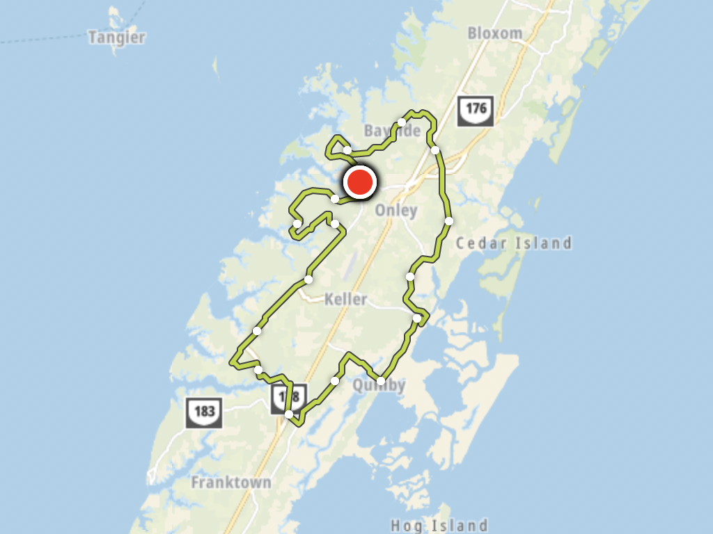
100 Kilometre Route
We didn’t care about winning, or even going particularly fast for that matter, so I simply maintained my normal training schedule. It’s also a low-key race with maybe four hundred riders spread amongst 100 mile, 100k, 50k and 25k options. We chose the 100k, a “Metric Century” (62.1 miles) which seemed eminently doable.
This would be my longest ride single-day ride (I’ve done longer over multiple days). It covered pretty much the entire middle third of Virginia’s Eastern Shore. I’ve done plenty of 50 mile rides in a single day but never a 100k. It’s not that I’m incapable. I simply prefer shorter distance. I have the same preference with running; I can run a half-marathon without any additional training any day of the week but I have no desire to go farther. I had no doubt I could finish a Metric Century especially on flat terrain but I felt ambivalent.
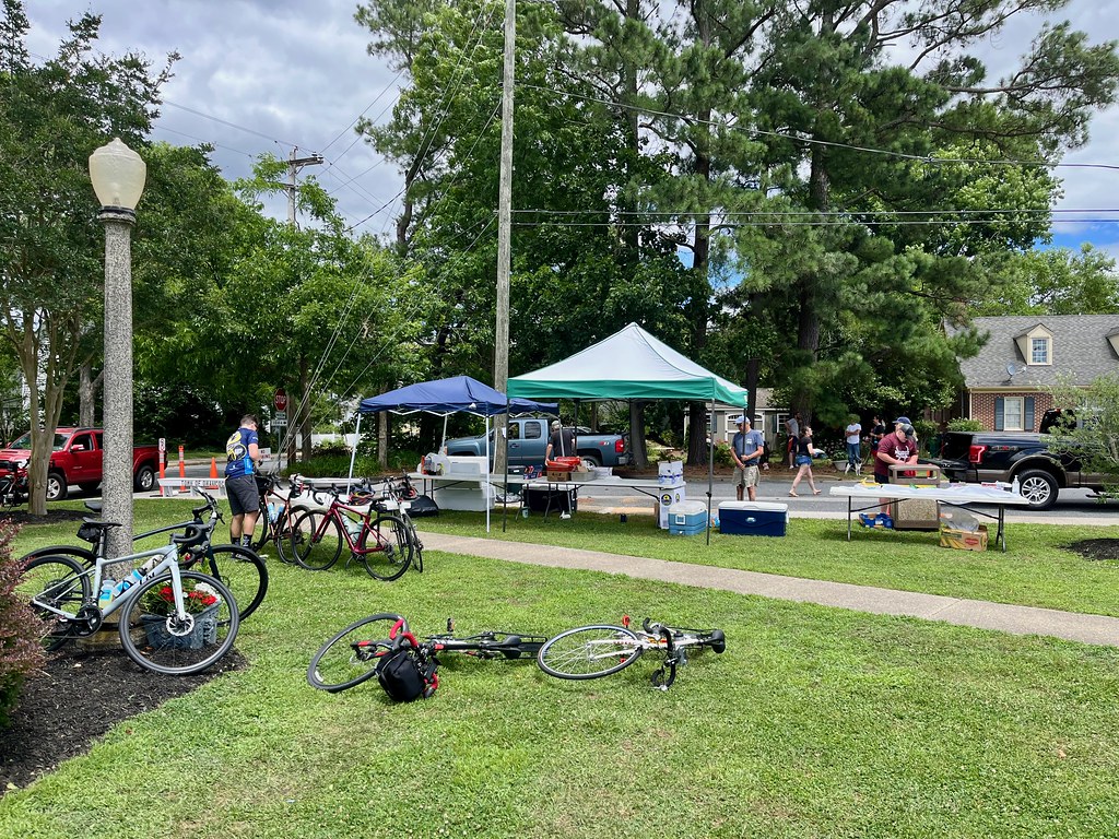
My friend recruited another cyclist to join our tiny peloton. So the three of us assembled on Onancock Town Square at the appointed time (map). We would return to the same spot a few hours later although a lot more tired, sweaty and dirty.
The Long Stretch
We left Onancock and headed down quiet country lanes into farm country. A couple of times we rode through small pine forests which were quite pleasant, and then past chicken farms which were decidedly not.
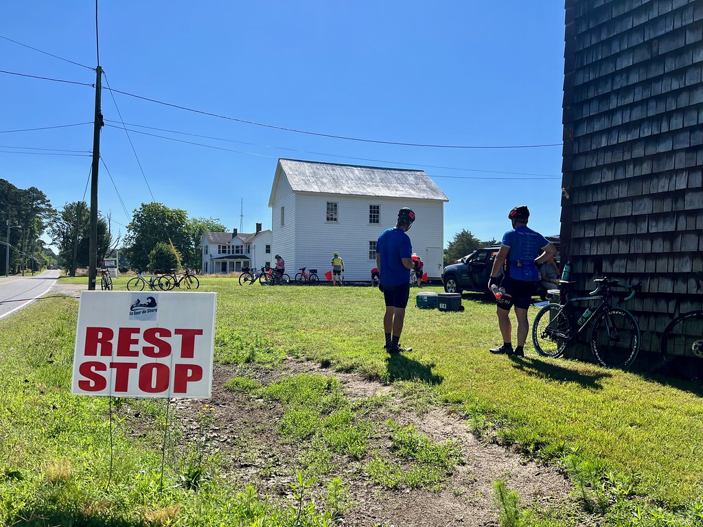
We didn’t reach the first rest stop until Mile 24, just over Occohannock Creek, approaching the town of Belle Haven (map). This was our longest segment without a break. Of course that was fine because our legs were still fresh and the sun sat low on the morning horizon. Even the temperature approached perfection, a rare June day where it barely broke 70° (~21° c.).
However, the wind pick-up and we watched as gusts rippled across adjacent cornfields in waves. Soon it rose to a sustained 20 mile per hour Northern blast, and occasionally gusted higher. It offered a helpful tailwind although it also foreshadowed a problem down the road because the route followed a loop. A tailwind now promised a headwind later.
I also noticed I was better trained than my companions. That offered opportunities to pause whenever I spotted something interesting, take a few photos, and then catch up to them a few minutes later.
Into the Wind
Refreshed, we began the second leg, a 16 mile trek to the Wachapreague rest stop. Soon we entered Exmore at the southern tip of the loop. Until that point we’d been cruising through Accomack County and now we briefly entered Northampton County. The 100 mile cyclists spent a lot of time in Northampton but we barely clipped it at the bottom of our route.
Then we turned a corner leaving Exmore and headed straight into the teeth of the wind. This would bedevil us for the next twenty-five miles (Miles 28 through 53). Of course there was nothing we could do about it other than gut it out. So we did.
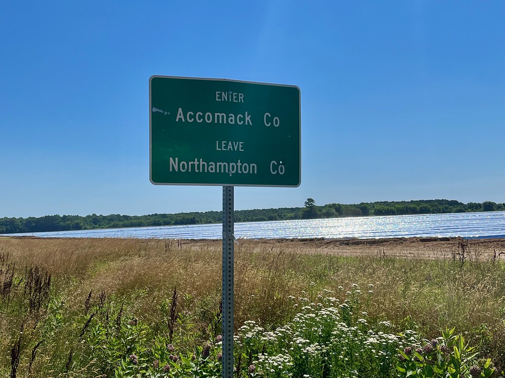
The rest of the way to Wachapreague was rather strenuous although I did stop and photograph the county line sign as we reentered Accomack (map). The four miles from Quinby to Wachapreague were some of the toughest of the ride, cycling directly into overpowering gusts that tried to push us backwards.
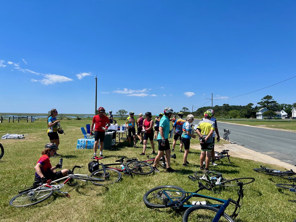
The rest stop in Wachapreague at Mile 40 was well earned (map). But I also had a contingency plan I figured out earlier. Our hotel was in Wachapreague and I could quit if things got ugly. Thankfully I didn’t have to pull that card though. I still felt great and I had a lot of energy left so the finish line wouldn’t be a problem today.
I also got a surprise visit from my wife and younger son. They’d been tracking our position from my mobile phone and they walked over from the hotel to see how we were doing. Cell coverage was pretty spotty in the more remote corners of the route and sometimes I’d disappear for awhile, but soon enough I’d pop back onto their screen.
Accomack. Or is it Accomac?
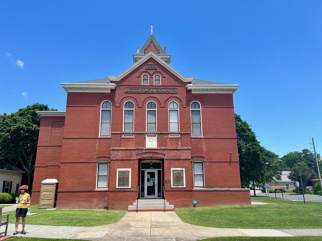
Fortunately the next leg covered only 10 miles, extending to the courthouse square for Accomack County (map). I say fortunate because we still fought the vicious headwind and by that time we were 50 miles into the ride. One farm blended into another, and yet into another, and all quite hypnotically. I wasn’t disappointed to peddle into the town of Accomac and arrive at the courthouse.
Incidentally, it’s the County of Accomack (with a “k”) and the Town of Accomac (without a “k”), which seemed rather gratuitous and confusing. They both derived from the name of the original Native inhabitants, the Accawmack tribe of Algonquians. When 17th Century settlers anglicized it they spelled it Accomac. Then for some unknown reason the Virginia General Assembly decided to append a “k” onto the county name in 1940. Just to be contrary, I guess.
Success
Anyway, I was way too far into the event to worry about spelling variations. We rode another couple of miles and turned the corner at the northern tip of the loop. Then we regained the tailwind for the final few miles towards the finish. I left my little group behind for the last little chunk into Onancock because I still felt great, and frankly I was ready to be done. My watch recorded a distance of 64.2 miles so we even got a couple of bonus miles out of the deal, too.
I enjoyed the setting and I enjoyed seeing my friends. I also proved that I could complete a Metric Century using my normal training regimen. So now I can concentrate on shorter distances again, right?
Leave a Reply