
It feels like I just got back from Costa Rica and then I’m right back on the road again. True enough, we made it home for only a couple of weeks before we began an extended drive through the southeastern United States. However, those were the only dates that worked with everyone’s schedules this summer. So we backed into these serial adventures, squeezing through narrow gaps left between work and school commitments. I hadn’t seen much of my family since before the pandemic and it was overdue.
That was the primary purpose and it dictated not only the dates but the general route: Atlanta to the Florida Panhandle to the Mississippi Gulf to Houston and finally the Texas Hill Country (map) — about 1,300 miles (2,100 kilometres) over two weeks. Each leg averaged about six hours so it was manageable. Drive, then hang out for two or three days, then drive again.
Well, the weather was a different story. Every family member we wanted to visit encouraged us to pick something other than late July. It gets hot down south. Really hot. And each stop seemed to get progressively hotter, concluding with Texas where it leveled out at 103° Fahrenheit (40° Celsius) along with oppressive humidity. I get it, but we didn’t have a choice.
The Count
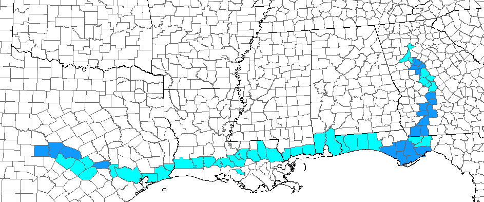
But there was a silver lining in addition to seeing family for the first time in ages, and I’m referring specifically to County Counting. I was able to add 22 new counties to my lifetime list, bringing it up to a total of 1,666. That’s 53% of counties in the United States. I’ve shaded new counties on our route with the darker blue color in the graphic. Previously visited counties are lighter blue.
I captured new counties in Georgia, Florida and Texas, and even completed the stubborn Florida Panhandle. You can’t finish the Panhandle just by driving along Interstate 10. Someone has to really dig in to the crevices to make that happen, and I felt pretty good about my effort.
I don’t expect to get every county in the U.S. in my remaining years on earth. My pace simply will not accommodate that unless I set a world record for longevity, and I’m comfortable with that. However I continue to chip away at it slowly nonetheless because that’s what I enjoy for some mysterious reason, forever pushing that boulder up the hill.
So the adventure was partly about the drive but mostly about the destinations. That’s why I’ll focus most of my attention on the destinations during this particular series. But I don’t want to completely ignore the random roadside encounters either. Let me talk about a few of them here before we move on to the heart of things.
Titan I Missile
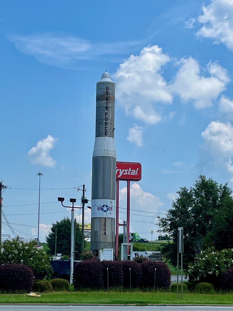
Certainly I never expected to come face-to-face with a Titan I missile when I pulled over for lunch in Cordele, Georgia (map). And why should I? It made no sense for a rocket capable of delivering a nuclear payload across the world to be sitting next to a gas station and a burger joint along Interstate 75. Plus they were all decommissioned something like sixty years ago, and they would hide underground in a silo anyway. So I think the larger story is how it got here.
Fortunately the Internet has an answer for everything, with a listing both in Atlas Obscura and Roadside America. There is a plaque at the site that says:
“The Rotary Club of Cordele initiated this project, a dream of its President, John S. Pate, Jr. The dream became reality when Confederate Air Force Pad No. I was christened July 17, 1969”.
Essentially it was surplus property intended for the scrap pile. Somehow the Rotary club convinced the Federal government to hand it over and now it stands along the highway.
Blue Angel
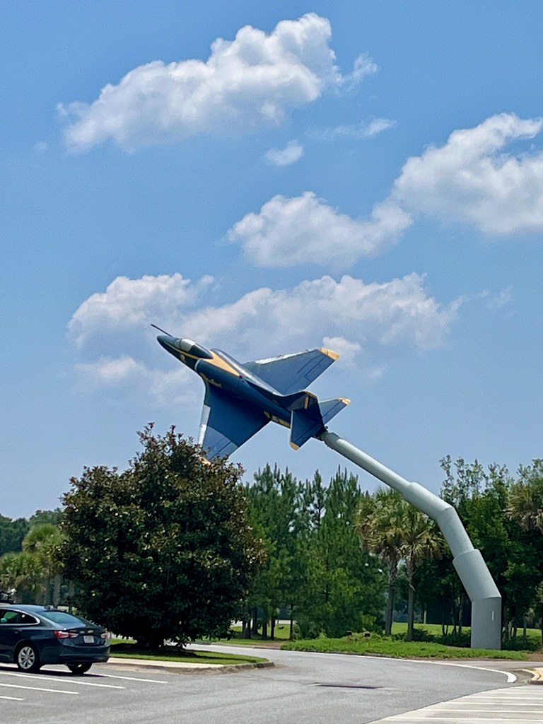
We encountered another fascinating roadside attraction several days later near Pensacola, Florida. This time it was a Navy A-4 Skyhawk painted like it performed for the Blue Angels aerobatics squadron. It sat along Interstate 10 at the Santa Rosa Westbound Rest Stop (map). The Blue Angels fly out of Naval Air Station Pensacola for for much of the year so the tribute actually made sense here.
There was a time in the not too distant past when it seemed like rest stops were verging on obsolescence. However I’ve noticed they’ve experienced something of a renaissance recently. They’ve definitely gotten more interesting. It’s almost like states are trying to out-do each other, which is wonderful. Maybe states finally understand that rest stops actually offer more than rest. They can create goodwill, acting as goodwill ambassadors and tourism promoters.
The Navy retired A-4’s in 2003, so like the Titan I, maybe it was better to preserve it than scrap it. Now this specimen sits at the end of a stick to the delight of motorists who stop to relieve themselves.
Texas Border
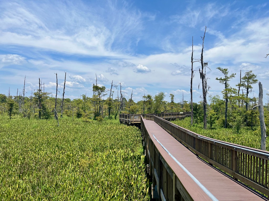
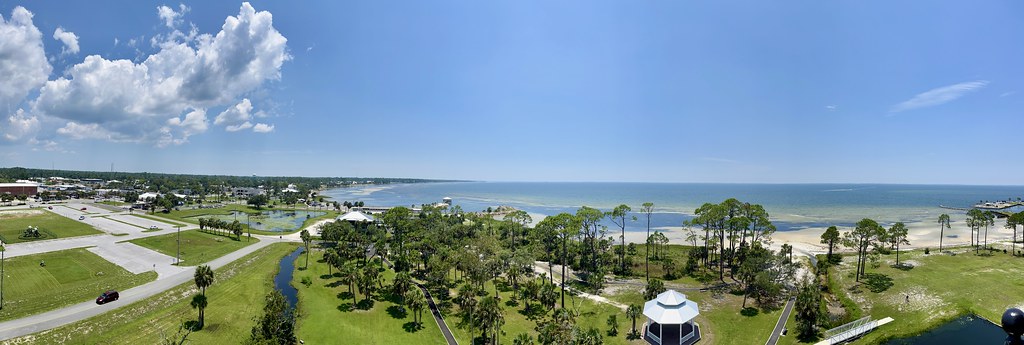
Once again along Interstate 10 although hundreds of miles away and a few more clicks into the future, we found a rest stop in Texas that surprised us in a different way. Officially it was the “Texas Travel Information Center” but let’s get real, it was a rest stop (map). It also had a fascinating boardwalk behind the facility that extended into the local wetlands. Well, the wetlands were a little drier than usual due to the heat and an extended drought, but it was still a pleasant spot to leave the car for a few minutes.
So those were the outliers. I’ll feature actual intended destinations in subsequent posts.
Articles in the Southern Heat Series
See Also: The Complete Photo Album on Flickr
Leave a Reply