
Washington, DC (2007 & 2009)
Few things are nicer than a walk on Theodore Roosevelt island on a beautiful day.
The Setting
We visited Theodore Roosevelt Island, often referred to by its shorter name “Roosevelt Island” an 88 acre nature preserve set amid the Potomac River and the surrounding urban landscape (map). The National Park Service maintained Roosevelt Island in a natural state with a green canopy of dense hardwood forest accented by lowland filtered by tidal marshes.
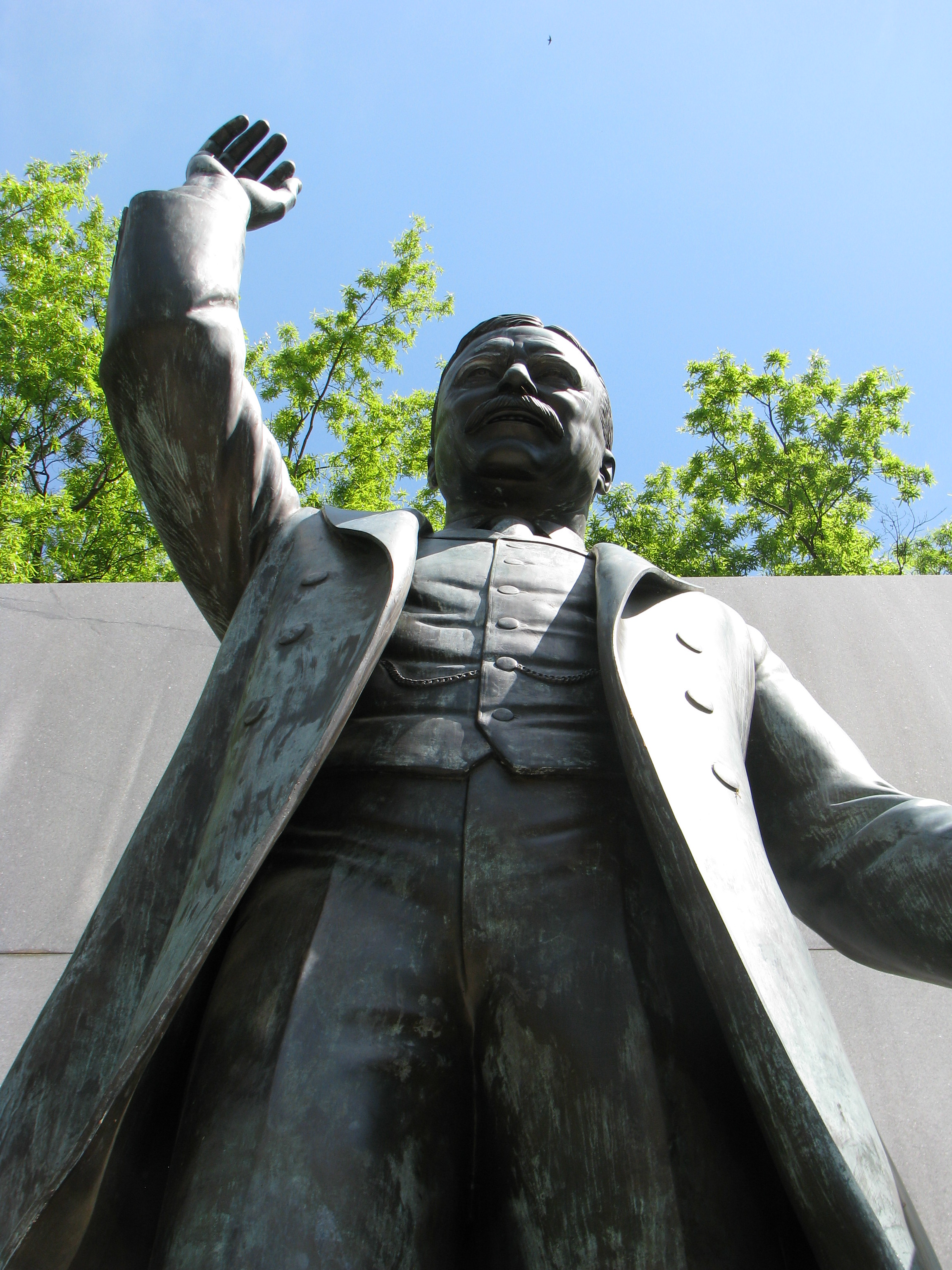
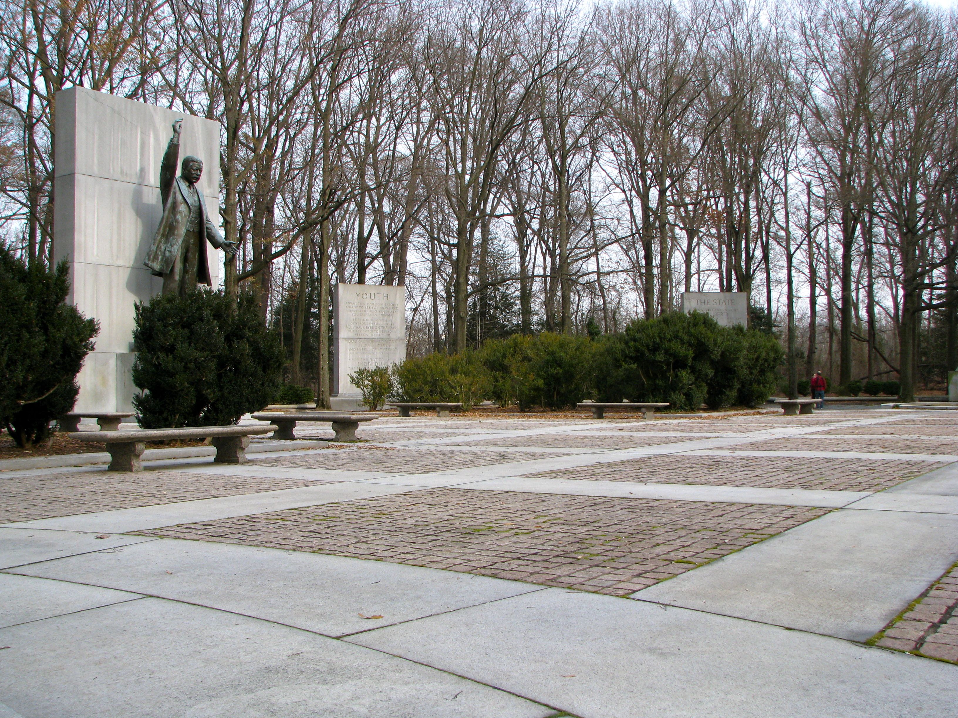
A memorial to Theodore Roosevelt, 26th President of the United States rose within a clearing on the northern end, delivering an emotional stump speech with raised arm as translated by carved tablets along the perimeter. To name such a restful oasis, hemmed in as it was between the highrise towers of Rosslyn and the crowded quarters of Georgetown and Foggy Bottom, was a fitting tribute to President Roosevelt. He, the consummate outdoorsman and conservationist of his generation, would have appreciated the gesture.
Some History
Reserved for the People
The Theodore Roosevelt Association purchased this island and nearby Little Island in 1932. They donated it to the American people as a thoughtful gift and as a tribute to the lasting memory of the man they pledged to honor. Under Association guidance, Landscape architect Frederick Law Olmstead, Jr. drafted a restorative plan carried out by the Civilian Conservation Corps as a public works project during the height of the Great Depression.
In the 1960’s, Eric Gugler designed the Memorial Plaza adorning the island’s highest point and Paul Manship sculpted the Theodore Roosevelt statue as its central focus. Neither object was visible from outside the park. They appeared suddenly from behind the forest curtain, a light-filled pocket within the darker woods.
Further Back in Time
The Potomac River formed Roosevelt Island naturally ages ago as softer stone eroded in river currents and floods, and the harder stone remained. People gravitated to the island as they arrived. Native Americans built seasonal fishing villages. English colonists called it My Lord’s Island and Barbadoes. George Mason, the author of the Virginia Bill of Rights and the namesake for a large University in Northern Virginia, once counted this as part of his vast estate. His son John constructed a mansion on this river-trapped outcropping and it became known as Mason’s Island.
Other names adorned it over time: I own an 1894 atlas that lists it as Analostan Island. Once it was a fishing village and later a plantation. Then it served as a drill field for Union troops during the Civil War and a picnic ground for local Washingtonians. Finally it became a verdant oasis in an otherwise concrete-gray metropolis.
Much more information can be found in the Theodore Roosevelt Island brochure that visitors can pick up at the sign post upon arriving on the island.
Getting Onto the Island

The National Park Services’ George Washington Memorial Parkway unit administered Roosevelt Island. Conveniently the GW Parkway ran along the western flank of the river directly across the way. The typical tourist remained unaware of this hidden gem, forgotten among the grandeur of nearby monuments and museums within the standard circuit. Locals gathered to stroll, jog or relax, understanding a secret passed down through generations: the island may be overlooked but it’s easy to reach.
From the Parkway
By car, Roosevelt Island can only be accessed from the northbound lanes of the GW Parkway. The park includs a small parking lot continuously filled with cars and motorcycles on pleasant days. Savvy visitors know better. Many bypass this carpark reflexively, understanding that more reliable options will avoid the hassle.
On Foot
Drivers can stash their cars in nearby Rosslyn with its abundant street parking and garages. Even more conveniently the Metro (Washington’s subway system) includes Blue/Orange/Silver Line stops in Rosslyn. Pedestrians from nearby Georgetown can easily cross Key Bride while enjoying some of the best river views of the city along their stroll towards the Virginia border. A confluence of three different hiking or biking trails join at the riverbank near the island, an eco-friendly carbon-free convergence:
- Potomac Heritage Trail, a hiking trail snaking north from Roosevelt Island along the Virginia shore past Arlington’s Chain Bridge and up towards the Beltway’s American Legion Bridge (formerly Cabin John Bridge).
- Mount Vernon Trail, a flat, paved walking/hiking/biking path running south from Roosevelt Island along the river past National Airport and eventually down to George Washington’s home at Mt. Vernon.
- Custis Trail, another paved path traveling west from Roosevelt Island alongside Interstate 66 towards Falls Church where it joins the much longer W&OD rails-to-trails conversion, extending deep into Loudoun County.
The Path
From Rosslyn visitors first walk towards Georgetown, but turn right before reaching Key Bridge, and follow a well-marked path a quarter of a mile to the island. Stay towards the right side of the trail to avoid swiftly-moving bicycles coming from behind. Visitors walking from Georgetown do basically the same thing but turn left after crossing Key Bridge. A dedicated skywalk delivers walkers safely over the busy GW Parkway as the trail continues towards the Roosevelt Island parking lot. From here, visitors cross a narrow river channel on the island’s footbridge. Bicycles are not allowed on the island and need to be left at a convenient bike rack next to the entrance.
A Great View from the Foot Bridge
An inspirational view appeared from the footbridge suspended above the calm Potomac. Familiar arches carried Key Bridge across the water-filled gap between the the two shores. Above it grew Georgetown like a masonry vineyard upon a rocky trellis, as the coastal plain gave way to Piedmont.
Healy Hall’s towering spire and Lauinger Library’s distinctive keyhole marked Georgetown University. We now stood in Washington, DC just a few feet from Virginia shoreline. The District’s territory included the entirety of the Potomac River along its common border with Virginia, an artifact of an agreement made when this was once part of Maryland. Even though we approached Roosevelt Island from the Commonwealth, the island itself was entirely within the District.
If you would like to know more interesting facts about the Virginia / District of Columbia border, please see my Strange Geography – District of Columbia page.
Abundant Island Trails
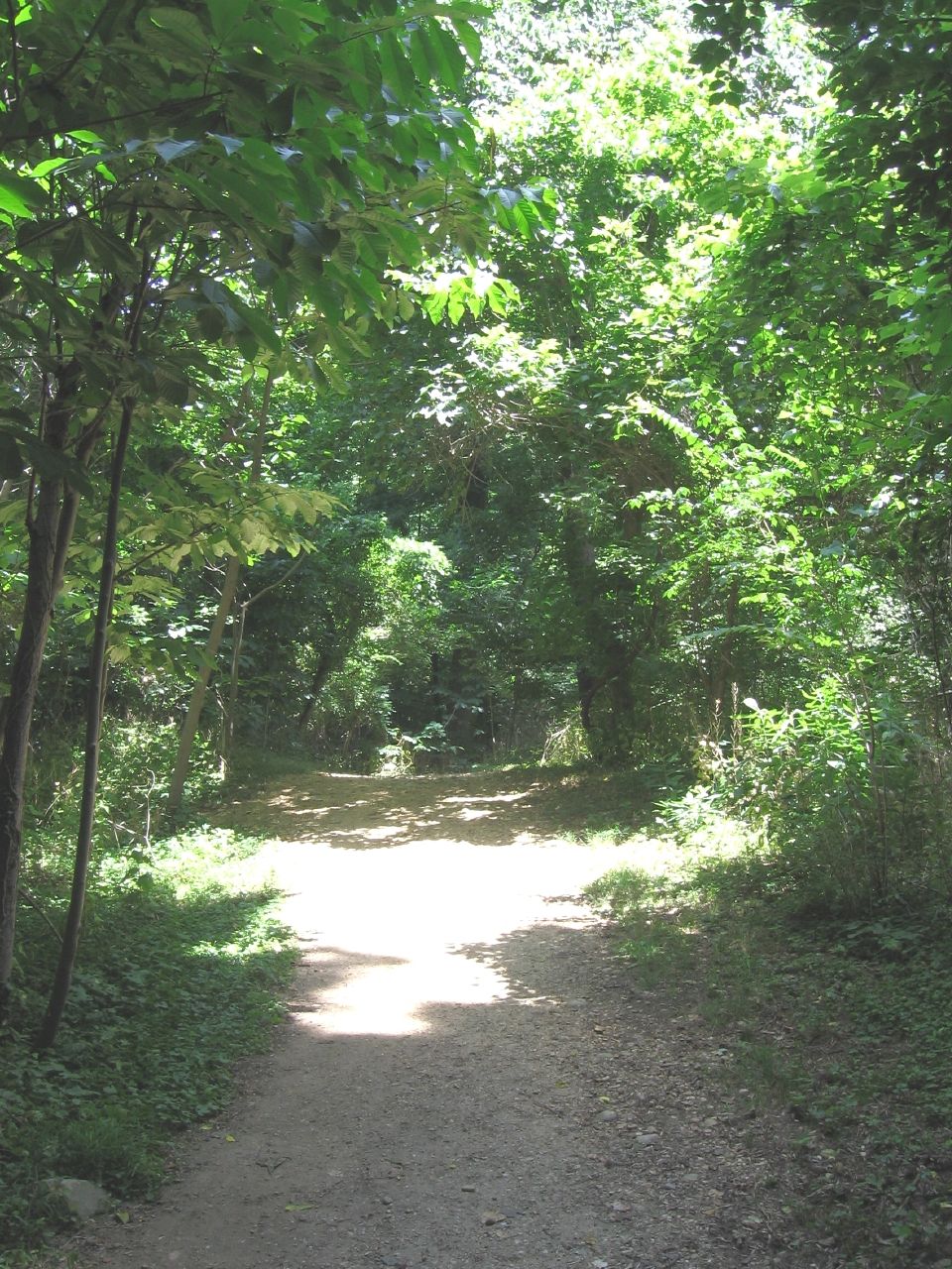
Secluded woodland paths crossed Roosevelt Island in north-south fingers. Bedrock rose several yards above the riverbank on the northwestern corner of island. When John Mason lived here — when people still called it Mason’s Island — he placed his home in this safe, dry quarter. Cultivated fields and gardens sloped downhill towards the muck. Dry land continued down the spine.
Modern landscapers blazed two secluded tracks along this central ridge. The Upland Trail extended from the far northern shore and stretched down the backbone nearly the length of the island. The Woods Trail extended south from the Memorial Plaza, running in parallel, to be joined eventually by the Upland Trail at the park’s only restroom facility. The commingled trail extended a little further south to the marshland entrance of the forebodingly named Swamp Trail. Trees grew so thickly that it was difficult to believe a city stood a half-mile away. Only airliners landing at nearby National Airport broke the spell.
Swamp
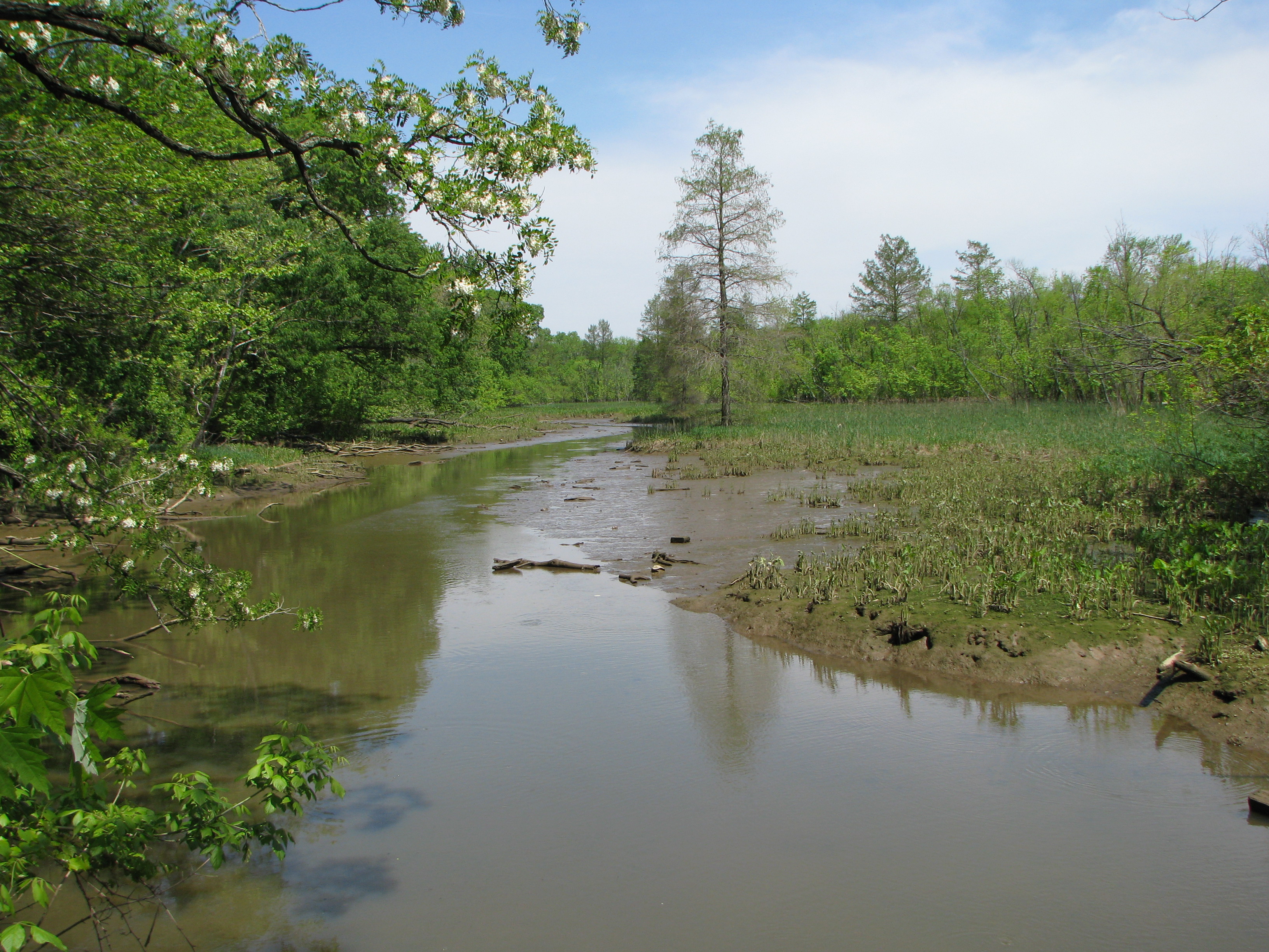
A short footbridge forded a shallow creek at the southern end of the island, marking a boundary between the Wood Trail and the Swamp Trail. Water flowing from the island did not form this creek. The rhythms of the moon forced Potomac waters up and back through this tidal marsh. This photograph was taken at low tide and higher water marks can be seen as a muddy banks below the vegetation in the foreground.
Wildlife Too
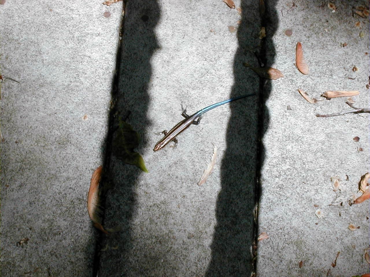
The island provided a haven for an incredible array of wildlife. We came across several southeastern five-lined skinks. These are the only native species of lizard found in the District of Columbia.
Incredibly, footings for the Theodore Roosevelt bridge rested upon the island’s southern terminus, a hundred feet in the opposite direction from this spot, carrying Interstate 66 between Virginia and the District of Columbia and dumping it onto Constitution Avenue adjacent to the National Mall.
Boardwalk
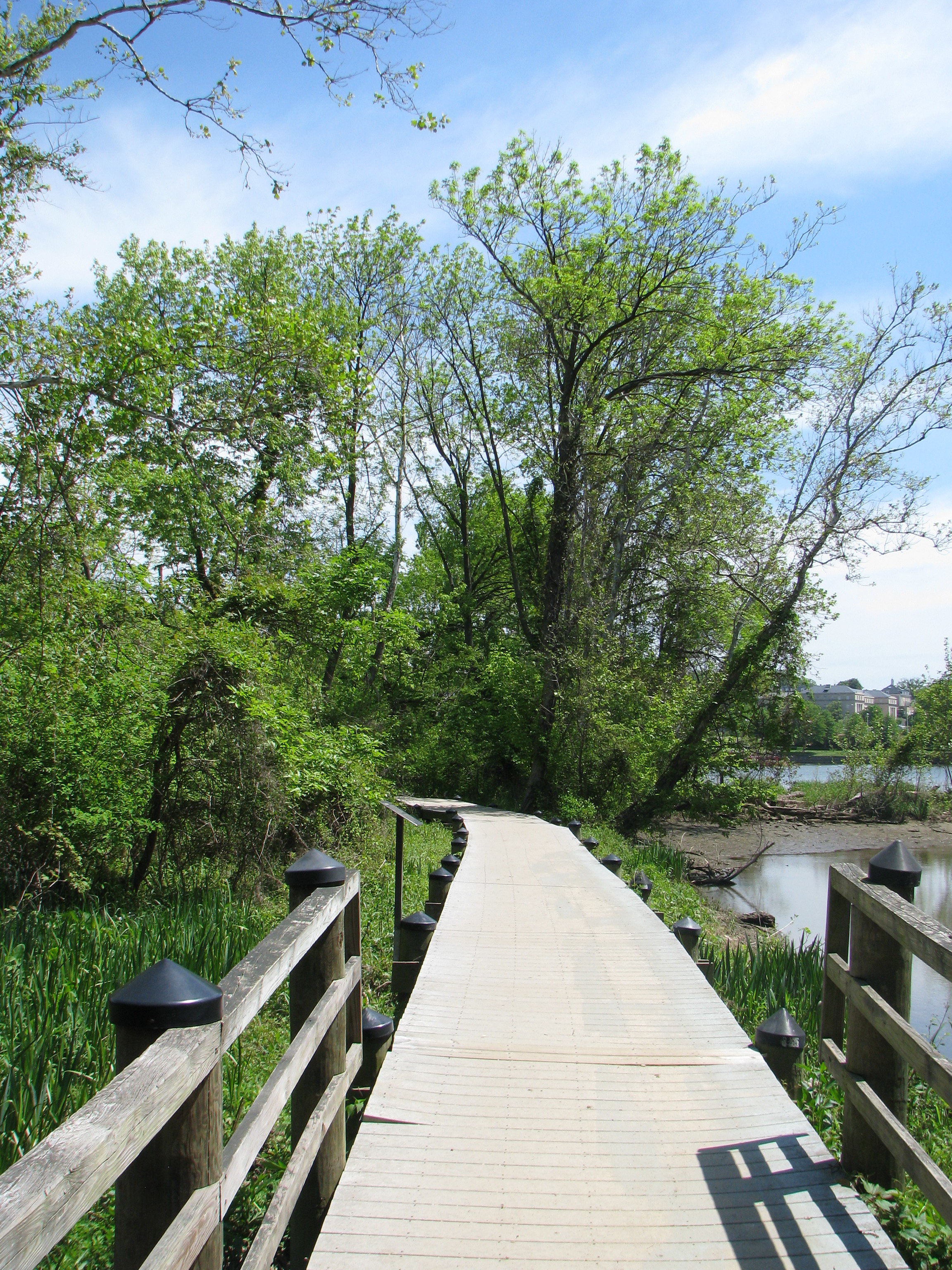
Into the marsh we marched, following the Swamp Trail along the island’s eastern flank. The trail was actually a pleasant, level-grade boardwalk built above the muck and mud. The trail included several alcoves built onto the boardwalk that allowed people to rest on benches or simply enjoy the natural scenery in solitude.
A spur cut due west from the main trail at about the midway point, pushing a hundred yards towards a pier into the murkiest depths. This led to the only part of Roosevelt Island naturally denied a thick layer of dense hardwood forest. We spotted a red wing blackbird perched high upon a dead branch chirping joyously in the open sky. Around the corner another Southeastern Five-lined Skink sunbathed on the boardwalk, only to scurry away as we approached.
Leave a Reply