
There are 53 Counties in North Dakota – “The Peace Garden State”
Also be sure to see my United States County Counting Page for the rest of the states.
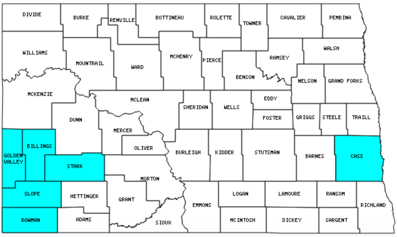
I have visited 6 Counties = 11.3% of Counties in North Dakota
Counties visited are colored-in; counties still needing to be visited are blank. Map created using Mob Rule.
Twelve Mile Circle Articles Featuring Places in North Dakota
Markers designate the North Dakota locations featured in Twelve Mile Circle articles.
Counties in North Dakota
Below are the 53 counties in North Dakota. Although infrequent, counties sometimes do change so please let me know if any of this information is out of date and I will update it. Those counties that I have visited are highlighted in Red. Readers can also link to any articles manually in this section if the map isn’t working.
- Adams: No, It’s Not There
- Barnes
- Benson: Disestablished National Parks
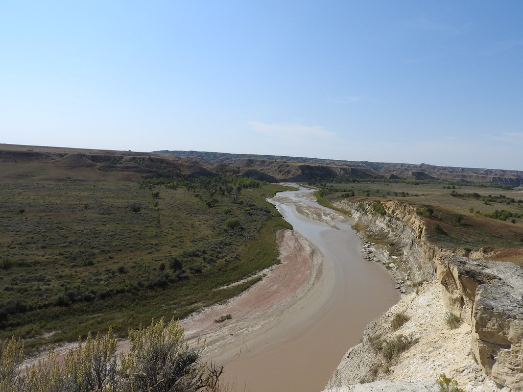
- Billings: No more rest?; Medora; Mustangs; Theodore Roosevelt National Park
- Bottineau: Practical Exclave
- Bowman: Hibachi House; Geese
- Burke: Bowbells; Blank to Blank
- Burleigh: State Capital on Time Zone Boundary
- Cass: Largest county population in North Dakota (123,138 people in 2000 Census); Red River of the North; Not the Usual
- Cavalier: Cavalier
- Dickey
- Divide: Good Fortuna; County Divided; Infrequent Crossings
- Dunn: North Dakota Time Zone Anomaly
- Eddy: Smallest county in North Dakota (630 square miles).
- Emmons
- Foster
- Golden Valley
- Grand Forks
- Grant: Least Visited U.S. Counties
- Griggs
- Hettinger: No, It’s Not There
- Kidder
- La Moure
- Logan: Least Visited U.S. Counties
- McHenry
- McIntosh
- McKenzie: Largest county in North Dakota (2,742 square miles); North Dakota Time Zone Anomaly
- McLean: Largest Artificial Lakes
- Mercer: Making the Switch
- Morton: Salem Sue, The World’s Largest Holstein Cow (statue)
- Mountrail
- Nelson
- Oliver
- Pembina: City of Cavalier; Icelandic Diaspora
- Pierce
- Ramsey
- Ransom
- Renville
- Richland: Wahpper, the World’s Largest Catfish (statue)
- Rolette: Rolla; Did Sir Walter Raleigh Get Drunk in Canada?; Highest Religious Affiliation
- Sargent
- Sheridan
- Sioux: Standing Rock Sioux Tribe; Making the Switch
- Slope: Smallest county population in North Dakota (767 people in 2000 Census); King of Portmanteau; Amidon.
- Stark
- Steele
- Stutsman
- Towner
- Traill
- Walsh
- Ward: Remote Chinese Restaurants
- Wells
- Williams: Manly Places
Quick Facts About North Dakota
- Location: West North Central United States. See map above.
- Size(1): 69,001 square miles. North Dakota is the 17th largest state. The next larger state is South Dakota and the next smaller state is Missouri.
- Population(2): 760,077 people. North Dakota is the 47th most populous state. The next more populous state is South Dakota and the next less populous state is Alaska.
- Population Density: 11.0 people per square mile. North Dakota is the 47th most densely populated state. The next more densely populated state is South Dakota and the next less densely populated state is Montana.
- Bordering States: North Dakota shares a border with 3 states: Montana; South Dakota and Minnesota.
- Admission to the Union: November 2, 1889. North Dakota was the 39th state admitted to the Union, after Colorado and before South Dakota.
- Capital: Bismarck.
- Highest Point: 3,507 feet at White Butte. See SummitPost’s White Butte page.
- Lowest Point: 750 feet at the Red River in Pembina Co.
- Government website: nd.gov: Official Portal for North Dakota State Government.
- Official Tourism website: North Dakota Tourism.
- Still not enough? See Wikipedia’s North Dakota page.
Sources:
(1) Wikipedia: List of U.S. states and territories by area. Land area only.
(2) Wikipedia: List of states and territories of the United States by population. Estimated population on July 1, 2019.
Leave a Reply