
I’d like to focus my attention firmly north a little longer to complete the circle, specifically, the Arctic Circle as it passes through Iceland. The previous articles, in case you haven’t had a chance to review them, involved Deadhorse, Alaska and the FINORU tripoint.
The Arctic Circle runs through very few countries, only eight of them as a matter of fact: the United States, Canada, Greenland (part of the Kingdom of Denmark but self-ruling as of June 1, 2009 and soon to be fully independent), Iceland, Norway, Sweden, Finland and Russia.
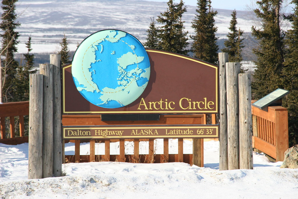
Countries take pride in this northerly honorific. It’s a big deal. In the United States, for example, there’s even a nice pull-off along Alaska’s Dalton Highway to mark the passage of this circle that represents the furthest extreme of the polar day/night.
Iceland Squeaks By
The circle goes rather convincingly through each of these countries except for Iceland, which barely earns membership in this exclusive Arctic club. In Iceland it happens only where the circle clips a tiny island positioned 40 kilometres (25 miles) out to sea.
Grímsey

This is Grímsey Island. It’s easy to comprehend its diminutive size. Simply open the map and ponder the land occupied by the airport runway. Then extrapolate. There isn’t much to be found here except for a tarmac strip and a cluster of homes defining the settlement of Sandvík on a space of 5.3 square kilometres (2.0 square miles). The people of Grímsey form the municipality of Grímseyjarhreppur in the county of Eyjafjarðarsýsla. And yes, I focused on that because I never pass an opportunity to post an eth (“ð”). I love that crazy letter.
The inhabitants make their living from the sea and increasingly from tourism. It seems that many people travel to Grímsey during the warmer months expressly to touch the Arctic Circle. Never mind that the circle fluctuates due to axial tilt, currently shifting northward about 15 metres per year. The marked spot is “close enough” I suppose, and who would begrudge their effort? It’s nice to see people appreciate and make an effort to attain a noteworthy geo-oddity. I will put this on my priority list if I’m ever lucky enough to visit Iceland again.
The islanders run a website, mostly in Icelandic but some in English, and they call themselves the “home of one hundred people – and one million seabirds.” Visitors can stay in either of two guesthouses and even take the ferry if they don’t want to fly.
Kolbeinsey
One other speck of Iceland called Kolbeinsey Island also sits north of the Arctic Circle about 105 kilometres (65 miles) from the coast (map). Maybe. It’s uninhabited and it probably won’t exist in a few years if it hasn’t disappeared under the waves already. This outcrop has been eroding rapidly for several decades.
Leave a Reply