
Kenai Fjords National Park, Kenai Peninsula Borough, Alaska, USA (July 2010)
Flightseeing is a great way to view the expansive Harding Icefield (map) on the southeastern side of the Kenai Peninsula, a part of Kenai Fjords National Park. Tours operate from all of the major towns in the vicinity including Seward, Homer and Soldotna. Options abound too, including wheeled aircraft or floatplanes, or even helicopters, and from very short to hours-long flights.
We flew out of Moose Pass on a floatplane, choosing that location because it was convenient to our base in nearby Cooper Landing. Our flight path took us south towards Seward, cutting west over the icefield and then down south to Aialik Bay, then following further along the various Kenai Fjords, before looping back across the entire length of the icefield, and finally over deep valleys and glacier-fed lakes to the floatplane dock.
I thoroughly enjoyed the flight. We wanted to do this sometime during our trip but we hadn’t made any definite plans. The day started cloudy and overcast but the sun began to peak through by mid-morning. Weather reports predicted an absolutely cloudless, picture-perfect afternoon so we immediately reserved a spot for later that day. The timing couldn’t have been better.
It was a small plane with room for a pilot and four passengers. It feels like real flying in something that small, with everyone getting window seats with amazing views. We hit a few bumps caused by the temperature gradients over the ice but nothing too turbulent. I was fine. One of the other passengers, however, spent most of his time with his face in an airsickness bag. That’s a point to remember. Take dramamine before departure if you’re subject to air or seasickness. This isn’t like flying on a jumbo jet.
Thousands of Feet of Ice
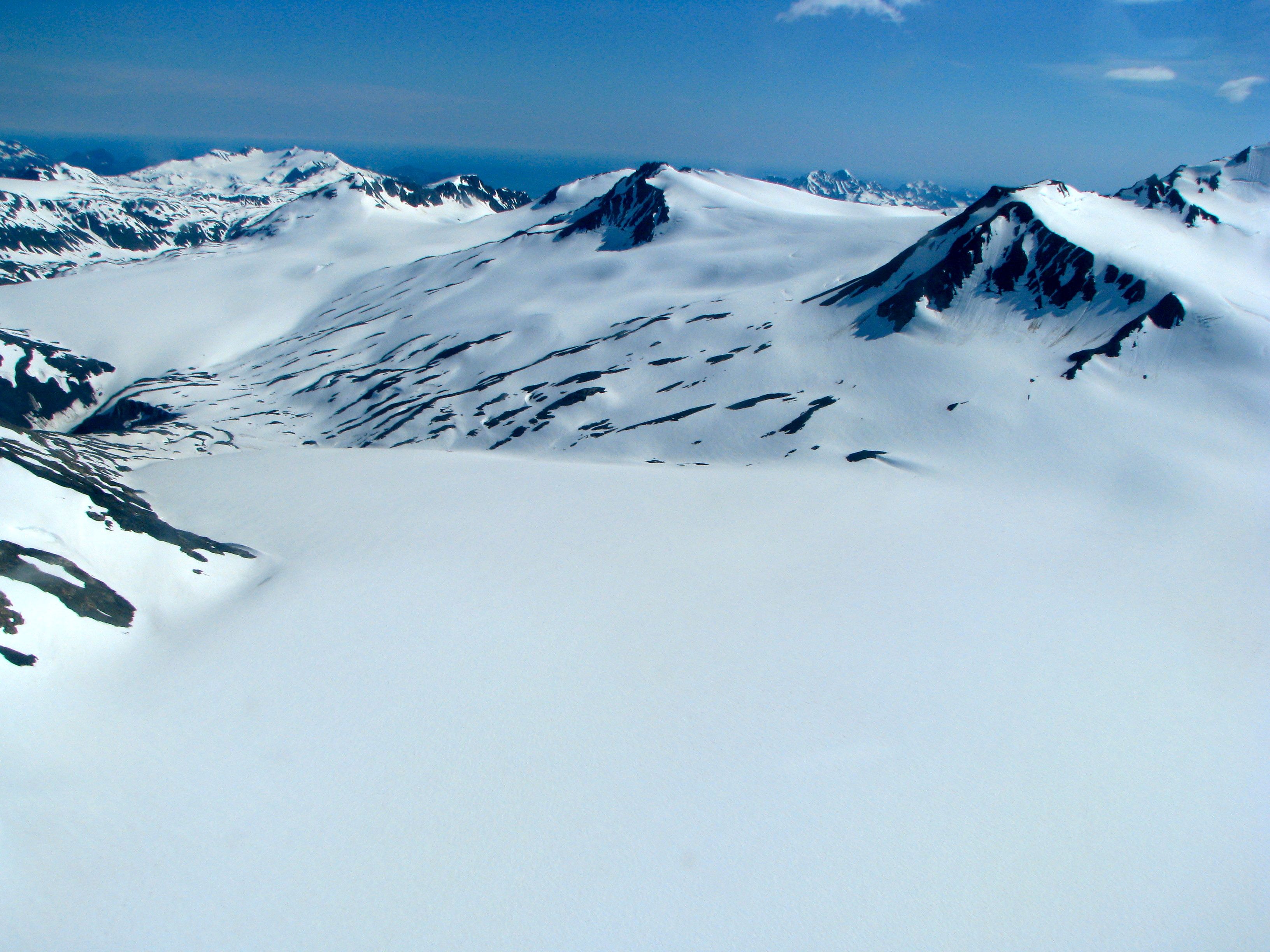
People do hike up to the icefield, and a few adventures ones even continue across. The rest of us can only begin to appreciate the magnitude of this immense geographic feature by air. It looks so gentle and lightly sloping with a few granite outcrops poking above the surface. Those are called nunatak and are the elevated places too high and too steep for the ice to envelop it in a blanket of white. Looks are deceiving up here. These are mountains with valleys, just as found elsewhere in the Kenai, except the valleys have filled completely with several thousand feet of solid ice build up through millennia.
The Harding Icefield collects more than 400 inches of new snow each winter to replenish what evaporation and the glaciers take away. Some of it melts but a lot of it does not, and it’s compressed into dark blue ice over the next three or four decades. However, there are no glacial channels at the middle of the icefield so the new ice has nowhere to go. It accumulates high enough to cover much of a mountain range except for the occasional peaks that form nunatak.
This immense icefield is named after Warren G. Harding, the 29th President of the United States who served during the early 1920’s. It’s a bit of a shame that something so beautiful was named for one of the worst, scandal-plagued presidents in American history, an Administration beset by corruption. He became the first president to visit Alaska though, so that was enough of a reason to name the icefield in his honor.
The core of the icefield covers 300 hundred square miles, with its glacial tentacles extending it out to 1,100 square miles, with much of it located in Kenai Fjords National Park. The ice is so thick that it extends up to 6,000 feet of elevation. Indeed, much of it is more than a mile thick. That’s some serious ice.
Abundant Glaciers

There are something like 40 glaciers that flow like tendrils from the edges of the icefield where gravity permits it. Many different types of glaciers descend from the field including alpine glaciers, hanging glaciers, and as with the example pictured above, tidal glaciers. As the name implies, a tidal glacier is one that terminates at a body of water that is subject to the tides, and is capable of spawning icebergs.
The airplane flew to the edge of the icefield then steeply descended above the glacier, circling back around almost like a carnival ride. I’m sure that’s part of the show. We could have descended more slowly but what would the fun have been in that?
This image is the famous Aialik Glacer found at the back of Aialik Bay in Kenai Fjords National Park [see my Kenai Fjords page]. The little island in the foreground is Squab Island. Two smaller islands poke from the edge of the glacier wall. We got to see a section of ice break from the wall and crash into the sea, although we’d get much closer looks later when we returned to Aialik by boat.
Kenai Mountains
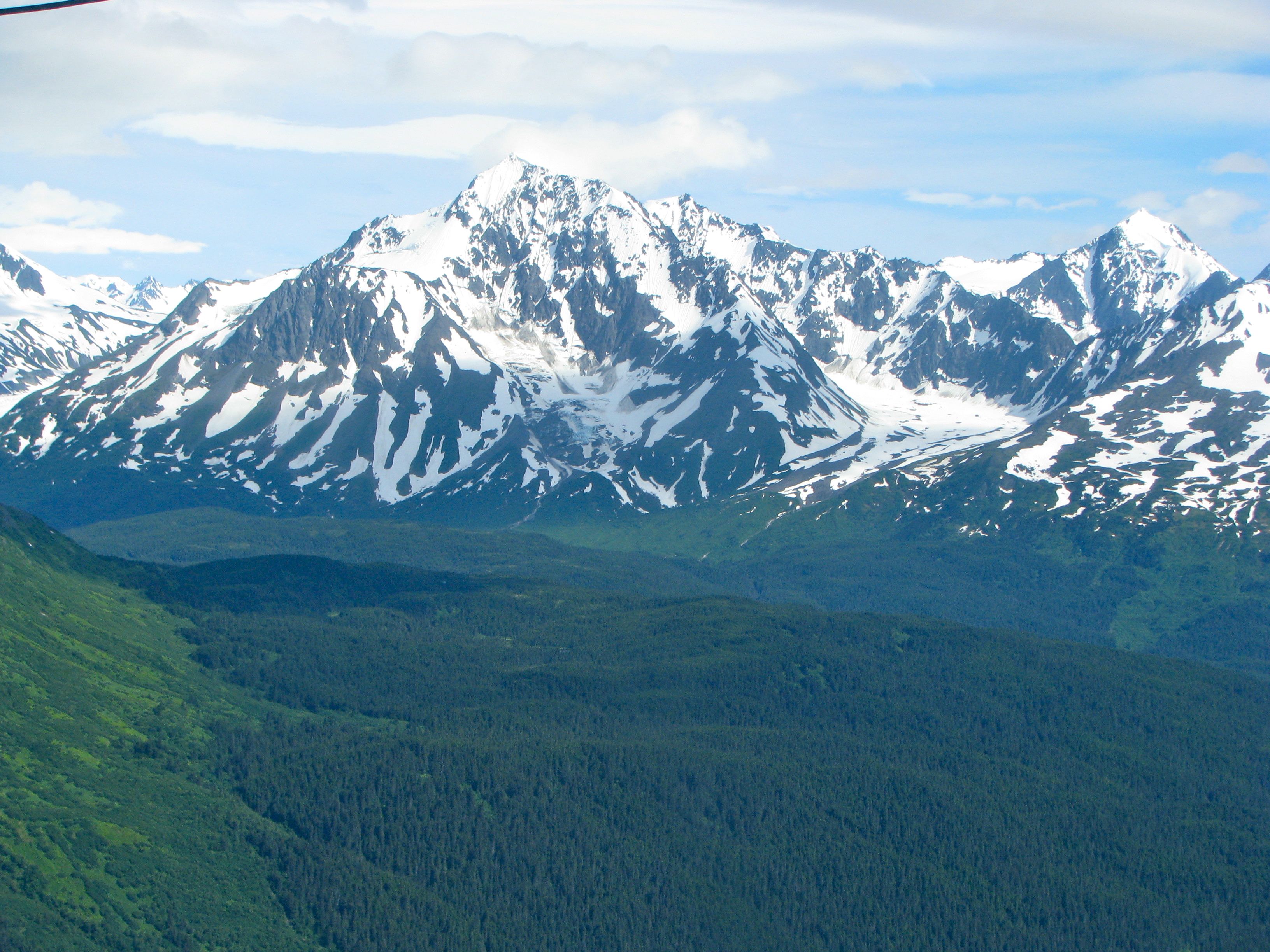
The scenic mountains continued to dazzle as we flew further away from the Harding Icefield. Notice even from this distance that glaciers continued to pour from the icefield into the lush, green valleys below. This amazing panorama went on for miles and miles. The Kenai Mountains stretch a good 120 miles in total, down the length of the eastern side of the peninsula, from the Chugach Mountains to the peninsular tip. The Harding Icefield shares these mountains with another icefield, the Sargent that borders on Prince William Sound.
Lakes, Rivers and Streams
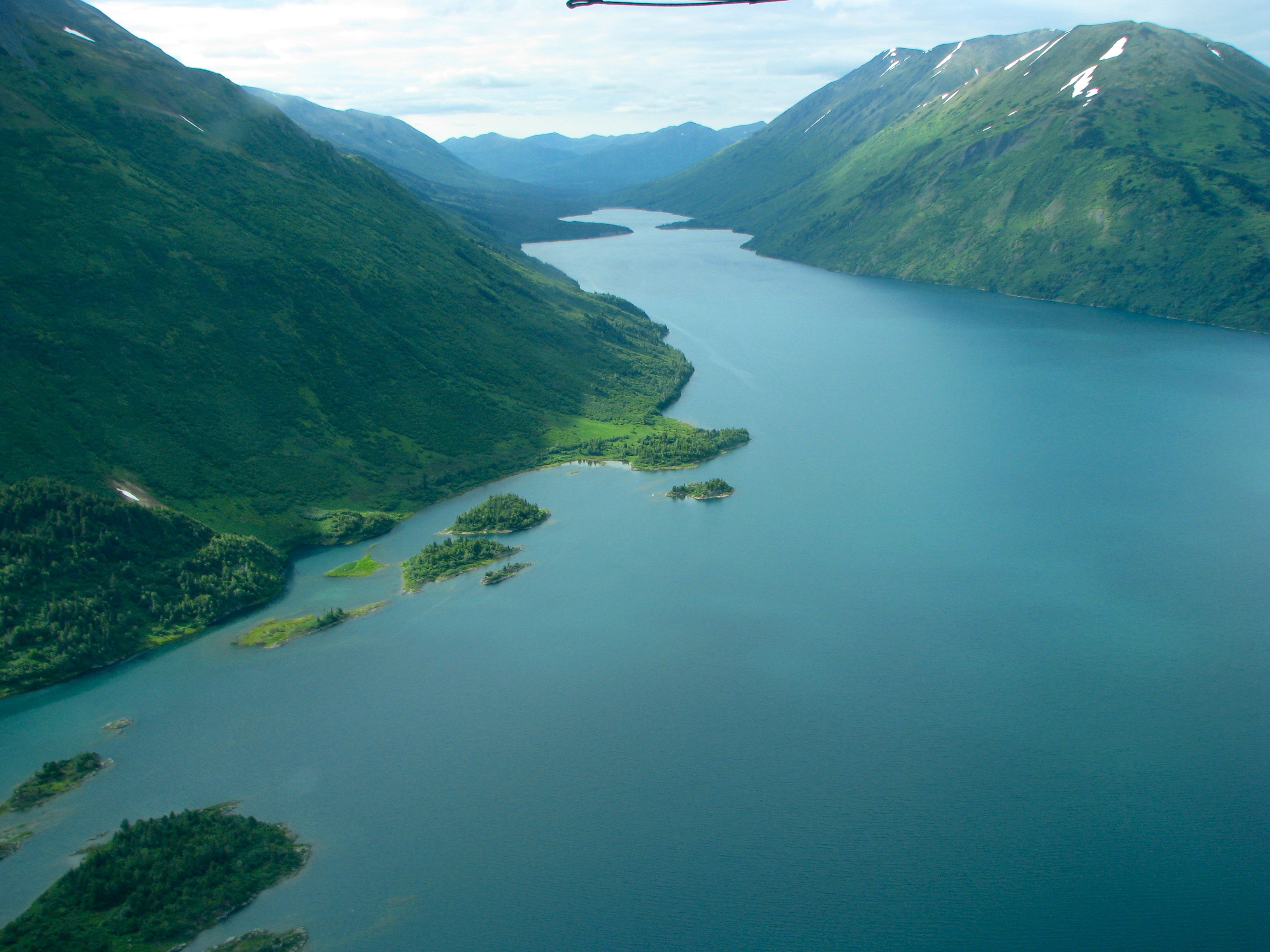
Water melts and flows from valley glaciers. It doesn’t produce the drama of icebergs calving as one experiences with tidal glaciers, but it does create an abundance of lakes, rivers and braided streams because the water has to drain somewhere.
The crushing weight of hundreds and even thousands of feet of ice pulverizes solid mountain rock into a fine powder called rock flour or glacial flour. The meltwater carries this powder away, giving rivers and lakes a characteristic cloudy appearance in shades of blue, green or gray. It is an unmistakable site. One can guess with fair certainty if a body of water can be traced back to a glacier as its source. We passed many such examples both during our flight and during our several days of driving, walking and hiking through various parts of the Kenai.
I think this one might be Cooper Lake, part of the Chugach National Forest. It’s a natural lake that’s been increased in size dramatically with a dam, and provides a source of hydroelectric power. I could be wrong but I’m sure someone will correct me if that’s the case.
Leave a Reply