
My second day of county counting focused west of Dayton, once again targeting five new counties. This time I planned to capture Butler and Darke counties in Ohio; and Union, Fayette, and Randolph counties in Indiana. Hopefully this excursion would also take about three hours like the previous day.
Unfortunately I knew that it wouldn’t match a similar level of personal contentment. I uncovered very little worth seeing after scouring the maps in detail. I told the family to sleep-in and I’d grind it out, going solo as soon as the sun rose, and be back before lunchtime. And I’m glad for that because nothing came easy during this drive. In some respects it was the flip-side of the enjoyable hunt the day before. It was frequently frustrating but I tried to make the best of it.
Germantown Covered Bridge
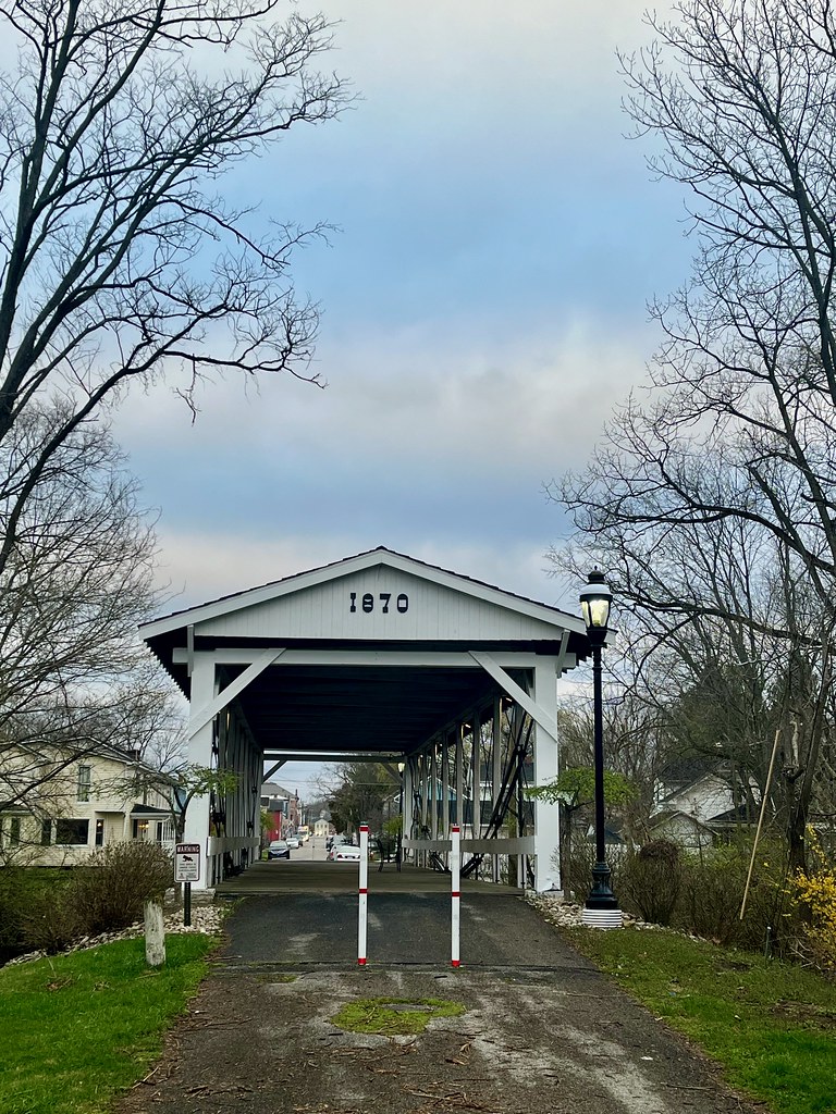
The day started easily enough, as I traveled southwest to a Dayton suburb where I added to my covered bridge count. I made it to the Germantown Bridge (map) pretty routinely.
This bridge dated to 1870 and included an obscure construction technique. Look closely on the sides and you can see the inverted bowstring trusses, supposedly the only bridge remaining like this. I’d arrived from the east, and I’ll recommend that future visitors come from the west instead. That way you can use the little parking lot instead of having to back-up and then turn around in someone’s driveway.
[This would be a great spot for a photo if I had one]
Then I hoped to visit the Hueston Woods Covered Bridge. Notice, however, the distinct lack of a photograph. That’s because road construction blocked the most direct route and I really didn’t want to take a lengthy detour. So I skipped it and went to the next attraction instead.
Bordersplit School

In the earlier days of Twelve Mile Circle — all the way back in 2010 — I wrote an article called Bordersplit, defining my newfound word as “an object cleaved by a boundary line.” Then I added a bunch of examples including a library, a gas station, a restaurant, a post office and some others. It was fun. Readers posted a lot of great comments including one from “Greg” who mentioned a school straddling the border between Ohio and Indiana in the town of College Corner.
Well, I filed that one away for future reference because it sounded interesting. Now, all these years later, I visited the spot in person. The full name is College Corner Union Elementary School and communities on both sides of the border operate it jointly. The doorway on the left is in Ohio and the doorway on the right is in Indiana. I drove down Stateline Road and parked in the school lot, making sure the border split my car. Thankfully nobody was there so I didn’t look like a freak taking photos in front of an elementary school.
Then I drove a couple of blocks towards the southeast where I clipped and captured Butler County, Ohio. Actually, the town of College Corner doesn’t just straddle a state border, it sits atop a county tripoint. This is where Preble County (Ohio), Butler County (Ohio) and Union County (Indiana) all join together.
Fayette County Jog
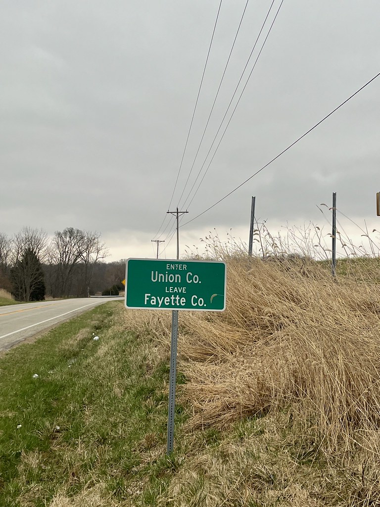
Fayette County, Indiana wasn’t too far away but I couldn’t find anything worth visiting there. So instead I hit it as an out-and-back which made more sense for my intended route. It let me save a few miles in spite of the appendage it created on my map.
This wasn’t a particularly pleasant leg because of highway construction and an entire series of cars that consistently drove about ten miles per hour below the speed limit. Then sleet fell from the sky. The entire week was chillier than normal and now it dipped below freezing during the early morning hours, and it threatened the rest of the drive. I made it into Fayette County, found a convenient place to turn around (map), and retraced my path. Fortunately precipitation remained to the south as I turned the corner and put some distance behind me.
Thistlewaite Falls
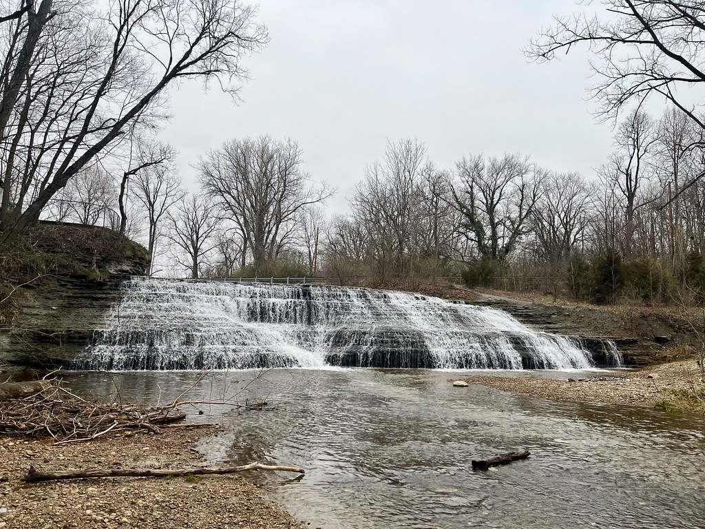
Road construction continued to delay my progress, getting especially bad in Richmond, Indiana where it blocked and diverted the main route through town. I already planned to stop in Richmond so I worked my way through side roads and residential neighborhoods to get where I needed to go. I wanted to visit a waterfall (map).
Thistlewaite Falls is a bit of a misnomer. It’s fake. Well, it’s not entirely fake because water is obviously falling, so I guess the correct word is man-made. Even so it has some history, extending back to 1854, and that should count for something. That’s when Timothy Thistlewaite dammed the river and diverted it into a new channel that led over a natural rocky ledge. He then harnessed the rushing water to power his mills. All signs of industry are long gone but the falls created by Thistlewaite still flow.
Hoosier Hill
I visited Ohio’s Highpoint the day before and now it was time to repeat the feat in Indiana at Hoosier Hill (map). The two highpoints have a lot in common: neither reaches exalted heights, the summits require minimal effort, and nobody else was there. Once again, I drove right up to the site and walked a few feet. Then I stood higher than anyone else in Indiana at 1,257 feet (383 metres) for a few minutes. There was one primary difference: Hoosier Hill was much more rural and it felt pretty middle-of-nowhere.
I think I’ve now been to 13 state highpoints plus the District of Columbia. So I’m probably running out of the easy ones.
A Foot Into Randolph County
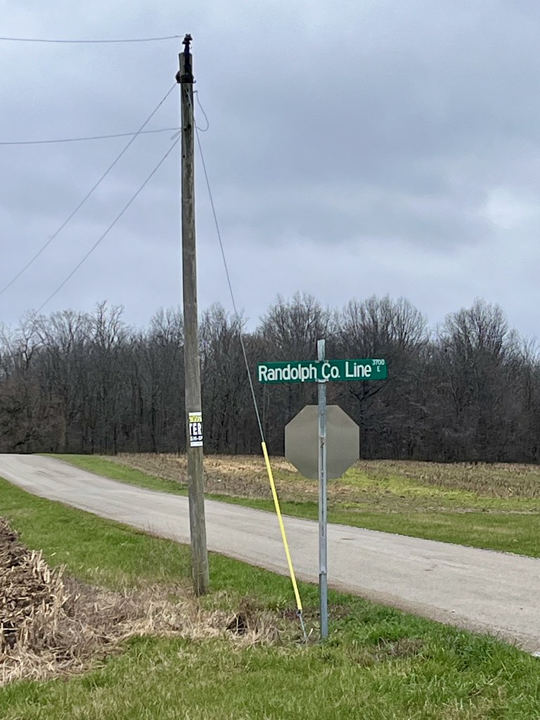
I noticed that Randolph County, Indiana was only another thousand feet-or-so north of Hoosier Hill and that made it an easy new capture. I drove up to the line and simply walked across. Thus, Randolph joined my very exclusive list of “foot only” counties. I arrived on foot, walked far enough to confirm my arrival, took a photo, and left on foot.
However, by then I’d been delayed and worn down, and I was tired of my excursion. I captured Darke County, Ohio on the most direct path to Interstate 70 and high-tailed it back to Dayton. I managed to capture all five of the new counties on my original plan but the Geeting and Dixon’s Branch Covered Bridges will have to wait for some other day because I skipped them too. I’m sure the 12MC audience will forgive me.
Articles in the Dayton, Ohio Series
See Also: The Complete Photo Album on Flickr
Leave a Reply