
This was supposed to be the younger kid’s trip. It was his turn to select a destination — anywhere in the world — as a present for his upcoming high school graduation next year. The older one chose Australia back in 2018 and we expanded it to include New Zealand too.
England seemed like a likely candidate this time around. However, the older kid came home from college for a few weeks and suddenly it switched to Costa Rica. Hmm… not sure how that happened. Maybe the older one’s pursuit of dual degrees in entomology and zoology?
So the gears shifted and Costa Rica became the new target; quite a difference from my last international trip a couple of months ago. I’d never been to Central America before so it felt like a good choice. Well done, kids.
The Plan
Costa Rica isn’t a huge country. It’s about the same size as the U.S. state of West Virginia with a population of just above five million. Nonetheless, we couldn’t possibly cover the whole thing in two weeks. We needed to cram whatever we could into a limited period so we focused on the northwestern corner. Basic research showed us that a lot of the popular stuff seemed to concentrate there. I’m sure there are many wonderful places elsewhere in Costa Rica and those will have to wait for another trip.
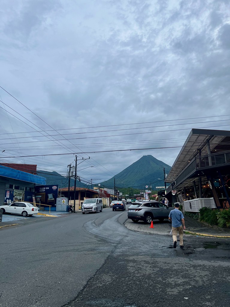
We split our time between different microclimates defined by elevation: northern lowlands (La Fortuna), Pacific beachfront (Tamarindo) and cloud forest (Monteverde). Essentially this created three considerably different experiences within a single trip. For instance, it was hot and sunny along the Pacific coast, a perfect spot for lounging at the pool and beach. Meanwhile, our temporary home in the mountains didn’t even need air conditioning and we wore long sleeves or light jackets in the evenings.
Getting There
We flew into Costa Rica via Miami, landing in the capital city of San José. International flights also land at Liberia, the largest city in Guanacaste Province, which is similarly convenient to our target area and might have been less hectic. Even so, flight availability led us to San José and it turned out fine. Our drive consisted of an oval so it didn’t really matter where we started. We’d see the same things regardless.
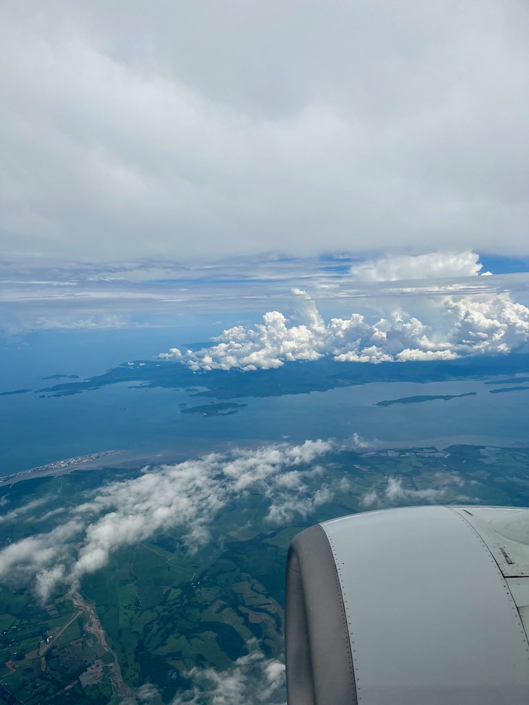
I took a photo as we descended into Juan Santamaría airport in San José. The town on the small sand spit at middle-left seems to be Puntarenas (map). The Nicoya Peninsula appears in the background.
Rainy Season

Temperature in Costa Rica remains fairly steady because of its location near the equator. Thus it has two seasons marked by rainfall instead. It’s either rainy season (May-November) or dry season (December-April). Most tourists visit during the dry season when they can escape wintertime cold back home.
But we’re not most tourists. Here we were two months into the rainy season, not that we had a choice. We had to balance work commitments with school schedules and that led us to June/July. Of course we knew it meant rain and we’d just have to deal with it. Managing expectations is half the battle.
It did rain at some point nearly every day but I wouldn’t call any single day a washout. Storms tended to concentrate in the afternoons so we simply shifted outdoor activities to the mornings. Even when it did rain — and it got quite intense at times — it rarely lasted more than a couple of hours. And along the Pacific coast at Tamarindo it never amounted to more than a stray shower between long stretches of sunshine.
We did fine. It also kept tourist hordes away so I called that a bonus. We had no issues booking same-day activities, getting into restaurants or finding reasonably priced accommodations. People also seemed to genuinely appreciate our business. I think I may have blindly stumbled upon a secret. Well, that’s assuming one doesn’t mind a little rain.
Money
The Colón is the unit of currency in Costa Rica, trading at a rate of about 540 to the U.S. Dollar during our visit. However, we barely ever touched an actual bill or coin, and we didn’t need any cash prior to arrival. Just about every restaurant, hotel or attraction accepted credit cards. And if they didn’t they accepted U.S. Dollars (maybe not at the best exchange rate). We even used an ATM that offered withdrawals both in Colónes and U.S. Dollars. Some of the more touristy places didn’t even bother posting prices in Colónes; they went straight to the Dollars. So, bottom line, it’s feasible to travel through the more traveler-focused swaths of Costa Rica without ever encountering an actual physical Colón.
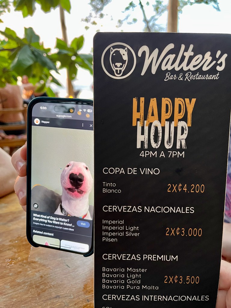
Still, it was important to understand the exchange rate. For example, one might want to know if the price of an Imperial beer (Costa Rica’s national lager of choice) at Happy Hour on the beach at Tamarindo is reasonable or not. We can debate the merits of Imperial beer although the price did seem pretty good given the location and point of sale; it’s about half that of any locally-produced craft beers. I’m less sure about the copyright or intellectual property issues related to an Internet meme used to brand a restaurant/bar but that’s a different issue. I’m a beverage enthusiast not an attorney.
Yes, that was the only photo I took of anything referencing Costa Rican currency, in case you were wondering. My younger kid was amused by this place for some reason known only to him. Those are his fingers holding up the phone.
Eating
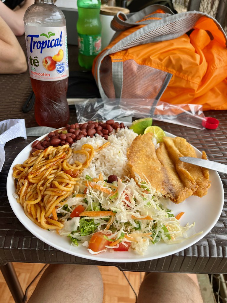
I hope you like rice and beans because that’s what you’re going to get at every meal along with Lizano Salsa (Costa Rica’s ubiquitous condiment of choice — vaguely reminiscent of Worcestershire). Every restaurant seemed to offer its own variation of Casado too: rice, beans, salad of various compositions, a protein of your choice, oftentimes plantains and then… an unpredictable mystery side dish unique to the whimsies of the cook. So spaghetti was the unusual addition in the photo above. I looked forward to guessing at every meal: what will be the mystery side this time?
Chifrijo was another popular dish I saw on many restaurant menus. This was a bowl of rice with an added layer of beans and pork belly, topped with pico de gallo, plus maybe an avocado slice, tortilla chips or other creative additions. Ceviche was common as well especially near the Pacific coast. For desert, they had a local treat called a Churchill, a kind of snow cone and ice cream combination with flavored syrups. It sounds strange but our kids loved them.
Costa Rica has tons of dining options from fancy to casual, and even plenty of cuisine from around the world if one somehow tired of the local fare. Most restaurants were also open-aired, allowing tropical breezes to pass straight through.
I preferred the Sodas, a generic term for little roadside mom-and-pop eateries. That’s where the locals go. It’s a huge meal at a reasonable price and it’s impossible to walk away hungry. It will take me awhile to lose all the weight I gained on this trip.
Driving
Driving was an adventure. I thought driving in Ireland a few years ago was difficult (on the left-side with a manual transmission on winding roads confined within tight stone walls). Costa Rica equaled it for difficulty or maybe topped it. Traffic signage, road markings, whatever, didn’t matter much. “Driver Beware” seemed to be the only consistent rule.
Every imaginable obstacle appeared without warning: dogs; pedestrians (no sidewalks); bicycles; ginormous potholes; motorcycles passing on blind curves; trucks driving half the speed limit; wildlife; torrential rain; construction; random backups, precious few places to pass safely; vehicles parked in active roadways, police checkpoints; steep twisting inclines, standing water; you name it.
The roads weren’t in particularly good shape either except for maybe the primary route within a town limits. So progress wasn’t measured so much distance as in time. And nothing happened quickly. I knew that all before we arrived and even then it was impossible to completely comprehend until I experienced it in person. Even so I drove more like a local than a tourist and I consistently beat Waze estimates. But it’s not for the faint of heart.
Driving aside, I thoroughly enjoyed our trip to Costa Rica. I’ll have much more to talk about in upcoming installments.
Articles in the Costa Rica Series
- Intentions and Observations
- In the Shadow of the Volcano
- Exploring La Fortuna
- Brew Day
- Relaxing in Tamarindo
- Beyond the Beach
- On To Monteverde
- Completing the Circuit
See Also: The Complete Photo Album on Flickr
Leave a Reply