
Terlingua, Brewster Co., Texas, USA (May 1992)
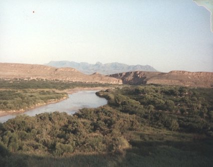
We left San Antonio, passed Uvalde, passed Del Rio, driving through ever smaller and less frequent towns, moving into one of the most remote locations imaginable. We were heading towards that place where the Rio Grande River flows southeast and then takes a sudden jog to the north. That crook in the river cradles a park named in its honer: Big Bend National Park.
This is one of the largest and least visited of the national parks in the Lower 48 states (map). Visitors don’t find themselves here while simply driving along the highway and pulling aside on a whim. No, it’s a trip always planned in advance, a conscious thought. The park is too far out of the way, too isolated to have it occur by happenstance. Those who know about the park understand its rugged beauty and arrive here purposely.
The river runs along the Park’s southern arc for more than a hundred miles and defines many of its features as it winds through steep canyons and carves thought the bottomlands. However only part of the river actually belongs within the boundaries of the park, only to the deepest part of the channel as it existed in 1848 when the Mexican-American War ended.
Big Bend National Park is in Texas, in the United States, but Mexico lays on the opposite shore of the Rio Grande. Once there was a semi-official ferry crossing from the park into the Mexican town of Boquillas del Carmen (see my Boquillas del Carmen page). Unfortunately that’s been shut down and the town has largely declined in the wake of new border restrictions.
UPDATE: The crossing to Boquillas del Carmen is open again!
The Campground
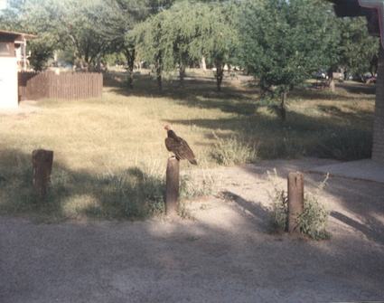
Buzzards acted as pigeons in this park’s campground, clustering and scavenging throughout the compound. They’d lost their fear of mankind as they pecked for scraps among the campers and tents. We watched in amazement as a flock descended upon the luggage rack of a minivan and proceeded to rip and tear into exposed baggage. Soon enough they uncovered savory victuals trucked into the park by a hapless family. They stripped the cache completely in a flurry of feathers, beaks and talons.
Otherwise the facilities were spartan but nice, and we certainly enjoyed finally making it out of the cities so we could rest for awhile in the wilderness.
The Chihuahuan Desert
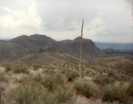
Big Bend is located in the Chihuahuan Desert and it’s the largest protected area of this fragile ecosystem anywhere in the United States. More rain tends to fall here than in other North American deserts although it’s still usually less than ten inches a year. This results in a veritable proliferation of life, and vastly more variety and number than its sister deserts.
With that consideration, it’s hard to underestimate the importance of Big Bend National Park as a protective place. This also makes it an attraction for visitors who can appreciate the natural remoteness, sometimes in conflict with the protective measures. We respected the park mission and made sure to follow marked trails at all times.
It was hot here in the desert but not so hot as to feel oppressive. We also made sure to carry plenty of water since there wasn’t a lot of shade in these empty spaces either.
Elevations
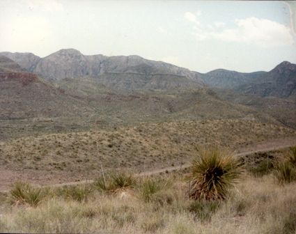
Some rather drastic elevation changes can be found throughout the boundaries of Big Bend National Park. The elevation along the river hits about 1,800 feet. Nearby stand the Chisos Mountains with Emory Peak rising to 7,800 feet. That’s a difference of greater than a mile. A trail runs up to the top of Emory Peak, a grueling five hour hike involving a scary climb for the last section. Several members of our party completed the trail and had plenty of stories to tell of their adventures upon their return. They remarked in particular about the huge swarms of ladybugs that could be found at the higher elevations.
Leave a Reply