
Resurrection Bay; Seward, Alaska (July 2010)
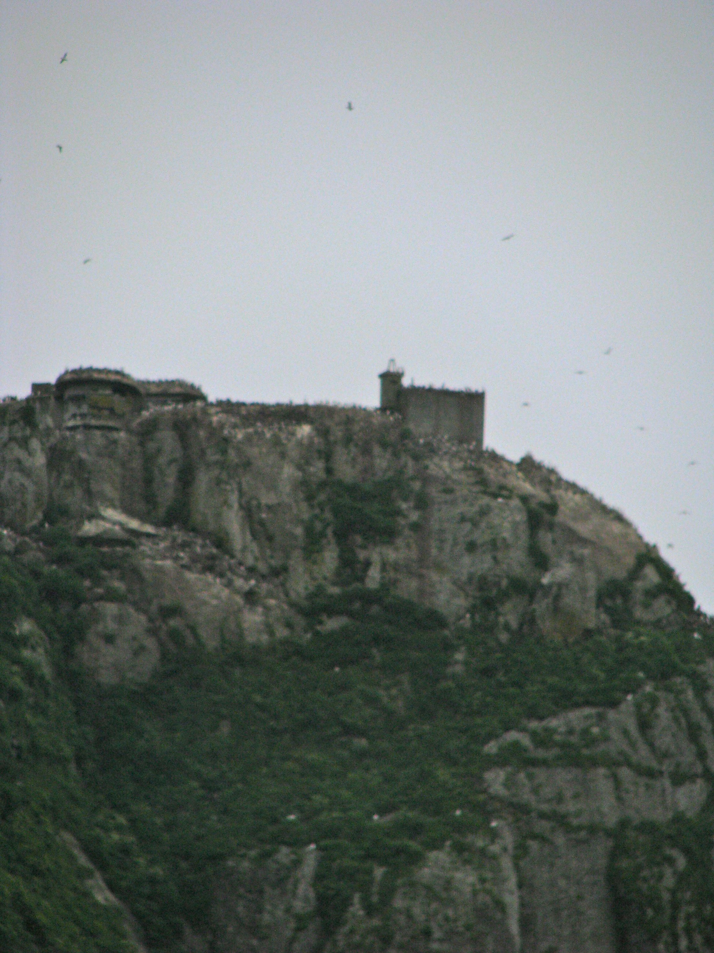
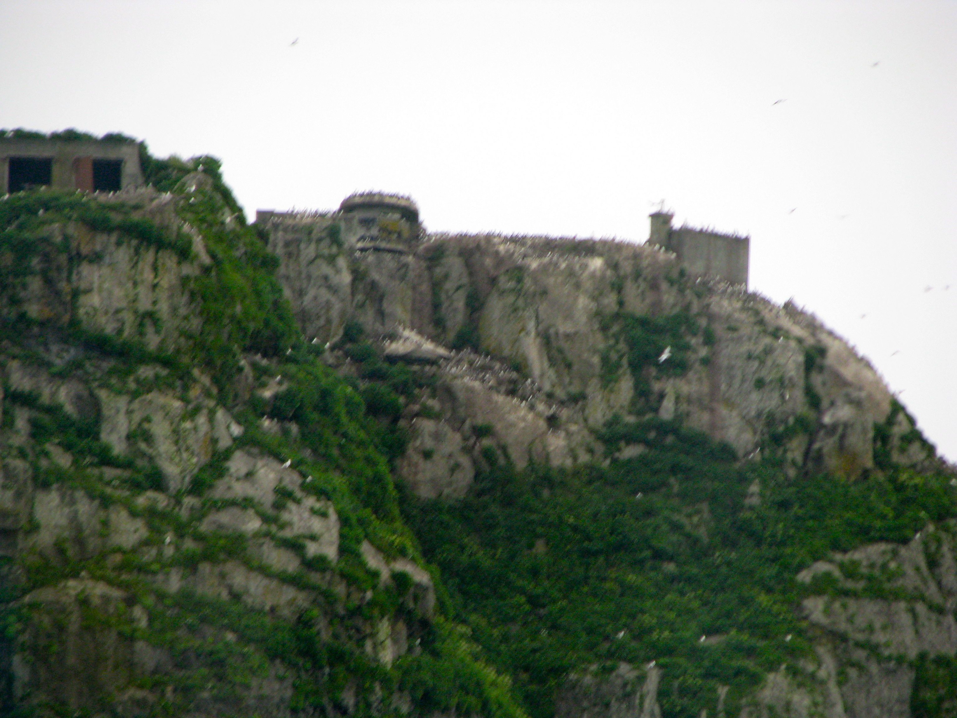
We rode through Resurrection Bay heading out of Seward on one of those all-day Kenai Fjords excursions. We came there to enjoy the natural beauty of the National Park, both the scenery and the animal life. The ship approached Barwell Island (map) at the opening of the bay and we got a closer look at the large bird colony nestled in the cliffs, and it offered a great show. What really attracted me though — given my fascination with military fortifications — was the row of concrete ruins set high atop the island.
In 1942 during the Second World War, Japanese airplanes bombed Dutch Harbor on Unalaska and its forces captured two of the Aleutian Islands, Attu and Kiska. It took the United States more than a year to mount a military campaign to retake the islands. The U.S. military quickly assessed the strategic importance of the Alaskan coastline in protecting the North Pacific shipping channels.
Seward, Alaska needed to be defended in case of attack or invasion. This no longer seemed an idle threat given the recent Aleutian Campaign. Much of Alaska and the military effort in the far north depended upon the availability of Seward’s ice-free port and its rail connection running deep into the interior to strategic points including Anchorage and Fairbanks.
Wartime Encampment
The defenses of Seward were headquartered at Fort Raymond with more than 3,000 men stationed just outside of town (now the site of the Seward Military Resort). Other significant defenses were located nearby at Fort McGilvray (now the site of Caines Head State Recreation Area). There were also, as an added measure, various smaller fortifications up-and-down Resurrection Bay.
That’s what led to the structures sitting so precariously atop Barwell Island. The War Department appropriated the 36 acres at the summit. Here they mounted searchlights and a radio station. An underwater cable connected the encampment at Barwell island to South Beach. Thus, Barwell’s function was to spot incoming enemy incursions and provide sufficient warning to much larger military facilities nearby.
Heading
These ruins are incredibly inaccessible. The waters around it are unforgiving and access is only possible using small boats under ideal conditions. Assuming a successful landing, a steep, rocky climb of more then two hundred feet nearly straight up a cliff would be necessary to reach the pinnacle. During the period the military occupied the site, they ferried supplies to the summit using a thick iron cable, remnants of which are still visible today. It must have been a miserable station, sitting alone and exposed to the full forces of Pacific Ocean weather.
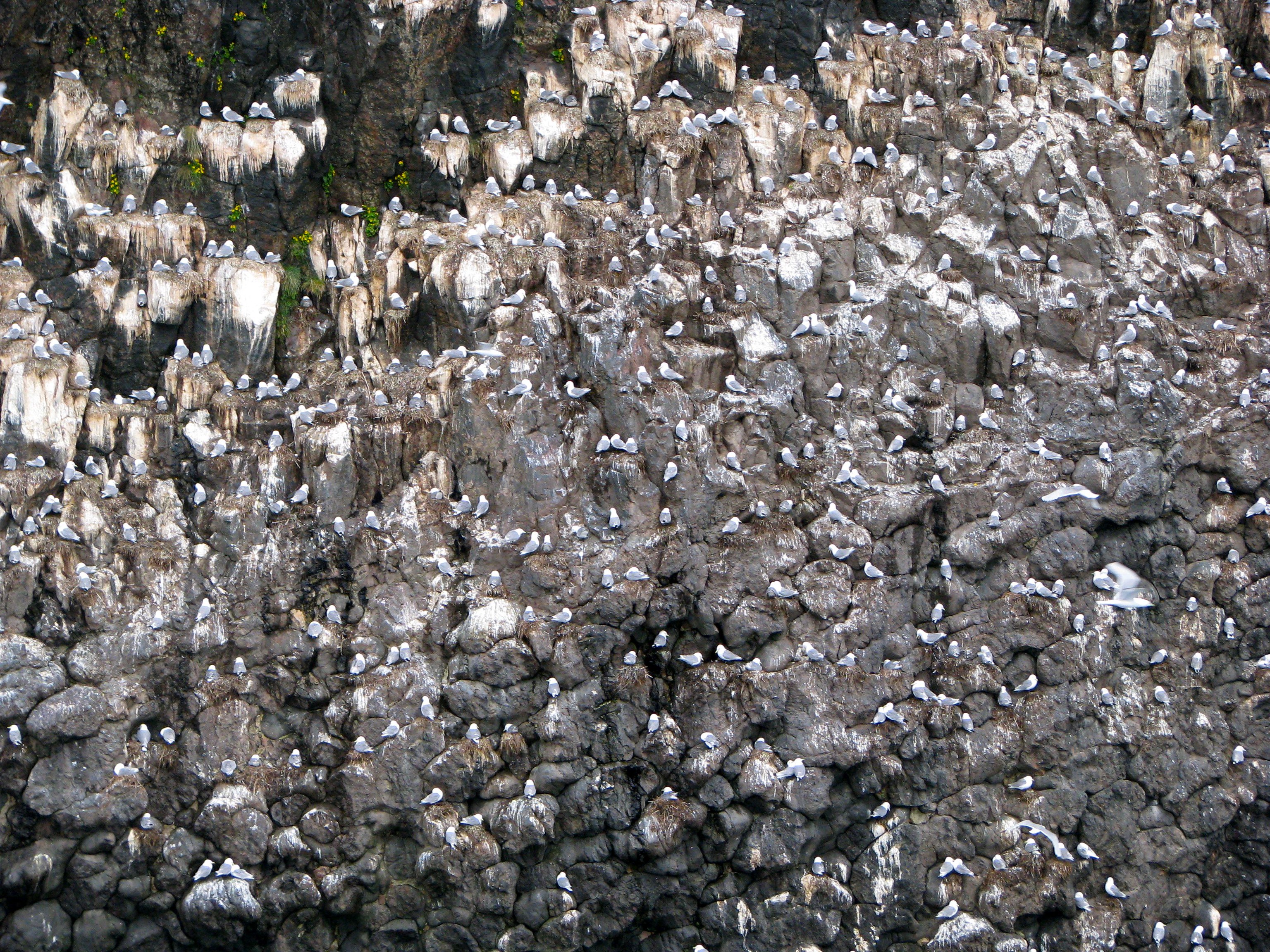
Today only birds live on Barwell Island. It is covered with bird rookeries of several different species. First visitors experience a wall of sound. Thousands of birds fill the air with a constant cacophony of calls and squawks. Next it’s the smell. Guano streaks the cliffs in white and the stench is palpable and unpleasant. Then the wind will blow in another direction and one can enjoy the sights and sounds of nature without the odor.
We remained just offshore Barwell Island, bobbing on the surface and staying a respectful distance away, and eventually sailed on to our next destination.
Readers who have an interest in forts might also want to check my Forts, Fortresses and Fortifications page.
Leave a Reply