
I didn’t spend all of my limited time strictly within the confines of Waikiki Beach and downtown Honolulu. Whether work-related or during precious spare time I did explore more of southeastern Oahu than I had on my previous trip. Unfortunately I couldn’t linger much and truly take the time to appreciate it. Even so, I now have ideas for someday when I return to Hawaii as a tourist.
Nu’uanu Pali Lookout
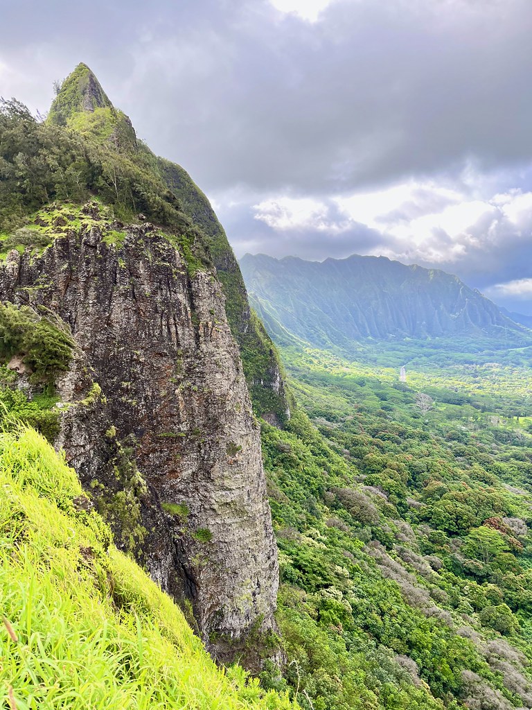
Oahu is a lot more than Honolulu although you have to make an effort to get there. Honolulu is a big American-style city with towering buildings and stifling traffic that just happens to occupy a lovely setting. However things improve dramatically just a few miles beyond the sprawl. Case in point, the amazing lookout at Nu’uanu Pali sat just six miles northeast of the state capitol (map). Punching through afternoon rush hour took some patience although the scenery far outweighed the hassle.
Two mountain ranges dominate the island, both weathered remains of former shield volcanoes. Ko’olau is the eastern one and people have to go over it or around it if they want to visit the windward side of the island. Fortunately the mountain also has a gap and the Pali Highway crosses there, with a particularly scenic wayside at the top. A crazy hurricane-force wind blew at this altitude and I feared I’d loose my phone over the side. But I found a way to brace myself and I took a few photos.
Interpretive signs explained some additional historical significance at this spot. This was a battlefield in 1795 when King Kamehameha united Oahu under his singular rule. Many warriors died gruesomely at Nu’uanu Pali; forced over the side of the cliff during the fight.
Lanikai Beach
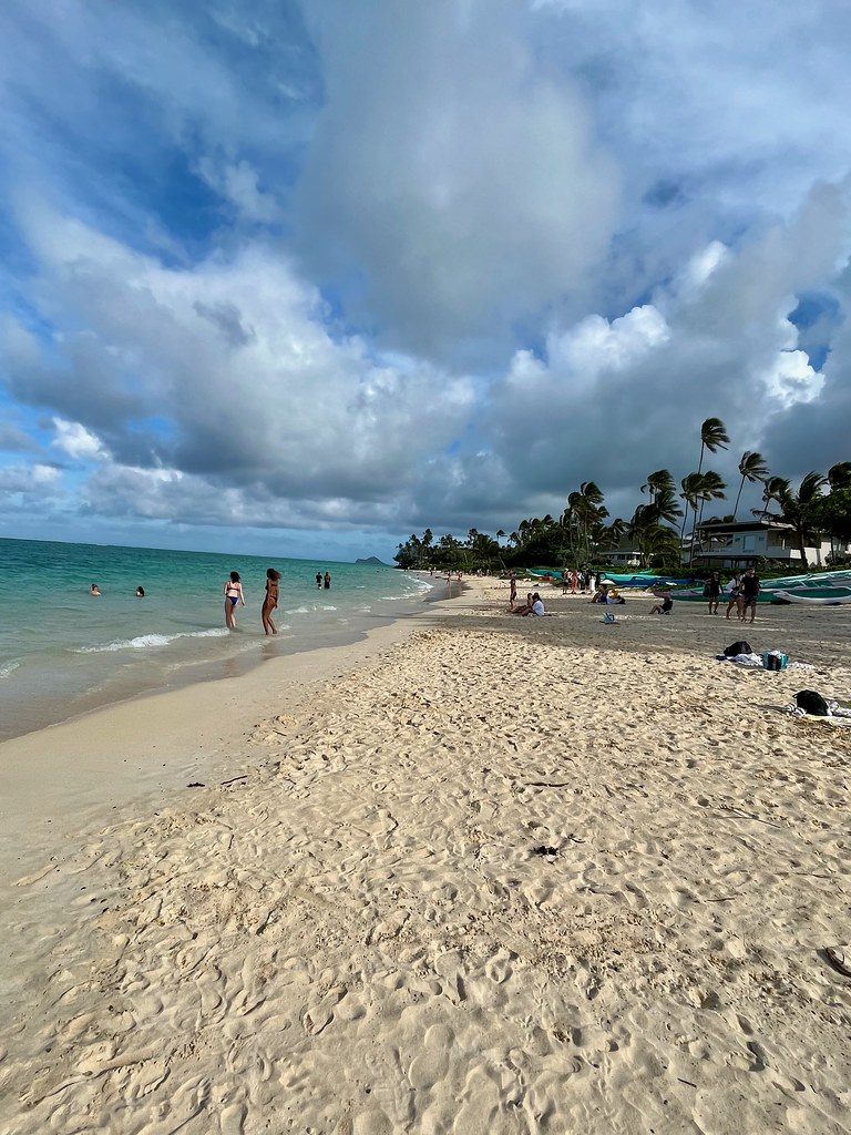
Beaches on the windward side of Oahu are some of the most beautiful I’ve ever seen. I dropped down from the Ko’olau ridge into the town of Kailua. Then I hugged the coast until arriving at Lanikai Beach (map). Parking is scarce but a spot magically appeared at one of the public access trails to the beach.
Perfectly calm turquoise water met some of the most finely-grained sugary sand imaginable. So, this more than any other place I’ve ever experienced, embodied the tropical paradise ethos. I had time to wade up to my knees and unfortunately little else before I had to return to Honolulu. I could spend a day or several here.
The Lanai at Pearl Harbor-Hickam
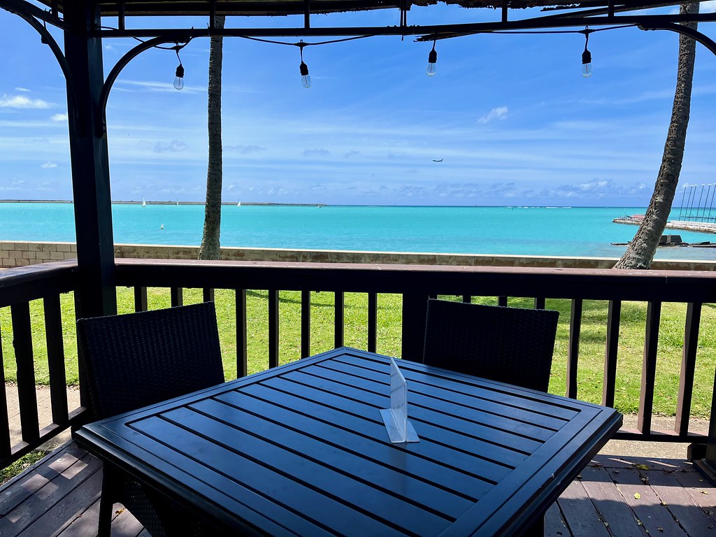
The scenery never stopped. One day we had to grab lunch between meetings at Joint Base Pearl Harbor-Hickam. The base offered several options including a casual restaurant called The Lanai (map). So that’s what we did, we dined on the lanai (e.g., porch or veranda) of The Lania. The scenic view offered a bonus too, a view of the runway at Daniel K. Inouye International Airport. Commercial and military jets shared the space. A Southwest or United airline jet bound for the mainland might roll by and prepare for takeoff, soon to be followed by a series of military fighters. It was a nicer backdrop than I usually enjoy during a quick bite.
Palm Circle
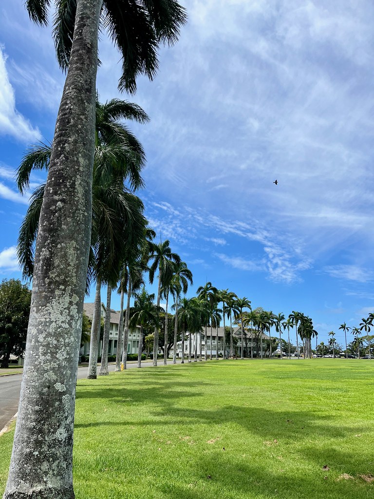
Military bases in Hawaii seemed like nice places to be stationed. I’m sure one could do much worse. One day I had a chance to take a quick windshield tour of Fort Shafter in Honolulu. A lot of it’s pretty typical for a military facility but it also had a special centerpiece: Palm Circle (map). This is where the general officers lived. Some of their rather impressive dwellings appear in the background.
Historically, the circle was a parade ground dating to the founding of the fort in the early 1900’s. It’s the oldest U.S. military base on Oahu and it still serves as the army’s Hawaiian headquarters — the Pineapple Pentagon. During World War II, the entirety of Army forces in the Pacific theater were commanded from this location.
Kalaniana’ole Highway
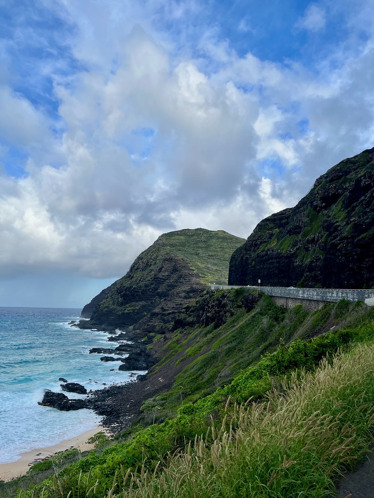
I drove further along Oahu’s southeaster coastline the same afternoon I visited Diamond Head. Towering cliffs interspersed with pristine beaches dotting the Kalaniana’ole Highway. In quick succession I passed Hawaii Kai, Lanai Lookout, Sandy Beach, and finally Makapuu Beach where I turned around (map).
Three days passed quickly. Way too quickly. Then it was time for my next stop: Tokyo.
Articles in the Asia-Pacific Series
- Oahu: Honolulu Waterfront
- Oahu: Beyond Waikiki
- Japan: Tokyo Temples and Tourists
- Japan: Exploring Tokyo
- Japan: Farther Afield
- South Korea: Seoul
- South Korea: The DMZ
- Postscript: Interesting Signs
- Postscript: Brew It
See Also: The Complete Photo Album on Flickr
Leave a Reply