
On the first day I stuck to my original plan. However, I needed to pivot to something different on the second day due to a storm hundreds of miles away. As an alternate, I could finish Michigan’s Thumb with only three more counties remaining: Sanilac, Huron and Tuscola. True, it would involve backtracking along some of the same Interstate highway I drove just a day earlier. Even so, that didn’t seem to matter as much with a 75 mile per hour (120 kph) speed limit. I could cover that ground quickly. But I would have to do it solo because my road trip buddy was back at school.
Second Day Loop
The bulk of The Thumb seemed to have a complete lack of interesting attractions. By interesting I mean to the Twelve Mile Circle audience, and specifically destinations qualifying as unusual or weird. I’m sure there are plenty of captivating locations there for normal people including miles of Great Lakes waterfront. Even so, Atlas Obscura and Roadside America showed nothing; I mean nothing, as in a complete void on their maps. This promised to be a really boring nonstop drive.
I poked all around the Internet trying to find something worthwhile. Finally I stumbled upon the Thumb Quilt Trail. The Thumb obviously represented the geographic area of Michigan I wanted to visit, but what about the quilt? I had visions of blankets.
Actually no, it referenced Quilt Blocks, which are painted geometric designs attached to the exterior walls of barns and other rural structures. This folk art tradition dates back to the mid/late 19th Century when German and Swiss immigrants settled in the Northeast and Midwest. These designs have undergone something of a resurgence lately. Fortunately the website had a map and I noticed several Quilt Blocks fell directly along my intended route.
I know what people are thinking. No, I don’t need anything else to count and I don’t intend to follow Quilt Trails in other parts of the country. I did this solely to break up the monotony of an otherwise uninspired drive. So let’s take a look at a representative sample from each of the three new counties that I added to my county counting list.
Sanilac County
I drove due-north on one of the more significant roads through the Thumb, on Michigan highway 53 (M-53). It slices all the way through the western side of Sanilac County, through the town of Marlette and then proceeds into lots of farmland. I stopped at a couple of recommended places in Marlette, one at a Christian thrift store (photo) and one at a daycare center in a building that looked like an old school house (photo). The artworks were titled “Patriotic Heart” and “Double Ohio Star & Card Trick.”
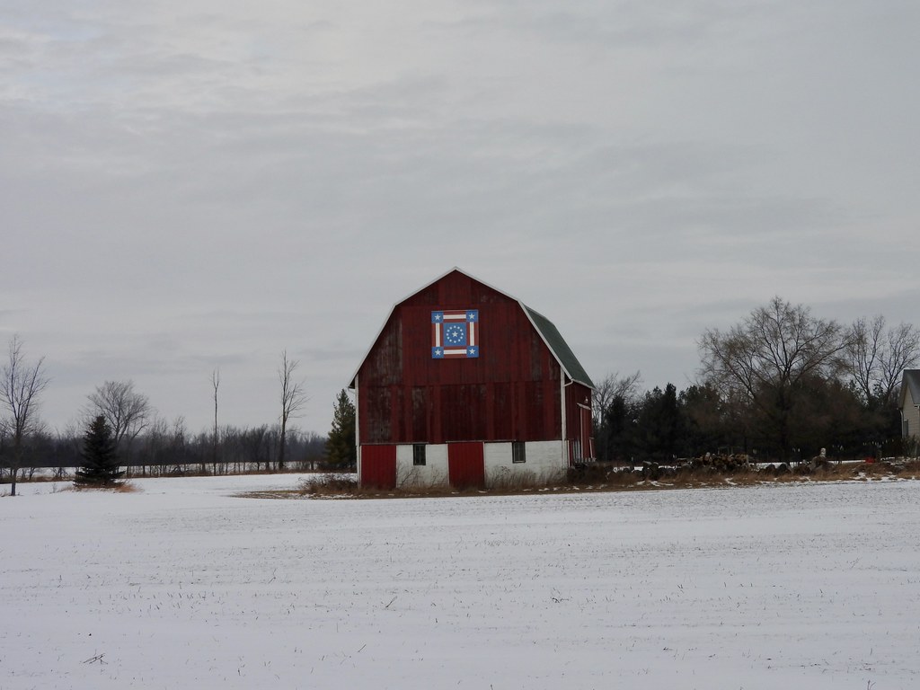
Then I drove north of town to a spot the website called the Wing Barn. It was hard to take photos of most of the barns because there weren’t many places to pull over on a swiftly-moving highway. Fortunately an access road provided a nice angle for a clear photo of the Wing Barn (map). The owners named the block on this barn “Glory Be.”
Huron County
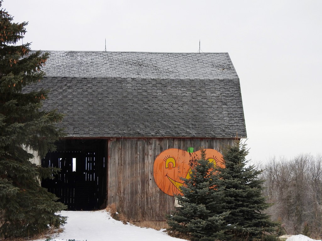
Then I continued on M-53 until I crossed into Huron County, the thumbnail on The Thumb. A few miles later I arrived at what the Quilt Trail called Janik’s Orchard (map). According to Facebook it’s called the “Czekai Family Orchard formerly Janik’s Orchard”. It had a For Sale sign in front when I pulled up though. I don’t know what name it will have later so your results may vary. It didn’t really matter to me either way, I just wanted to visit a new county. The barn had an actual quilt block on a side wall but I’d have to walk through snow to get to it. So I took a picture of the pumpkin and called it good.
The closest town is Bad Axe. If I lived there I know I’d enjoy saying, “Don’t mess with me, I’m a Bad Axe!” But that didn’t persuade me to buy the orchard although I did think about it for a second or two.
Tuscola County
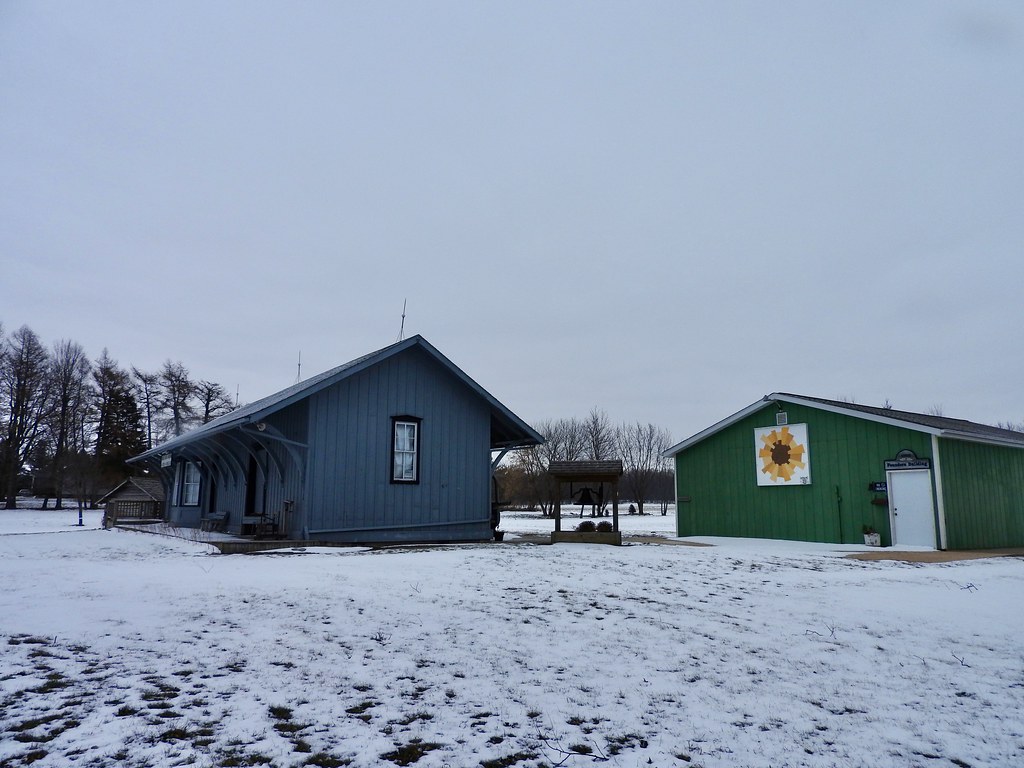
Finally I turned back towards the south, on various roads paralleling M-53. Soon I crossed into Tuscola County. I targeted a quilt block at the Mayville Museum titled “Modern Dresden” (map).
Too bad it was the middle of winter. I think I would have enjoyed the museum during its open season, with its old railroad station and vintage caboose. It also included a genealogy library, which would have interested me because that’s one of my hobbies. Coincidentally, a bunch of my distant relatives lived in Tuscola County (and neighboring Lapeer) at the turn of the last century. I’m sure I would have uncovered some interesting tidbits.
Bonus Afternoon
But wait! There’s more! I plowed through the county counting in the morning and I had an entire afternoon free. My son wasn’t available for the earlier drive but he could walk around the Michigan State University campus in East Lansing with me in the afternoon (map).
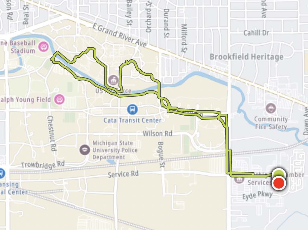
My GPS running watch works for walking too. So I thought it might be interesting to track my 5.3 mile path through the campus. It involved lots of poking around at a very casual pace. I had a few sites in mind, mostly in the historic North Neighborhood, the oldest part of the University. I wanted to see the Spartan Statue (photo) and the Beaumont Tower. Also I wanted to see The Rock (photo), essentially a stone billboard that’s painted with new messages every day. Everything else was a bonus.
Beaumont Tower
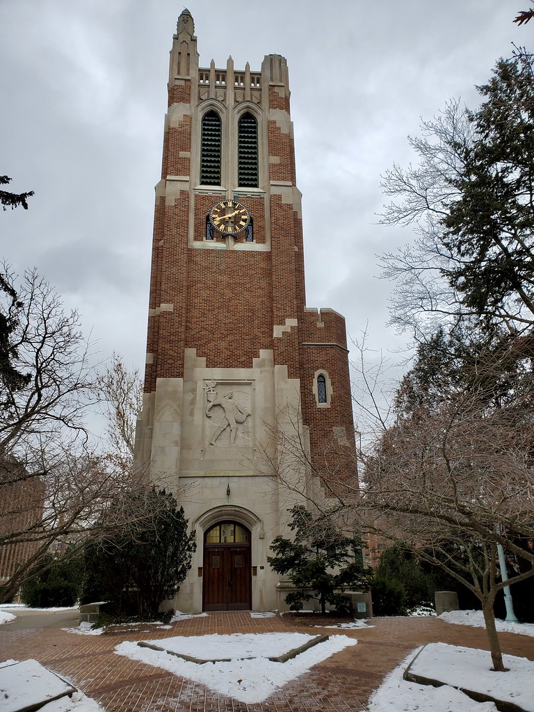
There’s not really a central point of the campus that I could determine; it just sort of sprawls all over the place. I guess that makes sense for the university that served as a model for the entire Land-Grant system. It’s also a Big 10 school so maybe the central focus is the football stadium or basketball arena. But I think one could also make a case for the Beaumont Tower.
This tower rose here about a century ago. It’s also a carillon so music from the bells sometimes fills the area. Previously, the university’s original instructional building sat on this site, the first building in the United States devoted to teaching scientific agriculture. So it marks a particularly historic spot on an already historic campus.
Red Cedar River

How many universities have a river running right through campus? Michigan State does, the Red Cedar River. It’s a tributary of the Grand River which eventually flows into Lake Michigan. This is a dominant landmark of the university, complete with a paved trail that follows its banks.
Certainly our walk barely scratched the surface of the larger university. Nonetheless I felt like we covered most of the “good stuff” and by then we were getting cold.
See Also: The first day of the adventure on 12MC and the Complete Photo Album on Flickr.
Leave a Reply