
Well, that didn’t last long. I felt pretty comfortable even a couple of months ago. It seemed like we’d finally reached the end of the pandemic and we even traveled to Canada. Then the Omicron variant reared its ugly head. I keep hoping, keep expecting, that I won’t have to mention COVID-19 ever again on Twelve Mile Circle. Yet, here we are.
So I dusted off the old playbook and decided to follow a similar plan for Christmas again this year. Let’s avoid the airlines, stay away from crowds, and take a nice road trip somewhere really quiet.
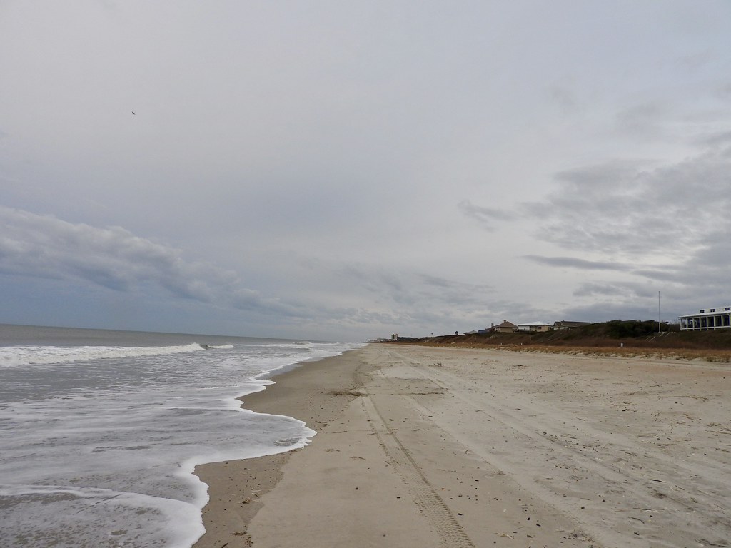
Yes, we heading down to the barrier islands of North Carolina again. Last year we visited Corolla on the Outer Banks (map). Well, this year we went just a little farther south, to Pine Knoll Shores on Bogue Banks (map). Even so, it was basically the same concept. The beach terrain seemed strangely familiar and equally devoid of tourists too. Most people hate going to the beach during winter and that’s why I love it.
An Ulterior Motive
Let’s be Honest. We all know exactly why I drove even father south to relive the same basic beach experience as last year. Yes, it was all about the counties. If I have to endure travel hassles due to a pandemic I might as well chip away at the nearest unvisited counties. Lemons into lemonade, right? Those counties aren’t going to count themselves, as I rationalized it.
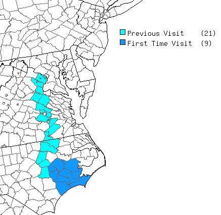
I targeted a tight cluster of nine counties in eastern North Carolina that popped-out on my county counting map. Naturally I needed to remove that empty spot I’d never touched before. Also I figured I could easily get there in a single day’s drive. As an added bonus, the area happened to abut a coastline.
The Initial Swath
Getting all nine counties didn’t involve a lot of complexity. On the way down I captured Lenoir, Jones, Onslow and Carteret. The map above shows the route as I traveled through North Carolina after leaving Interstate 95. Each of the intermediary points represented the actual GPS coordinates that guaranteed an entry into each new county. This added only about 20 minutes to the drive down.
At one point my wife asked if we were “doing a county thing” because she’d been tracking the optimal path on her phone. Yes, I confessed to that. However, in my defense, I did give her a heads up in advance that this was a primary purpose of our trip. She didn’t mind of course. She’s used to these silly detours and writes it off as one of my quirks.
Subsequent Swaths
The way back also deviated slightly from the optimal route, this time to the east rather than the west. Once again it added a rather reasonable 20 minutes to the overall track back to I-95. That path traveled through Craven, Pitt and Greene Counties.
The drive down and back accounted for most of the counties with only minor jiggering. Unfortunately two counties, Pamlico (map) and Beauford (map), sat to the east a bit, isolated from any logical path. So a simple jog wouldn’t work and I had to concoct a day-trip from our homebase on the beach. I’ll talk about that one in another installment, but I’ll offer a little foreshadowing: the plan worked brilliantly.
So there you go. Four new counties on the way down, three on the way back, and two requiring a special trip. That filled the entire gap and removed all unsightly doughnut holes! Remarkably, I’ve now been to nearly every U.S. county bordering the Atlantic Ocean. Only one remains — Washington County, Maine. That’s the furthest north Atlantic coastal county in the United States so I think I may take awhile to complete this oceanfront milestone.
Future Interstate 587?
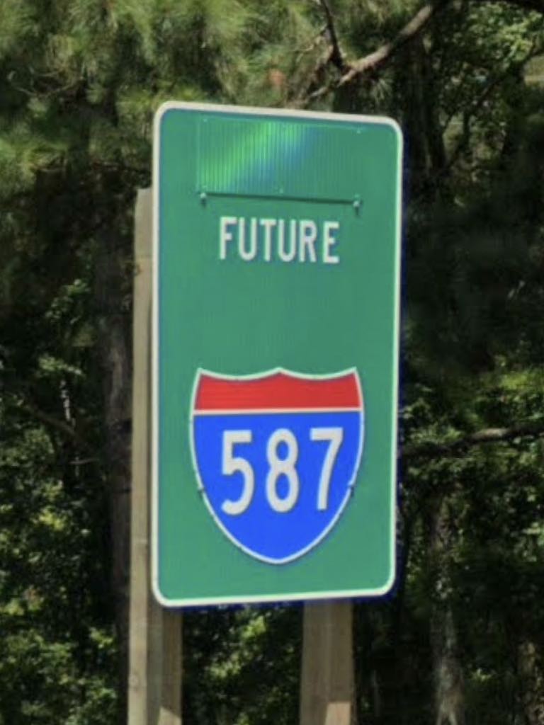
An interesting sign appeared on the way back as we drove out of Greenville, North Carolina on U.S. Route 264 (map). Well, what’s so interesting about that, you wonder? States add little spurs to the Interstate Highway System all the time. Actually I was pondering the specific number. 587.
I think many of us have a basic understanding of the numbering scheme. Interstate highways ending with an odd digit generally run north-south. The second two digits designate their geographic placement within the United States although with some exceptions (I’m looking at you, Interstate 99). Then, values increase along a continuum with smaller numbers in the west and larger numbers in the east. As a result, 87 would be pretty far east. The leading digit — the 5 — simply designates that it will be a spur of Interstate 87 when it’s added to the system. Are we good so far?
However, Greenville is distinctly east of Interstate 95. How could there ever be a spur of Interstate 87 this far east? And where was Interstate 87? I’d never heard of it before. So I looked it up. Well, the North Carolina portion stretches barely a dozen miles so far, running just outside of Raleigh (map). Indeed that portion does sit west of I-95 so I guess the numbering makes sense in that very limited circumstance. Eventually it will stretch to Norfolk, Virginia so in that context maybe the numbering makes less sense. Anyway, mystery solved.
Articles in the Bogue Banks Series
See Also: The Complete Photo Album on Flickr.
Leave a Reply