
There are 9 Councils of Government in Connecticut – “The Constitution State“
Also be sure to see my United States County Counting Page for the rest of the states.
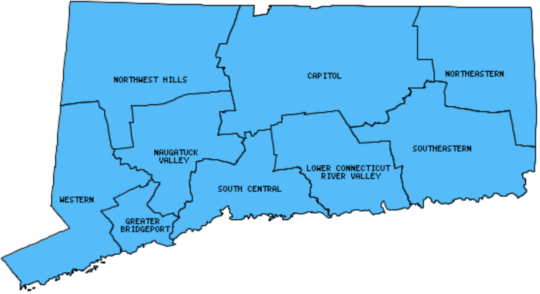
I have visited 9 Councils = 100% of Councils of Government in Connecticut
Councils of Government visited are colored-in; Councils still needing to be visited are blank. Map created using Mob Rule.
Twelve Mile Circle Articles Featuring Places in Connecticut
Markers designate the Connecticut locations featured in Twelve Mile Circle articles.
Interesting Connecticut County Trivia
Connecticut dismantled government at the county level in 1960. Instead, local government is handled directly by cities and towns. Counties continue to have meaning only for specialized purposes such as for judicial districts. However, beginning 2022, the U.S. Census Bureau recognized nine Councils of Government as county-equivalents.
Councils of Government in Connecticut
Below are the 9 Councils of Government in Connecticut. Although infrequent, counties sometimes do change so please let me know if any of this information is out of date and I will update it. Those councils that I have visited are highlighted in Red. Readers can also link to any articles manually in this section if the map isn’t working.
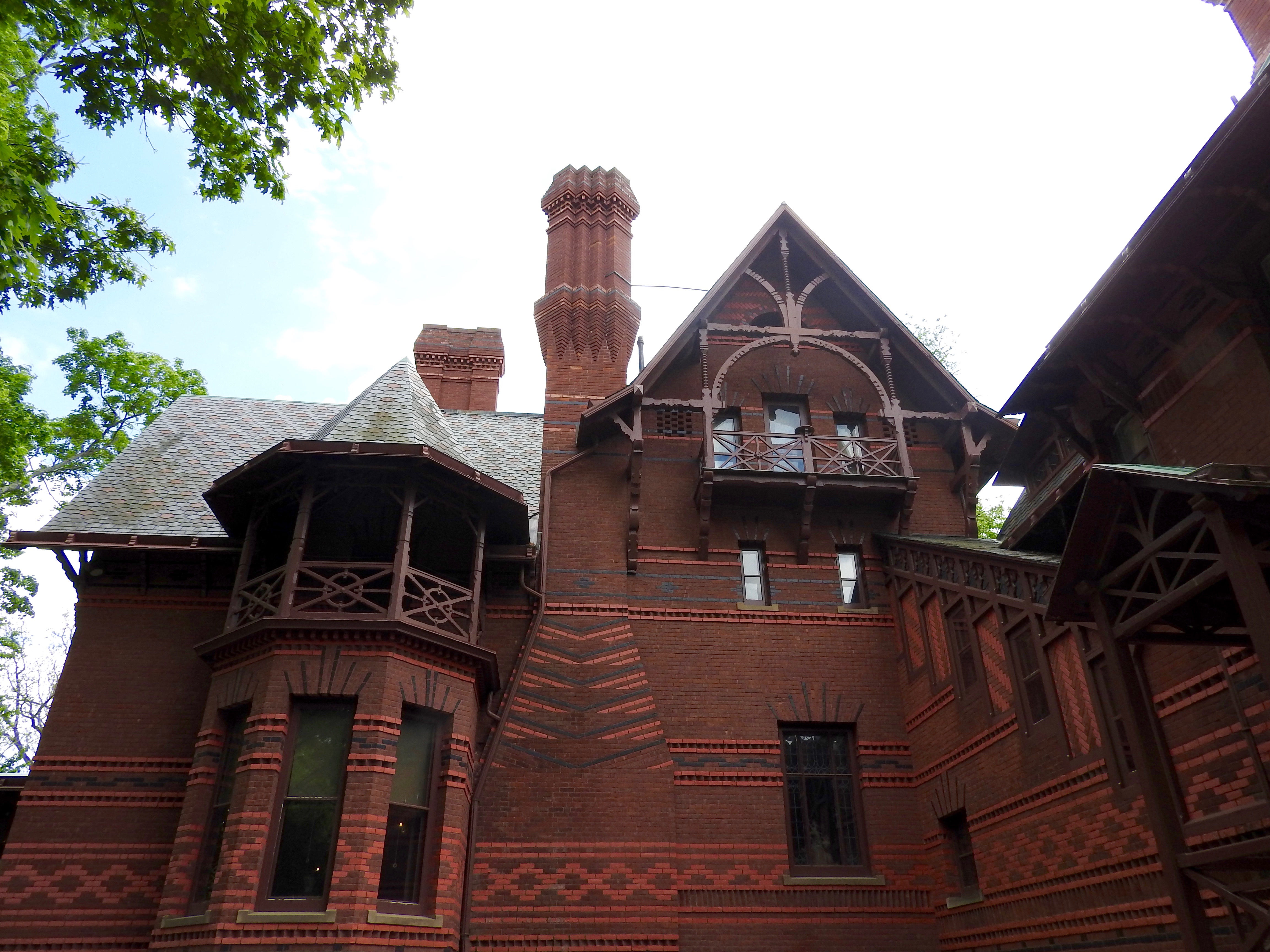
- Capitol: Largest council population in Connecticut (973,959 people in 2010 Census); Five Points; Mark Twain House; Millwright’s; State Line Pond
- Lower Connecticut River Valley: First Baptist Church; Menunketesuck Island
- MetroCOG: Golden Hill Paugussetts
- Naugatuck Valley: Stewart Ave. & Granger St.
- Northeastern: Smallest council population in Connecticut (96,617 people in 2010 Census); Air Line Trail; CTMARI Tripoint; Easternmost Connecticut; Governors Island
- Northwest Hills: Angle Bound 196; Bulls Bridge; Connecticut Highpoint; CTMANY Tripoint; Kent Falls; Lake Wononscopomuc
- South Central: Charles Island; New Haven; Podunk
- Southeastern: Bushy Point; Fort Trumbull; Willimantic Footbridge
- Western: Candlewood Lake; Connecticut Interstate 684; Gaylordsville Spite House; Great Captain Island; Mianus View; New York Rt. 120A; Tombolo; Westernmost Connecticut
Quick Facts About Connecticut
- Location: New England, United States. See map above.
- Size(1): 4,842 square miles. Connecticut is the 48th largest state. The next larger state is Hawaii and the next smaller state is Delaware.
- Population(2): 3,572,665 people. Connecticut is the 29th most populous state. The next more populous state is Oklahoma and the next less populous state is Utah.
- Population Density: 737.8 people per square mile. Connecticut is the 4th most densely populated state. The next more densely populated state is Massachusetts and the next less densely populated state is Maryland.
- Bordering States: Connecticut shares a border with 3 states: Massachusetts, New York and Rhode Island.
- Admission to the Union: January 9, 1788. Connecticut was the 5th state admitted to the Union, after Georgia and before Massachusetts.
- Capital: Hartford.
- Highest Point: 2,380 feet at Mount Frissell. See SummitPost’s Mount Frissell (Southwest Shoulder) page.
- Lowest Point: Sea Level at Long Island Sound.
- Government website: CT.gov Portal.
- Official Tourism website: Connecticut Travel.
- Still not enough? See Wikipedia’s Connecticut page.
Sources:
(1) Wikipedia: List of U.S. states and territories by area. Land area only.
(2) Wikipedia: List of states and territories of the United States by population. Estimated population on July 1, 2019.
Leave a Reply