
There are 67 Counties in Alabama – “The Heart of Dixie“
Also be sure to see my United States County Counting Page for the rest of the states.
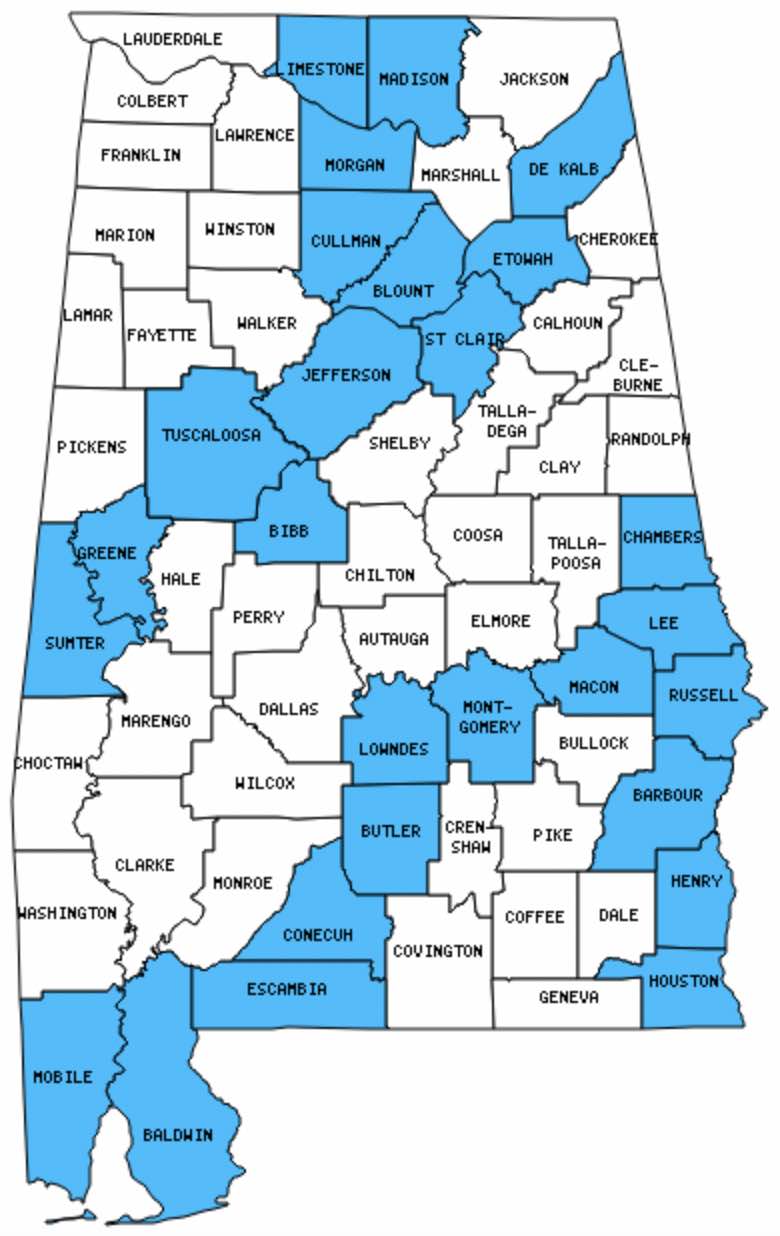
I have visited 27 Counties = 40.3% of Counties in Alabama
Counties visited are colored-in; counties still needing to be visited are blank. Map created using Mob Rule.
Twelve Mile Circle Articles Featuring Places in Alabama
Markers designate the Alabama locations featured in Twelve Mile Circle articles.
Counties in Alabama
Below are the 67 counties in Alabama. Although infrequent, counties sometimes do change so please let me know if any of this information is out of date and I will update it. Those counties that I have visited are highlighted in Red. Readers can also link to any articles manually in this section if the map isn’t working.
- Autauga
- Baldwin: Largest county in Alabama (1,596 square miles).
- Barbour: Tree That Owns Itself; Leroy Brown (fish); Yoholo Micco Trail
- Bibb
- Blount: Town of County Line
- Bullock: Three Notch
- Butler
- Calhoun: Piedmont
- Chambers
- Cherokee
- Chilton
- Choctaw
- Clarke
- Clay
- Cleburne
- Coffee
- Colbert
- Conecuh
- Coosa
- Covington
- Crenshaw
- Cullman
- Dale
- Dallas: Cahaba
- De Kalb
- Elmore
- Escambia: Adjacent Counties, Same Name, Different States
- Etowah: Smallest county in Alabama (535 square miles).
- Fayette
- Franklin
- Geneva
- Greene: Smallest county population in Alabama (9,974 people in 2000 Census); Hard Bargain Cemetery
- Hale
- Henry
- Houston: Smallest City Block; Giant Peanut
- Jackson: Chicken Foot Ridge
- Jefferson: Largest county population in Alabama (662,047 people in 2000 Census); Pre-Nazi Swastikas; Town of County Line
- Lamar
- Lauderdale
- Lawrence
- Lee
- Limestone
- Lowndes
- Macon
- Madison: Alabama Constitution Village; Disk Drive; Meridianville
- Marengo
- Marion
- Marshall
- Mobile
- Monroe
- Montgomery: Montgomery Biscuits; Alabama Capitol Building
- Morgan
- Perry
- Pickens
- Pike
- Randolph
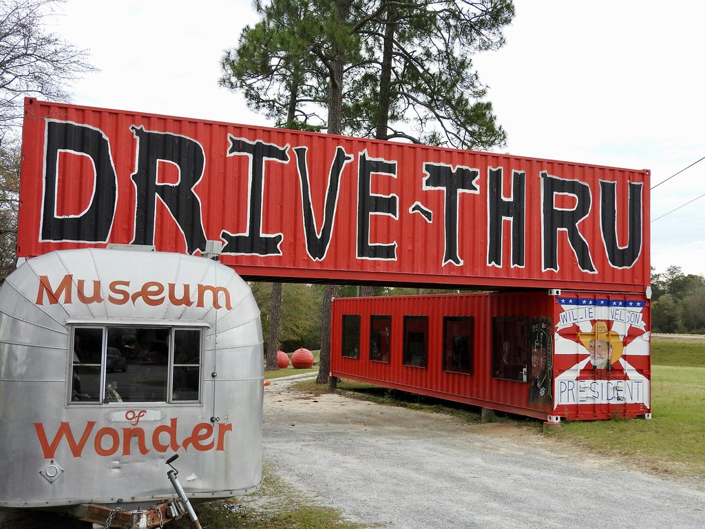
- Russell: RiverWalk; Museum of Wonder – Drive Thru
- Saint Clair
- Shelby
- Sumter
- Talladega: Sweet Home Alabama
- Tallapoosa
- Tuscaloosa: Historic Capitol Park
- Walker
- Washington: St. Stephens
- Wilcox
- Winston: The Free State of Winston
Quick Facts About Alabama
- Location: East South Central United States. See map above.
- Size(1): 50,645 square miles. Alabama is the 28th largest state. The next larger state is Arkansas and the next smaller state is North Carolina.
- Population(2): 4,887,871 people. Alabama is the 24th most populous state. The next more populous state is South Carolina and the next less populous state is Louisiana.
- Population Density: 96.5 people per square mile. Alabama is the 27th most densely populated state. The next more densely populated state is Wisconsin and the next less densely populated state is Missouri.
- Bordering States: Alabama shares a border with 4 states: Tennessee, Mississippi, Florida and Georgia.
- Admission to the Union: December 14, 1819. Alabama was the 22nd state admitted to the Union, after Illinois and before Maine.
- Capital: Montgomery.
- Highest Point: 2,404 feet at Cheaha Mountain. See SummitPost’s Cheaha Mountain page.
- Lowest Point: Sea Level at the Gulf of Mexico.
- Government website: alabama.gov: The Official Website of the State of Alabama.
- Official Tourism website: Alabama Travel.
- Still not enough? See Wikipedia’s Alabama page.
Sources:
(1) Wikipedia: List of U.S. states and territories by area. Land area only.
(2) Wikipedia: List of states and territories of the United States by population. Estimated population on July 1, 2019.
Leave a Reply