
12MC is back! Thank you for bearing with me while I took a brief respite from posting new articles. There were logistical reasons. Each race in the five state series took much of the morning, then we’d have to drive to the next location (stopping at geo-oddity sites along the way), arrive late each afternoon, and then start preparing for the next race the following morning. The distances were much farther than my Dust Bowl adventure, and we covered 2,700 miles (4,350 kilometres) in 9 days. Those unfamiliar with the basic overview can reacquaint themselves with our ambitious travel itinerary in The Pitch.
This was the longest break I’ve taken from 12MC in the six-plus years that I’ve been writing it. It felt weird. I had one article in the bag ready to post. It had a rushed and hurried tone without the quality normally befitting this site. So I gave myself permission to take a break. Now I’m able to look at the totality of my Riverboat adventure and organize subjects into themes rather than suffer the disjointed limitations of chronology.
I received several sightseeing suggestions from the 12MC audience both before I left and along the way. Some of those made it into the narrative and will appear in articles over the next couple of weeks. Enjoy!
The Mississippi and Ohio River Confluence

The Riverboat adventure focused on the Lower Mississippi River, defined as beginning at the confluence of the Mississippi and Ohio Rivers, and extending to the Gulf of Mexico. We didn’t make it all the way down to the Gulf although we started at the confluence and made it as far south as northern Louisiana.
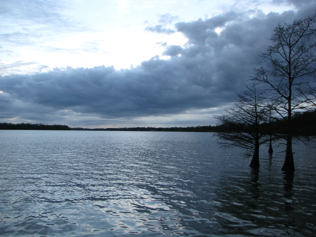
Well, we experienced only a single “disappointment” during the entire trip, and I’m almost embarrassed to call it a disappointment because it was so completely trivial. We planned a picnic lunch at Ft. Defiance Park located directly at the confluence (map). It would have been a lovely vantage point both for its scenery and its geographic significance. It would have offered Illinois’ southernmost point as well as its lowest point of elevation in addition to the awesomeness of the confluence itself. The park was closed because of recent flooding that happens frequently during springtime. Snowmelt flows down from the northern extremes of the Mississippi watershed and overruns the banks in floodplain areas. It was a mess.
Instead, under the guise of lemons vs. lemonade, we recorded one of the shortest state clips traversed by a 2-digit U.S. Highway. Traveling this route, we crossed from Kentucky into Illinois over the Ohio River, drove through Illinois for a single mile (map) stopping briefly for a few photos — noticed the water — and then crossed from Illinois into Missouri. Yes, it would have been nice to have been able to stop there for lunch. It didn’t happen. We salvaged our misfortune by having a perfectly fine picnic at an equally scenic spot a little farther downriver while waiting for the Dorena-Hickman ferry.
Kentucky Bluffs

Much of Kentucky featured irregular borders (map) defined by rivers or mountain ridges. The Ohio River determined much of its northern and western border. A small portion, however, at the far western extreme of the commonwealth and immediately south of the confluence straddled the Mississippi River. That was our target.
High bluffs protected some of this area so that residents here remained dry while their neighbors in Illinois and Missouri flooded. Here we stopped at Columbus-Belmont State Park for one of the races. That was the site of a Confederate fortification during the U.S. Civil War, perched atop the bluff in an attempt to control river access and commercial traffic during the conflict.
Memphis, Tennessee

Farther downstream, Memphis was undoubtedly the largest city we encountered during our journey. We blew through town on our first pass using its highways as a means to cross the river and push towards our next destination in rural Arkansas. We would see Memphis again on the return path and stay for a couple of days, and in a bit of foreshadowing, yes we visited Graceland.
Barges heading up- and downstream were a frequent sighting during our journey. Here, a barge passed below the Hernando DeSoto Bridge that carried traffic on Interstate 40 between Memphis, Tennessee and West Memphis, Arkansas.
Greenville Bridge

I’ve driven across the Mississippi River numerous times over the years. However I’ve never driven along the river this far before, not even during my Great River Road trip in Wisconsin. I gained a new appreciation for just how infrequently one can cross the river as we progressed southward down its path, jogging back-and-forth across its banks. One doesn’t comprehend that same sense of rarity on the Interstate highway system where the Mississippi River hardly seems an obstacle at all.
We used the Greenville Bridge outside of Greenville, Mississippi a couple of times during the drive. We had one race on the immediate western side in Lake Village, Arkansas, and another race just south of Greenville, Mississippi the next day. That provided a rare respite, an uncharacteristic day that involved little driving and some needed downtime.
Lake Chicot, Arkansas
The Arkansas race took place at a beautiful spot along Lake Chicot, the lake for which Lake Village gained its name. Chicot was a classic oxbow lake.
Wikipedia described it as “the largest oxbow lake in North America and the largest natural lake in Arkansas, formed 600 years ago by the meandering of the Mississippi River.” Astute 12MC readers know how much I love oxbows. Largest oxbow in North America! Largest natural lake in Arkansas! Sold. I experienced a genuine geo-oddity simply by watching marathoners loop through the park for a few hours while I went on a photo safari.
Then it started raining like crazy, with thunder and lightning and torrential downpours and the whole deal. This was our day without driving and we knew we were fortunate. I wasn’t disappointed by a rainy day. We were lucky even though the weather sucked, using it as an excuse to hole-up in a warm hotel room for an afternoon to relax.
Mud Island

At this point a special shout-out goes to reader “Bill C.” for suggesting the Riverwalk at Mud Island. As the park site explained, “The Riverwalk is an exact scale model of the Lower Mississippi River flowing from its confluence with the Ohio River at Cairo, Illinois 954 miles south to the Gulf of Mexico.” I didn’t know about this place in advance and I would have missed it without Bill C.’s suggestion. It was geo-geek paradise, so thanks Bill C.
The Riverwalk represented the entire Lower Mississippi in miniature, everything we’d just spent a full week driving, at a scale where every footstep representing about a mile. I was giddy as I hopped back and forth across the model, pointing out each spot we’d visited during our journey while my wife rolled her eyes and pretended to be amused. This photo captured the Kentucky Bend (aka “Bubbleland“) portion, which gave an indication of the model’s colossal scale.
The entire Riverwalk stretched about a half-mile with each concrete layer representing a five-foot elevation change. Notice the color changes, too. The light-tan coloration represented the floodplain. Thus, much of Kentucky Bend would be subject to periodic flooding while the darker-colored area remained dry. Not surprisingly, I noticed that’s where the farmers concentrated their homes when we’d visited the Bend earlier in the week.
Signage at the park indicated that the model held about 1.2 million gallons (4.5 million litres) of water at any given time. It was interactive too. Lots of children splashed around in the river and that was perfectly fine. The gift shop even sold T-shirts to that effect.
Leave a Reply