
The northernmost Ferry in Canada, and indeed for all of North America, is the Arctic Red River Ferry. It serves the Gwich’in settlement of Tsiigehtchic in the Northwest Territories. This is so far north that it’s actually above the Arctic Circle.
Arctic Red River Ferry
The ferry provides a vital link in the continuity of the Dempster Highway. Here it needs to negotiate the confluence of the Mackenzie and Arctic Red Rivers. Those using the ferry have two choices. They can cross the Mackenzie and continue their journey on the Dempster Highway. Alternately, at their request, they can cross over the Arctic Red River to access Tsiigehtchic.

Stopping points along the highway are rather sparse and far between. So a brief detour to Tsiigehtchic for fuel and supplies becomes a welcome opportunity. On the map above the Dempster Highway runs along the left, and Tsiigehtchic is the settlement on the right on the other side of the smaller river.
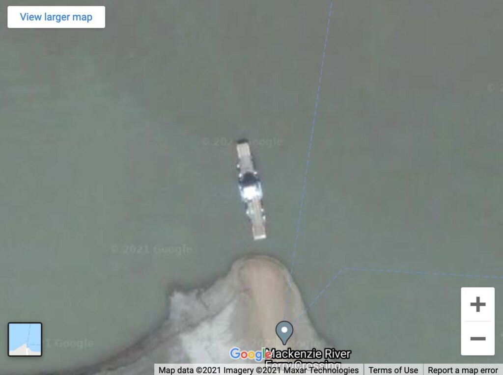
The Google Maps resolution for such a remote area is amazing. Drill down and the ferryboat itself becomes clearly visible. Drill back up and one can get an appreciation for just how far north the government of Canada has located this ferry service. The effort to keep it operational must be daunting.
Peel Ferry
There is another ferry about 70 km. further down the Dempster Highway, called the Peel Ferry. This section of the road runs mostly east-west so it is only slightly further south than the Arctic Red River Ferry. It’s an extremely close “second place” for the northernmost title. No other ferries in North America even come close.
It crosses the Peel River as the name implies, and it’s located outside of the community of Fort McPherson. Both ferries are seasonal and an ice bridge replaces them as soon as the weather permits.
These interesting locations are intended to introduce my newly-created Interactive Map of Canadian Ferries. This is the most comprehensive resource of its type on the Web. I found nearly 200 ferry routes in Canada. Who knew? Then I mapped and tagged each one of them, and linked them to their respective government or corporate websites.
Leave a Reply