Busy Days

The Twelve Mile Circle audience seems to enjoy little contests or puzzles interspersed within the usual healthy dose of geo-oddity goodness. Actually, sometimes I think the community relishes interactive topics even more than the purely informational ones based upon sheer number of comments posted to each article. Hopefully today will provide another opportunity for that. I’ve had some fun with my latest curiosity question over the last couple of days.


So how many individual states in the United States can someone visit in a single day by automobile?
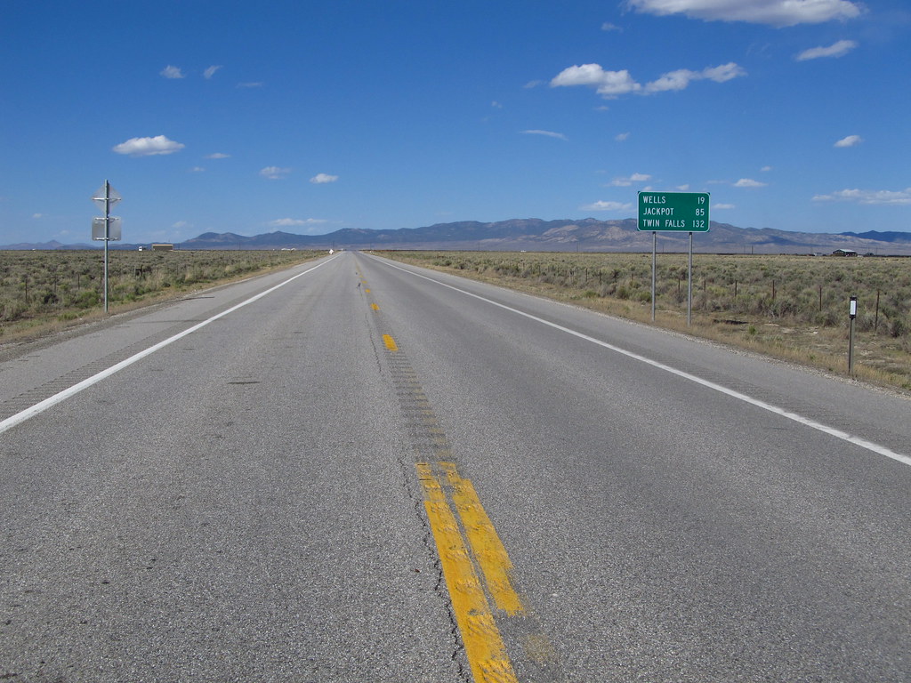
US 93 ... south of Wells, Nevada. Photo by Jasperdo; (CC BY-NC-ND 2.0)

My personal theoretical best result was eighteen states — counting the District of Columbia as a “state” for this purpose — in 23 hours and 59 minutes. Yes, we all realize DC isn’t a state. However I’ve noticed that various demographic and statistical measures include it as a state equivalent. Therefore I will treat it the same for this exercise.

My Solution

  • A = White River Junction, VT
  • B = Dover, NH
  • C = Eliot, ME
  • D = Revere, MA
  • E = Cranston, RI
  • F = Stamford, CT
  • G = New Rochelle, NY
  • H = Elizabeth, NJ
  • I = Port Richmond, PA
  • J = Brookside, DE
  • K = College Park, MD
  • L = Washington, DC
  • M = Leesburg, VA
  • N = Charles Town, WV
  • O = Erwin, TN
  • P = Woodfin, NC
  • Q = Greenville, SC
  • R = Lavonia, GA

I also used a variation on this theme where I diverted west after reaching West Virginia (map) rather than heading south. I captured only seventeen which again included the District of Columbia.

The rules of the game are simple

  1. Finish the journey in less than 24 hours according to default automatic directions calculated by Google Maps. 23 hours and 59 minutes is perfectly acceptable. 24 hours and 0 minutes crosses into the next day and is not acceptable. I realize that Google Maps directions change over time so some results may have a shelf life. Let’s not stress about that. No result lasts forever.
  2. The District of Columbia, as I mentioned previously, counts as a state-equivalent here. Nonetheless, we will consider a solution excluding the District as a tie-breaker.
  3. You may use only one destination per state on the map. That will make it more challenging. It will also make it easier to grade. So if the last pushpin is “R” we’ll know immediately that the value must be eighteen. Then I’ll only have to check whether it happens to include the District or not.
  4. You can only use place names as destinations. It doesn’t matter if it’s a town, a park, a neighborhood, an airport, or something else. If Google Maps considers it a destination it’s fine. However you cannot use specific street addresses, business locations or Latitude/Longitude coordinates. Just place names. Keep it simple like the list I used.
  5. Do not manipulate the route manually. Google Maps allows users to create intermediary points between destinations. Those don’t count for this exercise.
  6. Minimize backtracking. Notice that I am specifically allowing incidental backtracking. The Google Maps routing algorithm would make it extremely difficult otherwise. Just try to keep backtracks to reasonable distances, perhaps on the order of a couple of miles or shorter. Zero-backtracks will serve as a tie-breaker. I’d consider a solution more elegant if someone went to the effort of removing all backtracks.
  7. I reserve the right to clarify or create rules if readers discover bizarre or “unfair” loopholes.

Washington, DC in my solution provides an example of “acceptable” backtracking. A traveler would cover a 200 foot stretch of 16th Street NW in Washington, DC twice. I suppose one could search for specific neighborhoods to remove the backtrack but that would then add more words to the list and increase clutter. It’s all about tradeoffs.


The Current Target

So the current target is eighteen (counting DC) at 23 hours 59 minutes as described above. The goal is to either reach more than eighteen states (or find an eighteen state solution bypassing DC) or reduce the amount of time necessary. One could start with my route and shave a few minutes off of it. I think some slack might still exist. I stopped shaving it down as soon as I generated a value below 24 hours. However, I will be more impressed by solutions that exhibit individual creativity.

Feel free to expand this to other nations such as Canada or Australia. Then lay-down the gauntlet for other challengers. Maybe focus on international border crossings such as the number of European countries potentially visited in a single day and do the same. Have fun with it!

Finally, place a Google Maps “Short URL” in a comment when you defeat my solution. I know there are better answers lurking within the 12MC audience.


Posted

in

, , , ,

by

Tags:

Comments

24 responses to “Busy Days”

  1. Peter Avatar

    I can come up with 10 European countries. It is a routing from Vipiteno, Italy to Malmo, Sweden, by way of Basel, Luxembourg, Maastrict, Hamburg and Copenhagen. The countries are Italy, Austria, Liechtenstein, Switzerland, France, Luxembourg, the Netherlands, Germany, Denmark and Sweden.

    Despite the impressive number of countries, this routing is a bit frustrating. You would arrive in Malmo with almost three hours to spare, but would not have enough time to get to Norway or Finland before the 24 hours expires. Even worse, if you began the trip in Croatia, to add an eleventh country, you would be just over the 24-hour limit, by something like 20 minutes.

    1. Peter Avatar

      Whoops, I meant 11 European countries. Forgot to mention Belgium. With another 20 minutes it would be possible to add Croatia and make it 12.

  2. Richard Avatar
    Richard

    I got 14 European countries in 23 hours and 22 minutes. From the Netherlands to Romania. My route comes very close to Bosnia and Herzegovina, but this country is unfortunately not connected to the rest of the world via Google Maps.

    http://goo.gl/maps/V79S

    1. January First-of-May Avatar
      January First-of-May

      After several unsuccessful attempts at getting a route north to Poland, finally got that beaten! 15 countries (from Netherlands to Poland) in 23 hours, 56 minutes.
      (Hint: default routing from Liechtenstein to Italy’s corner goes through Germany anyway, so you don’t have to detour through Germany on the Luxembourg-Switzerland route which indeed is faster through France.)

      http://goo.gl/maps/4dvU

      1. Dominique M Avatar
        Dominique M

        http://goo.gl/maps/iCv4

        23:15. And only six destinations.

        1. Dominique M Avatar
          Dominique M

          22 hours, 48 minutes. 15 countries. And 15 destinations, this time, so it’s following all the rules. I’m trying for 16. If you don’t hear back from me, I proooobably didn’t make it.

          1. Dominique M Avatar
            Dominique M
          2. Dominique M Avatar
            Dominique M

            Sorry to spam – 22:29, 15 countries: http://goo.gl/maps/pLK4

          3. Dominique M Avatar
            Dominique M

            Can’t do any better than 15. However, with relaxation of rule 4, it’s possible to, while getting to within a few hundred metres of Bosnia, about 10 km from Romania (and thus 17 countries) in 23:59. http://goo.gl/maps/nzr1

          4. January First-of-May Avatar
            January First-of-May

            Sorry for doing it so late – I’ve been stuck in a forest in Kaluga Oblast without any sort of Internet access all the way since June 26, and only now returned to my home in Moscow City (a trip somewhat interesting from a border-counting perspective – but completely unrelated to this topic).
            Either way, now that I’m here, I’ve tried to cut down any “slack” there is in your 22:29 route (while keeping it recognizably the same). The result is 15 minutes shorter at 22:14 (I’m still not seeing 16 countries, but maybe these extra ten or so minutes early on would help you).
            Coincidentally, what I did with Switzerland is probably seriously bending the rules 🙂 The town I chose didn’t actually have any roads leading into it (known to Google at least), so Google apparently just chose the closest possible waypoint… which would otherwise be fine (it’s something like 250 meters away anyway) except it somehow manages to be in the middle of a tunnel. Either way, that little joke doesn’t explicitly break any rules, so maybe it should be allowed 😉

            Oh, and the link: http://goo.gl/maps/uA26

          5. January First-of-May Avatar
            January First-of-May

            I know it’s been a lot of time, but I recently wondered for some reason about Busy Days (the countries version) again.
            As it turns out, Google Maps is now able to properly connect locations in Bosnia and Herzegovina to other places, and with some fiddling I was able to make a working 16-country path based on that. (It also helped that over the last several months Google’s time estimates had apparently shortened somewhat in places.)
            Anyway, here’s 16 countries in 23 hours 43 minutes: http://goo.gl/maps/MkJvk

  3. Bryan Armstrong Avatar
    Bryan Armstrong

    I know some people have actually done these kinds of travels to see how many political divisions they could hit in a day.

    http://www.barrystiefel.com/21_states_in_one_day/21_states_in_one_day.htm
    This person visited 21 states in a single day – though it was kind of cheating considering it was the day DST ended + a time zone change from Eastern to Central, so it was technically 26 hours though it was all on the same calendar date. Visited states: ME, NH, MA, RI, CT, NY, NJ, PA, DE, MD, WV, VA, TN, NC, GA, AL, KY, IL, MO, AR, MS

    In Europe, there was someone who started in Poland, then visited Czech Republic, Slovakia, Austria, Hungary, Slovenia, Croatia, Italy, San Marino, Switzerland, Liechtenstein, Germany, France, Luxembourg, Belgium and finished the day in the Netherlands. That’s 16 countries in one day, and I’d imagine that’s only possible in Europe. Can’t find the link for it but I know they posted some videos on Youtube.

    For Canadian provinces, I’d thought of the route that would start at the tip of Newfoundland, then take the ferry to Nova Scotia, go to New Brunswick (with a brief in and out to Prince Edward Island), then through Quebec to the easternmost tip of Ontario. However, the route (with ferry from NL -> NS) appears to take 26 hours! There might be a shortcut through northern Maine but due to the border crossings it wouldn’t be practical.

    As for my home province of Saskatchewan, I do think it is possible to visit every city in the province in 24 hours. While so far I’ve got a best of 25 hours using Google, I do think 24 hours is possible.

    Start in Lloydminster [1]
    Highway 17 north, then 3 east to St. Walburg, 26 north to Loon Lake, 304 east to Meadow Lake [2]
    Highway 4 south to North Battleford [3], then 16 east to Langham, 305 east to Martensville [4], then 12 south to Saskatoon [5]
    Then take highway 11 north to Prince Albert [6], 3 east to Melfort [7], then 6 south to Watson, taking a U-turn by taking 5 west to Humboldt [8], then back east to Watson
    Continue south on the 6 to Dafoe, then follow 16 east to Yorkton [9]; then take 10 west to Melville [10], then 47 south to Estevan [11].
    Go back northwest on highway 39 through Weyburn [12], then turn north at the junction of 6 to the south edge of Regina [13].
    Finish up by following highway 1 west through Moose Jaw [14] to Swift Current [15].

  4. Pete Avatar
    Pete

    For the United States, Barry Stiefel claims to have actually driven through 19 states in twenty-four hours, and 21 states in a single calendar day (using a boost from the end of Daylight Savings Time): http://www.barrystiefel.com/21_states_in_one_day/21_states_in_one_day.htm

    For Canada, an obvious way to reach five provinces in 24 hours is from eastern British Columbia to western Ontario. In an attempt to reach six provinces, a more interesting five was reached using: East Hawkesbury, ON; Saint-Francois-Xavier, QC; Saint Leonard, NB; West Amherst, NS; and Borden-Carleton, PE.

    By breaking the rules, and really stretching definitions, 6 provinces might be possible going from one of the very eastern points of Ontario, through Quebec and New Brunswick, going through Nova Scotia after visiting Prince Edward Island, and taking the Cabot Strait ferry northeastward. Using maritime boundaries, it may be possible to reach Newfoundland and Labrador before 24 hours are up.

  5. hipsterdoofus Avatar
    hipsterdoofus

    I think the most I’ve ever done in a day is 8 (VA, D.C., MD, DE, PA, NJ, NY, CT) but that was not in an attempt to get as many as possible and included several hours of stops in D.C. and Philly. Would certainly be easy to get quite a few more in New England I think (well, a lot would seem to depend on traffic).

  6. Chris Avatar
    Chris

    I’m not sure if I followed the rules, so feel free to correct me and/or disqualify this answer. I’m not sure if you wanted us to specify a destination in each state, so I didn’t. Also, I have quite a bit of backtracking, around 10 miles worth twice. But, it’s only 23:10. It includes DC. http://goo.gl/maps/KFWu

  7. James Avatar
    James

    Here is a route touching 18 states and excluding D.C. The trip takes 23h 49min.

    http://goo.gl/maps/BPDP

    1-Kittery, ME
    2-Seabrook, NH
    3-Boston, MA
    4-Cranston, RI
    5-Stamford, CT
    6-Eastchester, Bronx, New York, NY
    7-Fort Lee, NJ
    8-Linwood, PA
    9-Claymont, DE
    10-Cumberland, MD
    11-Huntington, WV
    12-Chesapeake, OH
    13-Ulysses, KY
    14-Weber City, VA
    15-Johnson City, TN
    16-Woodfin, NC
    17-Greenville, SC
    18-Lavonia, GA

    1. mailinator Avatar
      mailinator

      I came up with an almost identical route, except passing through D.C. for a total of 19.
      If you take out some of the stops and really microscopically adjust a few points (Feltonville PA for Linwood, and place names instead of city names at the start and end) you can squeeze it down to 23:55
      http://goo.gl/Bn0yK
      Chickering Creek, Kittery ME
      Wyoming, RI
      Feltonville, PA
      Washington DC
      Chesapeake, OH
      Woodfin, NC
      New Light Cemetery, Hart, GA

  8. Mike and Josh Avatar
    Mike and Josh

    We’ve got 15 european countries in 23:53 hours, within all the rules (I think): Netherlands, Belgium, Luxembourg, France, Germany, Switzerland, Liechtenstein, Austria, Italy, Slovenia, Croatia, Hungary, Slovakia, Czech Republic, Poland. I tried to make it to Ukraine too, but it’s just to far as far as I can tell. http://goo.gl/maps/QdXE

    1. Mike and Josh Avatar

      And we’re clearly pwned by January First-of-May.

  9. Nathan Rae Avatar

    It’s amazing how convergent evolution is alive and well in Europe. Here is my 15 countries in 23:45 route that is so simular to Mike and Josh that I can hardly be bothered to post it but here you go: http://goo.gl/maps/ohGL

    Another route I tried was to visit all five micro states on mainland Europe which you can just about do in 23:51. This leaves just 9 mins to log on to the 12 Mile Circle site from San Marino so it can finally be added to Howder’s hit list! http://goo.gl/maps/31hC

    Nathan

    1. Twelve Mile Circle Avatar

      That’s my new favorite route, Nathan. I may have to put that on my list and do it myself someday unless someone else takes the bait.

  10. Matty Avatar
    Matty

    How about west of the Mississippi? I got 9 states in 20 hours 35 minutes:

    http://goo.gl/maps/2VKyB

    1. mailinator Avatar
      mailinator

      12 states west of the Mississipi (taking advantage of the loopy LA/MS border at the end) in 23:33
      http://goo.gl/mBvDH

  11. Mike Lowe Avatar

    Matty, try using the Texas FM roads and tiny town of Texline NW of Dalhart. That will gain you a lot of time. Perhaps it’s enough to stretch out to Nebraska within 24 hours. I know from experience that there are few communities out there. You might have to force things with lat-long coordinates or other Google Maps voodoo.

Leave a Reply

Your email address will not be published. Required fields are marked *

Latest Comments

  1. Technically it’s not always correct to say EST/CST, etc…. but just an indication that I’m changing time zone is enough,…

  2. In general, I wonder why navigating from the Atlantic Ocean to the Black Sea doesn’t count as inland navigation.

  3. Re: East/West Carroll parishes, you’re close, but the real reason for the split was more political than demographic or cultural.…