
The Extreme Connecticut Geo-Tour began a day early for me with a seven-hour drive from the Washington, DC area to a hotel in Avon, CT that I used as my home base. I timed the drive well, managing to avoid various rush hours along a nefarious traffic corridor. Then I shot an email to Steve of Connecticut Museum Quest, our geo-guide and master of all useful Connecticut Trivia, to let him know I’d arrived safely. I would be ready to go the next morning.
Warm-up Jog
Steve reminded me that it was early afternoon and that, oh by the way, the Southwick Jog was a straight-shot north from my hotel maybe ten miles. I really should go out and see it in person. And there was a brewpub right by it too. That preempted my preconceived plans for the remainder of the day: sitting by the hotel pool and taking a nap.
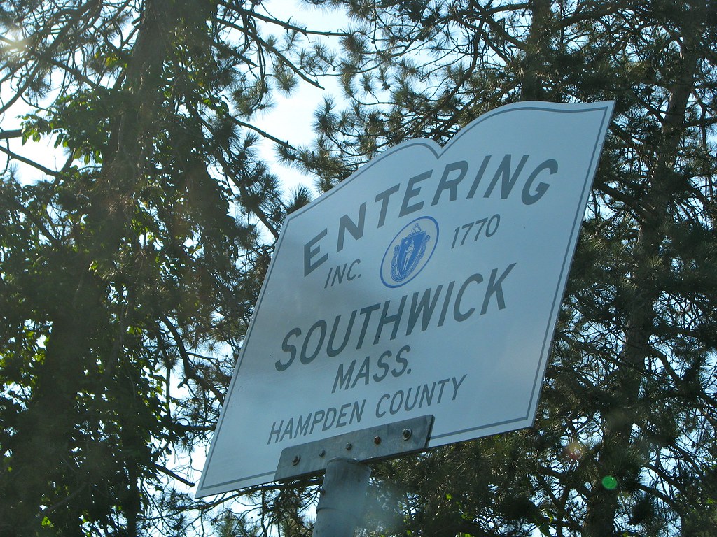
The Jog was an easy capture and it removed any possible pressure for the remainder of the trip. Now I had at least one geo-oddity under my belt no matter how the adventure unfolded the following day.
I do realize that the Southwick Jog belongs to Massachusetts — I thought I’d mention it before someone else points it out — however it should belong to Connecticut. It will return to Connecticut some day when justice finally rights this wrong. Then Massachusetts will slide into the sea without a nub to hold it into place.
Northernmost Spot

I felt like a kid on Christmas Eve that night and 5:00 am couldn’t come quickly enough. I met Steve in the hotel parking lot. Our fellow adventurer, Scott from The Scenic Drive joined us a minute later and we began.
We drove to Connecticut’s northwestern corner, stopping as close as possible to the northernmost point of the state. A casual viewer might consider the border between Connecticut and Massachusetts as a straight line (except for the Southwick Jog). Logically, any point along that border would be “northernmost” by definition. Things are never that simple. Borders, especially old borders established and surveyed during colonial times, display small margins of error. Courts have generally upheld these old boundaries too. They’ve become accepted official boundaries over time even with their minor mistakes.
Thus, the border between Connecticut and Massachusetts wanders a tiny bit north and a tiny bit south here-and-there as it forms an approximately straight line. The border strays the farthest north at a marker called Angle Bound #196 (map). That was our goal and we achieved it. Photographic proof is provided above. I won’t bother going into detail about the route we took other than to say that none of us felt comfortable trespassing on private property (unnecessarily as it turns out). Steve described all of that much better than I could ever hope to achieve.
Elevation Highpoint
The temperature never cooled down much overnight and dawn broke with stifling heat and humidity. I dripped with sweat even after that easy hike through the woods. It would set a tone for things to come.
This little northwest corner was filled with other geo-oddity goodies. Steve drove up Mt. Washington Road and parked at a small turnout just north of Connecticut’s border with Massachusetts. This served as a trailhead for Mount Frissell, and we intended to hike about five miles round-trip.
Steve and Scott are both experienced hikers and climbed the steep hills like mountain goats. I made a huge tactical mistake — trying to keep up with them. The extreme humidity sapped my power and I started sucking air badly. I couldn’t keep up with them and it was pointless to try. I felt like an extra in a bad World War II movie, “I’m done for it boys, leave me behind and finish the mission. Tell the family I love them. Arggg…“
Actually all I had to do was slow down, way down, like turtle speed, and keep moving. Steve and Scott didn’t rub it in too much and we all accomplished our geography goal.
We made it to the summit of Mt. Frissell and then we walked downhill, yes downhill, to the Connecticut highpoint. Take a look at the map. Most of Mt. Frissell including the summit falls within Massachusetts. The Connecticut highpoint takes place on the state border on Frissell’s southwest shoulder. Some states mark their highpoints with large obelisks. Connecticut? They use a four-inch metal rod. Way to underwhelm me, Connecticut. The hike nearly drowned me in my own sweat and this was the best you could do?
State Tripoint
From there it was only a stone’s throw to the Connecticut-Massachusetts-New York (CTMANY) Tripoint, perhaps a five minute walk away. You’ll also probably want to check Steve’s account on this portion of the adventure. I don’t remember much of that stop other than swatting at flies and wishing I could catch a cool mountain breeze that never materialized.
I was kicking myself in the tail all the way back from the tripoint to the car. We had only a single set time during the entire trip that could not be changed — a 2:00 ferry ride to the southernmost point. That was also the most important oddity I wanted to reach all day. I was pissed that my lack of hiking speed might prevent a ferry ride later, as I recovered in an air-conditioned car chugging Gatorade.
Steve said everything would be fine, but would it?
Leave a Reply