
I’d not spent much time in Accomack County, Virginia before. Well, one time a few years ago I did enjoy a long weekend in Chincoteague at the northern end of the county. I’ve also driven down busy U.S. Route 13 a few time on the way to other places. But the bicycle race “Le Tour De Shore” was my first chance to truly wander into the hinterlands where the locals lived.
Accomack is the northern county of two that form the Eastern Shore of Virginia. Accomack and Northampton sit physically apart from the rest of the state, on the other side of the Chesapeake Bay. So it’s an isolated almost timeless place; both out-of-the-way and nearly surrounded by water.
Riding a bicycle for 100 kilometres let me enjoy Accomack at a slower pace. I could savor the details rather than simply speed through, and I could stop wherever I wanted for photos along the way.
Estuaries
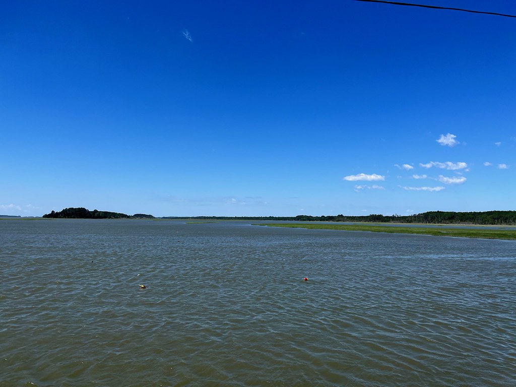
Nobody lives far from the water in Accomack. The Atlantic Ocean hugs one side of the peninsula and Chesapeake Bay hugs the other. Water also penetrates inland on the flat terrain such as in this image of the Machipongo River just outside of Quinby (map). Tidal estuaries and creeks intertwine with the land. There are no hills to speak of beyond a few small rises, with the highest point of elevation barely 60 feet above sea level. Climate change will not be kind to Accomack.
It’s pristine waterfront. Protective barrier islands lack human settlement, a complete contrast to resort towns further north in Maryland and Delaware. There’s no equivalent of an Ocean City or a Rehoboth here. Accomack does have a public beach at Assateague Island National Seashore. But that’s about it. Otherwise you better have a boat or be prepared for a long drive if you want to lounge on a beach.
Farms
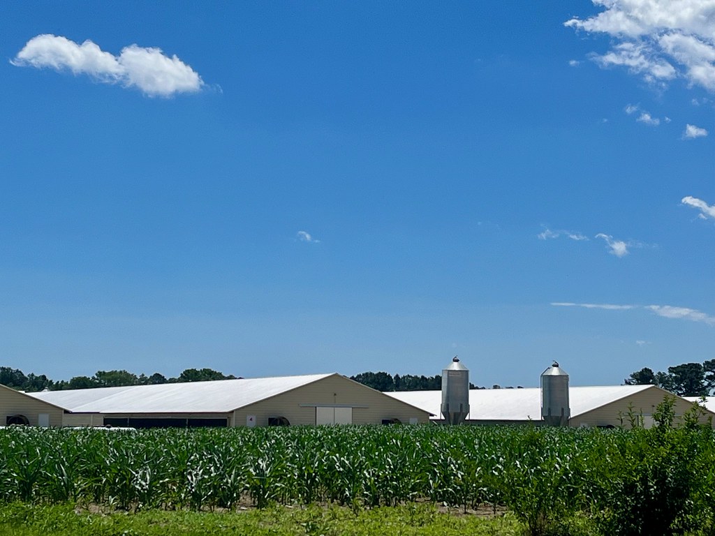
About 45,000 people live on Virginia’s Eastern Shore, with about two-thirds of them residing in Accomack. So that makes it quite rural. Many residents earn a living from the land or the sea; farmers or watermen. Naturally our route took us past plenty of both along the way.
Corn seemed to be the most popular crop, followed by wheat and soybeans, based on my rather unscientific assessment. And then there was poultry, lots and lots of poultry. Tyson Foods and Purdue both operated large chicken processing plants nearby. I snapped a photo of a farm with chickens and corn somewhere between Wachapreague and Locustville (map). You don’t want to be downwind of a poultry farm, trust me.
Quaint Towns and Villages
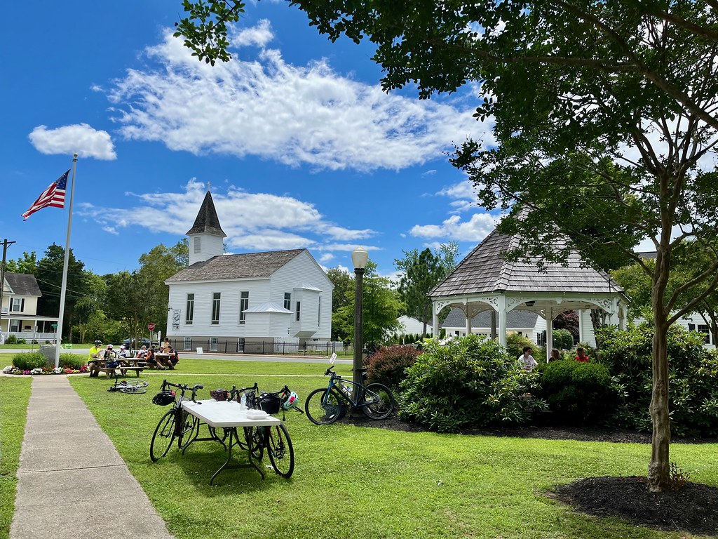
No large cities occupy the shore either. Even so, it’s studded with all sorts of little picturesque towns and villages. I saw a bunch of them from the seat of my bicycle:
- Onancock at the start/finish line, with it’s All-American town square (above).
- Exmore, just across the border in Northampton.
- Wachapreague on the Atlantic coastline.
- Accomac, the town without the “k.”
But we saw many more that were barely dots on the map, or maybe not even that. They all had their own distinctive personalities, visible once we got away from the highway.
Historic Structures
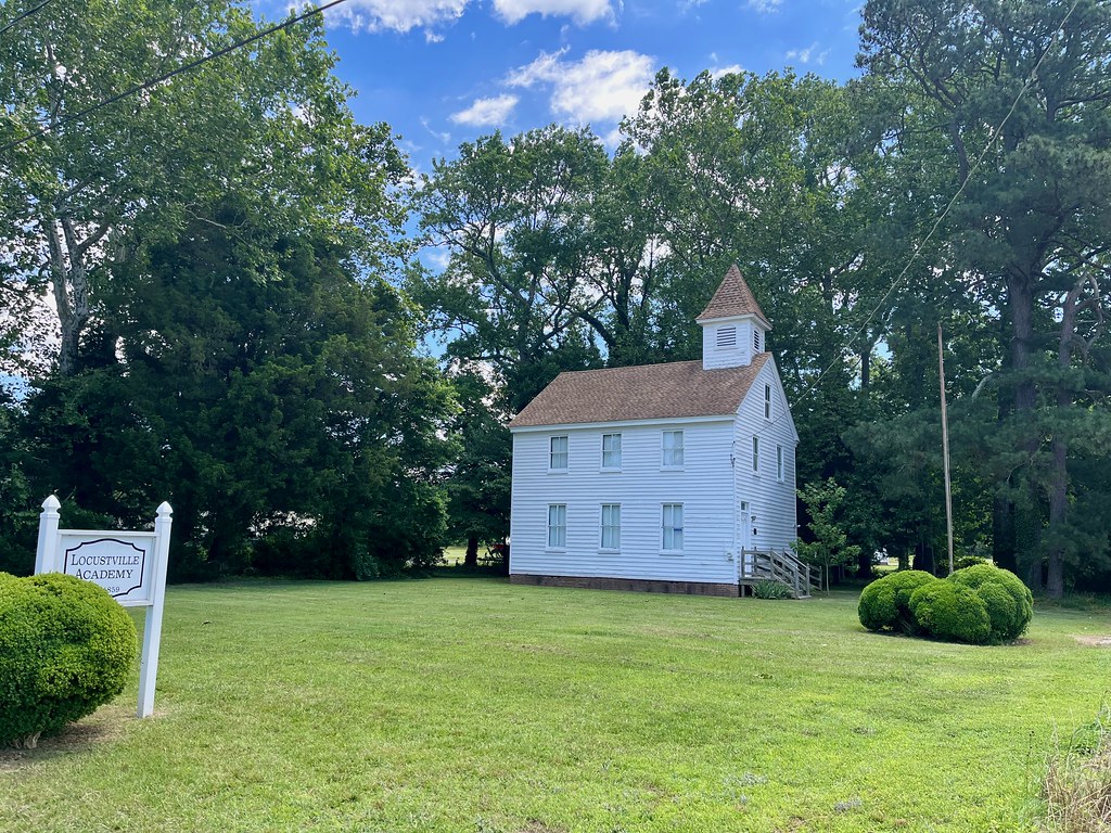
People have lived in this area for a very long time. Native Americans arrived thousands of years ago. English colonists established a shire here in 1634. The Chesapeake Bay was a veritable superhighway when ships provided the most efficient form of transportation, and the peninsula sat directly adjacent to the action. So settlers arrived here early and they left historic sites behind in their wake.
A few of them were well preserved although nature reclaimed many more. We saw all sorts of collapsed structures from bygone eras overgrown by vines and overtaken by neglect.
We pedaled past the Locustville Academy, built in 1859 as a private school (map). It served later as a public school around the turn of the last century. Somehow it escaped destruction and it now occupies a spot on the National Register of Historic Places.
Churches
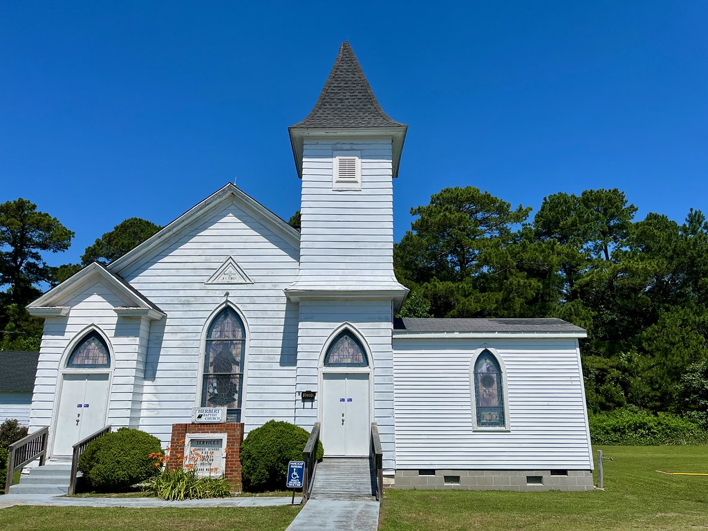
But much of the historic preservation seemed to involve churches. Religion was a big deal out here. There were several Christian denominations represented, with Methodist and Baptist appearing most regularly along our route. Every little hamlet seemed to have at least one church sitting on a neatly manicured lawn.
Local Culture
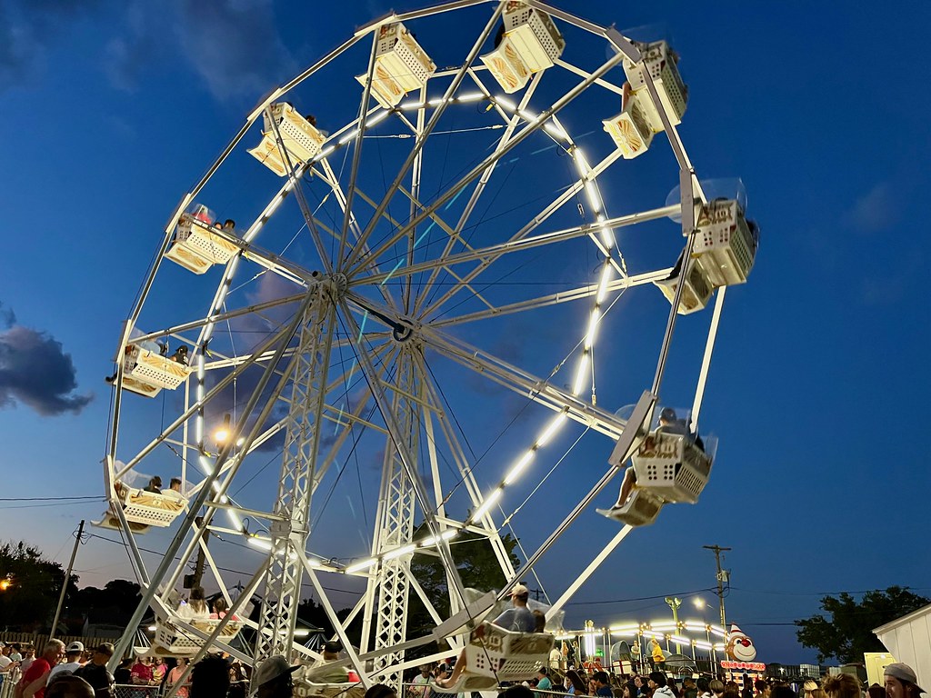
Obviously we got a lot closer to local culture on our backroads ride than along the highway. However, the best encounter actually happened after the bicycle race ended. We were talking with friends in Onancock who said we simply had to visit the Wachapreague Volunteer Fireman’s Carnival (map). They said it was something out of the 1950’s. We were staying overnight in Wachapreague so that was a pretty easy option.
They were right of course. It’s a fundraiser for the fire department that runs several nights per week in late June / early July. But it’s not a traveling carnival, it’s a permanent installation. There’s a tiny Ferris Wheel, an Octopus ride, a Tilt-A-Whirl, some kiddie rides, a string of concession stands, a very popular bingo hall, and a band stage. The whole thing stuffed onto a small lot and the place was packed with visitors. We could barely move. Available parking was almost nonexistent.
And Beyond
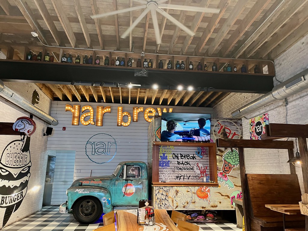
However, I didn’t get to add much to my brewery visit list because none existed throughout most of Virginia’s Eastern Shore. But don’t cry for me because I stopped on Maryland’s portion of the Delmarva on the drive down. We timed it so we’d arrive at Cambridge, Maryland at lunchtime. That let us stop at RaR (“Real Ale Revival”) Brewing burgers and a beverage flight. Then we took another break once we got to Salisbury, Maryland. That stop centered on Burnish Beer Company, for snacks and another flight. So at least I got sample a couple breweries I’d never visited before.
Leave a Reply