
There are 66 Counties in South Dakota – “The Mount Rushmore State“
Also be sure to see my United States County Counting Page for the rest of the states.
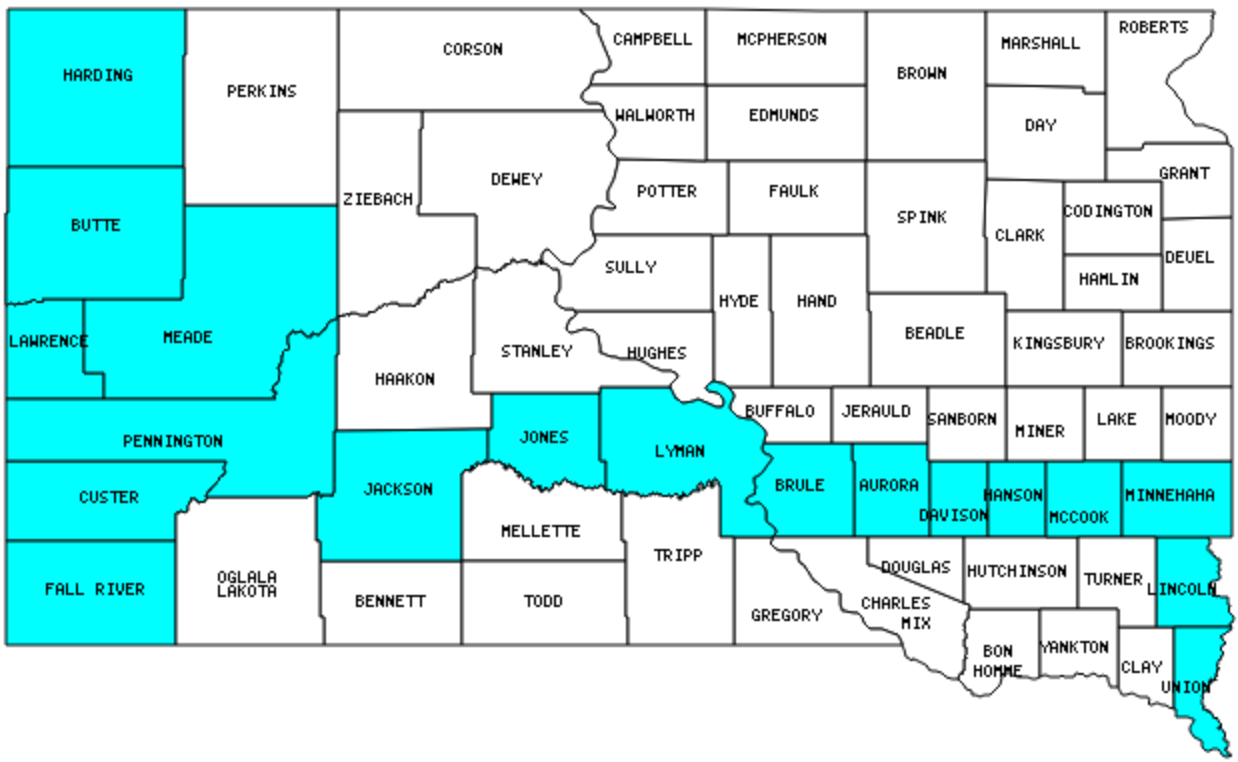
I have visited 18 Counties = 27.3% of Counties in South Dakota
Counties visited are colored-in; counties still needing to be visited are blank. Map created using Mob Rule.
Twelve Mile Circle Articles Featuring Places in South Dakota
Markers designate the South Dakota locations featured in Twelve Mile Circle articles.
Counties in South Dakota

Below are the 67 counties in South Dakota. Although infrequent, counties sometimes do change so please let me know if any of this information is out of date and I will update it. Those counties that I have visited are highlighted in Red. Readers can also link to any articles manually in this section if the map isn’t working.
- Aurora
- Beadle
- Bennett: Pole of Inaccessibility
- Bon Homme
- Brookings
- Brown
- Brule
- Buffalo
- Butte: Real Center of the Nation; Fake Center of the Nation
- Campbell: Not Fusion, CONfusion
- Charles Mix
- Clark
- Clay: Smallest county in South Dakota (412 square miles).
- Codington
- Corson: Standing Rock Sioux Tribe
- Custer: Crazy Horse Memorial; Pronghorn & Bison; Begging Burro
- Davison: The Corn Palace
- Day
- Deuel
- Dewey: Cheyenne River Sioux Tribe; Time Zone Limits
- Douglas
- Edmunds
- Fall River: Hot Springs Everywhere; Mammoth Site
- Faulk
- Grant
- Gregory
- Haakon: Cactus
- Hamlin
- Hand: An Arm and a Leg
- Hanson
- Harding
- Hughes: State Capital on Time Zone Boundary
- Hutchinson
- Hyde
- Jackson
- Jerauld
- Jones: Smallest county population in South Dakota (1,193 people in 2000 Census): Murdo Mystery
- Kingsbury
- Lake
- Lawrence
- Lincoln
- Lyman
- Marshall
- McCook
- McPherson: Least Visited U.S. Counties
- Meade: Largest county in South Dakota (3,471 square miles).
- Mellette
- Miner
- Minnehaha: Largest county population in South Dakota (148,281 people in 2000 Census).
- Moody
- Oglala Lakota (formerly Shannon): Wounded Knee; Oglala Sioux Tribe
- Pennington: Mount Rushmore National Memorial and Badlands National Park; Spearfish Canyon; Firehouse Brewing; Pigtail Auto Loop
- Perkins
- Potter: An Obscure Gettysburg
- Roberts: Coteau des Prairies
- Sanborn
- Spink
- Stanley
- Sully
- Todd: Rosebud Sioux Tribe
- Tripp
- Turner
- Union
- Walworth
- Yankton
- Ziebach: Cheyenne River Sioux Tribe
Quick Facts About South Dakota
- Location: West North Central United States. See map above.
- Size(1): 75,811 square miles. South Dakota is the 16th largest state. The next larger state is Nebraska and the next smaller state is North Dakota.
- Population(2): 882,235 people. South Dakota is the 46th most populous state. The next more populous state is Delaware and the next less populous state is North Dakota.
- Population Density: 11.6 people per square mile. South Dakota is the 46th most densely populated state. The next more densely populated state is New Mexico and the next less densely populated state is North Dakota.
- Bordering States: South Dakota shares a border with 6 states: North Dakota; Montana; Wyoming; Nebraska; Iowa and Minnesota.
- Admission to the Union: November 2, 1889. South Dakota was the 40th state admitted to the Union, after North Dakota and before Montana.
- Capital: Pierre.
- Highest Point: 7,242 feet at Black Elk Peak (formerly Harney Peak). See SummitPost’s Black Elk Peak page.
- Lowest Point: 966 feet at Big Stone Lake, Roberts County.
- Government website: State of South Dakota Official Home Page.
- Official Tourism website: South Dakota Tourism.
- Still not enough? See Wikipedia’s South Dakota page.
Sources:
(1) Wikipedia: List of U.S. states and territories by area. Land area only.
(2) Wikipedia: List of states and territories of the United States by population. Estimated population on July 1, 2019.
Leave a Reply