
There are 115 Counties in Missouri – “The Show Me State“
Also be sure to see my United States County Counting Page for the rest of the states.

I have visited 42 Counties = 36.5% of Counties in Missouri
Counties visited are colored-in; counties still needing to be visited are blank. Map created using Mob Rule.
Twelve Mile Circle Articles Featuring Places in Missouri
Markers designate the Missouri locations featured in Twelve Mile Circle articles.
Counties in Missouri
Below are the 115 counties in Missouri. Although infrequent, counties sometimes do change so please let me know if any of this information is out of date and I will update it. Those counties that I have visited are highlighted in Red. Readers can also link to any articles manually in this section if the map isn’t working.
- Adair
- Andrew
- Atchison
- Audrain
- Barry
- Barton: Switching Sides
- Bates
- Benton: That Other Warsaw
- Bollinger: Inland Hurricane
- Boone: Flat Branch Pub & Brewing
- Buchanan: The Airport on the “Wrong” Side of the River
- Butler
- Caldwell
- Callaway: Reality in the Real World; No Way! Way!
- Camden: Erasing Van Buren; Sunrise; State Nickname Streets
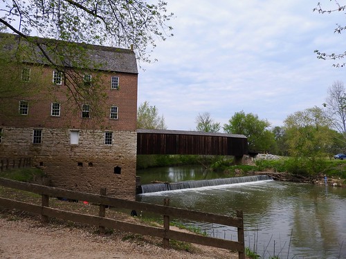
- Cape Girardeau: Historic District & Flood Wall; Cape Rock Park; Bollinger Mill
- Carroll
- Carter: Erasing Van Buren
- Cass: Quad County Towns, Crowdsourced; Erasing Van Buren
- Cedar
- Chariton
- Christian: Public Street
- Clarke
- Clay
- Clinton
- Cole
- Cooper
- Crawford: Reality in the Real World
- Dade
- Dallas
- Daviess
- Dekalb
- Dent
- Douglas
- Dunklin: John Hardeman Walker’s Bootheel
- Franklin: August Bottom Road
- Gasconade
- Gentry
- Greene
- Grundy
- Harrison
- Henry
- Hickory
- Holt
- Howard: Boone Scraps
- Howell
- Iron
- Jackson: Semi-Practical Exclaves Galore!; In the 4th of July Spirit; 75th Street Brewery; Hofbräuhaus Brewery & Biergarten; Mill Creek Restaurant and Brewery; River Market Brewing Company
- Jasper
- Jefferson: Crystal City
- Johnson
- Knox
- Laclede
- Lafayette
- Lawrence
- Lewis
- Lincoln
- Linn
- Livingston
- Macon
- Madison: Mine La Motte
- Maries
- Marion: Mark Twain Home
- McDonald
- Mercer
- Miller
- Mississippi: Dorena-Hickman Ferry; Riverboat Adventure; Ohio/Mississippi River Confluence
- Moniteau: Outside of California
- Monroe
- Montgomery
- Morgan: Sunrise
- New Madrid: New Counties
- Newton: Bonnie & Clyde Hideout
- Nodaway
- Oregon
- Osage
- Ozark
- Pemiscot: John Hardeman Walker’s Bootheel
- Perry
- Pettis
- Phelps: Rolla; Did Sir Walter Raleigh Get Drunk in Canada?
- Pike: Adjacent Counties, Same Name, Different States
- Platte
- Polk: Definitely Halfway
- Pulaski
- Putnam
- Ralls
- Randolph
- Ray
- Reynolds
- Ripley
- Saline
- Schuyler
- Scotland
- Scott
- Shannon
- Shelby
- St. Charles: Missouri Route 370
- St. Clair
- St. Francois
- St. Louis: Largest county population in Missouri (1,016,315 people in 2000 Census); Bellefontaine Neighbors; Maryland Heights; Natural Bridges
- St. Louis (independent city): City Museum; Dreadful Road Trip; Missouri Botanical Garden; Natural Bridges; Over the Road
- Ste. Genevieve: Crown Ridge Tiger Sanctuary
- Stoddard
- Stone
- Sullivan
- Taney
- Texas: Largest county in Missouri (1,179 square miles).
- Vernon
- Warren
- Washington: Certainly Not Austin
- Wayne: The State of Wayne
- Webster
- Worth: Smallest county in Missouri (267 square miles) and Smallest county population in Missouri (2,382 people in 2000 Census).
- Wright
Quick Facts About Missouri
- Location: West North Central United States. See map above.
- Size(1): 68,742 square miles. Missouri is the 18th largest state. The next larger state is North Dakota and the next smaller state is Oklahoma.
- Population(2): 6,126,452 people. Missouri is the 18th most populous state. The next more populous state is Indiana and the next less populous state is Maryland.
- Population Density: 89.1 people per square mile. Missouri is the 28th most densely populated state. The next more densely populated state is Alabama and the next less densely populated state is West Virginia.
- Bordering States: Missouri shares a border with 8 states: Iowa; Nebraska; Kansas; Oklahoma; Arkansas; Tennessee; kentucky and Illinois.
- Admission to the Union: August 10, 1821. Missouri was the 24th state admitted to the Union, after Maine and before Arkansas.
- Capital: Jefferson City.
- Highest Point: 1,772 feet at Taum Sauk Mountain. See SummitPost’s Taum Sauk Mountain page.
- Lowest Point: 230 feet at St. Francis River in Dunklin Co.
- Government website: Missouri State Government Home Page.
- Official Tourism website: Welcome to Missouri.
- Still not enough? See Wikipedia’s Missouri page.
Sources:
(1) Wikipedia: List of U.S. states and territories by area. Land area only.
(2) Wikipedia: List of states and territories of the United States by population. Estimated population on July 1, 2019.
Leave a Reply