
There are 82 Counties in Mississippi – “The Magnolia State“
Also be sure to see my United States County Counting Page for the rest of the states.
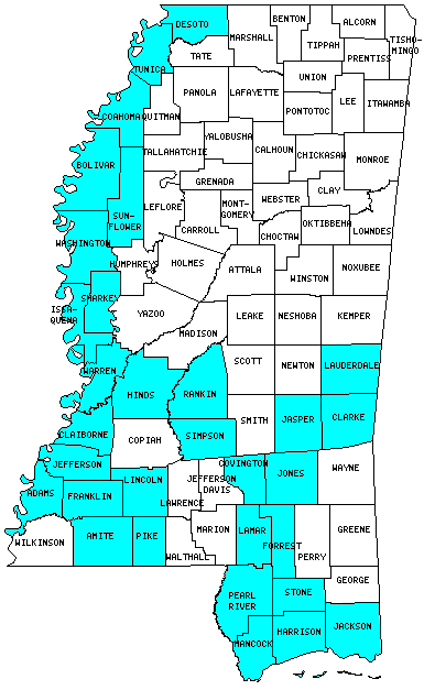
I have visited 31 Counties = 37.8% of Counties in Mississippi
Counties visited are colored-in; counties still needing to be visited are blank. Map created using Mob Rule.
Twelve Mile Circle Articles Featuring Places in Mississippi
Markers designate the Mississippi locations featured in Twelve Mile Circle articles.
Counties in Mississippi
Below are the 82 counties in Mississippi. Although infrequent, counties sometimes do change so please let me know if any of this information is out of date and I will update it. Those counties that I have visited are highlighted in Red. Readers can also link to any articles manually in this section if the map isn’t working.
- Adams: Carriage Tour of Natchez; Octagons
- Alcorn: Smallest county in Mississippi (400 square miles).
- Amite
- Attala
- Benton
- Bolivar
- Calhoun
- Carroll
- Chickasaw
- Choctaw
- Claiborne
- Clarke
- Clay
- Coahoma: Devil’s Crossroad
- Copiah
- Covington
- De Soto
- Forrest: Laurel & Hardy
- Franklin
- George
- Greene
- Grenada
- Hancock: Hawaii on the Mainland; INFINITY Science Center; Jourdan River Coastal Preserve; Just Keep Turning; Residential Airparks; Stennis Space Center Bus Tour; Stennis Space Center Visitor Center
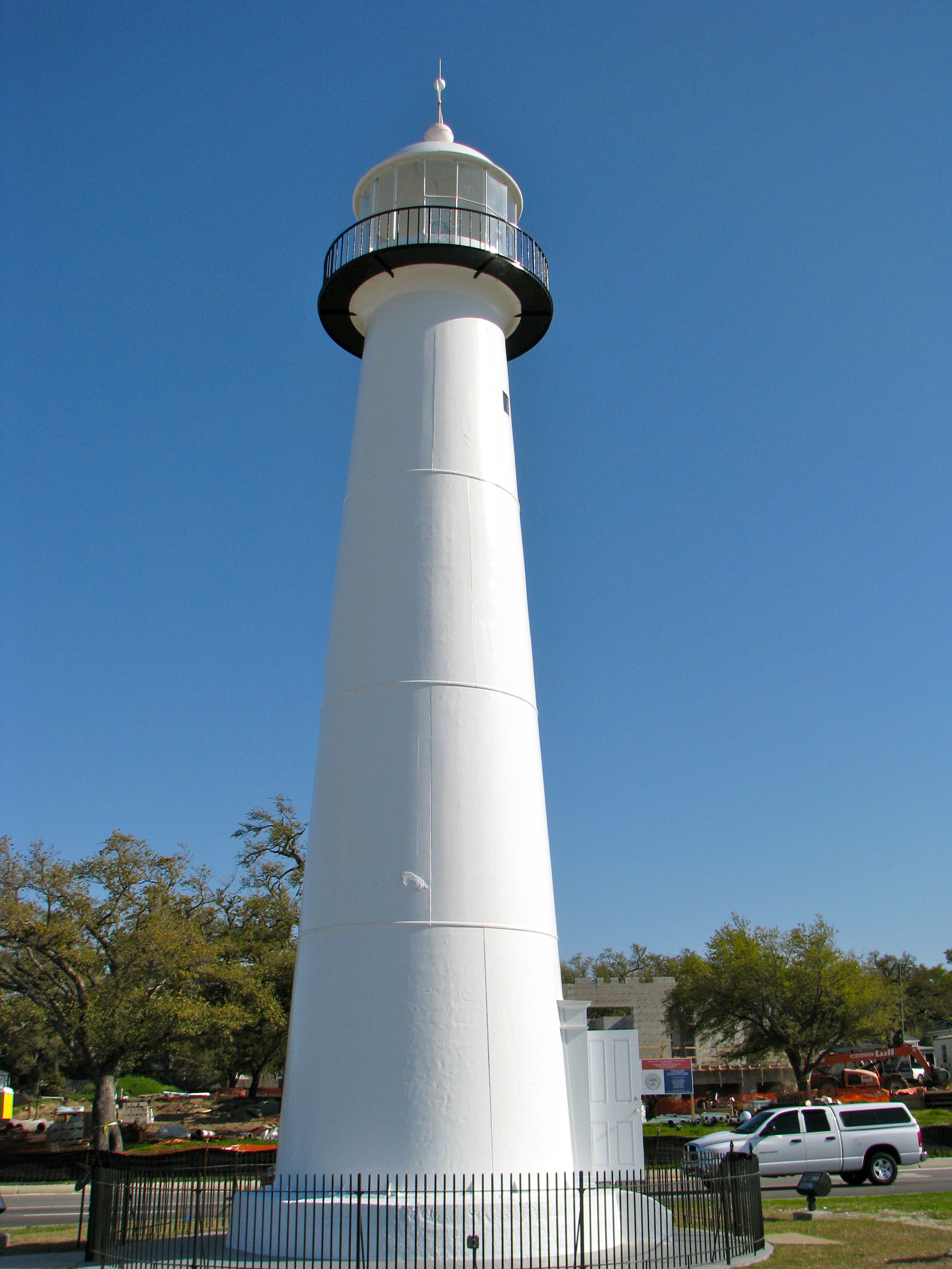
- Harrison: Biloxi Lighthouse; Jeff Davis; Mississippi Aquarium; Ocean Adventures Marine Park
- Hinds: Largest county population in Mississippi (250,800 people in 2000 Census); Jackson Zoo; Jackson Volcano; No, It’s Not There
- Holmes
- Humphreys: Midnight Volcano
- Issaquena: Smallest county population in Mississippi (2,274 people in 2000 Census); More Land than People
- Itawamba
- Jackson: Pascagoula Air Boat Ride; The Long Drive
- Jasper
- Jefferson
- Jefferson Davis
- Jones
- Kemper
- Lafayette
- Lamar
- Lauderdale: What’s the Meridian?
- Lawrence
- Leake
- Lee: The Cult of Elvis
- Leflore
- Lincoln
- Lowndes
- Madison
- Marion
- Marshall
- Monroe
- Montgomery
- Neshoba
- Newton
- Noxubee: X Marks the Spot
- Oktibbeha
- Panola
- Pearl River
- Perry
- Pike
- Pontotoc
- Prentiss
- Quitman
- Rankin
- Scott
- Sharkey: Rolling Fork
- Simpson
- Smith
- Stone
- Sunflower
- Tallahatchie
- Tate
- Tippah
- Tishomingo
- Tunica
- Union: Latitude Longitude Sequences
- Walthall
- Warren: Vicksburg River Views; Inconvenient Rivers
- Washington: Leroy Percy State Park; Greenville Bridge; Winterville Mounds
- Wayne
- Webster
- Wilkinson
- Winston
- Yalobusha
- Yazoo: Largest county in Mississippi (919 square miles).
Quick Facts About Mississippi
- Location: East South Central United States. See map above.
- Size(1): 46,923 square miles. Mississippi is the 31st largest state. The next larger state is New York and the next smaller state is Pennsylvania.
- Population(2): 2,988,530 people. Mississippi is the 34th most populous state. The next more populous state is Arkansas and the next less populous state is Kansas.
- Population Density: 63.7 people per square mile. Mississippi is the 32nd most densely populated state. The next more densely populated state is Vermont and the next less densely populated state is Arizona.
- Bordering States: Mississippi shares a border with 4 states: Tennessee; Arkansas; Louisiana and Alabama.
- Admission to the Union: December 10, 1817. Mississippi was the 20th state admitted to the Union, after Indiana and before Illinois.
- Capital: Jackson.
- Highest Point: 807 feet at Woodall Mountain. See SummitPost’s Woodall Mountain page.
- Lowest Point: Sea Level at the Gulf of Mexico.
- Government website: The Official State Web Site of Mississippi.
- Official Tourism website: Welcome to Mississippi.
- Still not enough? See Wikipedia’s Mississippi page.
Sources:
(1) Wikipedia: List of U.S. states and territories by area. Land area only.
(2) Wikipedia: List of states and territories of the United States by population. Estimated population on July 1, 2019.
Leave a Reply