
There are 87 Counties in Minnesota – “The Land of 10,000 Lakes“
Also be sure to see my United States County Counting Page for the rest of the states.
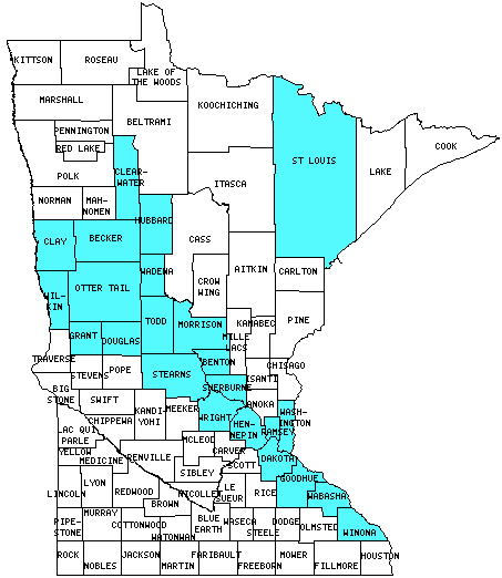
I have visited 23 Counties = 26.4% of Counties in Minnesota
Counties visited are colored-in; counties still needing to be visited are blank. Map created using Mob Rule.
Twelve Mile Circle Articles Featuring Places in Minnesota
Markers designate the Minnesota locations featured in Twelve Mile Circle articles.
Interesting Minnesota County Trivia
Red Lake County may be the only county in the United States that has borders with only two other counties while being totally landlocked. Pennington County borders it on the north, and Polk County wraps around and borders it on the west, south and east.
Counties in Minnesota

Below are the 87 counties in Minnesota. Although infrequent, counties sometimes do change so please let me know if any of this information is out of date and I will update it. Those counties that I have visited are highlighted in Red. Readers can also link to any articles manually in this section if the map isn’t working.
- Aitkin
- Anoka
- Becker: Big Tom the Turkey; The Visual Genius of Dave Oswald; For More Birds
- Beltrami
- Benton
- Big Stone: Giant Artichoke
- Blue Earth: Fort L’Huillier; Railroads Torment Colfax; Reconciliation Park
- Brown: Sleepy Eye
- Carlton
- Carver
- Cass
- Chippewa
- Chisago: Sunrise
- Clay: Municipally Owned Telephone
- Clearwater: Walk Across the Mississippi River; No It’s Not There; River Headwaters and Sources
- Cook: Vegetable Chain; Lady Chain; JAP Lake; Highpoint to Lowpoint; No, It’s Not There
- Cottonwood
- Crow Wing
- Dakota
- Dodge
- Douglas
- Fairibault: Jolly Green Giant; Golden Stripe
- Fillmore
- Freeborn
- Goodhue: Lake Pepin
- Grant
- Hennepin: Largest county population in Minnesota (1,116,200 people in 2000 Census); Mall of America; Rock Bands with Geographic Names; That’s Siouan for Water; Follow the Letter; Where the Stadium Once Stood
- Houston
- Hubbard: Named for Schoolcraft
- Isanti
- Itasca: No, It’s Not There
- Jackson
- Kanabec
- Kandiyohi
- Kittson: Lancaster Minnesota to Lancashire England
- Koochiching: Ownership Error
- Lac Qui Parle
- Lake
- Lake of the Woods: The Northwest Angle
- Le Sueur
- Lincoln
- Lyon: That’s Siouan for Water
- Mahnomen
- Marshall
- Martin: Welcome
- McLeod
- Meeker
- Mille Lacs: Bogus
- Morrison
- Power
- Murray
- Nicollet
- Nobles
- Normal
- Olmsted
- Otter Tail
- Pennington
- Pine
- Pipestone
- Polk
- Pope
- Ramsey: Smallest county in Minnesota (156 square miles); Great Waters Brewing Co.; More Strange Signs; City of Frogs; Canadian Ethnic Enclave
- Red Lake: Fewest County Borders – Part III: Red Lake Co., MN
- Redwood
- Renville
- Rice
- Rock
- Roseau: What Crosses an Airport Runway?
- Scott
- Sherburne: City of Frogs
- Sibley
- St. Louis: Largest county in Minnesota (6,225 square miles); Tin Can Mike; Duluth’s Canal Park; Fitger’s Brewhouse; Farthest Inland Port
- Stearns
- Steele
- Stevens
- Swift
- Todd
- Traverse: Smallest county population in Minnesota (4,134 people in 2000 Census).
- Wabasha: The Sylvester Family of Plainview, Minnesota; The Half-Breed Tract; Lake Pepin; GPS and Genealogy
- Wadena: Nimrod
- Waseca
- Washington
- Watonwan
- Wilkin
- Winona: The Half-Breed Tract
- Wright
- Yellow Medicine
Quick Facts About Minnesota
- Location: West North Central United States. See map above.
- Size(1): 79,627 square miles. Minnesota is the 14th largest state. The next larger state is Kansas and the next smaller state is Nebraska.
- Population(2): 5,611,179 people. Minnesota is the 22nd most populous state. The next more populous state is Colorado and the next less populous state is South Carolina.
- Population Density: 70.5 people per square mile. Minnesota is the 30th most densely populated state. The next more densely populated state is West Virginia and the next less densely populated state is Vermont.
- Bordering States: Minnesota shares a border with 4 states: North Dakota, South Dakota, Iowa and Wisconsin.
- Admission to the Union: May 11, 1858. Minnesota was the 32nd state admitted to the Union, after California and before Oregon.
- Capital: St. Paul.
- Highest Point: 2,301 feet at Eagle Mountain. See SummitPost’s Eagle Mountain page.
- Lowest Point: 600 feet at Lake Superior.
- Government website: Minnesota.gov.
- Official Tourism website: Minnesota tourism.
- Still not enough? See Wikipedia’s Minnesota page.
Sources:
(1) Wikipedia: List of U.S. states and territories by area. Land area only.
(2) Wikipedia: List of states and territories of the United States by population. Estimated population on July 1, 2019.
Leave a Reply