
There are 105 Counties in Kansas – “The Sunflower State“
Also be sure to see my United States County Counting Page for the rest of the states.
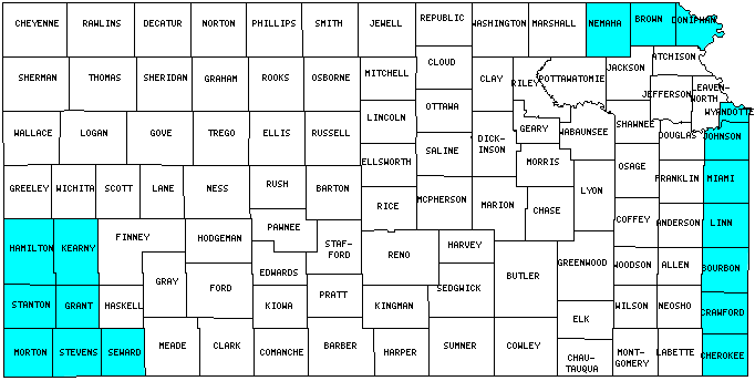
I have visited 17 Counties = 16.2% of Counties in Kansas
Counties visited are colored-in; counties still needing to be visited are blank. Map created using Mob Rule.
Twelve Mile Circle Articles Featuring Places in Kansas
Markers designate the Kansas locations featured in Twelve Mile Circle articles.
Counties in Kansas
Below are the 105 counties in Kansas. Although infrequent, counties sometimes do change so please let me know if any of this information is out of date and I will update it. Those counties that I have visited are highlighted in Red. Readers can also link to any articles manually in this section if the map isn’t working.
- Allen
- Anderson
- Atchison
- Barber
- Barton
- Bourbon
- Brown
- Butler: Largest county in Kansas (1,428 square miles); Throw the Dart; Hundred Dollar Hamburger.
- Chase: National Preserves
- Chautauqua
- Cherokee
- Cheyenne: Surrounded in Time
- Clark
- Clay
- Cloud
- Coffey
- Comanche
- Cowley: Life is Hard
- Crawford: Comedy Duos
- Decatur
- Dickinson
- Doniphan
- Douglas
- Edward
- Elkhart
- Ellis: Hays
- Ellsworth: Wilson
- Finney
- Ford: Time Zone Sundials
- Franklin
- Geary
- Gove
- Graham
- Grant: Mainly Marathons; Race Across America
- Gray
- Greeley: Smallest county population in Kansas (1,534 people in 2000 Census).
- Greenwood
- Hamilton
- Harper
- Harvey
- Haskell
- Hodgeman
- Jackson
- Jefferson
- Jewell
- Johnson: Largest county population in Kansas (451,086 people in 2000 Census); Trap Streets; Semi-Practical Exclaves Galore!.
- Kearny
- Kingman
- Kiowa
- Labette
- Lane
- Leavenworth: X Marks the Spot
- Lincoln
- Linn
- Logan
- Lyon
- Marion
- Marshall
- McPherson
- Meade
- Miami
- Mitchell
- Montgomery
- Morris
- Morton: Rolla; CO-KS-OK Tripoint; Morton Co. Museum; Point of Rocks; Miracle Well; Santa Fe Trail Wagon Ruts
- Nemaha
- Neosho: Black Gold
- Ness
- Norton
- Osage: Seventeen Steps from Middle
- Osborne
- Ottawa
- Pawnee
- Phillips
- Pottawatomie: Iconic Views; Visiting Oz
- Pratt
- Rawlins
- Reno
- Republic
- Rice
- Riley
- Rooks
- Rush
- Russel
- Saline
- Scott
- Sedgwick: Flipping Lat/Long Directions; Mmm… Doughnut
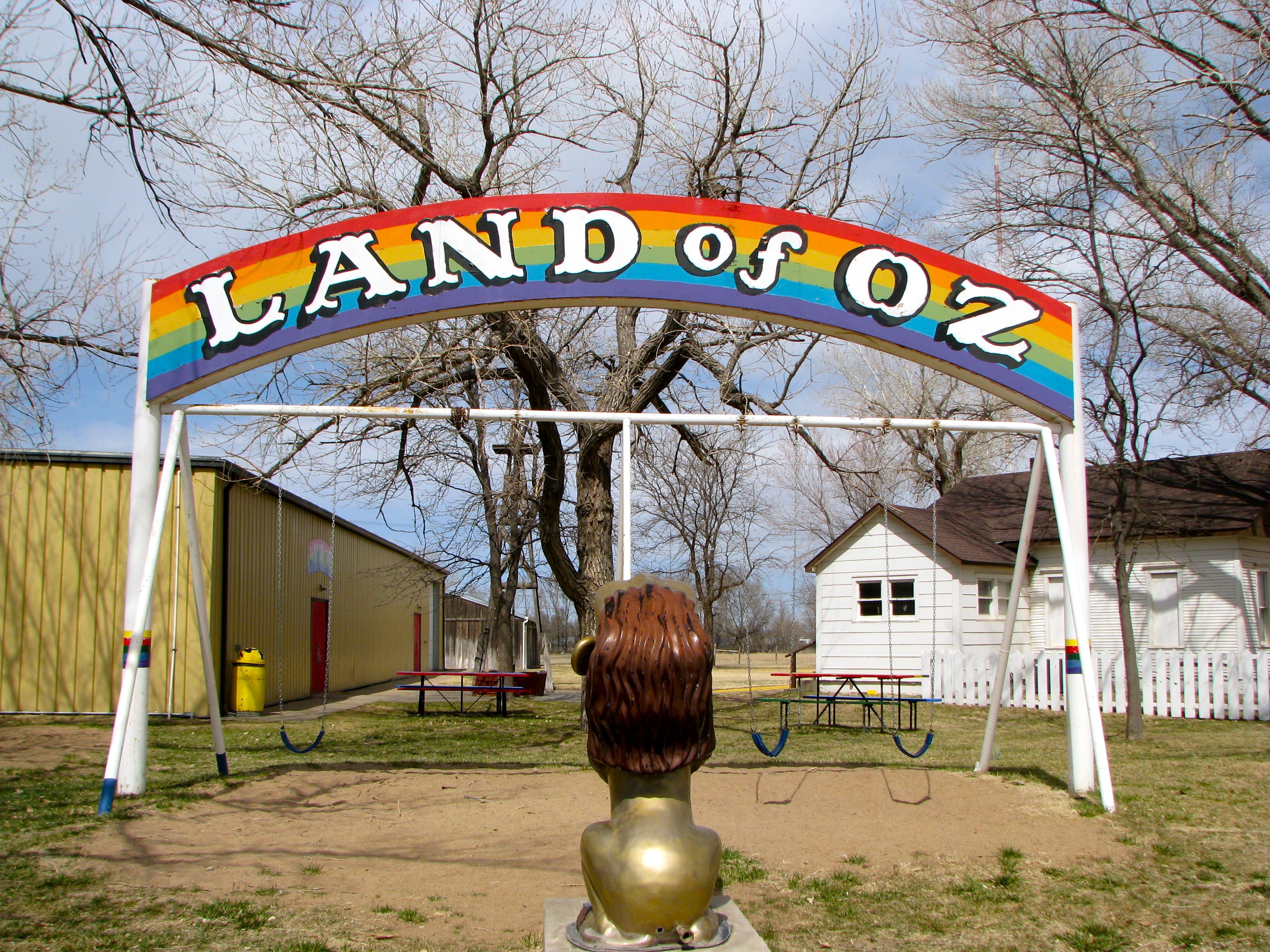
- Seward: Land of Oz; Switching Sides
- Shawnee: Seventeen Steps from Middle
- Sheridan
- Sherman: Kansas Mountain Time; Kanorado
- Smith
- Stafford
- Stanton
- Stevens
- Summer
- Thomas
- Trego
- Wabaunsee
- Wallace
- Washington
- Wichita: Not the City
- Wilson
- Woodson
- Wyandotte: Smallest county in Kansas (151 square miles); What State U; Back to the Lines.
Quick Facts About Kansas
- Location: West North Central United States. See map above.
- Size(1): 81,759 square miles. Kansas is the 13th largest state. The next larger state is Utah and the next smaller state is Minnesota.
- Population(2): 2,911,505 people. Kansas is the 35th most populous state. The next more populous state is Mississippi and the next less populous state is New Mexico.
- Population Density: 35.6 people per square mile. Kansas is the 41st most densely populated state. The next more densely populated state is Utah and the next less densely populated state is Nevada.
- Bordering States: Kansas shares a border with 4 states: Nebraska; Colorado; Oklahoma and Missouri.
- Admission to the Union: January 29, 1861. Kansas was the 34th state admitted to the Union, after Oregon and before West Virginia.
- Capital: Topeka.
- Highest Point: 4,039 feet at Mount Sunflower. See SummitPost’s Mount Sunflower page.
- Lowest Point: 679 feet at the Verdigris River in Montgomery County.
- Government website: Kansas.gov.
- Official Tourism website: There’s No Place Like Kansas.
- Still not enough? See Wikipedia’s Kansas page.
Sources:
(1) Wikipedia: List of U.S. states and territories by area. Land area only.
(2) Wikipedia: List of states and territories of the United States by population. Estimated population on July 1, 2019.
Leave a Reply